Railroads and Recovery: A map to propel the Missouri Land Boom.
Free Missouri. The Missouri Land Company. Capital Stock $500,000.
Out of stock
Description
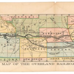
This promotional map of Missouri was created by the Leopold Gast & Brother Lithograph Co. for the Missouri Land Company shortly after Missouri’s emancipation in 1865. The map was designed to promote immigration and settlement in the state, which is why infrastructure and land development opportunities are highlighted. It prominently features the Union Pacific Railroad and the Hannibal and St. Joseph Railroad, which opened in 1860 and constituted the first railroad to cross Missouri. Sections of the Pacific Railroad’s Southwest Branch and the Cairo and Fulton Railroad are shown as dashed lines, indicating that they are under construction.
In the lower-left corner is a list of the Missouri Land Company’s officers and Board of Directors. The Missouri Land Company was founded by Senator Charles H. Howland and others in 1865 with the express purpose of promoting settlement here. Notably, the state is presented as “Free Missouri,” underlining to potential northern settlers that slavery had been abolished. This lets us tentatively date the map to 1865, Missouri’s emancipation. The emphasis suggests a promotional push to capitalize on the state’s post-war freedom and recovery, encouraging economic growth and population expansion after the turmoil of the Civil War.
Context is Everything
Missouri became a slave state in 1820 under the Missouri Compromise, balancing its entry with Maine as a free state. Unlike the Deep South, Missouri’s small-scale farms focused on crops like tobacco, hemp, and corn. Missouri’s climate was ill-suited for large plantations, so most slaveholders owned fewer than ten slaves. This small-scale slavery often meant that slave owners worked alongside their slaves, although the institution remained just as harsh.
During the 1840s and 50s, Missouri’s policy was continuously challenged by abolitionist migrants from the north and Europe. By 1854, the pressure resulted in The Kansas-Nebraska Act, which did not include a direct vote by Kansas on slavery but did allow for “popular sovereignty,” meaning the settlers of Kansas (and Nebraska) would decide whether to allow slavery through voting when they applied for statehood. This repealed the Missouri Compromise of 1820, which had previously prohibited slavery in those territories. With the outbreak of the Civil War, most Missourians voted to stay in the Union. By 1865, the Missouri State Constitutional Convention officially emancipated the state’s slaves, marking the end of slavery in Missouri.
Census
Due to its promotional nature, most copies of this map have perished over time, making this surviving example in its current condition a rare find. The OCLC does not list any examples of this map in institutional collections. An example of this map was offered as part of a lot by Hindman in 2022, but other than this, we have not been able to find parallels on the open market.
Cartographer(s):
Leopold Gast was a prominent 19th-century mapmaker and lithographer based in St. Louis, Missouri. Born in Germany in 1810, he emigrated to the United States in the mid-19th century, settling in St. Louis, where he established Leopold Gast & Brother Lithograph Co. in 1852. His company became one of the most successful lithography firms in the Midwest, producing a wide range of printed materials, including maps, advertisements, and promotional materials. Gast was known for his detailed and precise map work, which was crucial for Missouri’s land development and the expansion of railroads during the post-Civil War era.
Gast’s company played a crucial role in documenting the transformation of the American frontier, particularly in Missouri, as railroads and land speculators sought to attract settlers. One notable project was the 1865 promotional map of Missouri, created for the Missouri Land Company. His lithographic firm was well-regarded for producing high-quality, visually appealing maps widely used by businesses and the government. Gast’s work remains a vital historical resource, reflecting Missouri’s economic and infrastructural changes and the broader Midwest during the 19th century.
Condition Description
Good. Light toning and soiling. Exhibits slight loss to lower margin corners. Blank on verso.
References
