-
-
Add to cart
 Quick View
 - East & Midwest United States, United States
Gettysburg. Repulse of Longstreet’s Assault.
- $900
- Bachelder’s magnificent rendering of Longstreet’s Assault (Pickett's Charge).
-
-
-
-
Add to cart
 Quick View
 - East & Midwest United States, Featured Maps & Views, United States
Gettysburg Battle-Field.
- $2,400
- Bachelder's iconic 1863 view of the Battle of Gettysburg.
-
-
-
-
Add to cart
![[First State] Panorama of the Seat of the War Birds Eye View of Virginia, Maryland, Delaware and the District of Columbia](https://neatlinemaps.com/wp-content/uploads/2024/05/NL-00664-scaled-1-300x300.jpg)
![[First State] Panorama of the Seat of the War Birds Eye View of Virginia, Maryland, Delaware and the District of Columbia](https://neatlinemaps.com/wp-content/uploads/2024/05/NL-00664-scaled-1.jpg) Quick View
Quick View - Bird's-eye-views, East & Midwest United States, Featured Maps & Views
[First State] Panorama of the Seat of the War Birds Eye View of Virginia, Maryland, Delaware and the District of Columbia
- $2,200
- Bachmann's dramatic 1861 panoramic view of the central theater of the American Civil War.
-
-
-
-
-
Add to cart
 Quick View
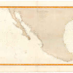
 - Americas, Mexico - Central & South America, Texas and The West
Carte de la côte occidentale d’Amérique…
- $875
- Nautical chart of Mexico, including San Diego and the Texas coast.
-
-
-
-
Add to cart
 Quick View
 - Curiosities - Miscellanea
The Presidents of our Great Republic.
- $850
- Patriotic broadsheet of American presidents, produced at the dawn of the Civil War by an icon in the NYC printing industry.
-
-
-
-
Add to cart
 Quick View
 - East & Midwest United States
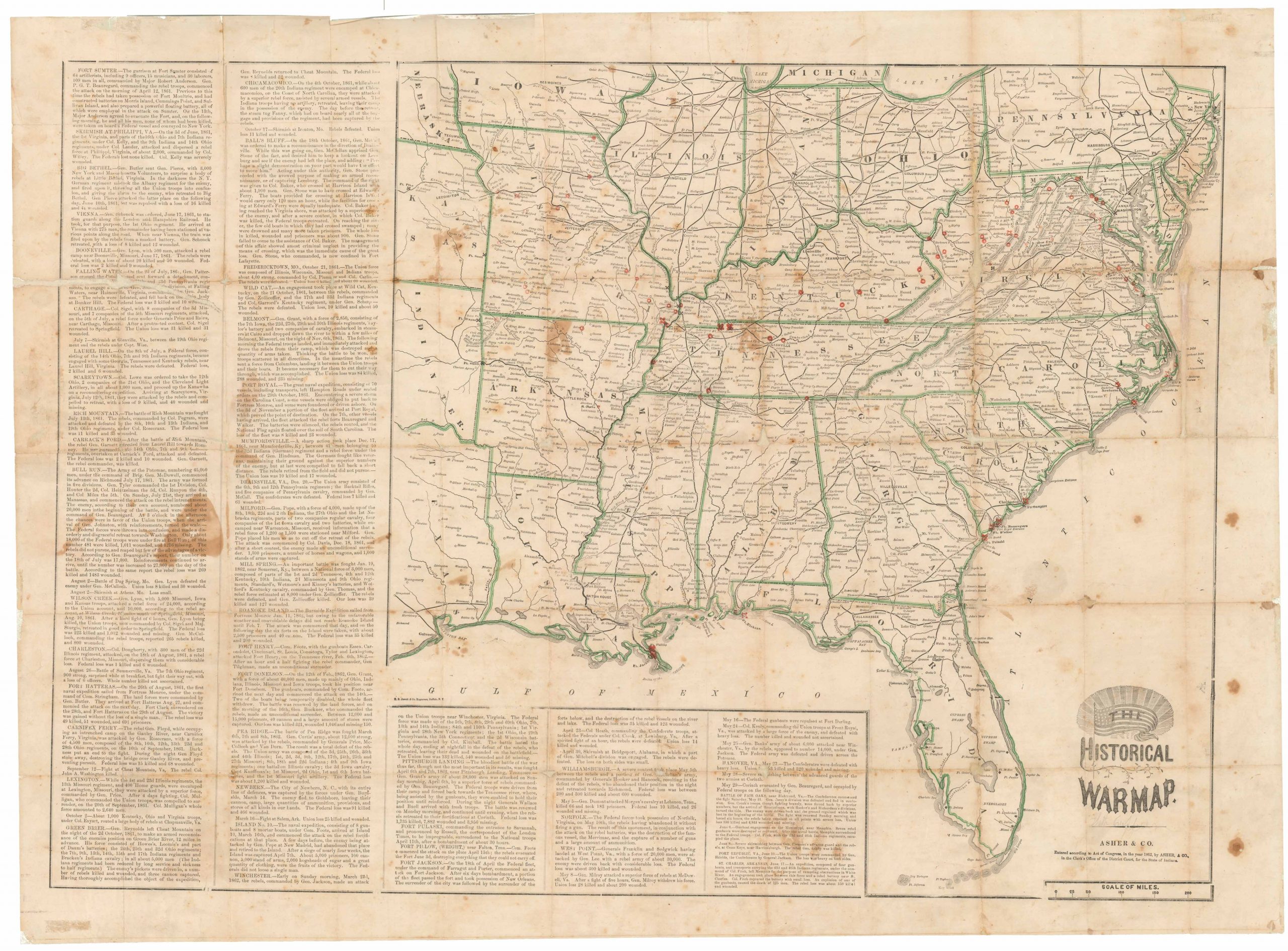
The Historical War Map.
- $975
- Printed broadside that provided the American public with a comprehensive overview of the Civil War, with an extensive narrative on the war’s progress.
-
-
-
-
-
Add to cart
 Quick View
 - East & Midwest United States
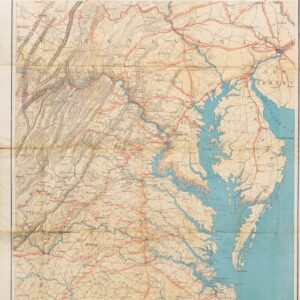
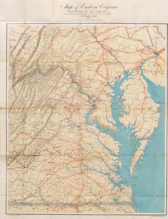
Map of Eastern Virginia Compiled from the best authorities and printed at the Coast Survey Office, A.D. Bache, Supdt. 1862.
- $1,700
- Alexander Bache’s Map of Eastern Virginia: a Union map of Washington’s Confederate backyard.
-
-
-
-
-
Add to cart
 Quick View
 - Bay Area & Silicon Valley, Bird's-eye-views, California
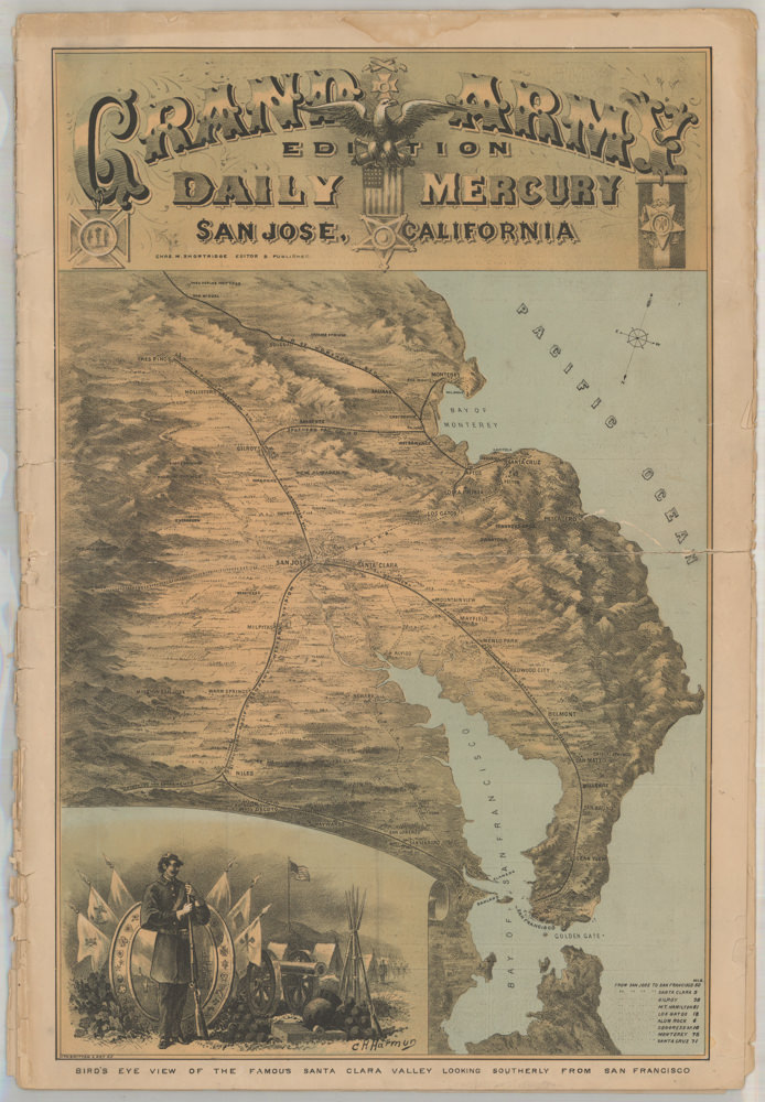
Bird’s Eye View of the Famous Santa Clara Valley Looking Southerly from San Francisco
- $2,400
- A rare and dramatic bird's-eye-view of Santa Clara Valley.
-
-
-