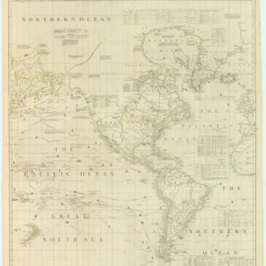
Mitchell’s wall-map of an adolescent America, presented here in a rare first edition with brilliant original color.
Mitchell’s Reference and Distance Map of the United States, by J. H. Young.
Out of stock
Description
A seminal and impressive masterpiece in American cartography.
This gorgeous and monumental map of the United States captures a crucial period in her history: half a century of unbridled self-confidence and territorial expansion, which saw the clearing of forests and plowing of fields, the creation of new paths of communication and travel, and the construction of new towns. It is, in many ways, a detailed rendition of what an eager and juvenile America looked like prior to the Civil War. The charted territory extends from the Atlantic Seaboard to the ninety-fifth meridian and the uncharted frontier of the Missouri Territory, which stretched from the newly formed state of Louisiana (1812) in the southeast to the borders with the Oregon Territory in the northwest. A massive unexplored landmass, which over the coming decades would be subsumed into the new nation with great efficacy.
Mitchell’s map is historically important because it captures in great detail what America looked like between the Adams-Onis Treaty (1819), which established new borders between the USA and territories controlled by Spain, and the Treaty of Guadaloupe Hidalgo (1848), which formally ended the US war with Mexico and saw the incorporation of Texas and California into the Union. Consequently, the map includes the frontier territories of Arkansas and eastern Missouri, and a Florida only recently ceded by Spain, but not a State quite yet. Within Missouri State (est. 1821) we find the newly founded capital of Jefferson City, whereas Kansas City, an important nexus in the ongoing westward expansion, at this stage remains an informal settlement not even mentioned on the map.
In the half century since its independence, America has grown from the original thirteen colonies to twenty-four individual states and a number of large territories. A pivotal point in this development was the conflict and subsequent treaty with Spain, who still controlled vast areas of the North American continent in the early 19th century, but whose political and military power had waned significantly, leaving them in a poor negotiating position. With the Adams-Onis Treaty, Spain had been forced to cede Florida to the US, whereas it managed to maintain control over the so-called Viceroyalty of Spain (New Spain), which consisted of vast swathes of land in eastern and southern America. In addition to ceding territories, the treaty established a firm border between the conflicting nations. This border more or less followed the Sabine, Red, and Arkansas Rivers until the 42nd parallel.
When Mexico declared independence from Spain two years later (1821), all of these holdings became part of it. In addition to once again shaking up the political landscape, the establishment of Mexico also meant that the North American Continent now had to be shared between two young and ambitious nations. The prospect of war between them seemed almost inevitable, although it impressively was held at bay for more than twenty years. It would in fact require the secession of Texas from Mexico (1836) and its subsequent incorporation into the United States before the two countries officially went to war (1846-1848), the end result of which we all know. This map was produced in the period of tense peace between the creation and subsequent reduction of Mexico.
An Expanding and Developing Nation
The map has a number of characteristics that are worth noting. Firstly, there is the clear division into states, each color-coded to effectively underline their distinction from their neighbors. Unity through statehood was at the core of the American experiment and maps such as these served to both recognize the distinct histories and characteristics of each state, while at the same time representing them as part of an indivisible whole. The map was meant for display on a wall, either in public institutions or in the libraries of the wealthy and influential. The production of maps at this scale was a cartographic innovation that pre-dated independence, but as America grew, it became an increasingly important visual tool for cementing territorial claims, illustrating the constantly changing frontiers and documenting the righteous development of a free nation. As such, precision and accuracy were just as important features as the political or ideological dimensions that maps of this age often touted.
Even though the bulk of the map’s space has been dedicated to representing the United States in its entirety, no less than thirteen inset maps have been included along the edges, each of which is worthy of some note. The largest, in the bottom right corner, depicts all of North America and has been entitled ‘General Map of the United States with the contiguous British & Mexican Possessions’. The inset map is visually important for a number of reasons. Firstly, it reveals the continental ambitions of the United States by depicting the US within the context of North America. This allows viewers to appreciate how much has been accomplished, but also how much still lies ahead.
The North America inset is deeply political in that it clearly shows where the new borders were drawn following the Adams-Onis Treaty of 1819, which not only ceded Florida to the US, but established a boundary west of the Mississippi that would ultimately allow the United States access to the Pacific. In this way, the map not only highlighted the political division of the American continent, but also underscored the enormous potential that lay in expanding further west. Finally, this largest inset is of interest because it denotes areas populated by different Native American tribes and communities. For example, the districts of the Mandans, the Osages, and the Ozarks are all depicted, as are areas under Sioux and Pawnee influence.
The smaller insets can roughly be divided into two categories: major urban centers and their vicinities and the parts of established States that fall outside the physical scope of the map. In the latter category we find the southern part of Florida depicted in the same scale as the map proper and located right next to the larger inset of America. A similar map depicts the northern half of Maine at the top, for which there also was not enough room on the map proper. Both insets underline the equality of worth afforded each state, ensuring that no formal part of the United States was omitted or diminished. These three maps stand out from the other, both in regard to what they are trying to achieve, but also when it comes to cartographic accuracy, and the inclusion of features such as a graticule. The final ten insets are all of important American cities and their surroundings. These include: Albany, Baltimore and Washington, Cincinnati, Charleston, New Orleans, Niagara Falls, Rochester, Boston, New York, and Philadelphia. Chicago is not featured, having been officially established only a year prior to the publication of this map.
The Creation of a Cartographic Showpiece
The map is framed by a decorative border of stylized arabesques and is lined with silk edges. At the center of the map’s top and bottom, the frieze is interrupted by inserted images, one showing a crest consisting of a Star-Spangled Banner shield resting on growths of corn (top), whereas the other shows a large shell flanked by fish, a trident, and other maritime symbols. Along the inner edge of the decorative border, a graticule overlays the map with a grid that not only increases the maps precision, but allows referencing beyond the scope of this particular chart. In addition to the actual meridians, the graticule grid uses letters for easy cross-referencing. This was a new feature predominantly seen in impressive and popular wall-maps. Thus, two individuals could look at two distinct copies of the map, but quickly ensure they were concentrating on the same feature or location by simply citing the grid reference (e.g. Montauk Point on Long Island lies in grid unit e/W)
Below the title cartouche is a fine steel engraving, designed by W. Mason and featuring an American bald eagle perched on a floating seashell with a coastal view in the background. This is iconic American imagery we are dealing with here: a powerful visualization of nationhood. The engraving is obviously a reference to the Great Seal of America, which was designed by Charles Thomson, secretary of the Continental Congress, in 1782 as a symbol of America’s strength, unity, and independence. As in the Great Seal, the eagle carries in its talons the dual forces of war and peace, as represented by arrows and olive branches. Moreover, the eagle has been endowed with an American crest of 13 red and white stripes, representing the original thirteen colonies that declared independence from Britain. A second American banner is found behind the eagle, perched inside the shell-boat and placed next to an unidentifiable white cloth and a halberd. The shell is traversing what seems to be the unruly waters of history, yet it remains steadfast and firm, anchored if you will, to the political core of America, in the form of Philadelphia and Washington D.C. in the background.
The map has been dissected into 36 sections and mounted on green cloth. It applies a scale of 1:1,584,000 and measures 173 by 137 centimeters (68.11 by 59.94 inches). The map comes in its original half-leather casing decorated with blue-marbled end-sheets and a gold-embossed leather label stating: Mitchell’s Map Of The United States.
There is some discussion as to how one distinguishes the original first edition from later editions. Walter Ristow, the late chief librarian for maps at the Library of Congress, claimed that the original version did not include the word Mitchell in the title, although we have not been able to verify the existence of such a map. In 1833, Samuel Augustus Mitchell, along with his compiler and engraver James Young, published A New Map of the United States and, in 1834, published Mitchell’s Reference and Distance Map of the United States, by J.H. Young with the same view, decorative borders, and engravers. Later editions, always dated, were to follow. As with the 1833 map, Mitchell offered this 1834 version for sale at his firm Mitchell & Hinnan in Philadelphia.
Background
In describing this phenomenal map, we have already noted the particular historical context that it was produced into, and how this context is legible from its details. Much of what the map is about revolves around areas which are not in fact shown, namely the vast and largely unexplored territories to the west. The United States was a nation in rapid growth, as the years immediately preceding this map’s publication had amply demonstrated. Yet Mitchell presents the US as a clearly delineated and strong modern nation, legitimizing territorial expansions in the process. It is in essence a chart designed to instill pride in its viewer (assuming of course the viewer was American): pride at what had been accomplished in such a short period; pride at the vastness and wealth of the nation; and perhaps most American of all, pride in a nation united in its celebration of diversity.
In hindsight, the bright optimism and projection of strength and unity that characterize Mitchell’s map belie the fact that the country was already headed on a steady collision course towards the Civil War. The 1820s saw fierce and contentious debate over the balance of slave and free states in the Union. The Tariff of 1828 and its protections for Northern industries led to the so-called nullification crisis, in which the state of South Carolina issued a direct challenge to the federal government by voiding the tariffs. In 1831, a few years before this map was published, Nat Turner led a bloody rebellion in Southampton, VA, which led to violent organized retaliations.
Before the Civil War, however, another dramatic event was closer at hand. Just two years after Mitchell issued this masterpiece, the small piece of uncolored land in the bottom left corner of the map would play a momentous role in shaping the history of the United States. The land is labeled “Part of Mexico,” but was also known as ‘Texas.’ In 1836, the Texian leadership declared independence from Mexico and established the Republic of Texas. Texan independence was short-lived. The Republic was annexed by the United States in 1845, which led to the Mexican-American War and eventually to the creation of the country, as we know it today.
Ultimately, Mitchell’s map is a celebration of America, of what has been achieved and of the greatness that still lies ahead. It is optimistic in every sense, from its dramatic coloration to the patriotic symbolism of the engraving.
Cartographer(s):
J.H. Young was an accomplished engraver and mapmaker based in Philadelphia and active in the first half of the 19th century.
Samuel Augustus MitchellSamuel Augustus Mitchell (1790 – 1868) was an American geographer and bookseller. During the middle of the 19th century, he became the dominant commercial publisher of geographic materials in America.
Mitchell worked as a teacher of geography before turning to publishing, but he found the materials available to students both antiquated and lacking, so he decided to abandon teaching in favor of producing geographic textbooks and maps. He quickly became one of America’s greatest cartographic publishers and played a decisive role in making Americans aware of their country’s geography.
Condition Description
The map is in excellent condition, mounted on original linen and sectioned for folding. It maintains its original folder case, half leather and marbled, with some rubbing and scuffing.
References
Ristow, Walter W. American Maps and Mapmakers: Commercial Cartography in the Nineteenth Century. Detroit, MI: Wayne State University Press, 1985; pp. 309-10.
Provenance: F. Edwards, 6/69; Warren Heckrotte.
