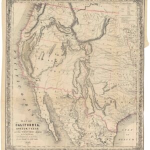
Crofutt’s 1874 promotional guide with splendid map of transcontinental routes
Trans-Continental Tourist, Containing a Full and Authentic Description of Over Five Hundred Cities…
Out of stock
Description
Scarce quarto format of Crofutt’s guide with wood-engravings in the text, some full-page. Four fold-out wood-engraved maps & plans; fold-out time-table with small map; large folding lithographed map of the world, hand-colored, laid in as issued.
Original flexible cloth lettered in gilt.
The fold-out maps are Omaha and Council Bluffs; Salt Lake City; Yellowstone Country; and Union and Central Pacific Railroads.
The large hand-colored folding map is Crofutt’s New Map of the Trans-Continental, American, & Trans-Continental, European, Route Around the World. It measures 47 x 96 cm, and is trimmed to or over neat lines at top and bottom.
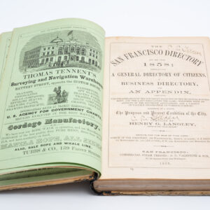
Full title is: Crofutt’s Trans-Continental Tourist, Containing a Full and Authentic Description of Over Five Hundred Cities, Towns, Villages, Stations, Government Forts and Camps, Mountains, Lakes… Passing over the Union Pacific Railroad, Central Pacific Railroad of California… from the Atlantic to the Pacific Ocean…
Cartographer(s):
Condition Description
Moderate wear, occasional pencil notes and memoranda; separated large folding map with a few long tears neatly repaired, short tears at fold intersections; very good.
References

![[Ortelius & Hogenberg Atlas Factice]](https://neatlinemaps.com/wp-content/uploads/2023/03/NL-01678-leo-belgicus-3_thumbnail-300x300.jpg)