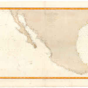
The first map to show California as an island!
Descriptio Indiae Occidentalis per Antonium de Herrera.
$3,600
1 in stock
Description
This rarely-available and seminally important 1622 map is the earliest known published image of the greatest of all cartographic myths: the Island of California. Similarly to many myths, we see here insular California’s humble beginnings, as the map is actually part of the pictorial title page of the Michiel Colijn expanded edition of Antonio de Herrera y Tordesillas’s Descritio Indiae Occidentalis.
The page is finely engraved and masterfully composed. Its layout consists of upper and lower sections within a vegetal border. The lower section includes the simple map, which is presented on a trapezoidal projection framed by a pinned-down unfolding scroll, the effect of which immediately draws the attention of the viewer. Adjacent on either side are New World natives in dugout canoes. The upper section is a tripartite composition with the title at center. The title itself sits below a decorative Castilian coat-of-arms and is flanked by eight fascinating vignettes of pre-Cortes Aztec gods and kings, along with a stepped temple.
The origin of insular California, and its representation on maps, stems from a mix of psychological and geographic factors. Renaissance mariners and conquistadors, including Christopher Columbus, were influenced by medieval-period literature, especially the travels of Marco Polo and Sir John Mandeville, which described East Asia as filled with a vast number of islands. The early discoveries in the New World met those expectations: for example, Columbus’s first discoveries were islands, which we know today as the ‘West Indies.’
After Hernan Cortes conquered Tenochitlan (present-day Mexico City) in 1521, he immediately cast his eyes on the great ocean to the west, believing the rich islands of East Asia to be near; the enormity of the Pacific Ocean was not well-understood at the time.
The reconnaissance expeditions of the first half of the 16th century led or authorized by Cortes found in the Baja Peninsula many of the hallmarks of an island, including a long, continuous coastline. The voyages faced a variety of dangers that helped to shroud the geography of California from mapmakers, including storms, rocky coasts, and constant fog. Furthermore, the northern end of the Gulf, where the Colorado River meets the sea, constitutes a vast delta which confused the ship captains and featured a dangerous tidal bore.
All these factors, combined with an unwillingness of expedition leaders to deliver disappointing news to their superiors (if California were an island, the Spanish would have dominion over its entirety), obscured a definitive understanding of the shape and extents of California. Mapmakers, in turn, were unsure whether or not to plot it as an island.
It was only a matter of time before the island of California made its way on to commercially published maps, starting as we see here in Amsterdam. Herrera y Tordesillas first published Descritio Indiae Occidentalis in 1601. That edition did not contain this important title page, which first appeared in the 1622 Michiel Colijn edition. The title page, which was engraved and printed in Latin, accompanied 1622 editions of Herrera in both French and Dutch. Colijn’s reason for including the island of California map is a mystery, as he gives no explanation.
Cartographer(s):
Michiel Colijn (1584 – 1637) was an Amsterdam-based printer and publisher trained under prominent bookseller Cornelius Claesz. After Claesz’s death, Colijn acquired much of his publishing infrastructure and opened his own successful business.
The Dutch Pirate Edition
Michael Colijn’s 1622 Amsterdam edition of Antonio de Herrera y Tordesillas’ Descripcion de las Indias Occidentales is generally considered a pirated edition. The book was initially part of Herrera’s historical work, Historia general de los hechos de los castellanos en las islas y tierra firme del mar océano”(a.k.a. Historia general), first published between 1601 and 1615 in Spain. The book was considered highly valuable because of its detailed descriptions and maps of Spanish America, making it a sought-after source of geographical knowledge about the New World.
In 1622, Michael Colijn, a Dutch printer and bookseller, republished the work in Amsterdam without proper authorization from Spanish authorities or the original rights holders. During this time, Spain was highly protective of its geographic knowledge due to ongoing conflicts with rival European powers. The Dutch, in particular, were engaged in the Eighty Years’ War (1568–1648) against Spanish rule of the Netherlands and sought to weaken Spain’s control over the Dutch and Flemish by weakening Spain’s control over her overseas empire. In reproducing and distributing Herrera’s work, Colijn violated Spanish copyright protections and state secrecy policies concerning geographical information. This piracy was motivated by the Dutch desire to access valuable knowledge about Spanish colonies in the Americas.
The Amsterdam edition of Descripcion de las Indias Occidentales was not a legal re-publication but rather an unauthorized attempt to profit from and exploit Spanish intellectual property during a period of intense rivalry.
Condition Description
Very good. Even overall toning.
References
Burden, P., The Mapping of North America, 195.
Polk, D. The Island of California: a History of the Myth. Lincoln: University of Nebraska Press, 1995.

