Dissolution and Continuity.
Holland (Koningrijk der Nederlanden).
$145
In stock
Description
A lovely example of William and Alexander Keith Johnston’s c. 1850 map of Holland or the Netherlands that appeared in The national atlas of historical, commercial, and political geography, a work noted for its craftsmanship and importance for popularizing physical geography.
Provinces are shaded and outlined in hand color for easy distinction. Cities and towns, roads, waterways, terrain, railways, and other features are noted throughout. Four scales, a legend, and a glossary of Dutch geographical terms with their English equivalents appear below the title.
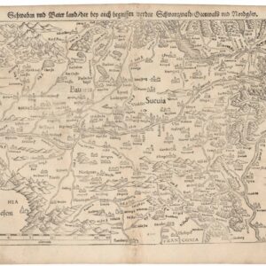
The kingdom is depicted after the fallout from the Napoleonic Wars and the separation of Belgium from the Netherlands in 1830 – 1831. The resulting land border between the two states, seen here, is jagged and does not follow natural features, and moreover includes complicated groups exclaves and enclaves.
An unresolved issue from the partial dissolution of the Netherlands was the status of Luxembourg and Limburg, which were divided between Holland and Belgium but retained a wide degree of autonomy (a note explains that much of the Dutch portion of the provinces appears on the atlas’ map of Belgium on the preceding page). The Dutch portion of both entities were also members of the German Confederation despite being possessions of the Dutch king, which caused periodic diplomatic crises in the mid-19th century.
Cartographer(s):
William and Alexander Keith Johnston were Scottish brothers based in Edinburgh who operated a prominent map engraving and printing business in the mid-19th century. A.K. Johnston was the driving force behind the business and remained in the world of cartography throughout his life, while William later entered politics, serving as the Lord Provost of Edinburgh and being knighted for his service. Johnston’s maps and atlases earned high praise for their accuracy and comprehensiveness (A.K. Johnston was strongly influenced by Alexander von Humboldt).
Condition Description
Very good. Toning along edges. Light foxing.
References
![[Ortelius & Hogenberg Atlas Factice]](https://neatlinemaps.com/wp-content/uploads/2023/03/NL-01678-leo-belgicus-3_thumbnail-300x300.jpg)