1878 U.S. report on the survey that fixed the U.S.–Canadian border along the 49th parallel.
Reports upon the Survey of the Boundary between the Territory of the United States and the Possessions of Great Britain. Washington: Government Printing Office, 1878.
$500
1 in stock
Description
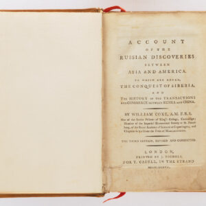
This 1878 first edition constitutes the official report of the United States Northern Boundary Commission, issued under the direction of Archibald Campbell, U.S. Commissioner, and Donald Roderick Cameron, his British counterpart. It documents one of the most ambitious and technically demanding surveys ever undertaken in North America: the final demarcation of the 49th parallel—the boundary between the United States and British North America—from the Lake of the Woods to the crest of the Rocky Mountains.
The work includes 13 detailed folding maps and 15 lithographed and engraved plates, several printed in color, illustrating the terrain, boundary monuments, and astronomical observations that guided the surveyors. The maps trace the line of demarcation through forests, plains, and mountains, recording the newly erected stone cairns, iron posts, and earthen mounds that physically marked the international frontier. Other plates depict the survey teams, their field instruments, and panoramic views of the frontier landscape.
The Reports provide a comprehensive narrative of the joint British-American field operations carried out between 1872 and 1876. These surveys completed the territorial definition first set out by the Treaties of 1818 and 1846, which had long left the exact placement of the boundary unresolved. Delayed by decades of diplomatic tension, the San Juan water boundary dispute, and the American Civil War, the Northern Boundary Commission at last translated the theoretical “line of the forty-ninth parallel” into a precise and mutually accepted geographic reality.
The survey’s success rested on the use of state-of-the-art astronomical and geodetic methods, combining triangulation, chronometric timing, and barometric leveling. The resulting maps stand among the most accurate frontier surveys of the 19th century, and the Reports capture both the scientific rigor and logistical hardship of the enterprise.
Archibald Campbell (1813–1887), who had previously served as commissioner on the Northwest Boundary Commission (1857–62), brought decades of experience in international boundary work. His Reports mark the culmination of a career dedicated to reconciling the cartography of empire with the realities of geography on the ground.
Issued by the U.S. Government Printing Office, this folio volume was produced in limited numbers for official and scientific use; few copies were made available to the public. It remains a cornerstone of North American boundary and exploration literature, valued both for its meticulous cartography and for the insight it offers into the final closing of the continental frontier.
Cartographer(s):
Archibald Campbell (1813–1887) was an American surveyor, diplomat, and commissioner best known for his leadership in defining the northwestern boundary between the United States and British North America. Born in New York, Campbell began his career as a civil engineer and surveyor in the U.S. Coast Survey before entering the State Department’s boundary service.
Campbell served as United States Commissioner on the Northwest Boundary Commission (1857–1862), which resolved the territorial limits established by the Treaty of 1846 between the United States and Great Britain. His work, interrupted by the San Juan Islands dispute and later resumed as U.S. Commissioner on the Northern Boundary Commission (1872–1876), culminated in the final demarcation of the 49th parallel from the Lake of the Woods to the Rocky Mountains.
Campbell’s tenure was marked by diplomatic finesse as well as technical precision—balancing the interests of two empires through rigorous geodetic and astronomical surveying. His contributions stand as a cornerstone in the scientific mapping of the U.S.–Canadian frontier.
Condition Description
5 plates, some of which are colored, 13 maps (repaired tear in map). Red cloth (boards worn, spine repaired, endpapers renewed).
References
Provenance: St. Paul Public Library (stamps) – PBA Galleries. Phillips, Atlases 1264; Howell 52:64.
