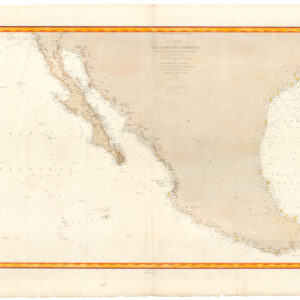
Gorgeous and extremely rare state of Sanson’s landmark map of North America.
Amerique Septentrionale
Out of stock
Description
Nicholas Sanson’s Amerique Septentrionale was arguably the most influential European map of North America in the 17th century. It was created under the auspices of Louis XIV and focuses on the French Crown’s North American possessions.
In the history of cartography, the map is notable as the first to publish many features of North America, as well as one of the first to use a sinusoidal projection (sometimes called Sanson-Flamsteed projection), with scale constant along a central meridian.
There are three states of the map: the first state, of which only two examples are known, has no land to the north-west of California; the second state (our map), also very rare, adds coastline to the north and west and eliminates a few place-names north of California; the third
state is the same as the second, except that Lake Ontario has been shaded to match the other Great Lakes. The map was officially published in 1658 as part of Sanson’s atlas, Cartes générales de tout les parties du monde, which was France’s first comprehensive atlas and presaged France’s growing influence in cartography, which had been dominated by the Dutch for a century.
This work is the first atlas map to show and name several features in the Great Lakes from the Jesuit Relations, records of Jesuit missionaries that were published/written in 1649. It is the first to include Montréal, which had only become a permanent settlement in 1642. Lake Superior and Lake Ontario are first named here on an atlas map and Lakes Michigan and Huron are accurately mapped for the first time.
Additionally, using the 1630 account of Spanish Father Alonso Benavides Memorial, the map shows many important features in the Southwest, including Santa Fe — inappropriately placed on the Rio Grande, which is shown to flow southwest — as well as areas marking the Apache, Navajo, and Taosij (Taos).
The map depicts some famous geographic myths that had not yet been dispelled. California is shown as an island and the map features a hypothetical Northwest Passage—an outlet from Hudson Bay leading to an area labeled “Mer Glaciale.” It would not be until the 1780s that the records of Samuel Hearne’s 1771 journey up the Coppermine River would be published, proving that there was no outlet from Hudson Bay leading to the Pacific.
Other features appearing on an atlas map of North America for the first time include New Amsterdam — as an island distant from the coast, though in the approximately correct location — and New Sweden, the 1638 colony established on the site of what is now Wilmington, Delaware.
Cartographer(s):
Nicolas Sanson d’Abbeville (1600-67) was perhaps the greatest cartographer of 17th century France — a period of France’s political ascendancy in Europe and also a period in which French cartographers displaced the Dutch as Europe’s leading map makers.
As a young man, he attracted the attention of Cardinal Richelieu and, in time, became Géographe Ordinaire du Roi for Louis XIII and Louis XIV, both of whom he personally instructed in geography. Under Louis XIII, Sanson became a minister of state. Sanson has become known as the “father of French cartography,” and his influence is such that the sinusoidal projection he employed has become known as the “Sanson-Flamsteed projection,” recognizing the impact of Sanson (Flamsteed was an English astronomer royal from 1675 to his death in 1719).
Pierre MariettePierre Mariette I (1569–1657) was an influential French publisher and engraver recognized for developing French cartography and publishing during the early 17th century. Initially, Mariette focused on publishing art prints but pivoted to cartography after purchasing map plates from Melchior Tavernier in 1644. He partnered with Nicolas Sanson, a foundational figure in French cartography, to produce detailed folio maps and atlases. In this collaboration, Sanson provided geographic expertise and map designs, while Mariette managed engraving, printing, and distribution. Their maps often included both their imprints, reflecting their partnership’s close, interdependent nature.
Mariette’s legacy extended beyond his lifetime, though disputes over rights to the plates emerged between Sanson and Mariette’s heirs after Mariette’s death. A legal settlement in 1674 allocated most plates to Sanson’s family, leading to a mixture of attributions in later editions of the maps. Pierre Mariette’s contributions laid the groundwork for the Mariette family, who continued to impact French publishing and mapmaking well into the 18th century, establishing the Mariette name as synonymous with high-quality cartographic and artistic publishing in France.
Condition Description
Splendid color, at least some of which is original. A few thin spots and a few small restorations in margins outside engraved area, else excellent.
References
Burden, The Mapping of North America I, 294 (state 3); Leighly, California as an Island, p. 33, plate 7; McLaughlin, The Mapping of California as an Island, 12; Pastoreau, Les Atlas Français XVIe-XVIIe Siècles, p. 387-9; Wagner, The Cartography of the Northwest Coast of America to the Year 1800, 360, pp. 130-2; Wheat, Mapping of the Transmississippi West I, p. 39; Martin, Maps of Texas and the Southwest, p. 83, plate 10.
