Daniel Burnham’s plan to reshape San Francisco, resurrected after the 1906 earthquake but scrapped after backlash from property owners.
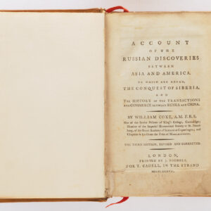
Report on a plan for San Francisco by Daniel H. Burnham. Assisted by Edward H. Bennett. Presented to the Mayor and Board of Supervisors by the Association for the Improvement and Adornment of San Francisco.
Out of stock
Description
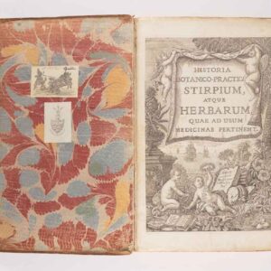
This is a rare 1905 book containing a report accompanied by more than 50 illustrations, photographs, maps, and plans demonstrating the “Burnham Plan” for San Francisco, a grandiose scheme to redesign the city.
By the turn of the 20th century, San Francisco was in need of revitalization. This was true of many contemporary cities only more so given the rapidity of San Francisco’s development in the wake of the California Gold Rush. The quick succession of phases in the city’s history had also led to a haphazard intermingling of architectural styles, which was not especially aesthetically pleasing. Many of the city’s well-heeled residents demanded more coordinated action by the government to implement a standardized vision for the city to clean it up and make it function more efficiently.
Burnham was a highly respected architect and city planner who was a leading figure in the City Beautiful movement, making him ideal for designing such a plan to remake the city. He was hired for the purpose by the private citizens’ group the Committee for the Improvement and Adornment of San Francisco, which included former mayor James Phelan. Burnham and his associates set up a studio atop Twin Peaks, which they came to value highly for its spectacular views of the city and usability as a public space.
The plan, which aimed to elevate San Francisco into the Pantheon of global cities, was influenced by equal parts Hausman’s Paris and ancient Greece and Rome. Wide diagonal boulevards would meet at traffic circles (“round points”) adorned with obelisks, with the largest and most important being at Van Ness and Market. These boulevards would divide the city into districts defined by function, such as government, commerce, finance, entertainment, industry, and, of course, housing. Colossal neoclassical buildings, including a large Athenaeum on Twin Peaks and an amphitheater nearby in Cole Valley, would be the crown jewels of the remade city.
Aside from the most developed part of the city, Burnham also had plans to beautify the “outside lands.” Tree-lined boulevards would provide scenic traffic arteries between different parts of the city, including a raised boulevard circling the entire city and an extension of the Golden Gate Park Panhandle to the central intersection of Van Ness and Market. A huge park roughly twice the size of Golden Gate park cutting southwest across the city would stretch from Lake Merced to Twin Peaks. Some of Burnham’s other proposals included a subway system and pedestrian-only zones downtown.
Although Burnham’s plan had support from some prominent backers like Phelan, doubts about its cost and feasibility, as well as opposition from homeowners and businesses that would need to be relocated to realize it, chipped away at public support in the months before the earthquake and great fire on April 18, 1906. Burnham’s original drawings and other materials, along with many of the copies of this report, were burned along with the rest of the records at City Hall. Although the destruction of the city could have provided an opportunity to rebuild it in an entirely new form, the desire to save on costs doomed Burnham’s plan as a viable model for reconstruction.
Still, some elements of Burnham’s plan were implemented, at least partially, after the earthquake, including the Park Presidio and Sunset Boulevards, one-way streets downtown, the reconstructed Civic Center, and, eventually, a subway.
Census
As the entire report and the individual maps are not consistently cataloged, it is difficult to establish the distribution of this report and its maps, illustrations, and photographs. The present edition, published in 1905 by the Sunset Press, is held by the San Francisco Public Library, the University of California Berkeley, Stanford University, Sant Clara University, and several other universities and research institutions throughout California and across the United States, while the book or its maps are quite rare to the market.
Cartographer(s):
Condition Description
The book's cover suffers from shelf-wear, while the cover has come away from the spine in a couple of places and the binding is beginning to loosen. There is handwriting on the inside of the front cover as well as toning on the endpapers and the foredge of the pages. The text itself is clean. Of the foldout maps near the rear of the book (following p. 184), all three have wear and some marginal splitting along the fold lines. The first map of San Francisco as it existed in 1904 has a tear near the bottom, while the smaller and larger (OCLC 78139418) maps showing Burnham's vision are otherwise in good condition.
References
Greg Kamiya, “SF’s lost opportunity to be reborn as ‘Paris, with hills’” The San Francisco Chronicle, October 27, 2017.

