
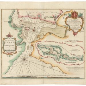
John Lindsay entered the Royal Navy as a chaplain in 1755. By 1757, he held that post aboard HMS Fougueux, a 64-gun ship of the line, and it was during the vessel’s stay in Cork Harbor that year that he began the survey on which this chart is based. The Fougueux was originally a French prize — her name a reminder of the capture that had added her to the British fleet — and Lindsay’s assignment to her placed him at one of the most important anchorages in the Atlantic approaches to Britain and Ireland. The resulting chart, published in 1759, was substantial enough to displace Collins’s longstanding survey of Cork from the pages of Great Britain’s Coasting Pilot, the principal navigational reference for British coastal waters.
-
-
Add to cart
 Quick View
 - British Isles, Europe
A New and Correct Chart of the Harbour of Corke by the Revd. J. Lindsay.
- $650
- 1759 Nautical Chart of Cork Harbour, Dedicated To George Anson.
-
-