
The Palestine Exploration Fund (PEF) was founded on June 22, 1865, in London, in the immediate aftermath of the Ordnance Survey of Jerusalem — the first Ordnance Survey conducted outside the borders of Great Britain. Its founders included a distinguished circle of Victorian clergymen, scientists, and philanthropists, with the support of Queen Victoria, and the Fund quickly became the preeminent British institution for the scholarly study of the Levant.
Though nominally a civilian research organization, the Fund maintained throughout its early history an intimate relationship with British military intelligence. Its surveys were conducted by Royal Engineers, its findings studied by the War Office, and its expeditions consistently served dual purposes that were rarely entirely academic.
The Fund’s greatest cartographic achievement was the Survey of Western Palestine (1871–1877), led by Lieutenants Claude Conder and H.H. Kitchener, which produced the first comprehensive modern map of the region. By the early 20th century the focus had shifted toward archaeological expeditions, culminating in the 1913–1914 Wilderness of Zin survey led by C. Leonard Woolley and T.E. Lawrence — nominally a biblical archaeology mission but in practice a military intelligence operation on the eve of the First World War. The Fund continues to operate today as a learned society promoting research into the history and archaeology of the Levant.
-
-
Add to cart
 Quick View
- Eastern Mediterranean - Holy Land, Middle East - Holy Land Maps
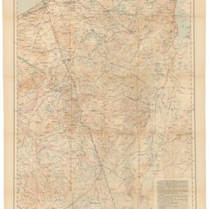
The Negeb or Desert south of Beersheba.
- $425
- 1921 War Office Map of the Negev, Based on the 1913–1914 Woolley-Lawrence-Newcombe Survey.
-
-