
Sherman & Smith (fl. c. 1829–1855), sometimes operating as Stiles, Sherman & Smith, were among the foremost cartographic engravers in antebellum New York City, maintaining offices at the corner of Broadway and Liberty Street. The firm — which included engraver George E. Sherman, surveyor and engraver John Calvin Smith, and at times Samuel Stiles — was the preferred engraver for major American government cartographic projects of the mid-19th century, including maps prepared for the Army Corps of Topographical Engineers, charts for the U.S. Coast Survey, and — most relevantly — the official engraved maps of the United States Exploring Expedition. Their work for private publishers included maps for Thomas Bradford and John Disturnell.
Active during the critical decades of American continental expansion, Sherman & Smith’s output constitutes a significant portion of the official cartographic record of the young republic.
-
-
Add to cart
 Quick View
 - California, San Francisco
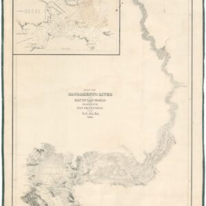
Map of Sacramento River and Bay of San Pablo with Harbour of San Francisco by the U.S. Ex. Ex. 1841.
- $4,500
- Extremely rare 1841/1858 Wilkes U.S. Exploring Expedition Map of the Sacramento River and San Francisco Harbor.
-
-