
Gouverneur Kemble Warren (1830–1882) was born in Cold Spring, New York, and graduated second in his class from West Point in 1850, entering the Corps of Topographical Engineers — the Army’s elite unit of scientific soldiers tasked with mapping an unmapped nation. In the mid-1850s he was assigned to the Pacific Railroad Survey project, where his contribution proved to be the most enduring cartographic legacy of the entire enterprise: the Map of the Territory of the United States from the Mississippi River to the Pacific Ocean (1857), compiled from all four survey routes and every other reliable source then available. Known simply as the Warren Map, it was the most comprehensive and accurate cartographic picture of the American West produced to that date, and remained the standard reference for the region well into the following decade. It appeared in Volume XI of the Pacific Railroad Survey Reports.
Warren’s subsequent career carried him from the surveying field to the most consequential ground of the Civil War. Serving as Chief Engineer of the Army of the Potomac, he is credited with one of the decisive acts of the Battle of Gettysburg: on the afternoon of July 2, 1863, recognizing that Little Round Top stood undefended and commanded the entire Union left flank, he rushed troops to hold it moments before the Confederate assault. The position held. His reputation, however, did not survive the war intact. At the Battle of Five Forks in April 1865, Philip Sheridan relieved him of command in disputed circumstances, a public humiliation that Warren spent the rest of his life contesting. A court of inquiry finally vindicated him in 1882 — but the findings were announced after his death. He died in August of that year, at fifty-two, having never learned the outcome.
-
-
Add to cart
 Quick View
 - Texas and The West
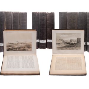
PACIFIC RAILROAD SURVEYS. Reports of Explorations and Surveys, to Ascertain the Most Practicable and Economical Route for a Railroad from the Mississippi River to the Pacific Ocean, Made Under the Direction of the Secretary of War, in 1853-4. Washington, D.C.: Beverley Tucker, 1855-1861.
- $6,000
- The Complete Pacific Railroad Surveys, Senate Issue, 1855–1861.
-
-