Aaron Arrowsmith (1750-1823) was perhaps his generation’s most influential English mapmaker. He served as hydrographer to the British Royal Family from 1810 until his death. Born in County Durham in northern England, Arrowsmith moved to London around 1770, where he won an apprenticeship under William Faden, the royal cartographer of King George III. Soon after, Arrowsmith began studying engraving under John Cary, who had set up a successful business focused on mapmaking despite being only a few years his senior.
One of the accomplishments that secured Arrowsmith’s renown as a cartographer was his chart of the world based on the Mercator projection, which he published in 1790. Some years later, a second world map based on globular projection was published. In the coming years, Arrowsmith dedicated himself to producing detailed maps of the British Empire and beyond, famously creating his first North American chart in 1796, followed by a range of seminal maps depicting The South Pacific (1798), The West Indies and Spanish Dominions in America (1803), The Indian Subcontinent (1804), Egypt (1807), Scotland (1807), Mexico (1803 & 1810), South Africa (1815) and The North Pole (1818). His 1790 map of America was re-issued several times, the most important of which was in 1802. The detailed study of this particular map was a crucial part of Lewis and Clark’s preparations for the great Corps of Discovery expedition (1803-1806).
In 1804, Arrowsmith joined forces with Samuel Lewis of Philadelphia to produce the New and Elegant General Atlas Comprising all Discoveries to the Present Time, which for many years set an American standard for compiling popular atlases.
In 1810, Arrowsmith was appointed royal hydrographer to the Prince of Wales, who appointed him as hydrographer to King George IV upon ascending the throne a decade later. His success prompted several family members to follow in his footsteps (most notably his son Aaron and his nephew John), establishing a line of English cartographers carrying the Arrowsmith name.
Mount Arrowsmith on Vancouver Island is named after him.
Archived
- Out of Stock
- Asia
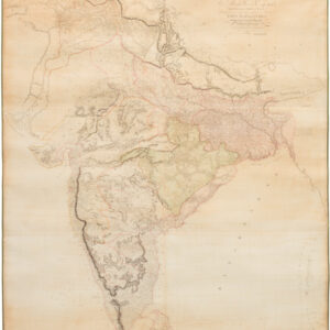
To Mark Wood Esq. M.P., Colonel of the Army in India, Late Chief Engineer and Surveyer General, of Bengal, This Map of India Compiled from various Interesting and Valuable Materials Is Inscribed in Grateful Testimony of His Liberal Communications By his obedient and most humble Servant A. Arrowsmith.
- An extraordinarily detailed wall map of British interests and possessions in the Indian Subcontinent at the dawn of the 19th century, executed by one of the Empire’s foremost cartographers.
- Read moreQuick View
-

