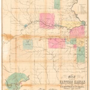
Albert D. Searl (1831-1902) was an American surveyor, civil engineer, and abolitionist active in Kansas during the ‘Bloody Kansas’ period (1854-58).
Born in Southampton, Massachusetts, Searl moved to Kansas in 1854, where he played a central role in laying out the town of Lawrence. In 1856, he partnered up with another Lawrence pioneer, Edmund Burke Whitman, to become General Land Agents for abolitionist-minded settlers from the East Coast. The pair published an essential map of Eastern Kansas shortly after the sacking of Lawrence in May 1856.
During the Civil War, Searl was commissioned as a 2nd Lieutenant in the Union Army’s 9th Kansas Cavalry Regiment. After the war, Searl remained in Lawrence until 1882, when he moved to Leadville, Colorado to become head surveyor for the Rio Grande Railroad out of Denver. Searl died in 1902.
Archived
- Out of Stock
- Texas and The West
Map of Eastern Kansas.
- Iconic 1856 map of East Kansas, published just a month after the sacking of Lawrence and in the midst of the tumultuous ‘Bloody Kansas’ era.
- Read moreQuick View
-
