George Karl Ludwig Preuss (1803–1854), anglicized as Charles Preuss, was a surveyor and cartographer who accompanied John C. Fremont on three of his five exploratory expeditions of the American west, including the expedition where he and Fremont were the first to record seeing Lake Tahoe from a mountaintop vantage point as they traversed what is now Carson Pass in February 1844.
-
-
Add to cart
 Quick View
 - Texas and The West
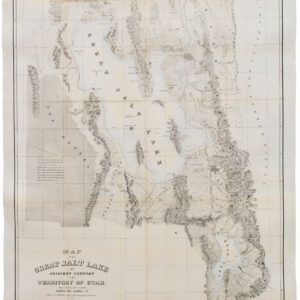
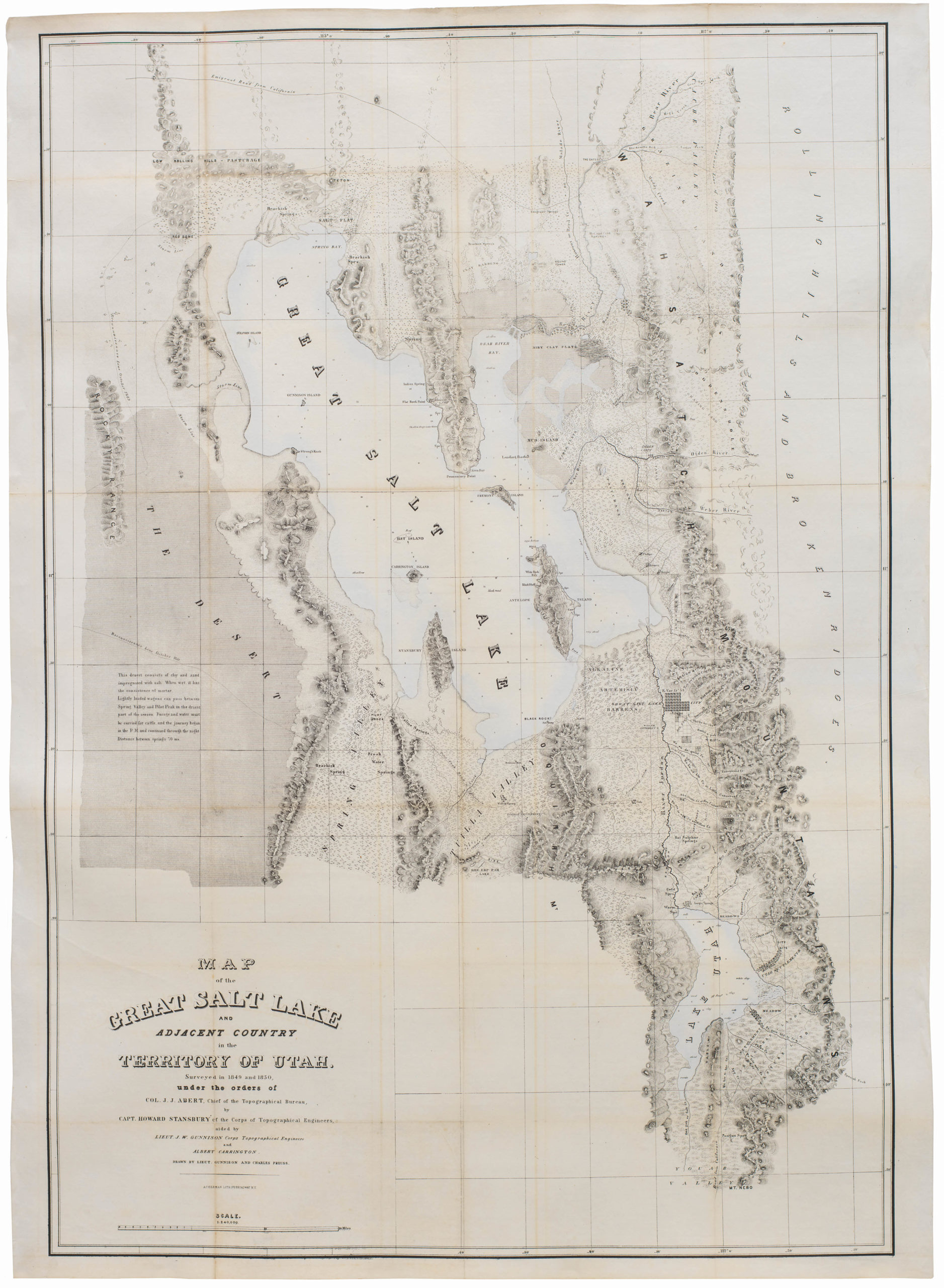
Map of the Great Salt Lake And Adjacent Country in the Territory Of Utah. Surveyed in 1849 and 1850…
- $850
- "Scientific cartography of the Territory of Utah may be said to date from the appearance of this map." - Wheat
-
-
-
Archived
- Out of Stock

- Texas and The West, United States
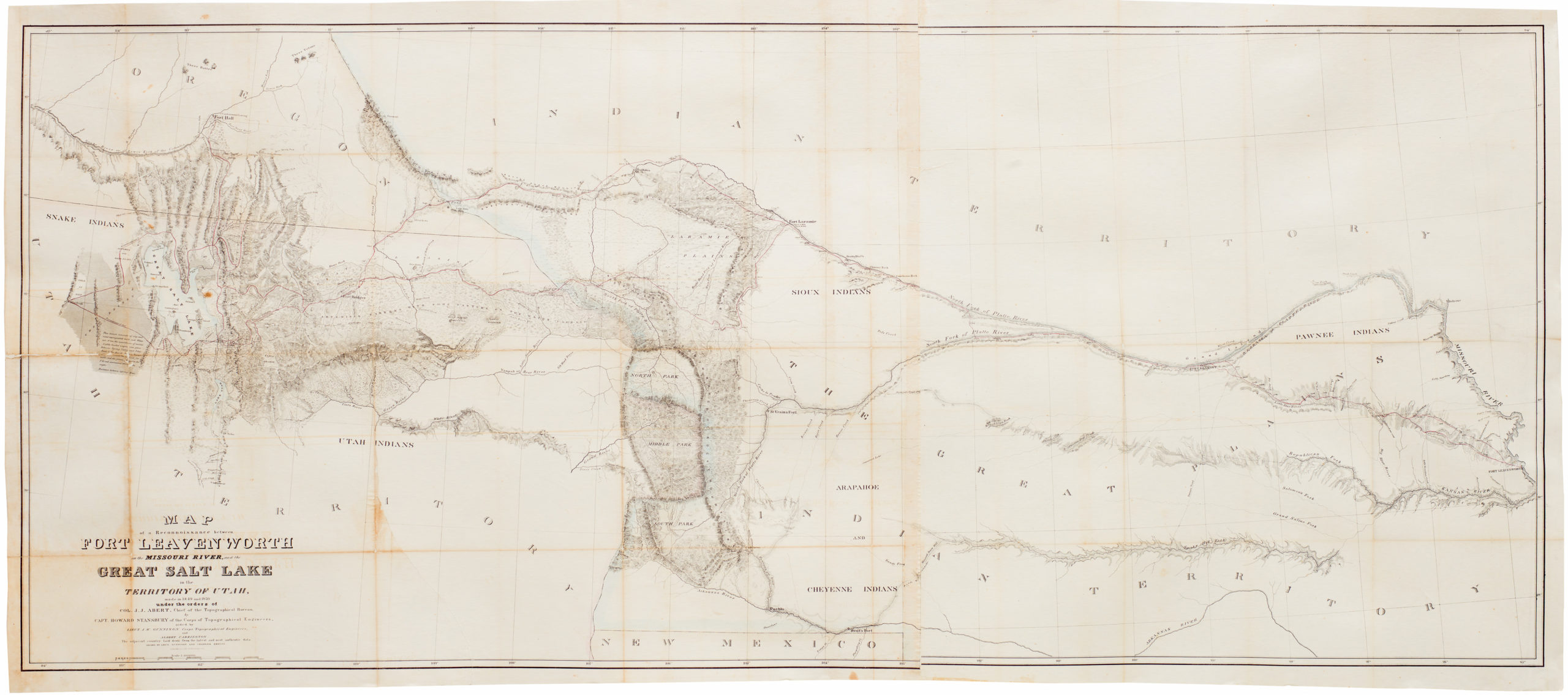
Map of a Reconnoissance between Fort Leavenworth on the Missouri River, and the Great Salt Lake in the Territory Of Utah…
- One of the seminal cartographic achievements for the mapping of the West, professionally backed on sturdy linen.
- Read moreQuick View
-
- Out of Stock
- California, Texas and The West
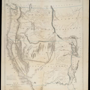
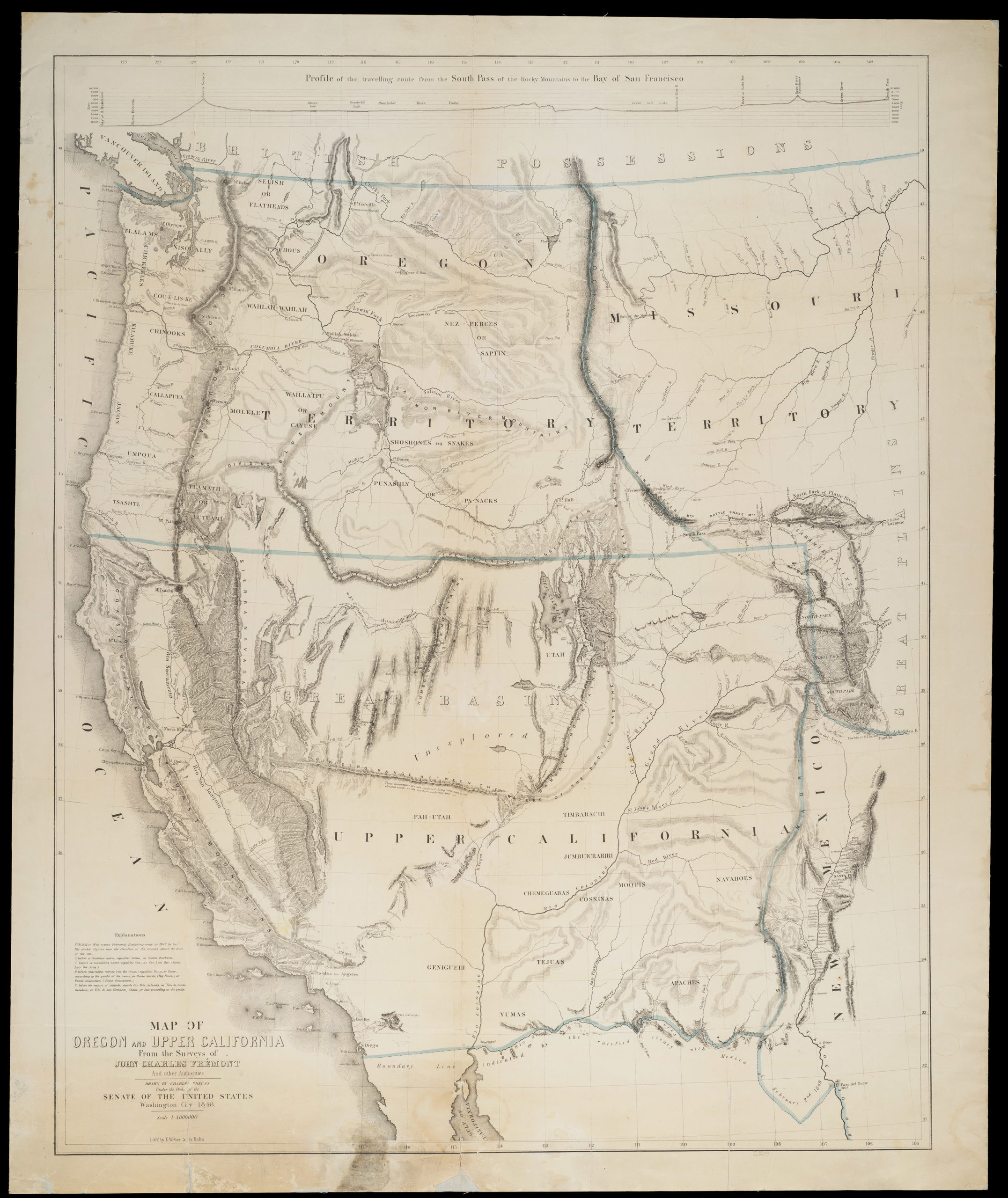
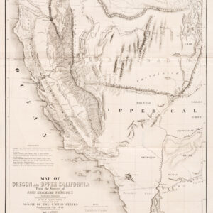
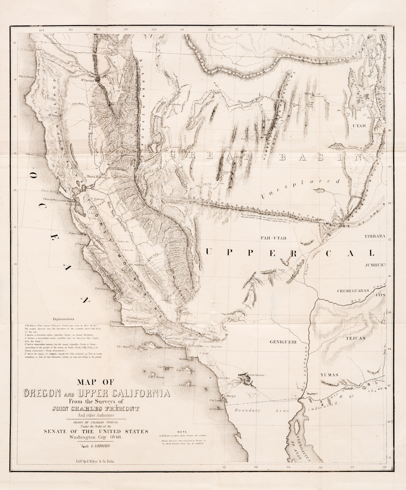
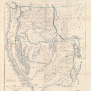
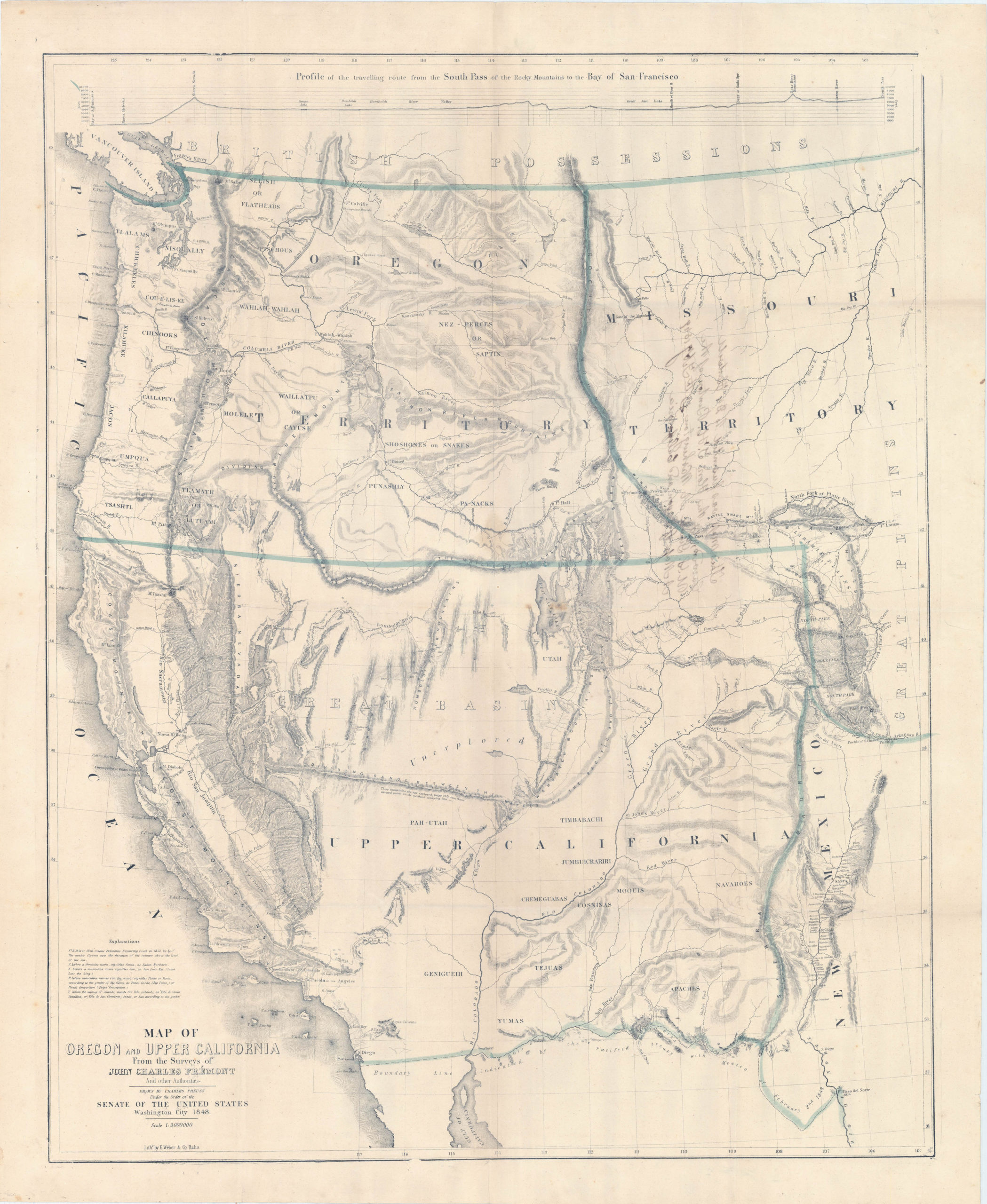
Map of Oregon and Upper California from the Surveys of John Charles Fremont and Other Authorities
- Frémont & Preuss mapping the West
- Read moreQuick View
-
- Out of Stock
- California, Texas and The West
Map of Oregon and Upper California from the surveys of John Charles Fremont and others authorities drawn by Charles Preuss…1848
- "The one great general map of 1848 was that of Fremont and Preuss…" - Wheat
- Read moreQuick View
-
- Out of Stock
- California, Featured Maps & Views, Texas and The West
Map of Oregon and Upper California from the Surveys of John Charles Fremont and Other Authorities
- Presentation copy by Senator T.H. Benton.
- Read moreQuick View
-