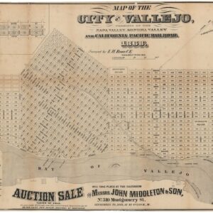
E.H. Rowe was a civil engineer and surveyor active in the Bay Area during the middle of the 19th century. Not much is known about him, but we can assemble some information from various survey maps of the period.
Warren Heckrotte notes that in 1849, the Alta California newspaper mentions E.H. Rowe as the surveyor of Parker House. This was among San Francisco’s most renowned hotel and gambling establishments at the time. In 1850, however, the Parker House was replaced by the Jenny Lind Theatre, which, after being destroyed in the fires of 1851 and subsequently rebuilt, was purchased by the City of San Francisco in 1852 for use as the city hall.
In light of this, and his involvement in several key maps of the period (e.g. Map of the Rancho del Cañada de Capay, in the county of Yolo, Alta California from 1854), we assume that he served in an official surveying capacity for the City of San Francisco.
-
-
Add to cartQuick View
- Bay Area & Silicon Valley, California
Map of the City of Vallejo, terminus of the Napa Valley, Sonoma Valley and California Pacific Railroad.
- $4,500
- The first official town plan of Vallejo.
-
Add to cart
