Nicolas De Fer (1646–1720) was a French cartographer and geographer who also worked as an engraver and publisher. He was renowned for his massive output and his pleasant visual designs. He was the son of a Parisian cartographer and began apprenticing at an early age. By twelve, however, he shifted his apprenticeship to the closely associated field of engraving – a move his father no doubt encouraged, as it might enhance his competitive position on the market with his son as a trained engraver.
De Fer’s father died in 1673, but Nicolas did not take over the company until 1687, at which point it had been virtually run into the ground. Nevertheless, Nicolas had a knack for business and soon turned things around. By 1690, he was so successful that he won employment as the official geographer to Louis, Le Grand Dauphin of France, and son of the reigning French king, Louis XIV. Soon after, with support from the Spanish and French courts, De Fer was appointed the official geographer for King Louis XIV. In 1720, shortly before his death, he was even appointed royal geographer to Philip V, king of Spain.
De Fer’s popularity in the Bourbon royal circles was primarily due to his appreciation of the propagandistic effects of strategic cartography. But no doubt his keen sense of aesthetics helped as well. Whatever the case, his maps were hugely popular, well-funded, and widely distributed. He was impressively productive, publishing over 600 sheets from his atelier and covering everything from town plans to world maps. Many of his maps rode the political conjunctures of the age. Hardly would a territory have been won or surrendered before De Fer’s atelier was working on a map delineating the new realities.
-
-
Add to cart
 Quick View
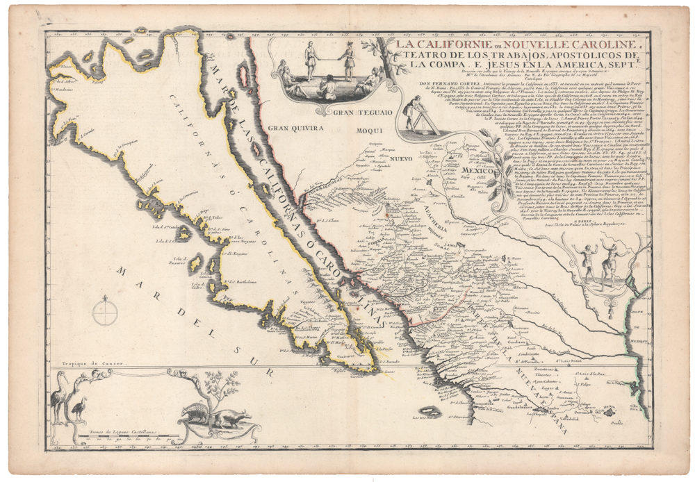
 - Americas, California, North America
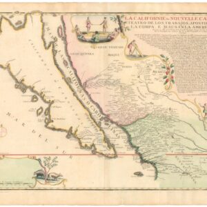
La Californie ou Nouvelle Caroline, Teatro De Los Trabajos Apostolicos De La Compa. E. Jesus En La America Septe…
- $7,500
- [Old Color] The largest cartographic depiction of the island of California ever made.
-
-
-
-
Add to cart
 Quick View
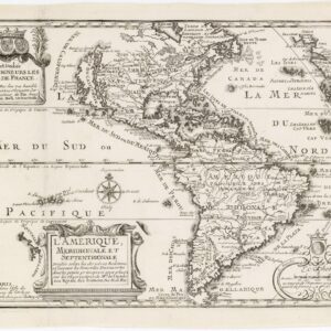
 - Americas, Mexico - Central & South America, North America
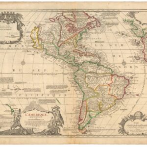
L’Amerique meridionale et septentrionale
- $1,800
- Nicolas de Fer’s seminal map of the Americas.
-
-
-
Archived
- Out of Stock
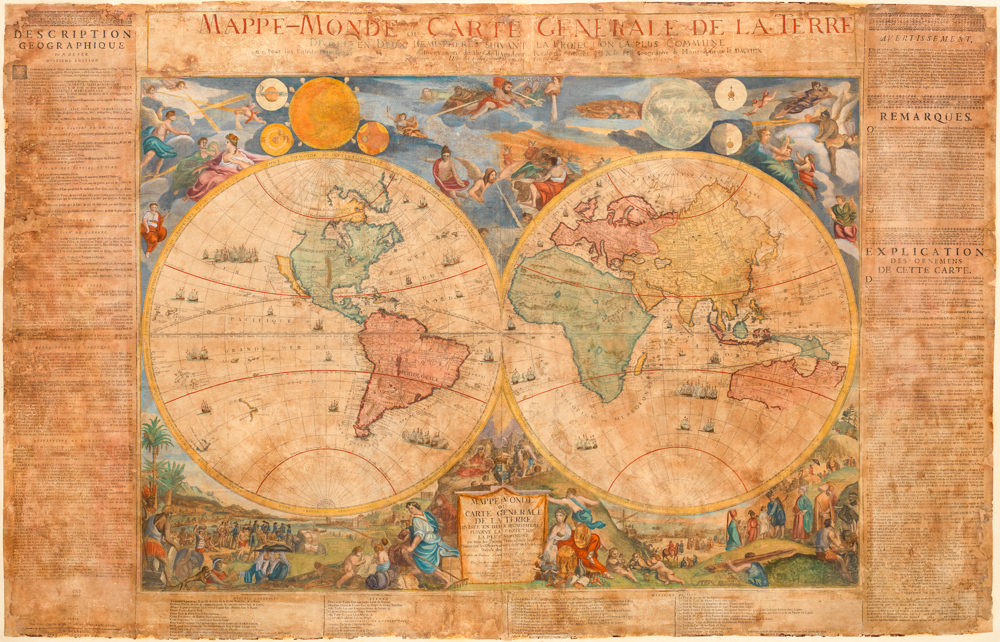
- Featured Maps & Views, World
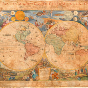
Mappe-Monde ou Carte Generale de la Terre Divisee en Deux Hemispheres Suivant la Projection la Plus Commune ou Tous les Points Principaux sont Placez sur les Observations…
- An early state of De Fer's famous world wall map -- an Enlightenment masterpiece in which the highest artistic and scientific aspirations of the age coalesce.
- Read moreQuick View
-
- Out of Stock
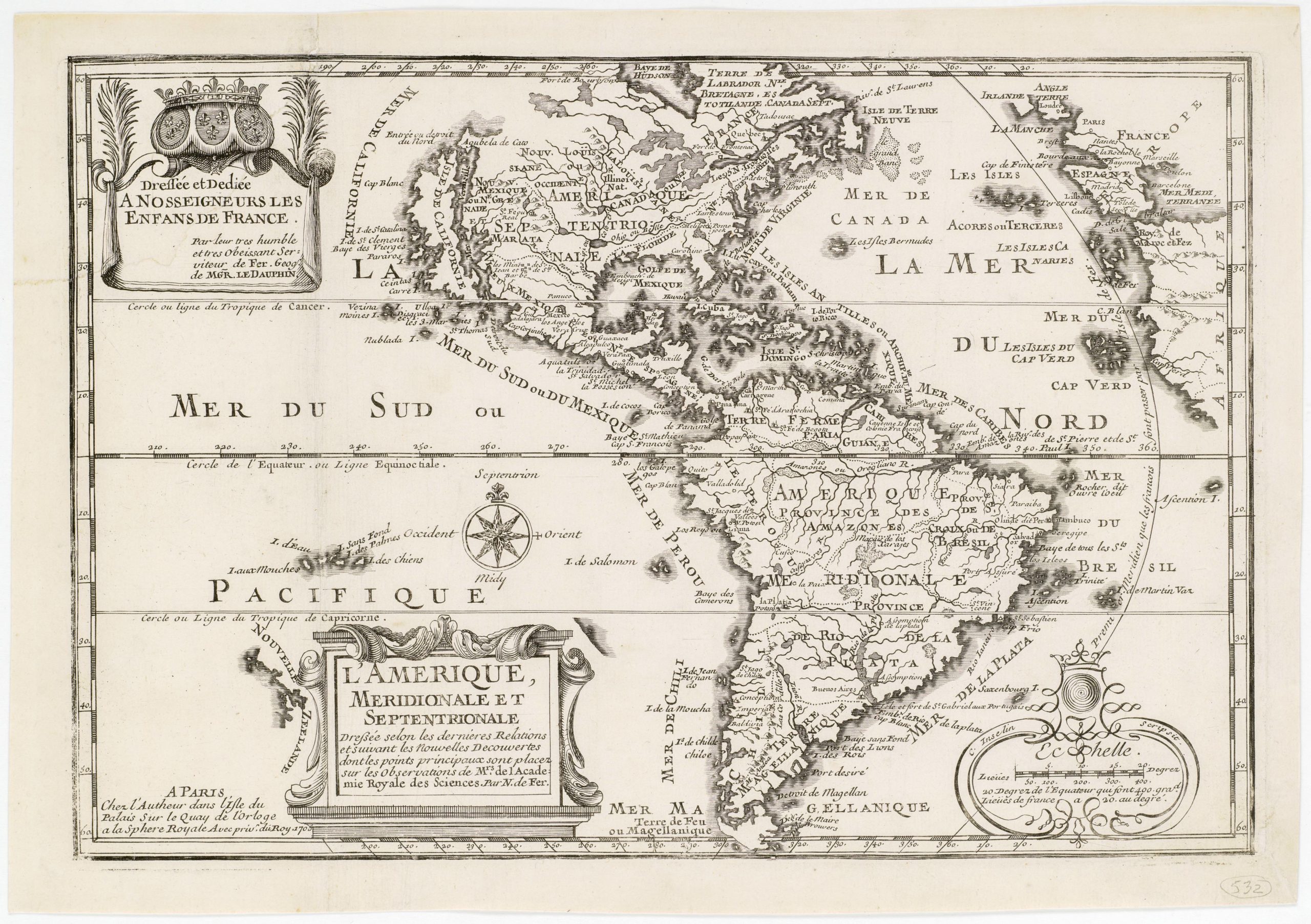
- North America
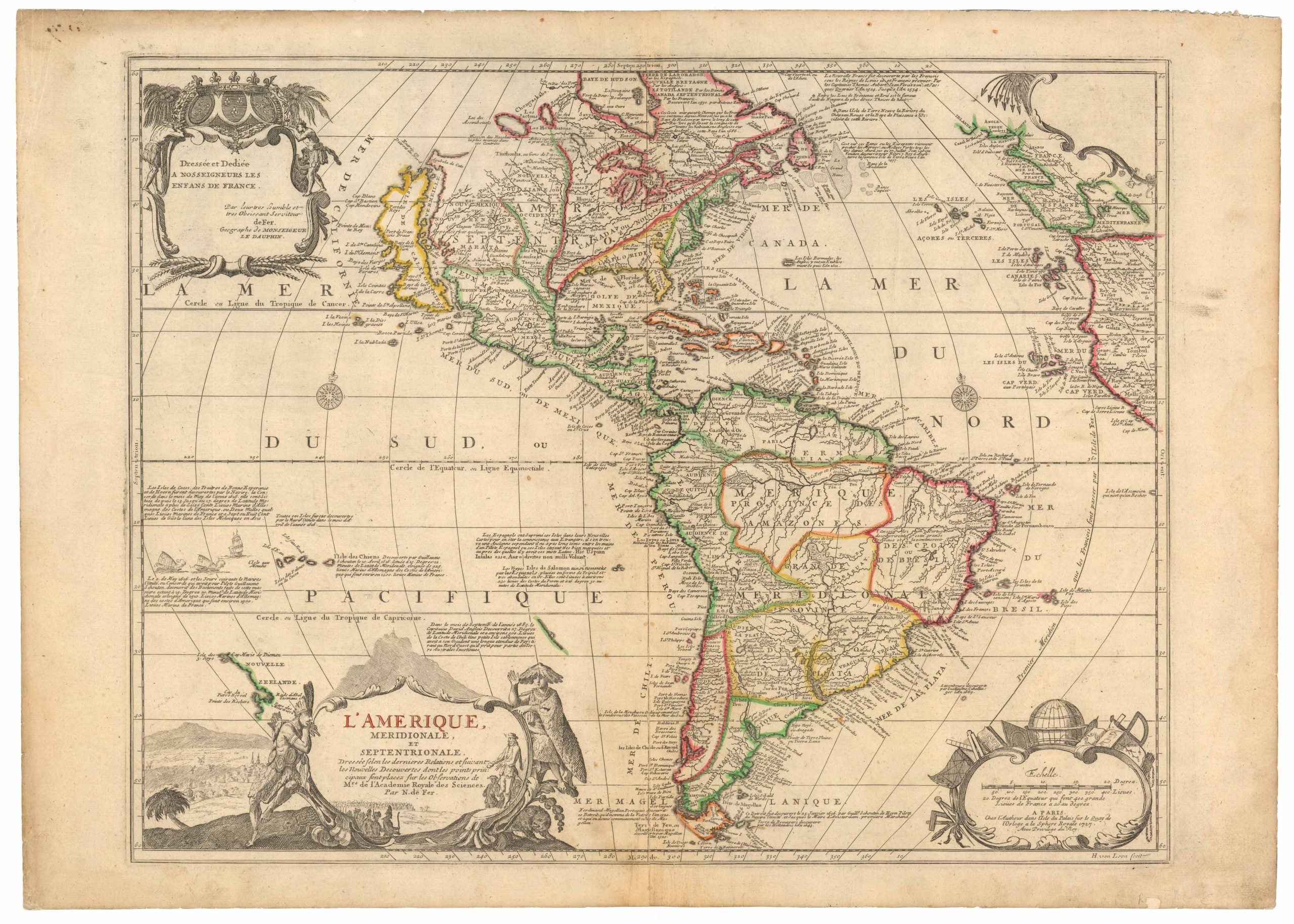
L’Amerique, Meridionale et Septentrionale Dressee selon les Dernieres Relations et Suivant les Nouvelles Decouvertes…
- Finely-engraved small map of the Western Hemisphere featuring a prominent Island of California and three elaborate cartouches.
- Read moreQuick View
-
- Out of Stock
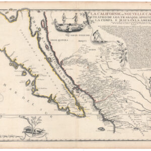
- Americas, California, North America
La Californie ou Nouvelle Caroline, Teatro De Los Trabajos Apostolicos De La Compa. E. Jesus En La America Septe…
- The largest and finest cartographic depiction of the island of California ever made.
- Read moreQuick View
-