In 1856, William H. Rand opened a printing shop in Chicago and two years later hired a newly arrived Irish immigrant, Andrew McNally, to work in his shop. In 1868, the two men, along with Rand’s nephew George Amos Poole, established Rand McNally & Co. and bought the Tribune’s printing business. The company initially focused on printing tickets and timetables for Chicago’s booming railroad industry, and the following year supplemented that business by publishing complete railroad guides.
The first Rand McNally map, created using a new cost-saving wax engraving method, appeared in the December 1872 edition of its Railroad Guide. Rand McNally became an incorporated business in 1873; with Rand as its president, McNally as vice president, and George Poole as treasurer.
Rand McNally published its first road map, the New Automobile Road Map of New York City & Vicinity, in 1904.
-
-
Add to cart
 Quick View
 - California, Southern California
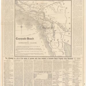
Map of Coronado Beach San Diego, California.
- $1,200
- Early 1887 Promotional Broadside for the Hotel Del Coronado.
-
-
-
-
Add to cart
 Quick View
 - California, Southern California
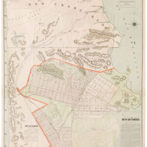
Map of Coronado Beach. San Diego, California.
- $2,800
- The seldom seen large-format edition of Rand McNally’s map of Coronado Beach, San Diego.
-
-
-
-
Add to cart
 Quick View
 - Pictorial maps, Texas and The West, United States
The Indian-detour; Santa Fe; Harveycars.
- $675
- The Roots of Romanticism of the American Southwest.
-
-
-
-
Add to cart
 Quick View
 - California, San Francisco
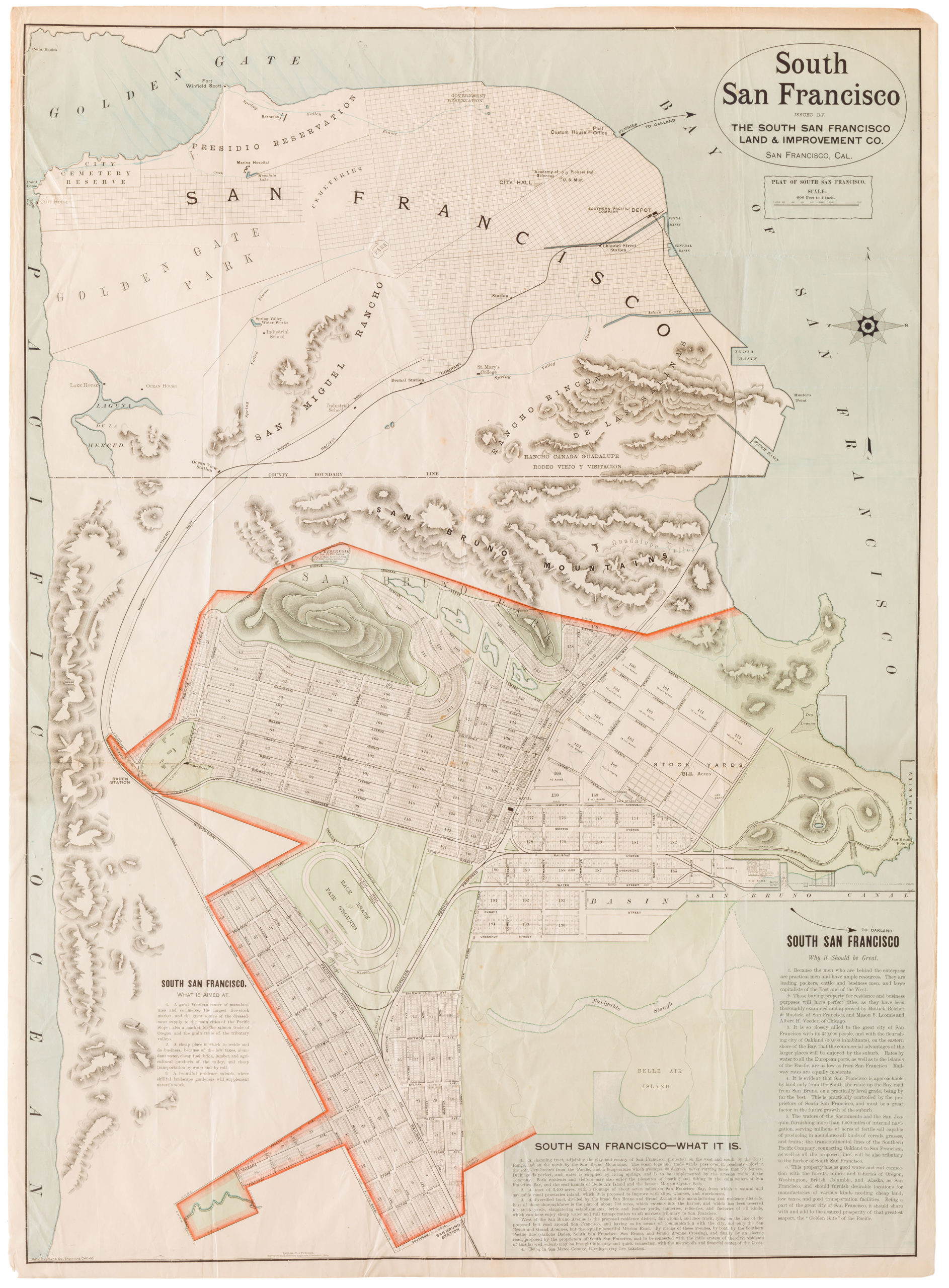
South San Francisco. Issued By The South San Francisco Land & Improvement Co.
- $2,600
- Large-format circa 1892 Rand McNally promoting the development of South San Francisco.
-
-
-
-
-
Add to cart
 Quick View
 - World
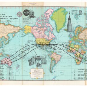
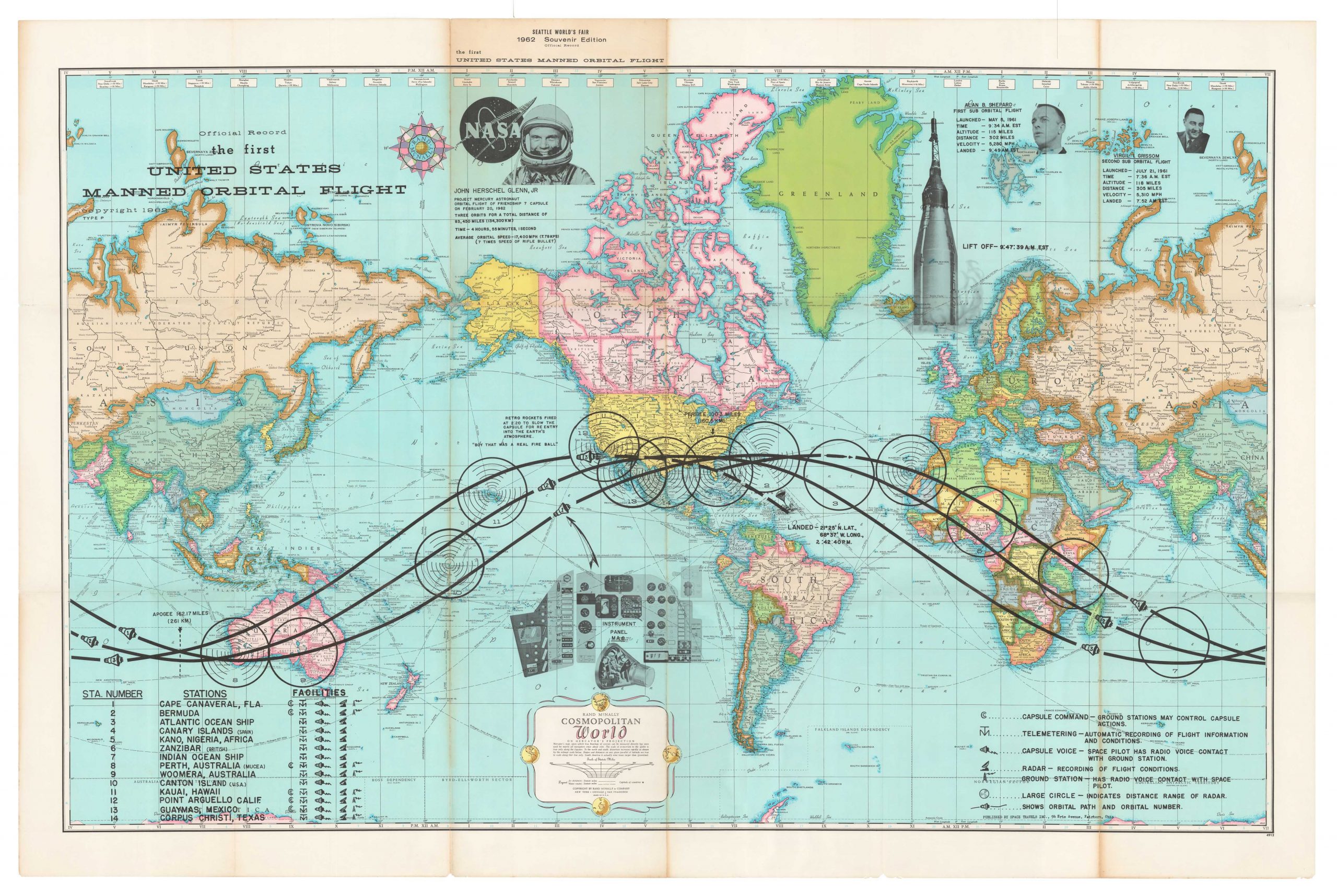
Official Record. The First United States Manned Orbital Flight.
- $675
- Mapping the First United States Manned Orbital Flight.
-
-
-
-
-
Add to cart
 Quick View
 - United States, World War I and World War II, Pictorial maps
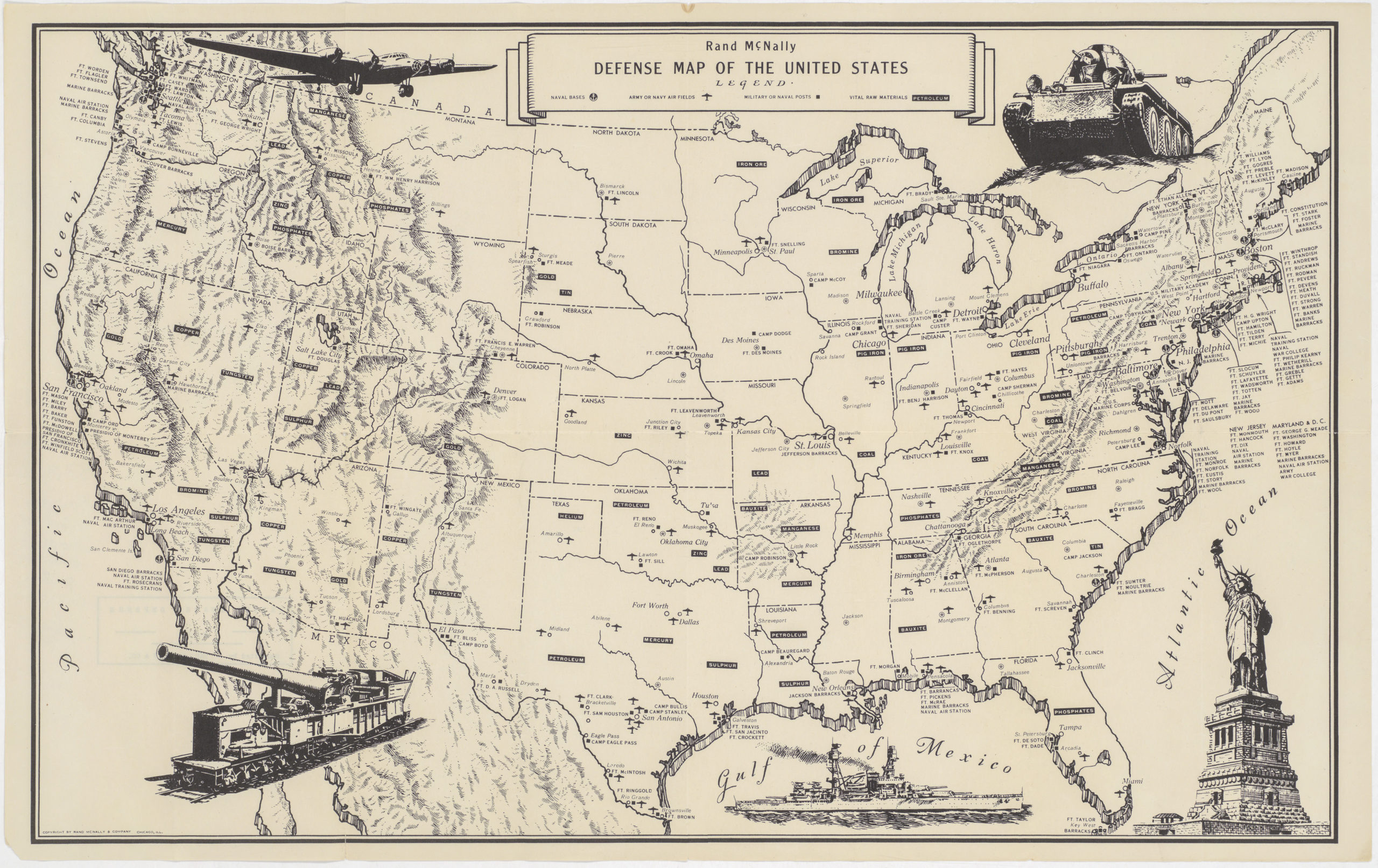
Rand McNally Defense Map of the United States
- $450
- Fascinating World War II era map of U.S. military bases and vital raw materials.
-
-
-
Archived
- Out of Stock
- Texas and The West
Phoenix Street Map.
- Hand water colored 1952 urban plan of Phoenix, Arizona.
- Read moreQuick View
-
- Out of Stock
- East & Midwest United States
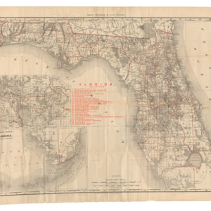
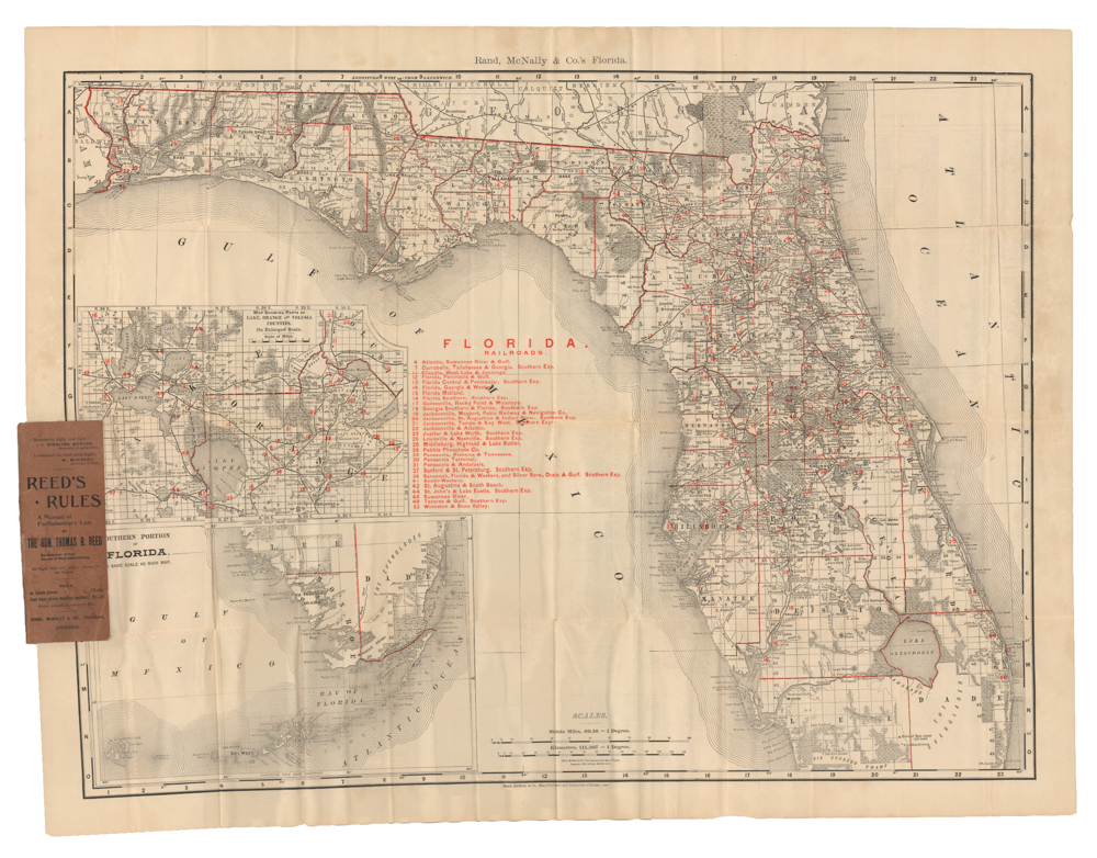
The Rand-McNally Vest Pocket Map of Florida
- A rare pocket version of Rand, McNally and Co.'s 1895 railroad map of Florida.
- Read moreQuick View
-
- Out of Stock
- United States
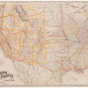
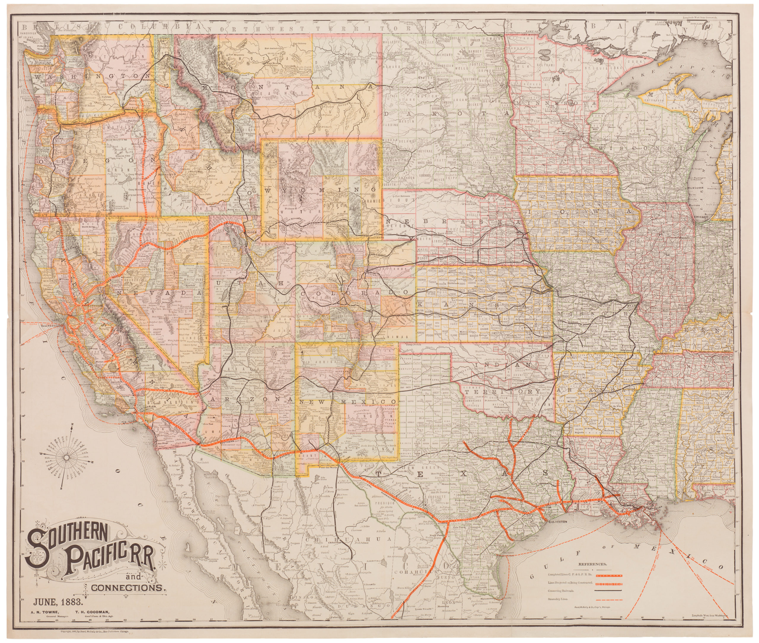
Southern Pacific R.R. and Connections. June 1883
- Definitive 1883 map of the Southern Pacific Railroad
- Read moreQuick View
-
- Out of Stock
- United States
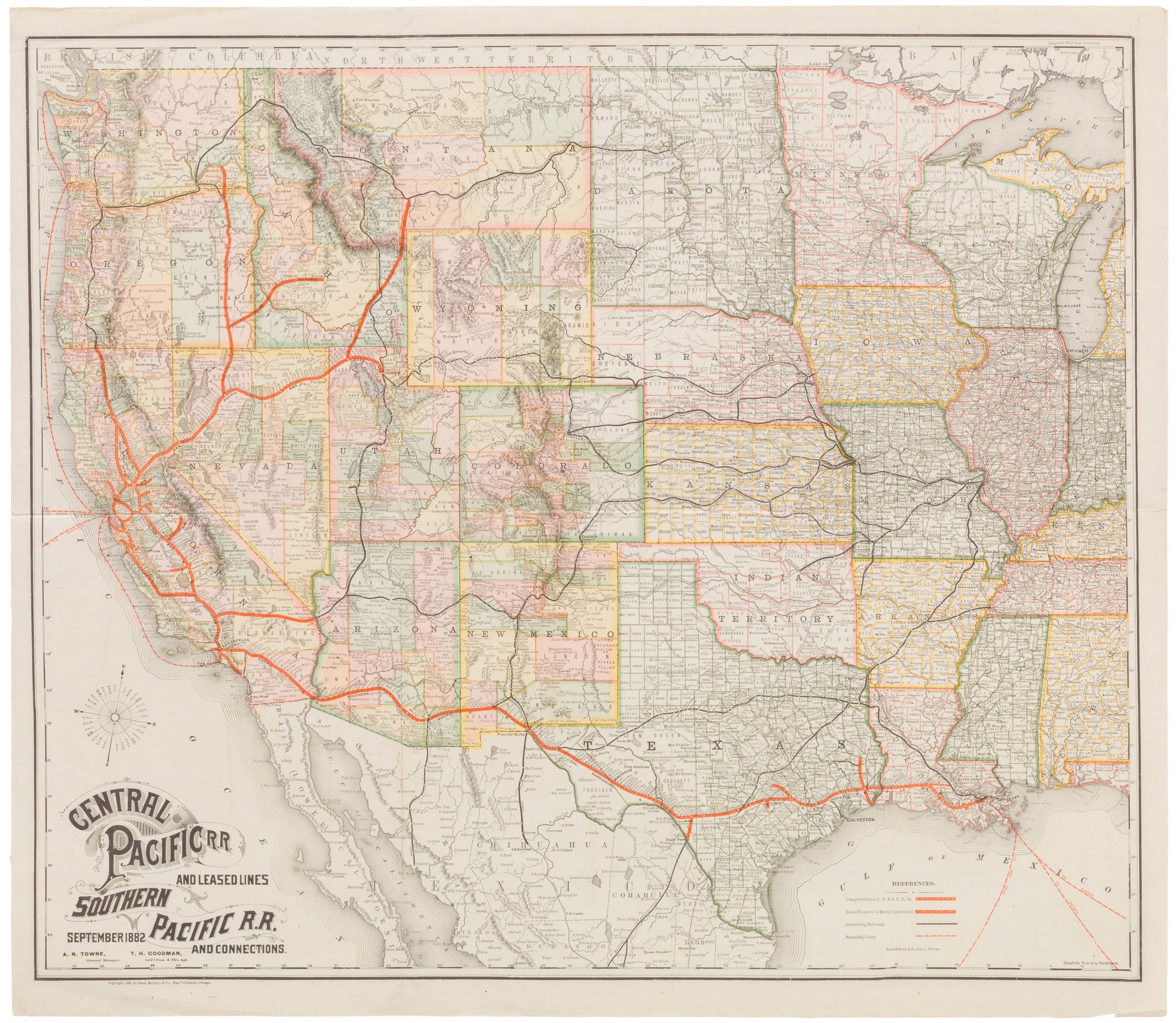
Central Pacific R.R. and Leased Lines; Southern Pacific R.R. and Connections. September 1882. A.N. Turner, General Manager. R.H. Goodman, Gen’l Pass. & Tkt. Agt.
- Attractive 1882 map of Central and Southern Pacific Railroad lines
- Read moreQuick View
-