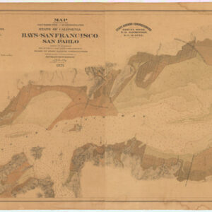
Thomas Jefferson Arnold (d.1878) was a city engineer in San Francisco during the 1870s. His formal title was Engineer of the Sea Wall. He is behind a number of important maps for large infrastructural projects such as this one, but is perhaps better known for designing the so-called Sea Wall of San Francisco. Plans and drawings of his original structure still exist in the archives, but the wall was only begun in earnest in 1878, the same year Arnold died. To this day, the protective barrier that Arnold visualized constitutes both the foundation for the Embarcadero Roadway, as well as a protective dyke that shields downtown San Francisco from flooding.
In many ways, Arnold represents the fuzzy line between civil servant and private entrepreneur. Prior to producing his famous San Francisco Bay Tide Lands map as a city engineer for San Francisco, Arnold had worked as chief engineer for the Southern Pacific Railroad, among other things contributing to an important mapping of the railroad, drawn up by G.F. Allardt and published in 1868 (see https://lccn.loc.gov/2002630524).
Archived
- Out of Stock
- Bay Area & Silicon Valley, San Francisco
Map Exhibiting the Salt Marsh, Tide and Submerged Lands Disposed of by the State of California in and Adjacent to the Bays of San Francisco and San Pablo and now Subject to Reclamation Prepared from Maps of the U.S. Coast Survey & Official Records by Order of the Board of State Harbor Commissioners for the United States Commissioners on San Francisco Harbor…
- The power of private enterprise in America: a rare and important map of the San Francisco Bay Tide Lands, showcasing ambitions behind the city’s development.
- Read moreQuick View
-
