Thomas Jefferys (c. 1710-1771) was one of the significant commercial cartographers in London in the middle of the 18th century. He issued many maps, but Braddock Mead’s American maps, particularly Map of the Most Inhabited Part of New England (1755), stand as his greatest successes. Even though Jefferys was not an actual compiler of maps himself, his skills as an engraver and, perhaps more importantly, in entering the right commercial partnerships soon established him in cartographic circles.
Jefferys’s origins and beginning in the map trade are somewhat obscure. From around 1735, we know he apprenticed as an engraver with the famous English map maker Emmanuel Bowen. Once trained, he worked as an engraver for several London publications, usually on map-related projects. Jefferys increasingly gravitated to his projects and gradually became a publisher and engraver, primarily of maps. In 1746, he was appointed geographer to the Prince of Wales, which meant that at his ascension to the throne fourteen years later, Jefferys became Royal Geographer to King George III. In real life, these titles conferred a reputation as a tradesman favored by the court; they did not entail a salary or specific commissions per se. By 1750, his position and hard work allowed Jefferys to move to new and larger premises at Charing Cross in central London.
The Seven Years War (1756-63), a British-French conflict fought in Europe, America, and South Asia, created a boom in the demand for maps. Jefferys was ideally positioned to respond to this demand. During those years, maps of the Americas became especially popular, and with John Green (Mead) in his fold, Thomas Jefferys produced the very best of these on the market. In general, Jefferys took advantage of the increasing demand. Indeed, two of his maps – both compiled by Braddock Mead/John Green – are among the most influential maps ever made of the British colonies in America. Jefferys’s maps were in sync with public sentiment. He displayed a strong position against French territorial claims when war with France loomed. This was not particularly controversial since the French policy of encircling and encroaching on the English colonies was considered a real threat, but it did help his business.
With the war’s conclusion in 1763, demand waned, and having lost his best in-house cartographer; things were not looking up. In 1765, following several self-funded county surveys in England that Jefferys had hoped would save him financially, his publishing house went bankrupt. By joining forces with Robert Sayer of London, another publisher specializing in maps, he attempted a final come-back in 1768 by publishing his General Topography of North America. In this impressive atlas, Jefferys reissued 93 American maps and charts in 106 sheets, including the third and final state of Mead’s seminal map of New England. While the atlas enjoyed some commercial success and stands as a pivotal publication in the repertoire of American cartography today, it was not enough to save him. After Jefferys died in 1771, Robert Sayer purchased the remaining plates from Jefferys’ estate and used them to reissue maps with John Bennet.
-
-
Add to cart
 Quick View
 - East & Midwest United States, Featured Maps & Views
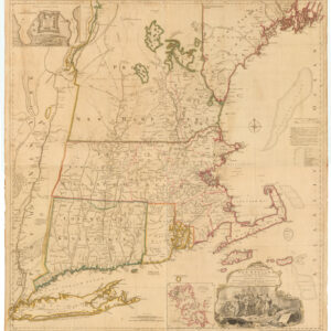
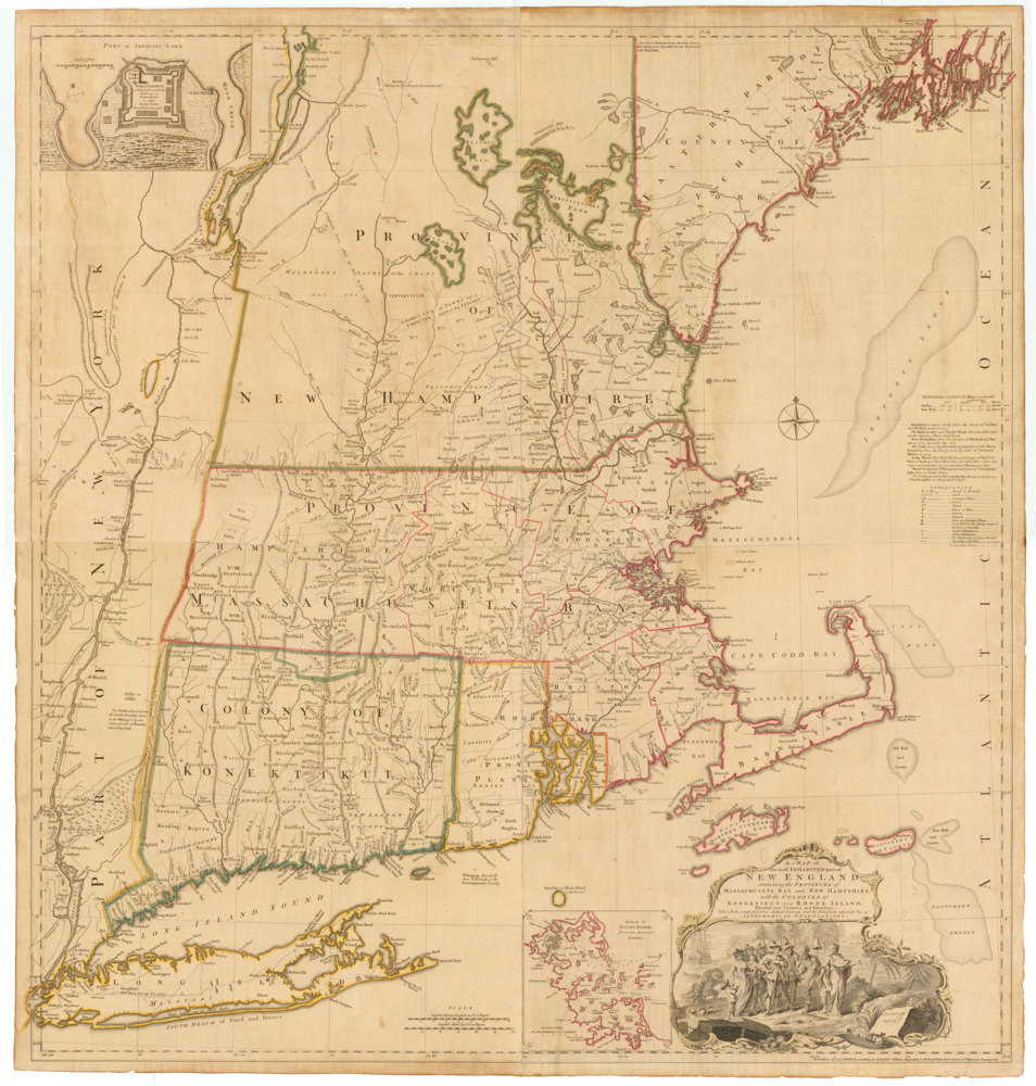
A MAP of the most INHABITED part of NEW ENGLAND, containing the PROVINCES of MASSACHUSETS BAY and NEW HAMPSHIRE, with the COLONIES of KONEKTIKUT AND RHODE ISLAND…
- $55,000
- Unobtainable first state of one of the most influential maps of New England ever made.
-
-
-
Archived
- Out of Stock
- Canada and The Great Lakes, Pacific Northwest - Hawaii - Alaska
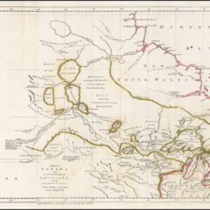
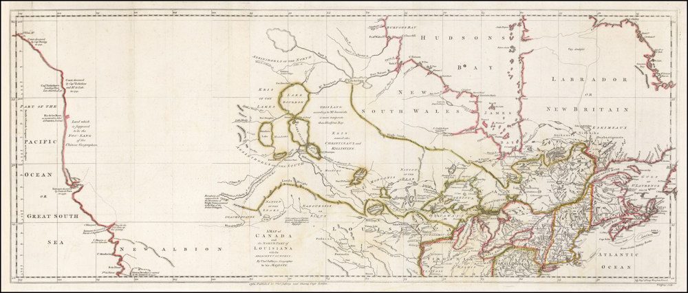
A Map of Canada and the North Part of Louisiana with the Adjacent Countrys
- Remarkable 1762 coast-to-coast map of Canada, Upper Midwest & Plains.
- Read moreQuick View
-
- Out of Stock
- Americas, Canada and The Great Lakes
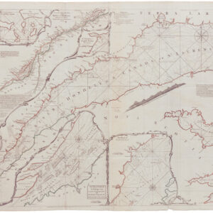
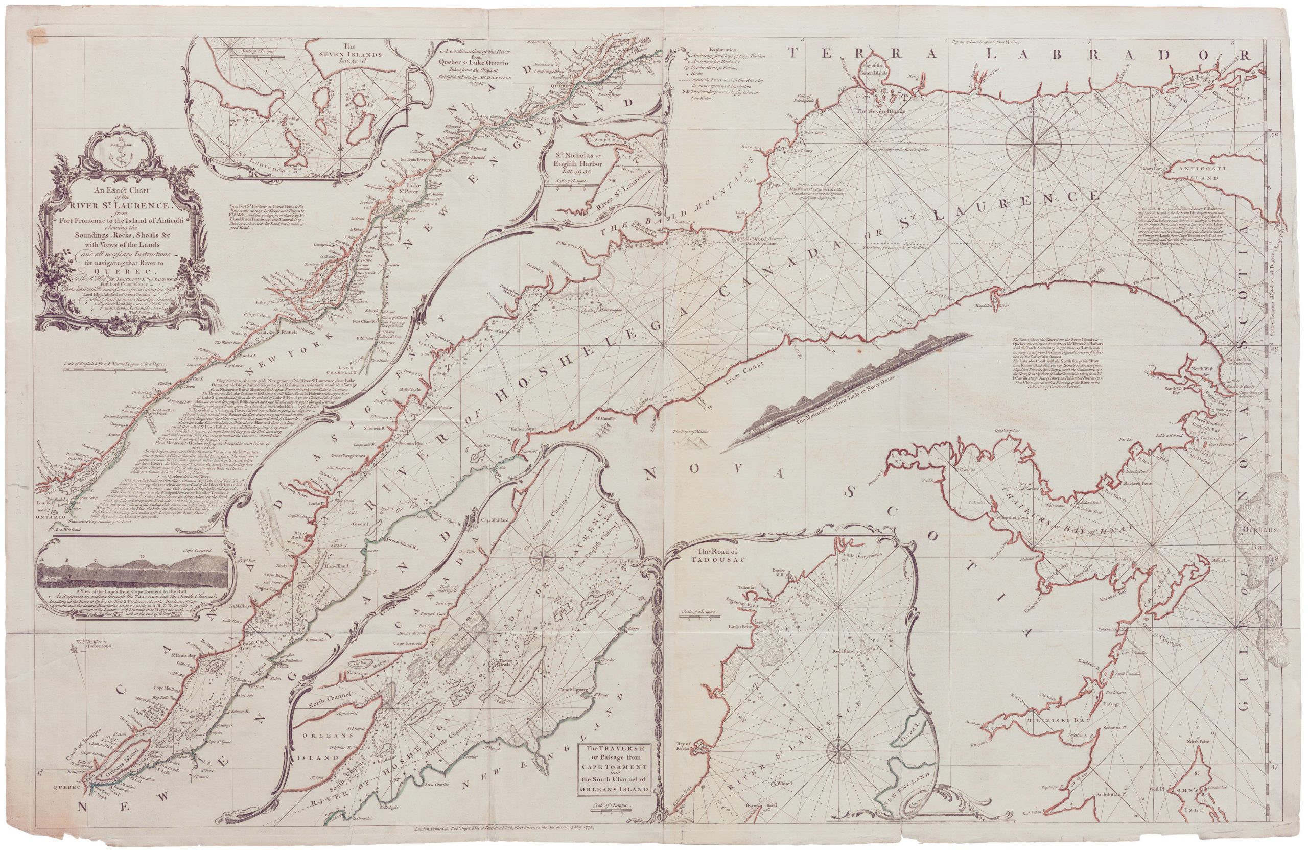
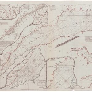
An Exact Chart of the River St. Laurence, from Fort Frontenac to the Island of Anticosti shewing the Soundings, Rocks, Shoals &c with Views of the Lands and all necessary Instructions for navigating that River to Quebec…1775
- Important 1775 map of French trading routes - the first definitive British map of the St. Lawrence River.
- Read moreQuick View
-