-
-
Add to cart
 Quick View
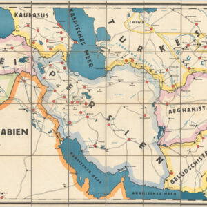
 - Asia, Iran - Persia - Central Asia, Curiosities - Miscellanea
Wandkarte der Teppichgebiete.
- $975
- A thematic map of carpet regions in the Middle East and Central Asia, produced at the height of the ‘Persian rug craze.’
-
-
-
-
-
Add to cart

 Quick View
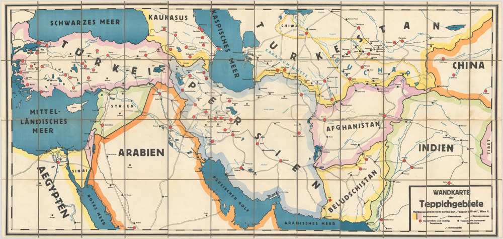
 - California, Bay Area & Silicon Valley, Pictorial maps, Bird's-eye-views
Berkeley California.
- $750
- Rich pictorial bird's-eye-view of Berkeley, including the University of California.
-
-
-
-
-
Add to cart

 Quick View
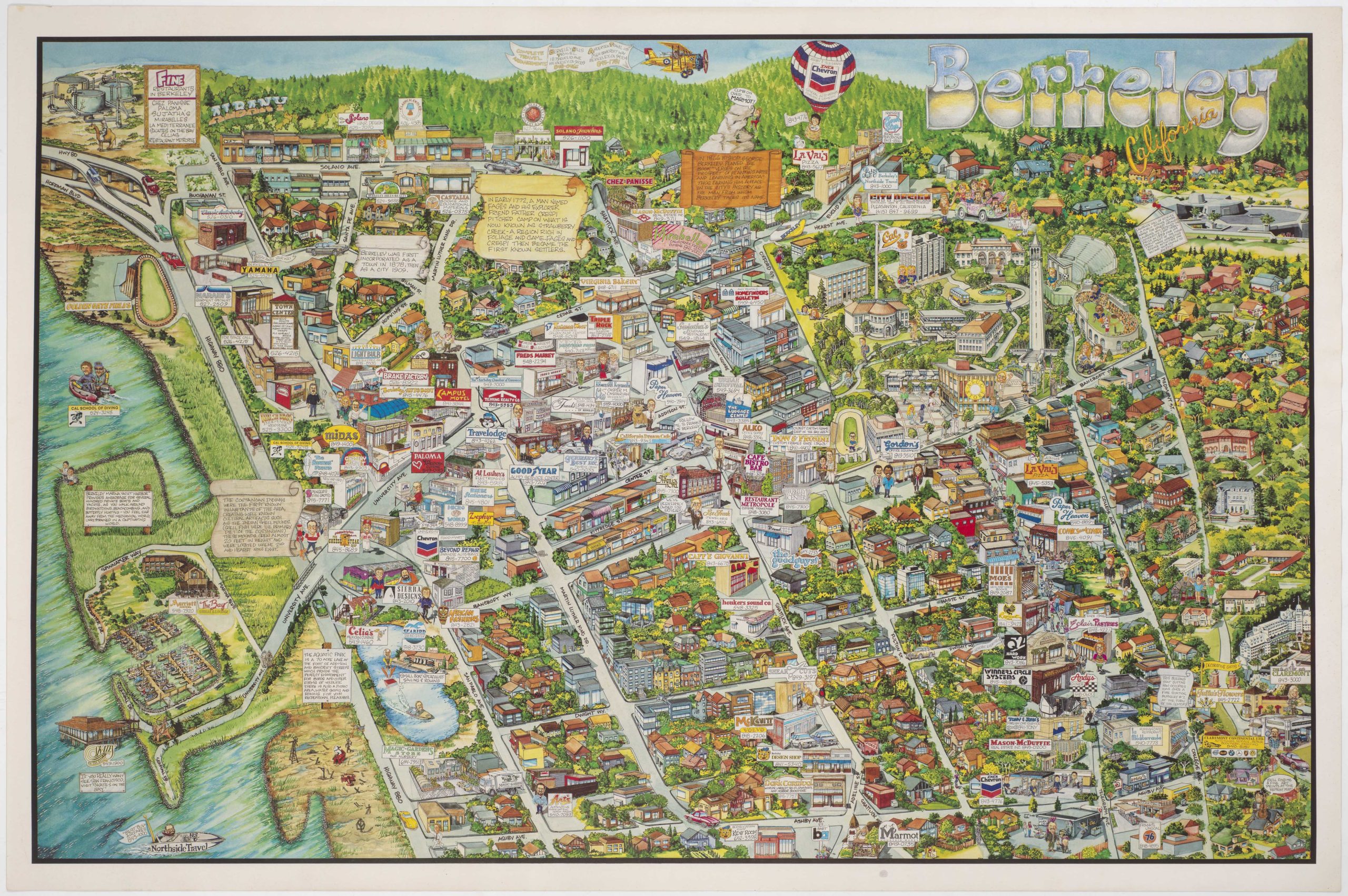
 - California, San Francisco, Bird's-eye-views
San Francisco.
- $950
- Special 1974 pictorial map of San Francisco issued by the Mark Hopkins Hotel.
-
-
-
-
-
Add to cart
 Quick View
 - Bird's-eye-views, California, San Francisco
Site of Golden Gate-International Exposition: “A pageant of the Pacific”
- $875
- A masterfully-composed 1939 color panorama of San Francisco and its newly built bridges.
-
-
-
-
Add to cart

 Quick View
 - Iran - Persia - Central Asia, Curiosities - Miscellanea
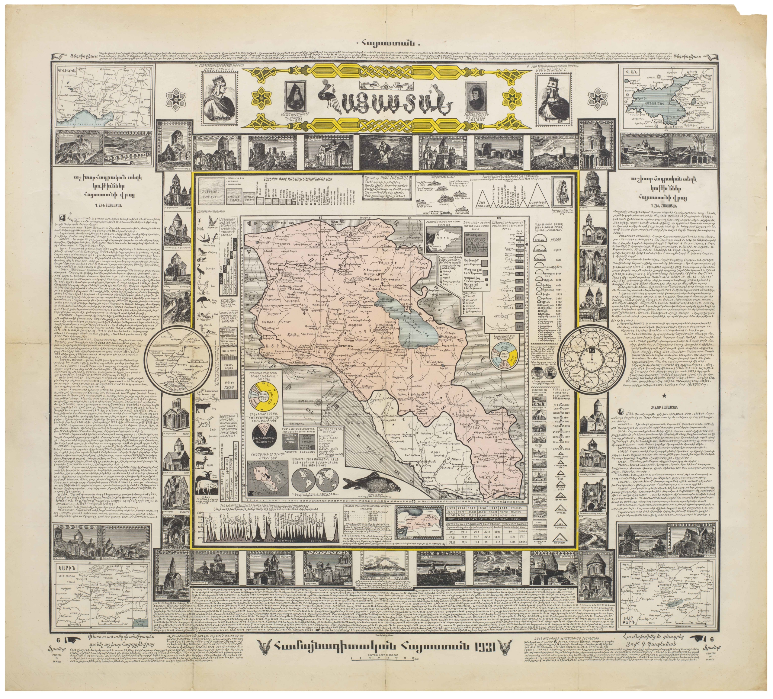
Hayastan: hamaynagitakan Hayastan (Armenia: Encyclopedic Armenia)
- $2,600
- A cartographic celebration of Armenia and Armenian culture.
-
-
-
-
-
Add to cart
 Quick View
 - Pictorial maps, San Francisco
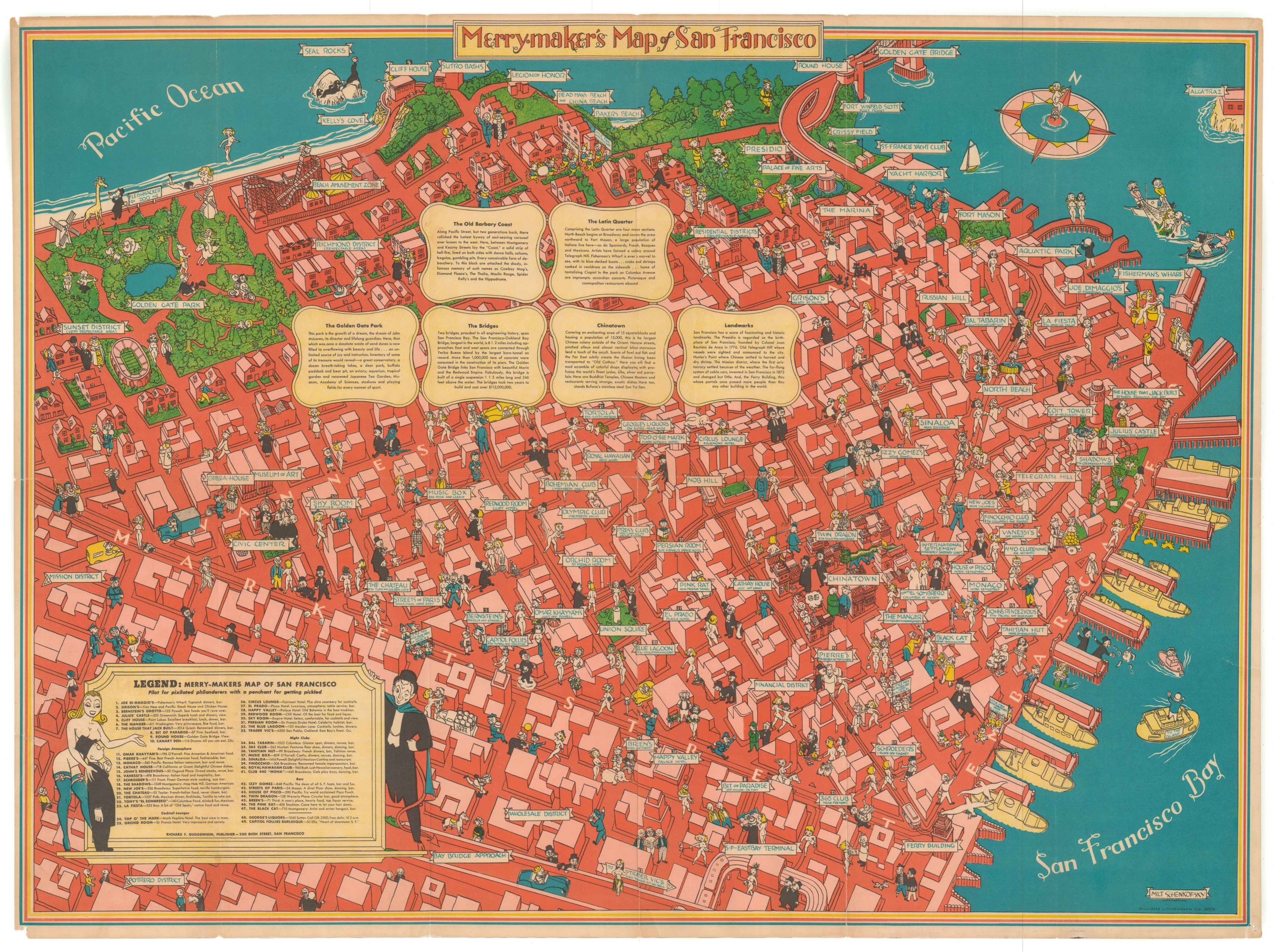
Merry-Maker’s Map of San Francisco
- $1,600
- A 1940 pictorial map of San Francisco that captures the zeitgeist of Herb Caen's “Baghdad-by-the-Bay.”
-
-
-
-
-
Add to cart

 Quick View
 - Americas, Curiosities - Miscellanea, Mexico - Central & South America, United States
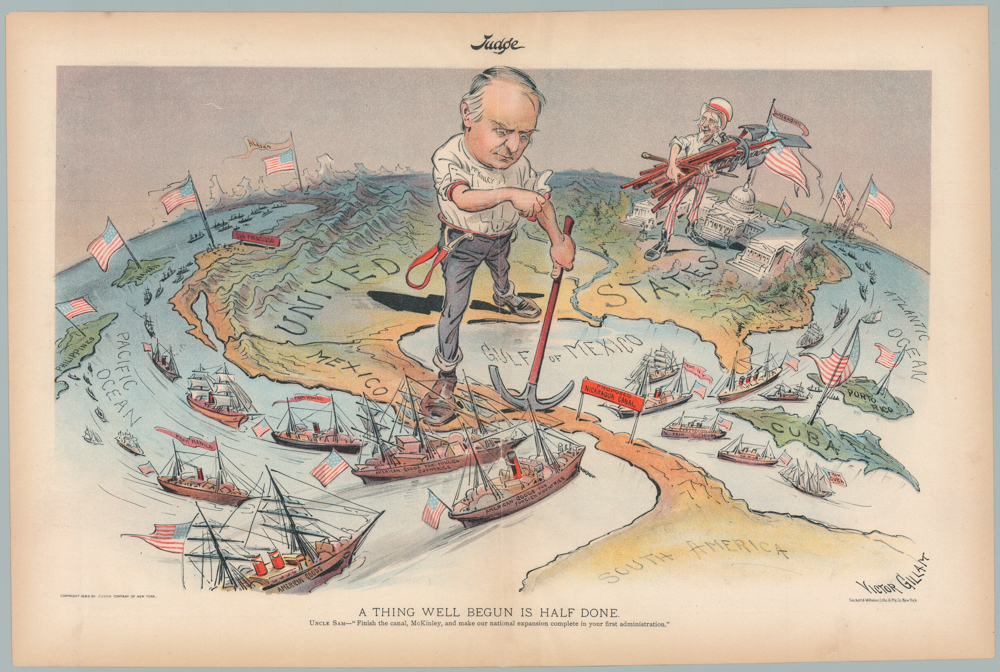
A THING WELL BEGUN IS HALF DONE. UNCLE SAM—“Finish the canal, McKinley, and make our national expansion complete in your first administration.”
- $1,200
- William McKinley & Uncle Sam: a wonderful 1899 persuasive map advocating for the construction of the Nicaragua Canal.
-
-
-
-
-
Add to cart
 Quick View
 - Texas and The West
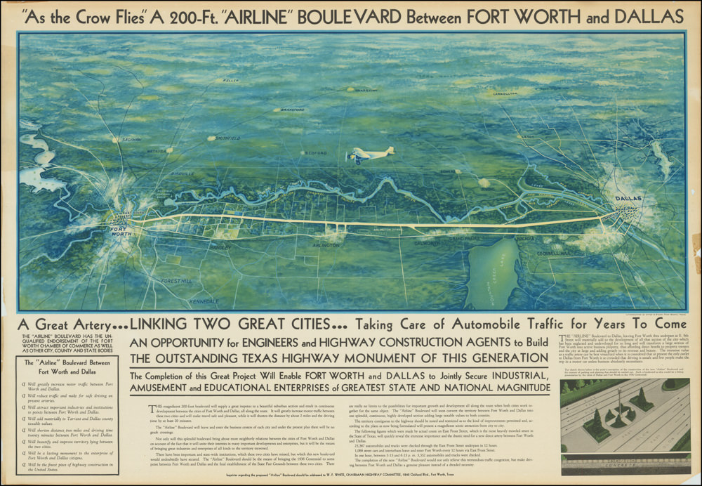
“As the Crow Flies” A 200-Ft. “Airline” Boulevard Between Fort Worth and Dallas
- $2,900
- A highly artistic broadside for the visionary Dallas-Fort Worth Airline Boulevard: a Depression-era infrastructure project designed to bridge and unite two Texas cities.
-
-
-
-
-
Add to cart
![The Original Silicon Valley Map & Calendar [1994]](https://neatlinemaps.com/wp-content/uploads/2021/06/NL-00909_Thumbnail-300x300.jpg)
![The Original Silicon Valley Map & Calendar [1994]](https://neatlinemaps.com/wp-content/uploads/2021/06/NL-00909_Thumbnail.jpg) Quick View
Quick View - California, Bay Area & Silicon Valley, Pictorial maps, Bird's-eye-views
The Original Silicon Valley Map & Calendar [1994]
- $775
- On the eve of the dot-com bubble: a vibrant 1994 pictorial bird's-eye-view of Silicon Valley.
-
-
-
-
-
Add to cart
 Quick View
 - Bay Area & Silicon Valley, California
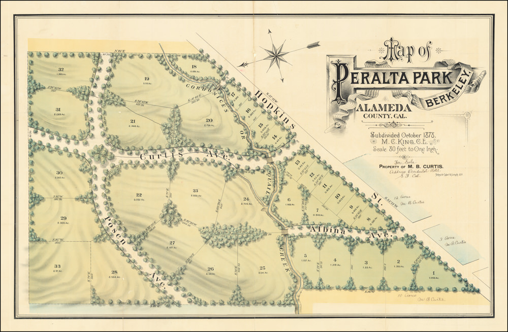
Map of Peralta Park, Berkeley, Alameda County, Cal. Subdivided October 1878. M.C. King, C.E. Scale 80 Feet to One Inch. Property of M.B. Curtis.
- $2,450
- Land grants, failed endeavors, and a fabulously wealthy stage actor: the story of North Berkeley's Peralta Park.
-
-
-
-
-
Add to cart

 Quick View
 - Eastern Mediterranean - Holy Land, Bird's-eye-views
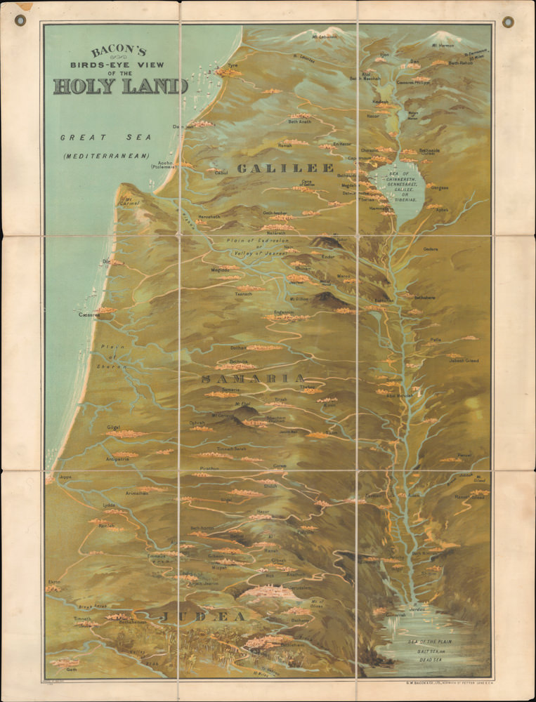
Bacon’s Bird’s-Eye View of the Holy Land
- $2,600
- George Washington Bacon’s iconic bird’s-eye-view of the Holy Land.
-
-
-
-
-
Add to cart
 Quick View
 - East & Midwest United States
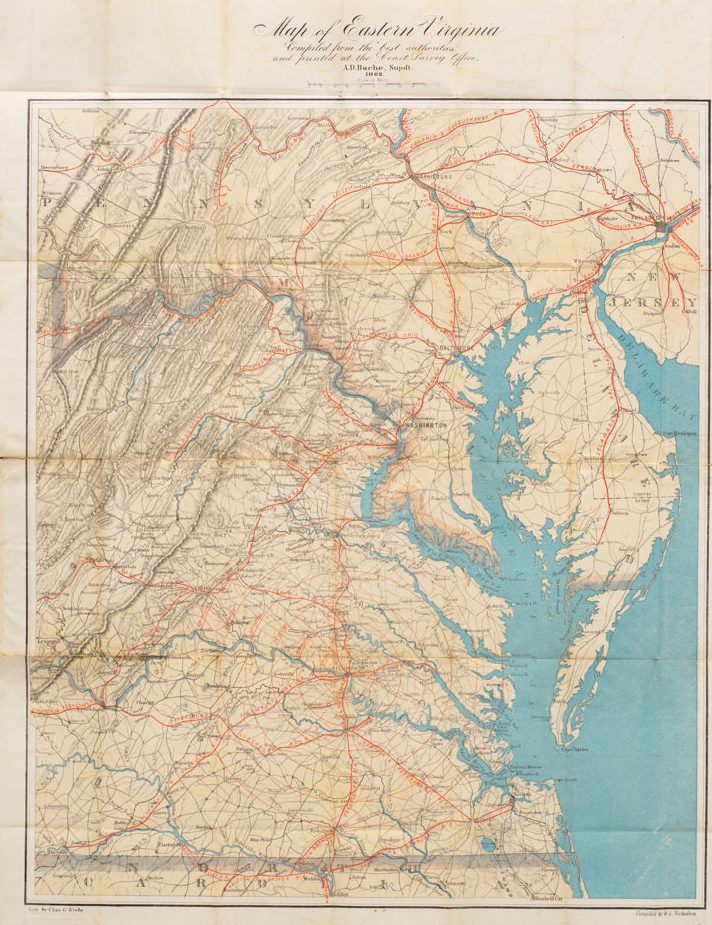
Map of Eastern Virginia Compiled from the best authorities and printed at the Coast Survey Office, A.D. Bache, Supdt. 1862.
- $1,700
- Alexander Bache’s Map of Eastern Virginia: a Union map of Washington’s Confederate backyard.
-
-
-