-
-
Add to cart
 Quick View
 - California, Bay Area & Silicon Valley, Bird's-eye-views
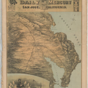
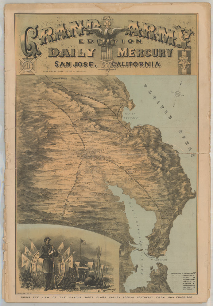
Bird’s Eye View of the Famous Santa Clara Valley Looking Southerly from San Francisco
- $2,400
- A rare and dramatic bird's-eye-view of Santa Clara Valley.
-
-
-
-
-
Add to cart
![[Map of Steamship Routes and the Railways and Post Roads of the Russian Empire]](https://neatlinemaps.com/wp-content/uploads/2020/04/NL-00827_Thumbnail-300x300.jpg)
![[Map of Steamship Routes and the Railways and Post Roads of the Russian Empire]](https://neatlinemaps.com/wp-content/uploads/2020/04/NL-00827-scaled.jpg) Quick View
Quick View - Europe, Russia & Eastern Europe
[Map of Steamship Routes and the Railways and Post Roads of the Russian Empire]
- $1,850
- In-progress construction of the Trans-Siberian Railway: a scarce wall map depicting the transportation network of the Russian Empire at the end of the 19th century.
-
-
![[Map of Steamship Routes and the Railways and Post Roads of the Russian Empire]](https://neatlinemaps.com/wp-content/uploads/2020/04/NL-00827-scaled-300x300.jpg)
-
-
-
Add to cart
![[Title in Russian] Russian Empire in the 18th Century (European Section)](https://neatlinemaps.com/wp-content/uploads/2020/04/NL-00822_Thumbnail-300x300.jpg)
![[Title in Russian] Russian Empire in the 18th Century (European Section)](https://neatlinemaps.com/wp-content/uploads/2020/04/NL-00822-scaled.jpg) Quick View
Quick View - Curiosities - Miscellanea, Russia & Eastern Europe
[Title in Russian] Russian Empire in the 18th Century (European Section)
- $675
- Educating school children during the Cold War: Soviet historical wall map of the Russian Empire in the 18th century.
-
-
![[Title in Russian] Russian Empire in the 18th Century (European Section)](https://neatlinemaps.com/wp-content/uploads/2020/04/NL-00822-scaled-300x300.jpg)
-
-
-
Add to cart
 Quick View
 - California, Bay Area & Silicon Valley, Pictorial maps, Bird's-eye-views
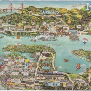
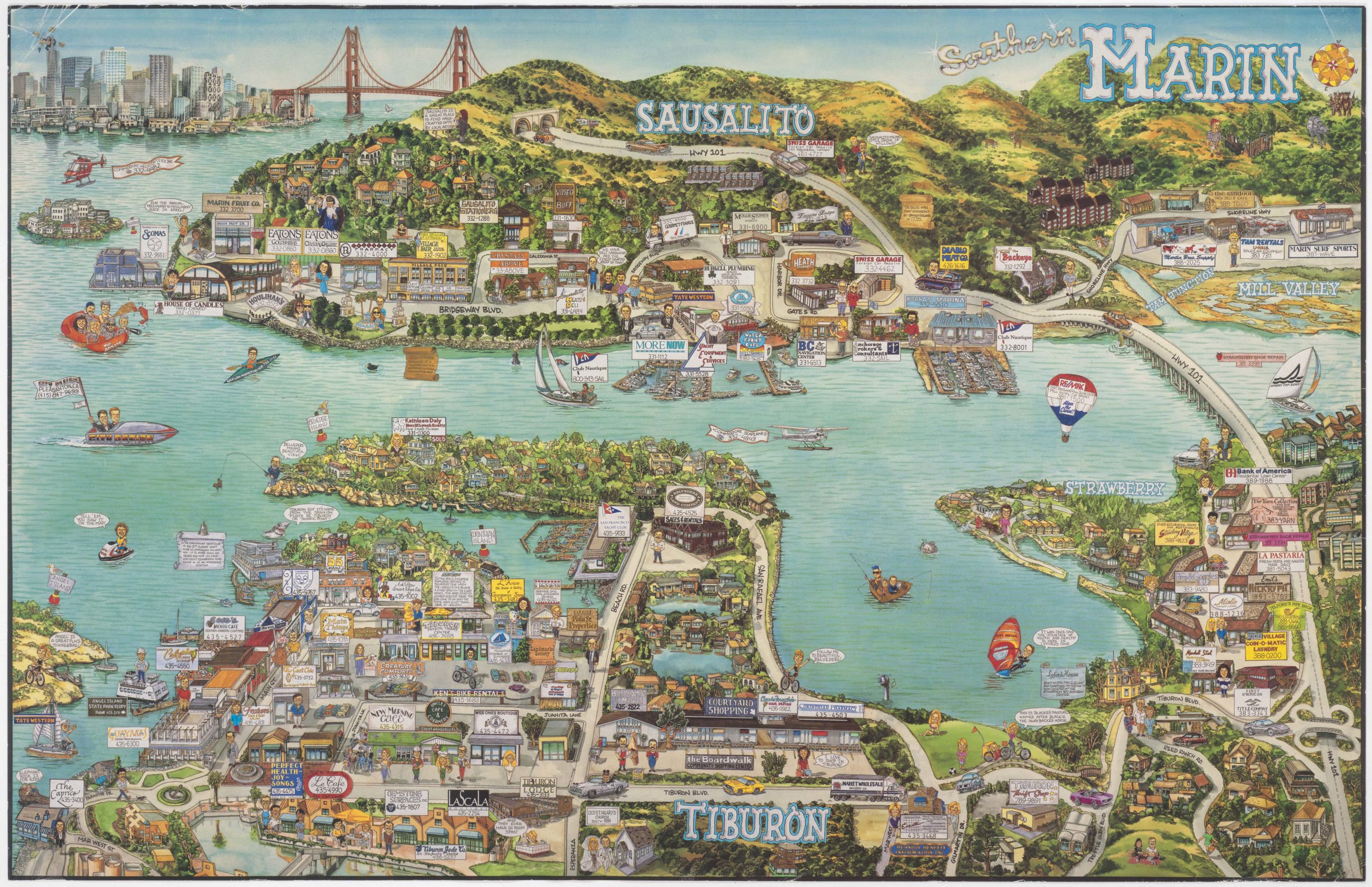
Southern Marin
- $2,400
- Fabulous pictorial bird's-eye-view of Tiburon, Mill Valley, and Sausalito.
-
-
-
-
-
Add to cart
 Quick View
 - California, San Francisco, Bird's-eye-views
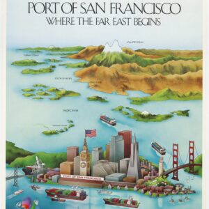
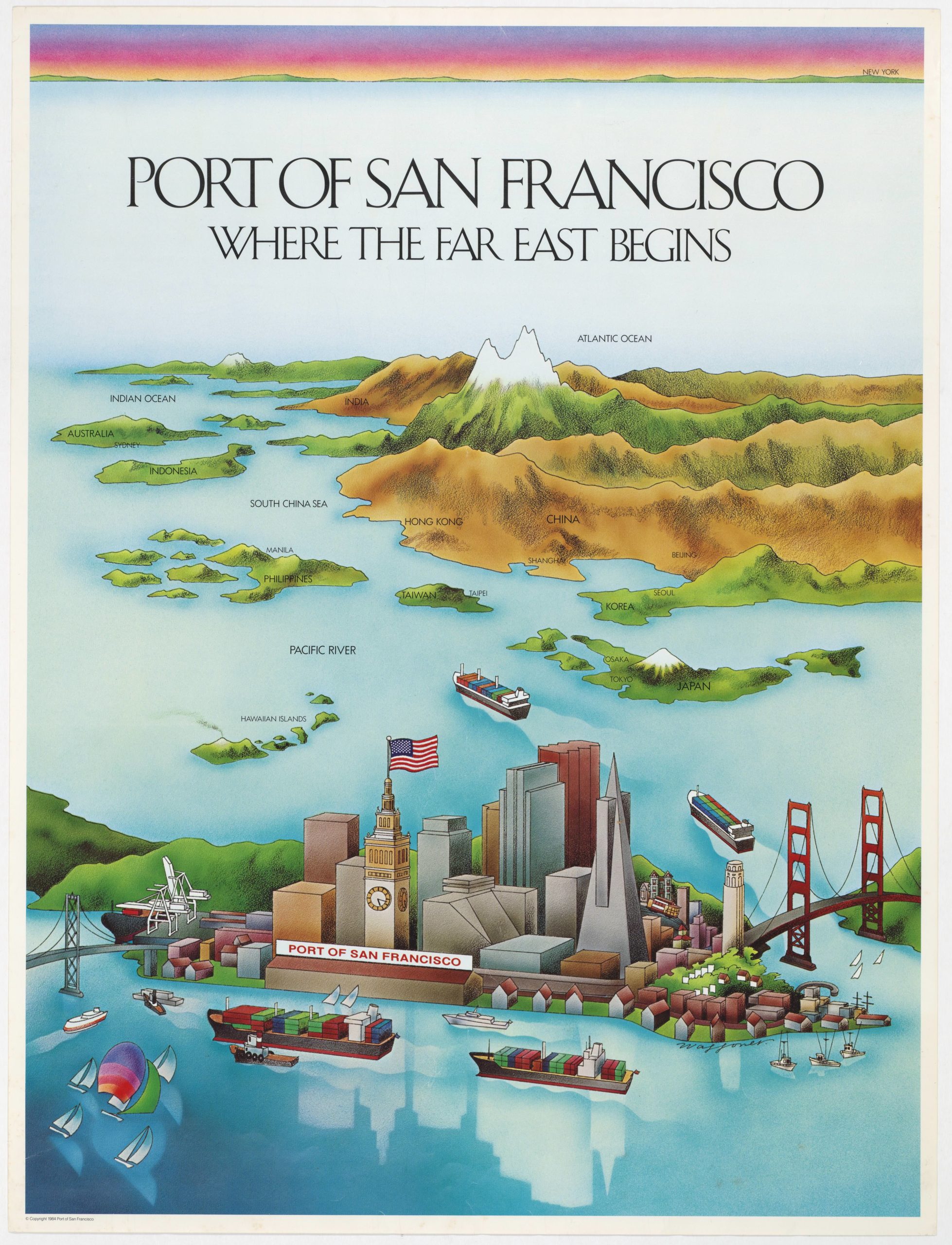
PORT OF SAN FRANCISCO. WHERE THE FAR EAST BEGINS
- $775
- Uncommon promotional bird's-eye-view in the style of Saul Steinberg showing the port of San Francisco as the gateway to Pacific commerce.
-
-
-