-
-
Add to cart

 Quick View
 - Europe, Italy, Bird's-eye-views
Lago di Como
- $3,000
- Francesco Citterio's fantastic mid-19th century panorama of Lake Como.
-
-
-
-
-
Add to cart
 Quick View
 - Southern California, California
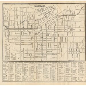
B. O. Kendall’s Map of the City of Pasadena, Cal. Corrected to August 1st, 1895.
- $375
- An early map of Pasadena, published by one of its most prominent builders.
-
-
-
-
Add to cart
 Quick View
 - California
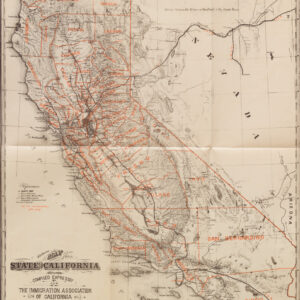
Californien. Veröffentlicht von der Einwanderungs-gesellschaft von Californien. (“The Immigration Association of California.”) San Francisco. No. 10 California Str. (wrapper title)
- $450
- Britton & Rey 1882 California guide for German immigrants, with Lake Tahoe as 'Bigler Lake.'
-
-
-
-
Add to cart
 Quick View
 - Bird's-eye-views, Turkey - Ottoman Empire
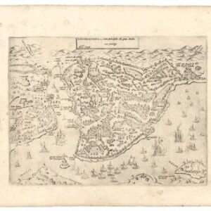
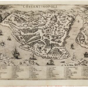
Costantinopoli città principale del gran turcho.
- $1,700
- Lafreri-school 1568 Zenoi reverse-image bird's-eye-view of Istanbul.
-
-

-
-
-
Add to cart
 Quick View
 - Bird's-eye-views, Turkey - Ottoman Empire
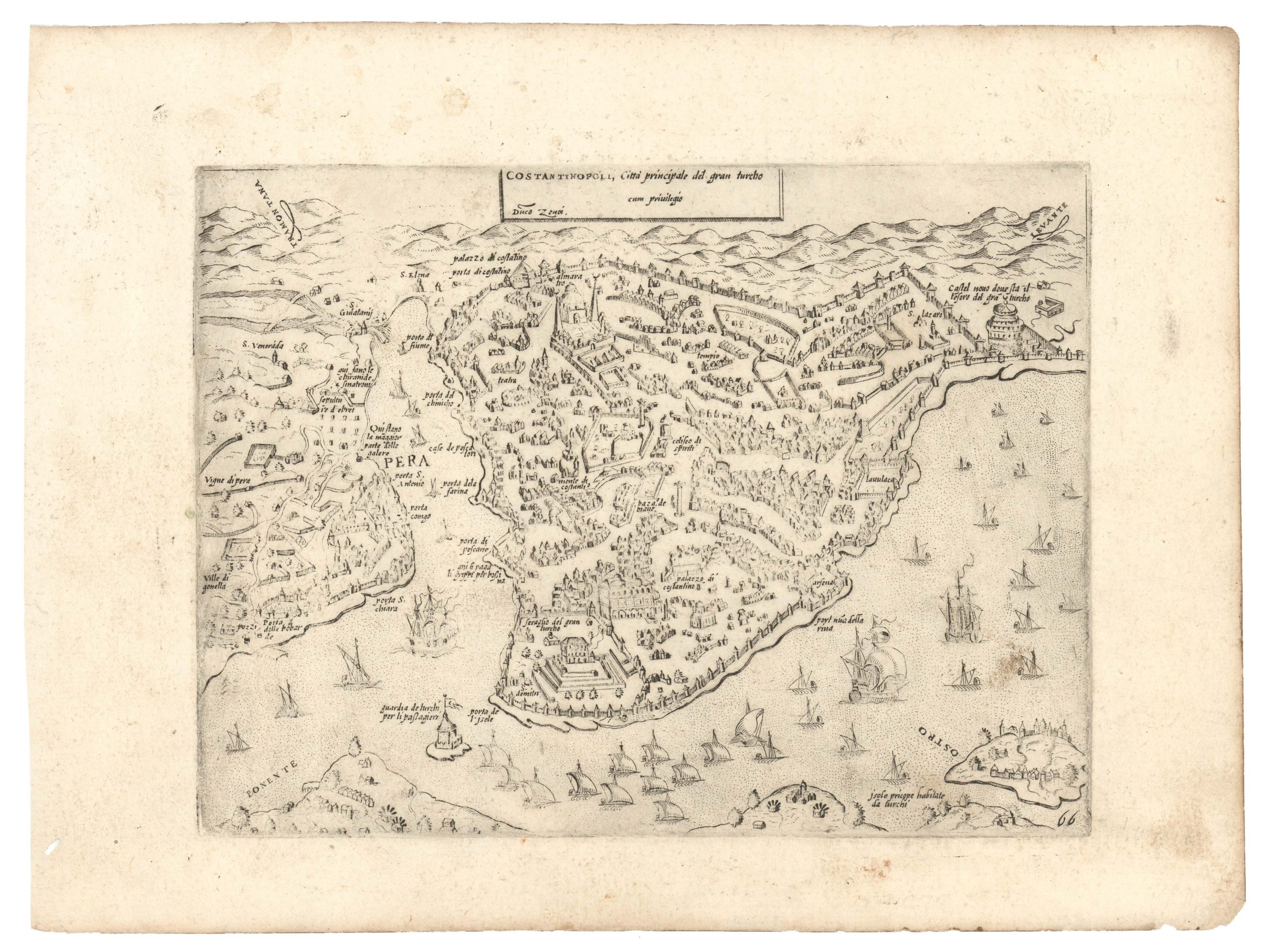
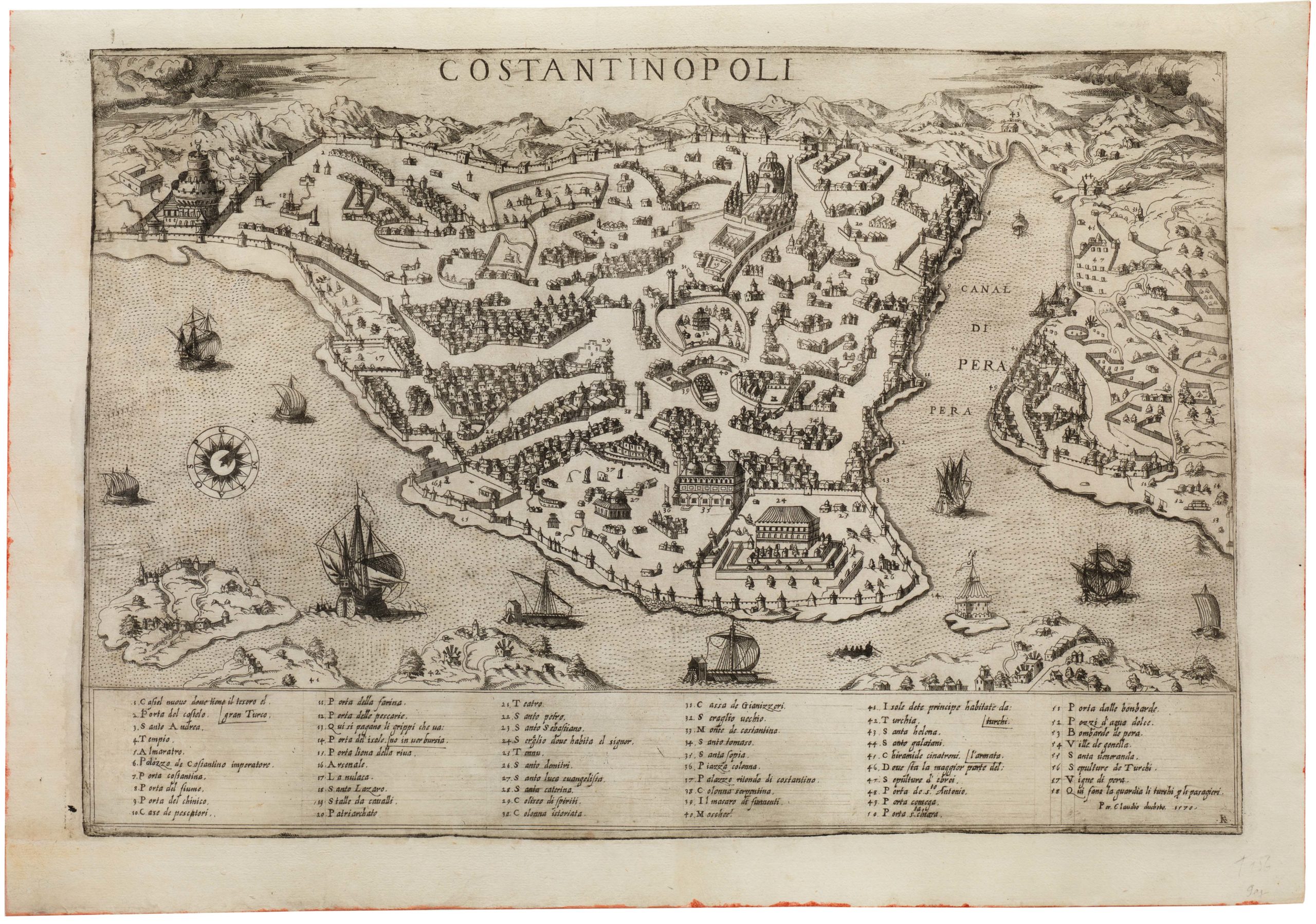
Constantinopoli
- $4,200
- Lafreri-school rendition of Süleyman the Magnificent’s capital.
-
-
-
-
-
Add to cart
 Quick View
 - Europe, Italy
Siciliae Veteris Typus.
- $1,400
- Ortelius’s pioneering of map of Sicily in Antiquity with excellent old color.
-
-
-
-
Add to cart
 Quick View
 - Curiosities - Miscellanea
Save or Delete.
- $1,800
- BANKSY Greenpeace Poster and Sticker Sheet.
-
-
-
-
Add to cart
 Quick View
 - Europe, Italy
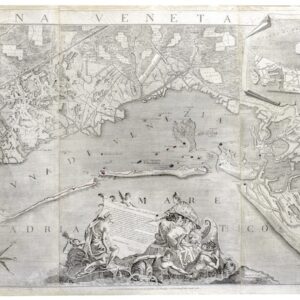
Laguna Veneta.
- Ludovico Furlanetto's Monumental Map of the Venetian Lagoon (1780).
-
-
-
-
Add to cart
 Quick View
 - Curiosities - Miscellanea
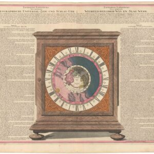
ZACHARIAS LANDTECKS Neu inventierte GEOGRAPHISHE UNIVERSAL-ZEIG UND SCHLAG-UHR.
- $1,800
- Rare and intriguing engraving of Zacharias Landteck’s Universal Clock with early color.
-
-
-
-
Add to cart
![[Redwood City] Oakleigh Park.](https://neatlinemaps.com/wp-content/uploads/2025/02/NL-02339_thumbnail-300x300.jpg) Quick View
Quick View - Bay Area & Silicon Valley, California
[Redwood City] Oakleigh Park.
- $650
- A seemingly unrecorded brochure for Oakleigh Park in Redwood City, complete with a bird's-eye-view.
-
-
-
-
Add to cart
 Quick View
 - Bay Area & Silicon Valley
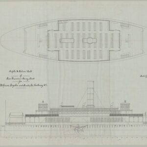
Ferry Boat San Pablo S.F. & S.J. Ry. Co. / Profile & Salon Deck of San Francisco Ferry Boat.
- $775
- A unique manuscript blueprint for the Atchinson, Topeka and Santa Fe Railway Company’s San Pablo Ferry.
-
-
-
-
Add to cart
 Quick View
 - California, Southern California
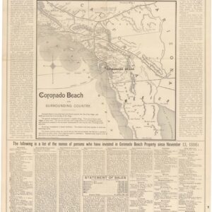
Map of Coronado Beach San Diego, California.
- $1,200
- Early 1887 Promotional Broadside for the Hotel Del Coronado.
-
-