-
-
Add to cart
 Quick View
 - Americas, Mexico - Central & South America
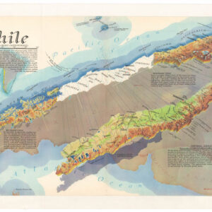
Chile
- $675
- A distinctive, mind-bending view of Chile.
-
-
-
-
Add to cart
 Quick View
 - Americas, Mexico - Central & South America
Panorama del Canale di Panama.
- $875
- Only the second printed view of the Panama Canal in history.
-
-
-
-
Add to cart
 Quick View
 - Americas, Mexico - Central & South America, North America
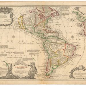
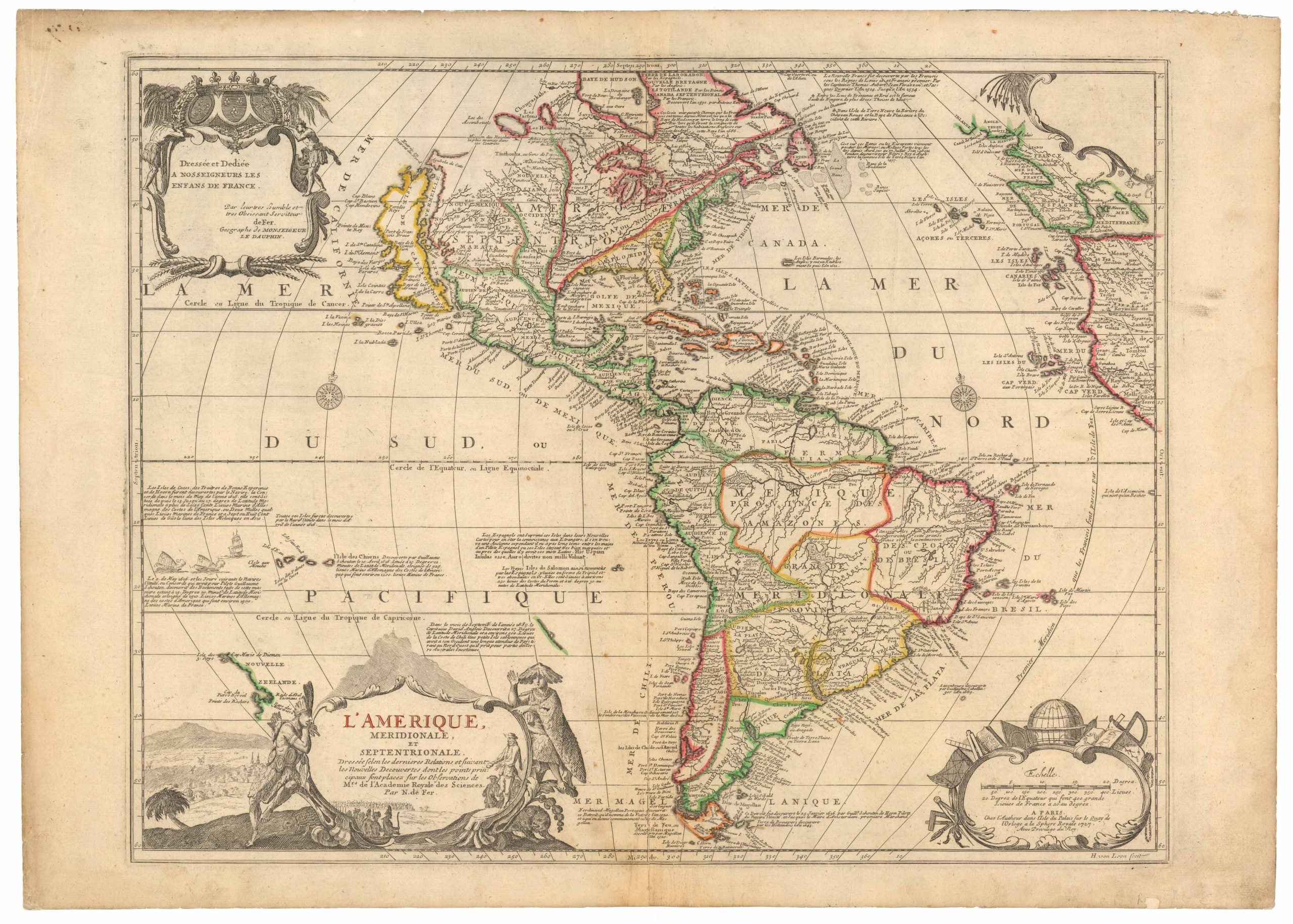
L’Amerique meridionale et septentrionale
- $1,800
- Nicolas de Fer’s seminal map of the Americas.
-
-
-
-
-
Add to cart
 Quick View
 - Americas, Mexico - Central & South America
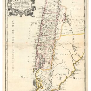
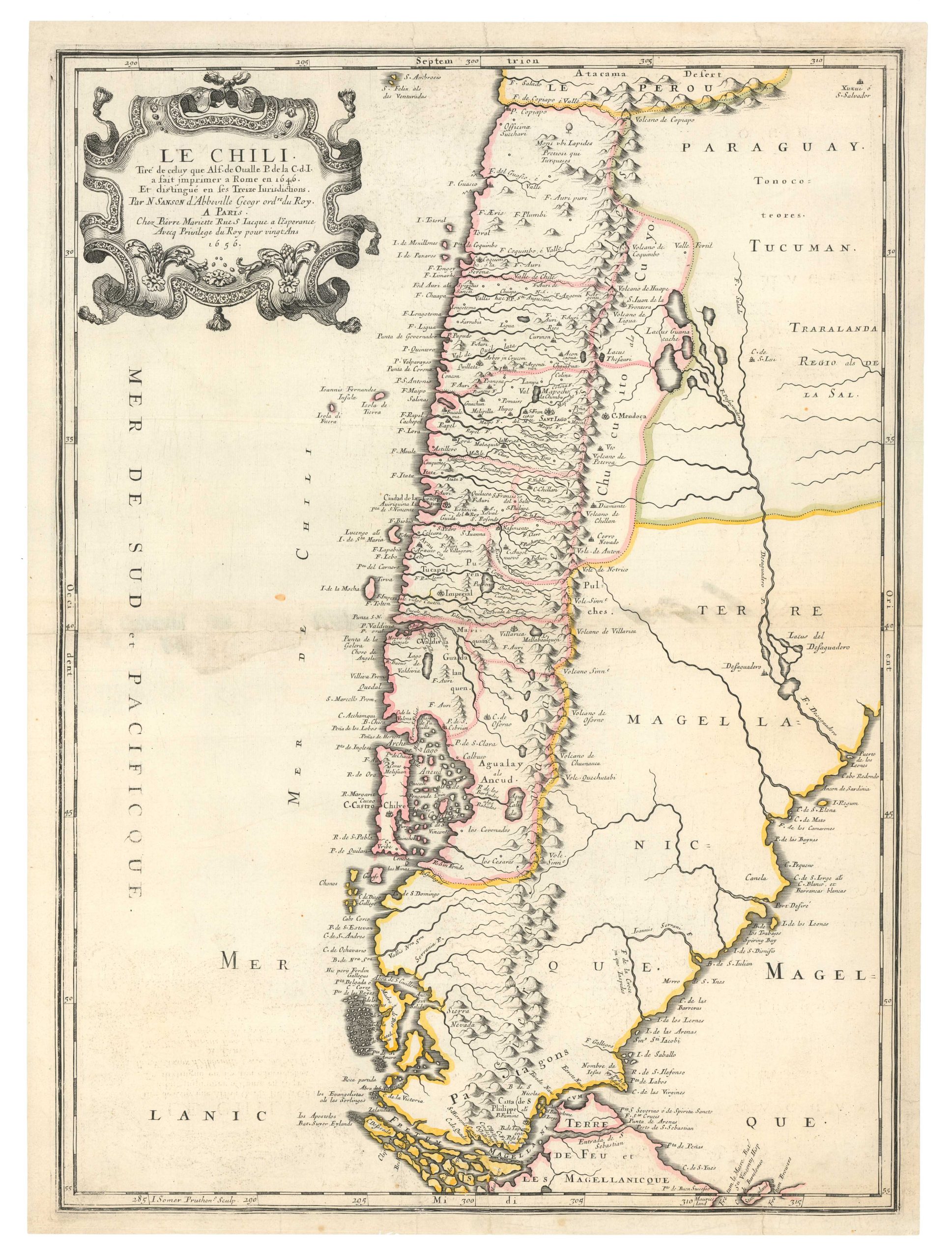
Le Chili. Tire de celuy que Alf-de-Oualle P. d la C.d.I. a fait imprimer a Rome en 1646
- $475
- Sanson’s 1656 map of Chile: based on the most iconic and important map of the region produced in the 17th century.
-
-
-
-
-
Add to cart
 Quick View
 - Americas, Cuba, West Indies, Caribbean, East & Midwest United States, Texas and The West, United States
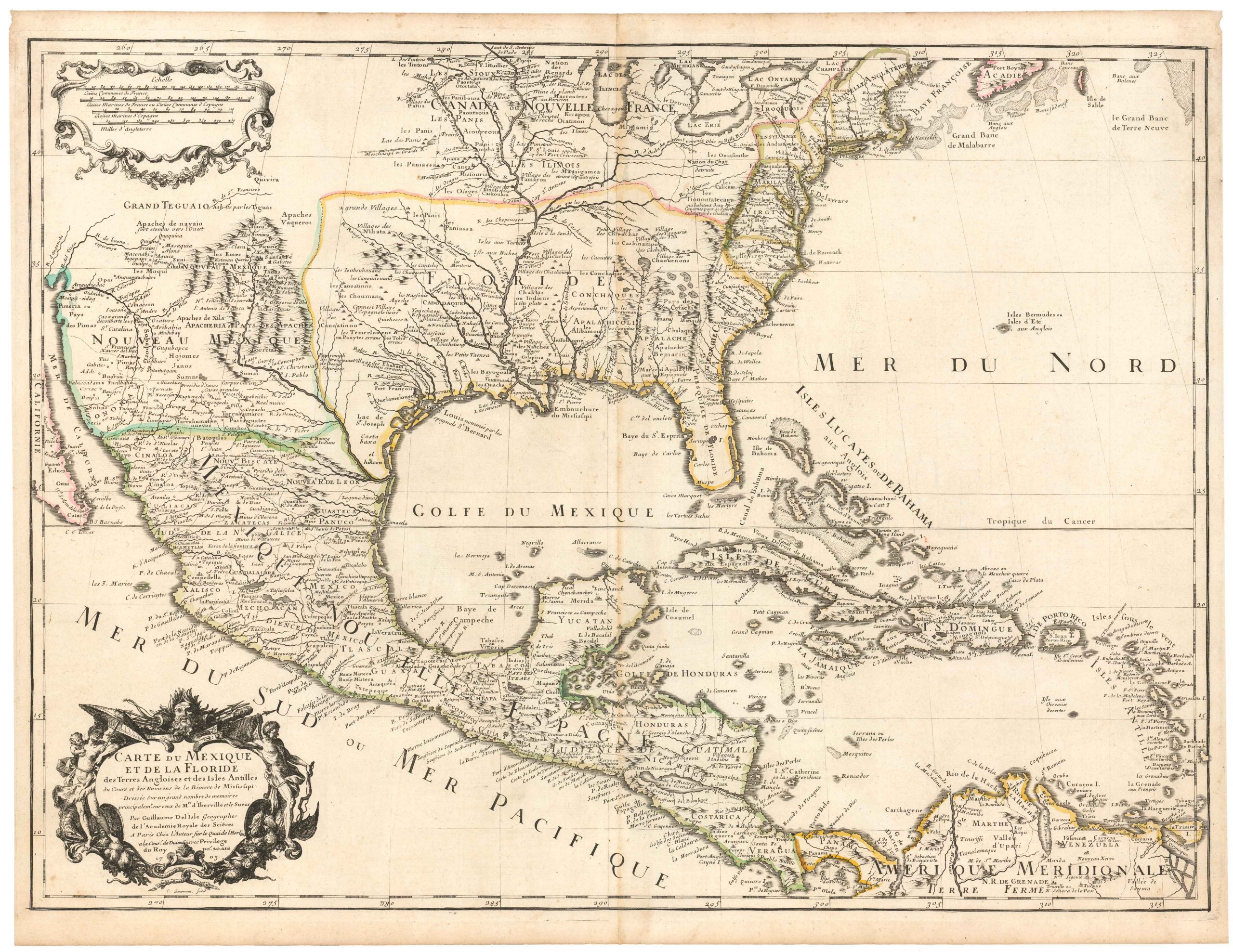
Carte Du Mexique et de la Floride des Terres Angloises et des Isles Antilles du Cours et des Environs de la Riviere Mississipi
- $1,800
- De l’Isle’s paradigm-setting chart of the Gulf of Mexico, the first accurate plotting of the full course of the Mississippi River.
-
-
-
-
-
Add to cart
 Quick View
 - Americas, Mexico - Central & South America
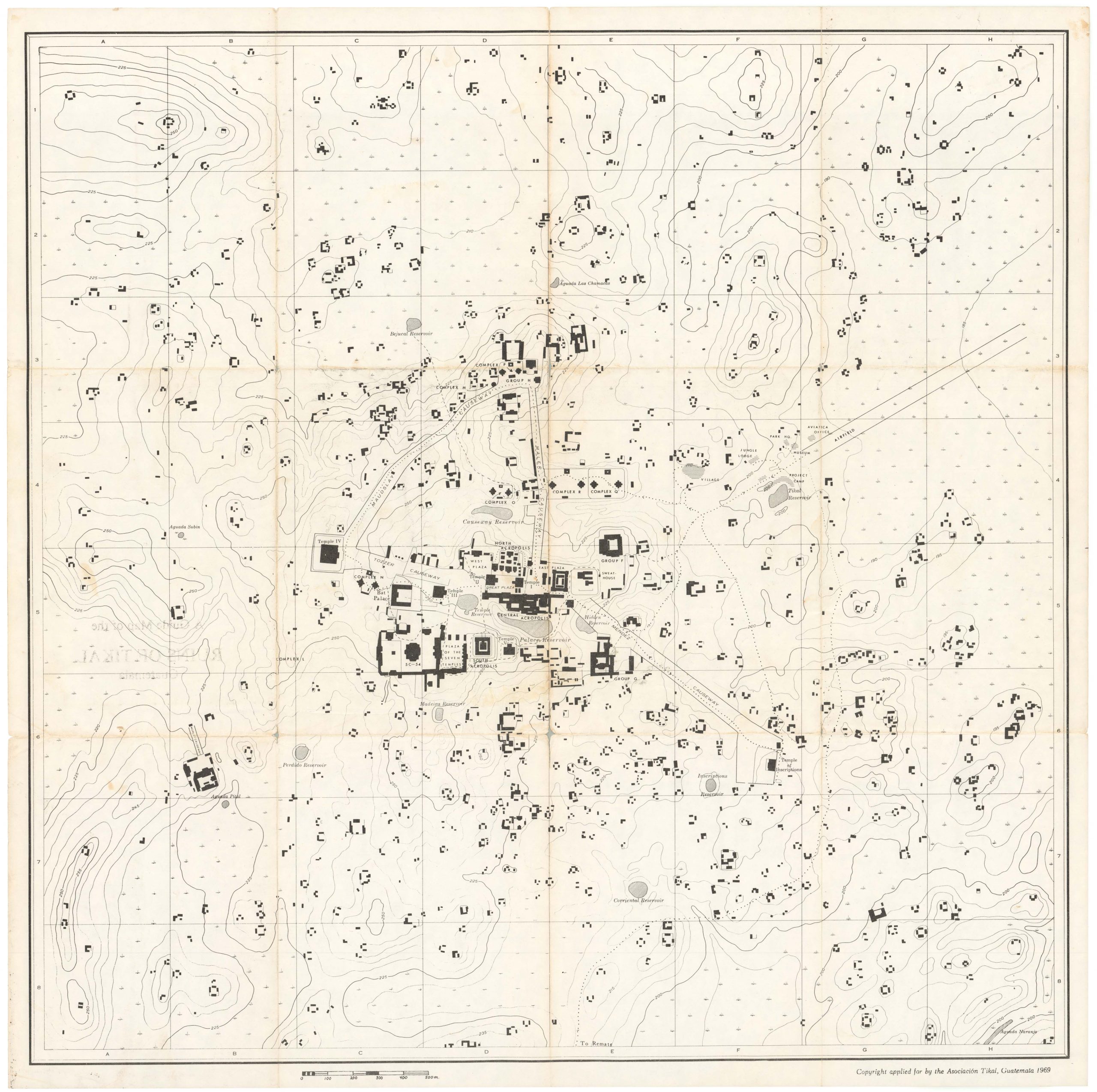
A Guide Map of the RUINS OF TIKAL Guatemala.
- $675
- An archaeological plan of the ruins of the great Mayan city of Tikal, a site that still baffles historians to this day.
-
-
-
-
-
Add to cart
![[Vietnamese Maps of North America: Mexico, Canada, USA]](https://neatlinemaps.com/wp-content/uploads/2022/04/NL-01262-USA_thumbnail-scaled-300x300.jpg) Quick View
Quick View - Americas, Canada and The Great Lakes, Curiosities - Miscellanea, Mexico - Central & South America, United States
[Vietnamese Maps of North America: Mexico, Canada, USA]
- $675
- Three curious maps of North America made in South Vietnam.
-
-
-
-
Add to cart

 Quick View
 - Americas, Mexico - Central & South America
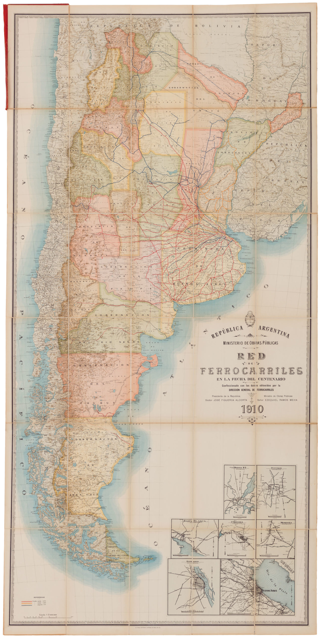
República Argentina / Ministerio de Obras Publicas / Red de ferrocarriles en la fecha del centenario / Confeccionado con los dalos obtenidos por la dirección general de ferrocarriles…
- $1,600
- A fabulous large-format official Ministry of Public Works 1910 railroad map of Argentina.
-
-
-
-
-
Add to cart

 Quick View
 - World, Americas, Mexico - Central & South America, Atlases & Books
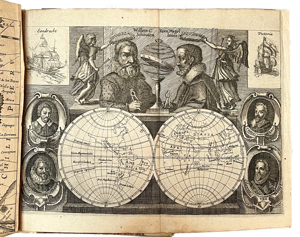
Diarium vel Descriptio laboriosissimi, & molestissimi Itineris, factia Guilielmo Cornelli Schoutenio, Hornano. Annis 1615, 1616 & 1617.
- $6,200
- Willem Schouten’s journal of the famous 1615-7 Le Maire-Schouten expedition, one of history’s greatest voyages of discovery.
-
-
-
-
-
Add to cart
 Quick View
 - Americas, Mexico - Central & South America, North America
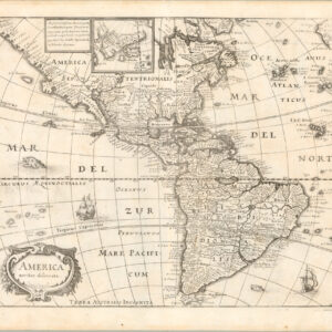
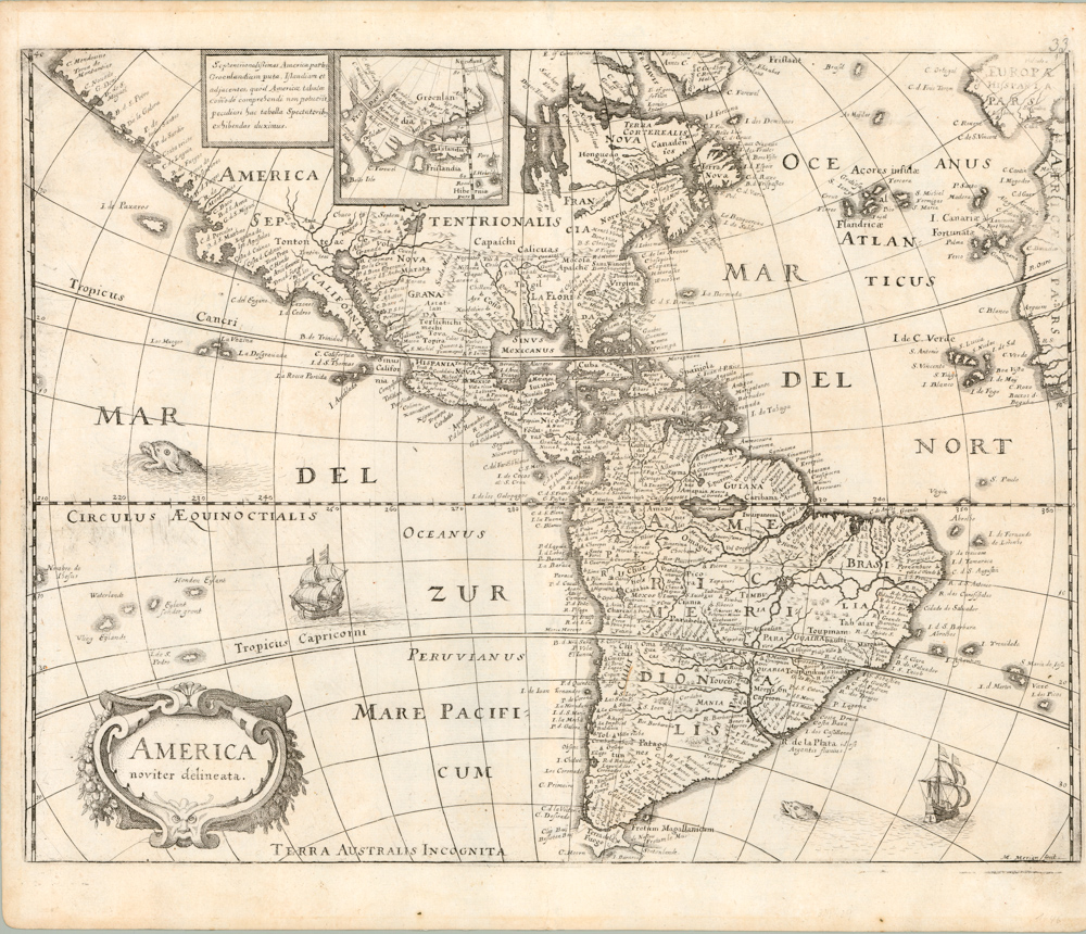
America noviter delineata.
- $975
- Beautiful 1638 Merian chart of the Americas dating back to the early days of exploration and representing an important transition from one level of New World cartography to another.
-
-
-
-
-
Add to cart
 Quick View
 - Canada and The Great Lakes
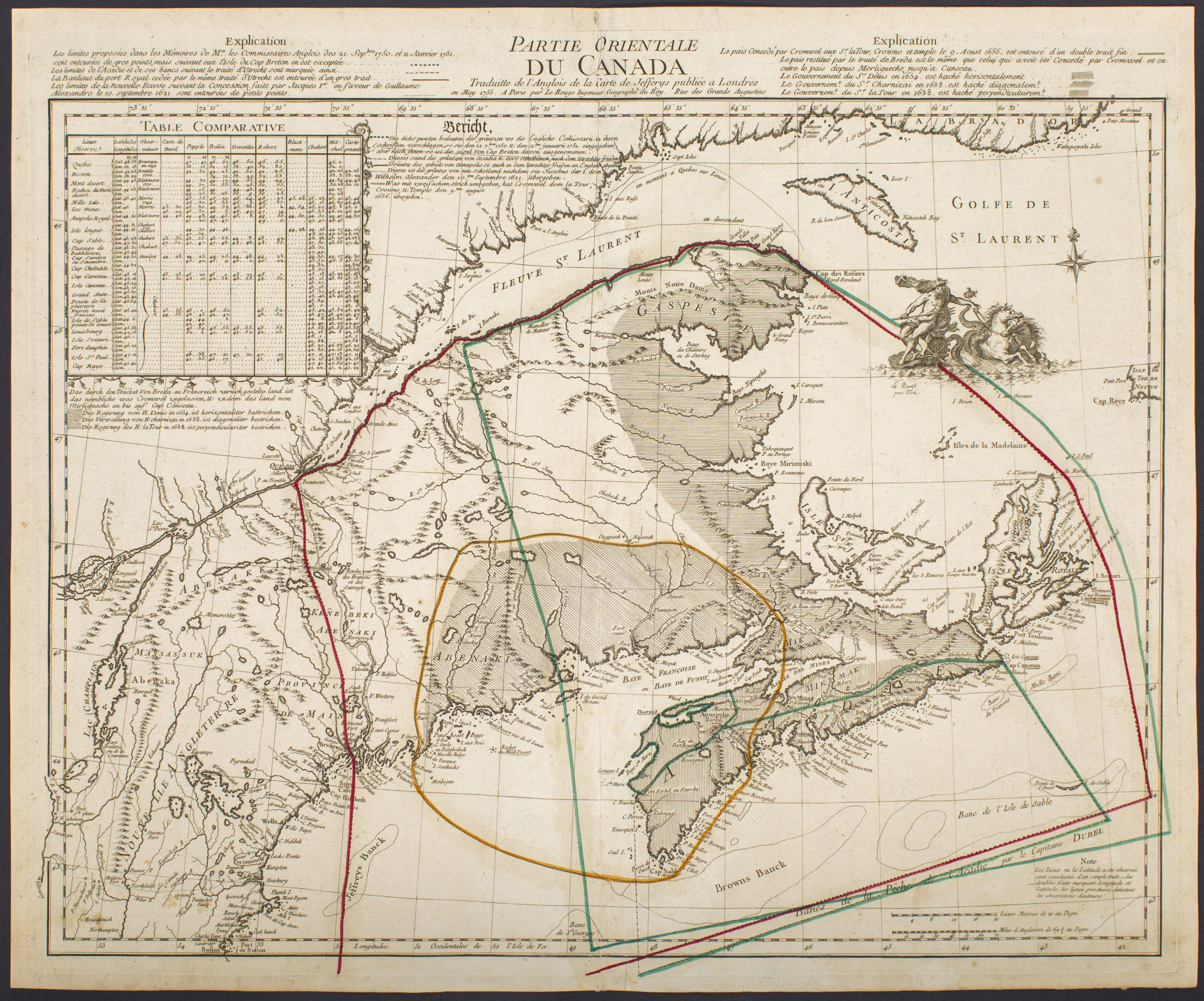
Partie Orientale Du Canada Traduite de l’Anglois de Carte de Jefferys publiée a Londres en May 1755…
- $2,850
- Scarce 1755 map of French and British historical claims, published in Paris on the eve of the Seven Years’ War.
-
-
-
-
-
Add to cart

 Quick View
 - Americas, Curiosities - Miscellanea, Mexico - Central & South America, United States
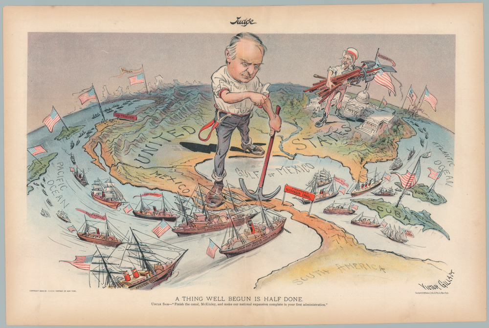
A THING WELL BEGUN IS HALF DONE. UNCLE SAM—“Finish the canal, McKinley, and make our national expansion complete in your first administration.”
- $1,200
- William McKinley & Uncle Sam: a wonderful 1899 persuasive map advocating for the construction of the Nicaragua Canal.
-
-
-