-
-
Add to cart
 Quick View
 - Bay Area & Silicon Valley, California
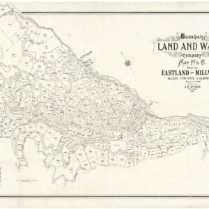
Tamalpais Land and Water Company Map No. 5 showing Eastland and Millwood, Marin County, California.
- $2,800
- Early pre-Mill Valley cadastral map of Eastland and Millwood, Marin County.
-
-
-
-
Add to cart
![[Oil Painting of Lake Merritt, Oakland]](https://neatlinemaps.com/wp-content/uploads/2024/05/NL-01966_thumbnail-300x300.jpg) Quick View
Quick View - Bay Area & Silicon Valley, California, Featured Maps & Views, Michael's Collection
[Oil Painting of Lake Merritt, Oakland]
- $14,500
- The earliest known view of Oakland’s Lake Merritt.
-
-
-
-
Add to cart
 Quick View
 - California, Bay Area & Silicon Valley
Album of photographs of commercial and residential properties in Berkeley, California.
- $1,250
- A fascinating documentation of Berkeley in the 1930s.
-
-
-
-
Add to cart
 Quick View
 - Bay Area & Silicon Valley, California
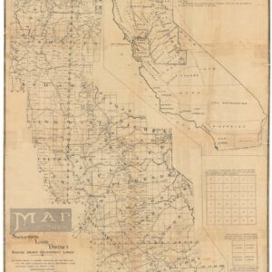
Map of the Sacramento Land District.
- $275
- A Scarce Early 20th Century Survey Map of Northern California.
-
-
-
-
Add to cart
 Quick View
 - California, Bay Area & Silicon Valley
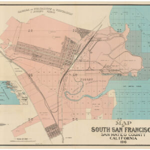
Map of South San Francisco, San Mateo County, California.
- $1,600
- A large-format urban plan of South San Francisco.
-
-
-
-
Add to cart
 Quick View
 - Bay Area & Silicon Valley, California
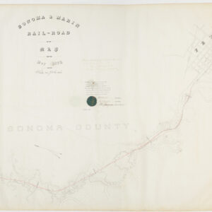
Sonoma & Marin Rail-Road Map, May 1875.
- $2,200
- Railroad manuscript map with early Petaluma town plan and survey work down to Marin County.
-
-
-
-
Add to cart
 Quick View
 - Atlases & Books, Bay Area & Silicon Valley, California
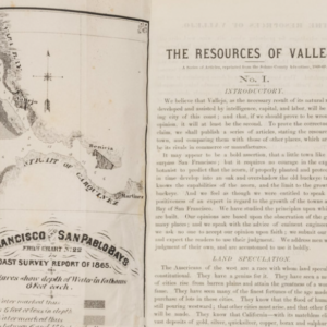
The Resources of Vallejo: A series of articles, reprinted from the Solano County Advertiser, 1868-69
- $3,200
- An early promotional booklet on Vallejo with two very rare folding maps.
-
-
-
-
Add to cart
 Quick View
 - California, Bay Area & Silicon Valley
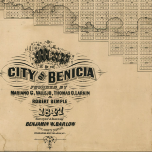
Map of the City of Benicia Founded By Mariano G. Vallejo, Thomas O. Larking & Robert Semple 1847 Surveyed & Drawn By Benjamin Barlow City & County Surveyor.
- $6,500
- Barlow’s rare and pioneering map of Benicia - the earliest comprehensive plan of one of California’s first state capitals.
-
-
-
-
Add to cart
 Quick View
 - Bay Area & Silicon Valley, California, Pictorial maps
Being a map of central California, showing some of the people, places and events that had to do with our early days. Wells Fargo Bank & Union Trust Co., San Francisco, Established 76 years ago, in 1852
- $1,200
- An unrecorded 1928 Wells & Fargo promotional map showing important people, places, and events in California history.
-
-
-
-
Add to cart
 Quick View
 - Bay Area & Silicon Valley, San Francisco
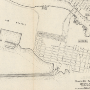
Trans-Bay Tube Study General Plan Location no. 12
- $550
- The first tube across San Francisco Bay?
-
-
-
-
Add to cart
 Quick View
 - Bay Area & Silicon Valley, Bird's-eye-views, California
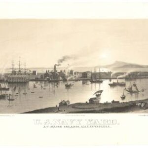
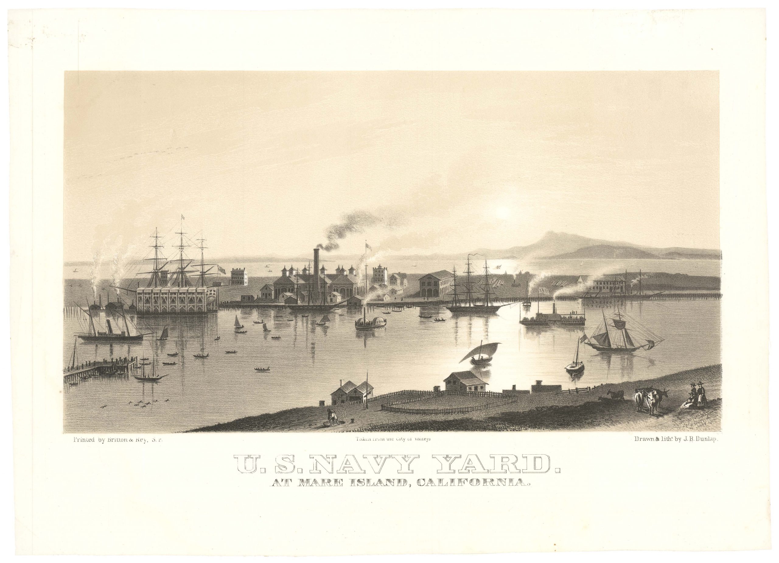
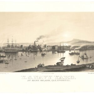
U.S. Navy Yard. At Mare Island, California.
- $4,500
- Early view of the U.S. Navy Yard at Mare Island, with Marin and Mount Tamalpais in the background.
-
-
-
-
-
Add to cart
 Quick View
 - Bay Area & Silicon Valley
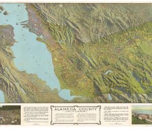
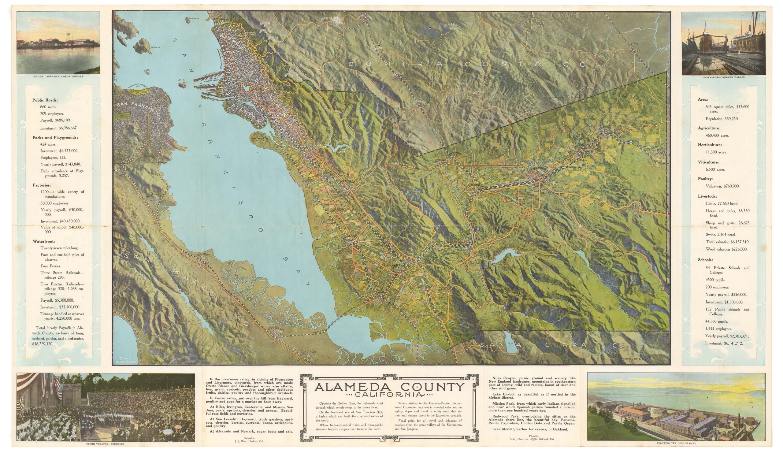
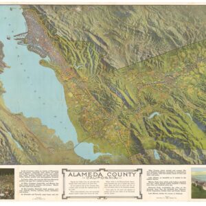
Alameda County
- $975
- A most unusual bird's-eye-view pamphlet of Alameda County and the Greater Bay Area during a pivotal period in California's history.
-
-
-