-
-
Add to cart
 Quick View
 - Atlases & Books, San Francisco
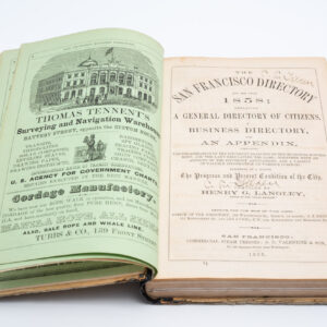
San Francisco Directory Year and Business Guide for 1858: Henry G. Langley Compiler.
- $2,400
- The first Langley San Francisco city directory!
-
-
-
-
Add to cart
 Quick View
 - Bird's-eye-views, Pictorial maps, San Francisco
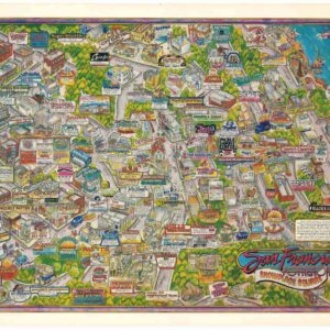
San Francisco Potrero Hill Showplace Square.
- $1,200
- Images of a different era: an exciting, block-by-block glimpse of late 1980s Potrero Hill, San Francisco.
-
-
-
-
Add to cart
 Quick View
 - San Francisco
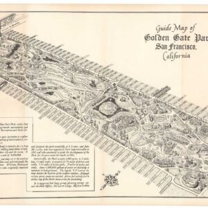
Guide Map of Golden Gate Park San Francisco, California.
- $650
- 1956 Ted Hubbard map of Golden Gate Park.
-
-
-
-
Add to cart
 Quick View
 - San Francisco
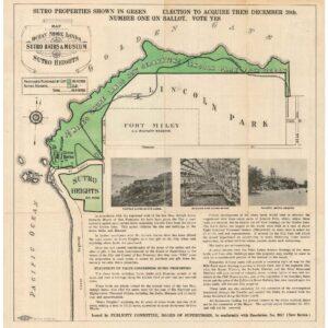
Map of the Ocean Shore Lands. Sutro Baths & Museum Sutro Heights.
- $875
- A large Britton & Rey cartographic advertisement for Sutro’s shore-lands.
-
-
-
-
Add to cart
 Quick View
 - San Francisco
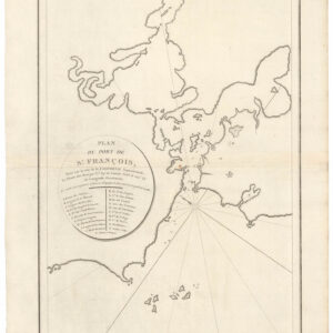
Plan du Port de St. François, Situé su la côte de la Californie Septentrionale.
- $975
- The world’s first detailed look at San Francisco.
-
-
-
-
Add to cart
 Quick View
 - San Francisco
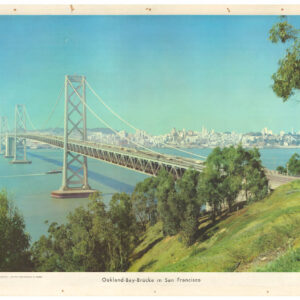
Oakland-Bay-Brücke in San Francisco.
- $375
- A beautiful large-format c. 1955 photographic print of the Bay Bridge.
-
-
-
-
Add to cart
 Quick View
 - San Francisco
The “Chevalier” Commercial, Pictorial and Tourist Map of San Francisco From Latest U.S. Gov. and Official Surveys. Designed-Engraved And Copyrighted By Aug. Chevalier, Lithographer Publisher, 507 Mission St. San Francisco.
- $2,900
- Chevalier's famous map of San Francisco for the 1915 Exposition with original booklet.
-
-
-
-
Add to cart

 Quick View
 - Bird's-eye-views, California, Pictorial maps, San Francisco
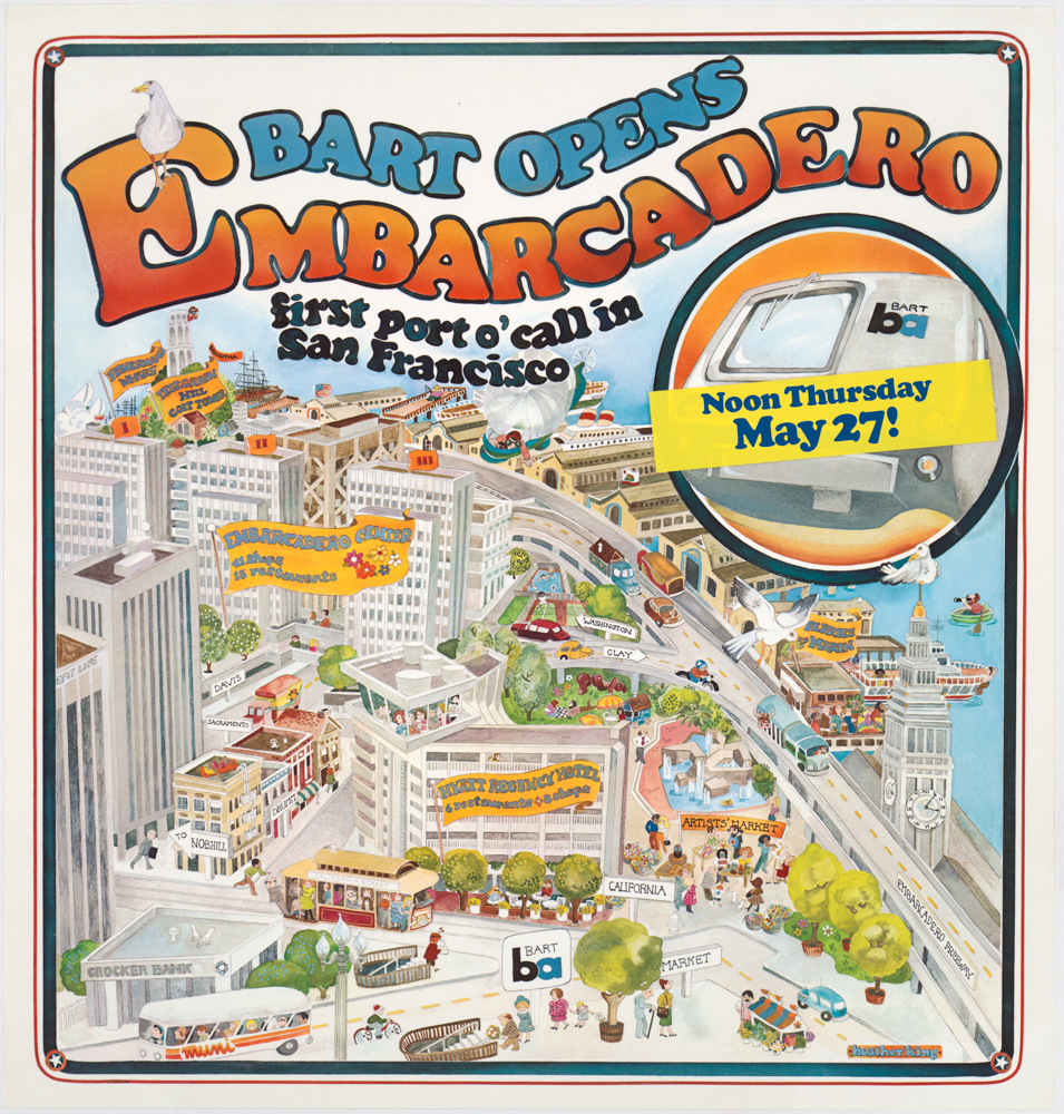
Bart Opens Embarcadero. First port o’call in San Francisco
- $475
- Celebrating public transit -- a pictorial view of downtown San Francisco announcing the 1976 opening of the Embarcadero BART station.
-
-
-
-
-
Add to cart
![[Seventeen original Taber albumen photographs of California and Oregon]](https://neatlinemaps.com/wp-content/uploads/2023/07/447973_0-300x300.jpg) Quick View
Quick View - California, San Francisco
[Seventeen original Taber albumen photographs of California and Oregon]
- $975
- An extraordinary collection of late 19th-century photographs from America's West Coast.
-
-
-
-
Add to cart
 Quick View
 - San Francisco
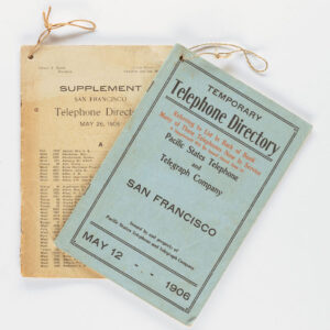
Temporary Telephone Directory with Supplement, San Francisco May 12, 1906
- $2,200
- The first 1906 San Francisco Temporary Telephone Directory - with rare extra supplement!
-
-
-
-
Add to cart
 Quick View
 - San Francisco
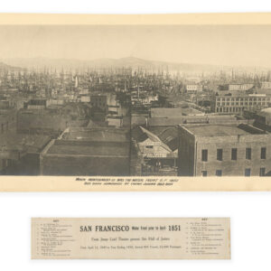
San Francisco Water Front prior to April 1851.
- $7,500
- The "Forest of Masts" Panorama -- The Earliest Known Photograph of San Francisco.
-
-
-
-
Add to cart
 Quick View
 - San Francisco
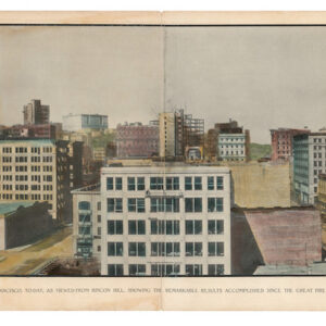
San Francisco, to-day, as viewed from Rincon Hill, showing the remarkable results accomplished since the Great Fire of April 1906
- $875
- An important panorama of post-1906 San Francisco, captured by one of the most iconic photographers of the American West.
-
-