-
-
Add to cart
 Quick View
 - Curiosities - Miscellanea
Save or Delete.
- $1,800
- BANKSY Greenpeace Poster and Sticker Sheet.
-
-
-
-
Add to cart
 Quick View
 - Curiosities - Miscellanea
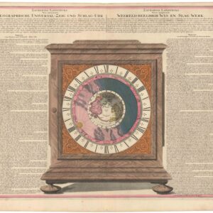
ZACHARIAS LANDTECKS Neu inventierte GEOGRAPHISHE UNIVERSAL-ZEIG UND SCHLAG-UHR.
- $1,800
- Rare and intriguing engraving of Zacharias Landteck’s Universal Clock with early color.
-
-
-
-
Add to cart
 Quick View
 - Curiosities - Miscellanea
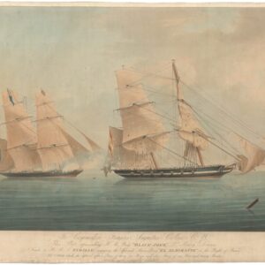
To Commodore Francis Augustus Collier C.B., this plate representing H.M. brig “Black Joke.”
- $1,900
- A rare 1830 aquatint of action on the high seas: HMS Black Joke captures a Spanish slave ship.
-
-
-
-
Add to cart
 Quick View
 - Curiosities - Miscellanea, France & Switzerland
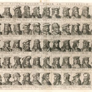
Omnium Regum Galliae usquae ad praesentem iccones.
- $2,800
- Duchetti’s extremely rare 16th-century broadsheet with 63 small busts of French kings from Faramund to Henry III.
-
-
-
-
Add to cart

 Quick View
 - Curiosities - Miscellanea, Featured Maps & Views
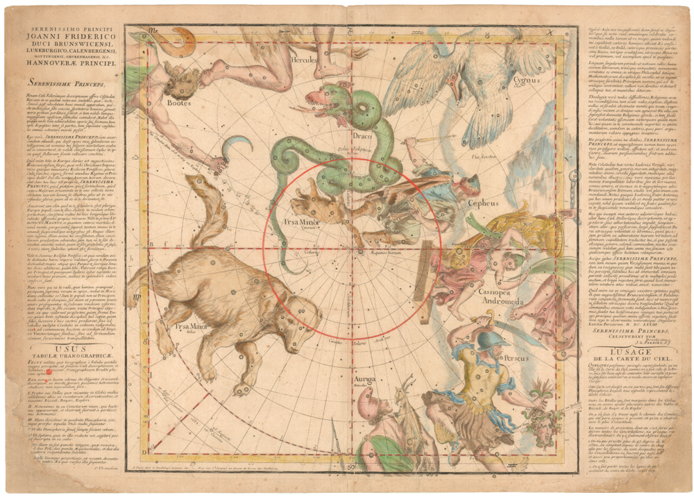
Globi coelestis in tabulas planas redacti descriptio, auctore R. P. Ignatio Gastone Pardies Societatis Jesu mathematico. Opus postumum
- $15,500
- One of the rarest sets from the Golden Age of celestial cartography.
-
-
-
-
-
Add to cart
 Quick View
 - Curiosities - Miscellanea
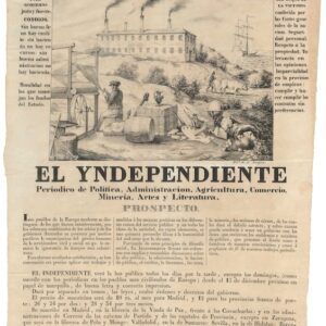
El Yndependiente Periodico de Politica, Administracion, Agricultura…. / Constitucion de 1837.
- $1,800
- A Spanish broadside celebrating the Spanish Constitution of 1837.
-
-
-
-
Add to cart
 Quick View
 - Curiosities - Miscellanea
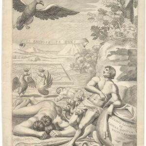
Studio Geografi di Giovan Batista Nicolosi.
- $575
- The wonderful and intriguing title page for Nicolosi's magnum opus, Dell’ Ercole e Studio Geografico.
-
-
-
-
Add to cart
![Diario del Gobierno de la Republica Mexicana. Tome VII, Num. 697 [&] El Exmo. Sr. vice-presidente interino de los Estados-Unidos Mexicanos… Valentin Gómez Farías… sabed: …Sr. Presidente intorno D. Antonio Lopez de Santa-Anna, para mandar en persona y como general en gefe las fuerzas del ejécito…](https://neatlinemaps.com/wp-content/uploads/2024/05/NL-01744-1_thumbnail-300x300.jpg) Quick View
Quick View - Curiosities - Miscellanea
Diario del Gobierno de la Republica Mexicana. Tome VII, Num. 697 [&] El Exmo. Sr. vice-presidente interino de los Estados-Unidos Mexicanos… Valentin Gómez Farías… sabed: …Sr. Presidente intorno D. Antonio Lopez de Santa-Anna, para mandar en persona y como general en gefe las fuerzas del ejécito…
- $2,200
- Two rare official documents showcasing General Santa Anna’s pivotal role in the Texas Revolution and Mexican-American War.
-
-
-
-
Add to cart
 Quick View
 - California, Curiosities - Miscellanea
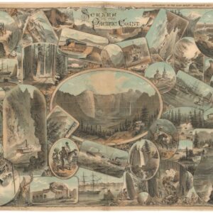
Scenes on the Pacific Coast.
- $2,800
- Pacific Panorama: Keller's Visual Tapestry of the West Coast.
-
-
-
-
Add to cart
![Team-signed photo of Czechoslovakia’s 1969 hockey team [with souvenir glass puck].](https://neatlinemaps.com/wp-content/uploads/2024/05/NL-01963-4_thumbnail-300x300.jpg) Quick View
Quick View - Curiosities - Miscellanea
Team-signed photo of Czechoslovakia’s 1969 hockey team [with souvenir glass puck].
- $900
- A unique Cold War photograph.
-
-
-
-
Add to cart
![[Dr. Seuss] This Is Ann….. She Drinks Blood!](https://neatlinemaps.com/wp-content/uploads/2024/05/NL-01354_thumbnail-300x300.jpg) Quick View
Quick View - Curiosities - Miscellanea, World
[Dr. Seuss] This Is Ann….. She Drinks Blood!
- $1,450
- Discover Dr. Seuss's unique wartime creation: an engaging map that combines his iconic illustrations with life-saving information on malaria prevention for soldiers.
-
-
-
-
Add to cart
 Quick View
 - Curiosities - Miscellanea
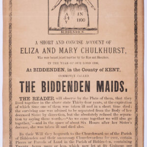
Handbill for the Siamese Twins “The Biddenden Maids”
- $875
- An early Victorian handbill relaying the inspirational tale of the conjoined Biddenden Twins of Medieval England.
-
-