-
-
Add to cart
![[First State] Panorama of the Seat of the War Birds Eye View of Virginia, Maryland, Delaware and the District of Columbia](https://neatlinemaps.com/wp-content/uploads/2024/05/NL-00664-scaled-1-300x300.jpg)
![[First State] Panorama of the Seat of the War Birds Eye View of Virginia, Maryland, Delaware and the District of Columbia](https://neatlinemaps.com/wp-content/uploads/2024/05/NL-00664-scaled-1.jpg) Quick View
Quick View - Bird's-eye-views, East & Midwest United States, Featured Maps & Views
[First State] Panorama of the Seat of the War Birds Eye View of Virginia, Maryland, Delaware and the District of Columbia
- $2,200
- Bachmann's dramatic 1861 panoramic view of the central theater of the American Civil War.
-
-
-
-
-
Add to cart
![[1838 Republic of Texas manuscript document detailing the votes for elected office, including President].](https://neatlinemaps.com/wp-content/uploads/2023/06/NL-01852-front_thumbnail-300x300.jpg) Quick View
Quick View - Michael's Collection, Texas and The West
[1838 Republic of Texas manuscript document detailing the votes for elected office, including President].
- $8,500
- Original Republic of Texas referendum document stipulating the results of the 1838 election of Mirabeau Lamar.
-
-
-
-
Add to cart

 Quick View
 - Featured Maps & Views, Turkey - Ottoman Empire
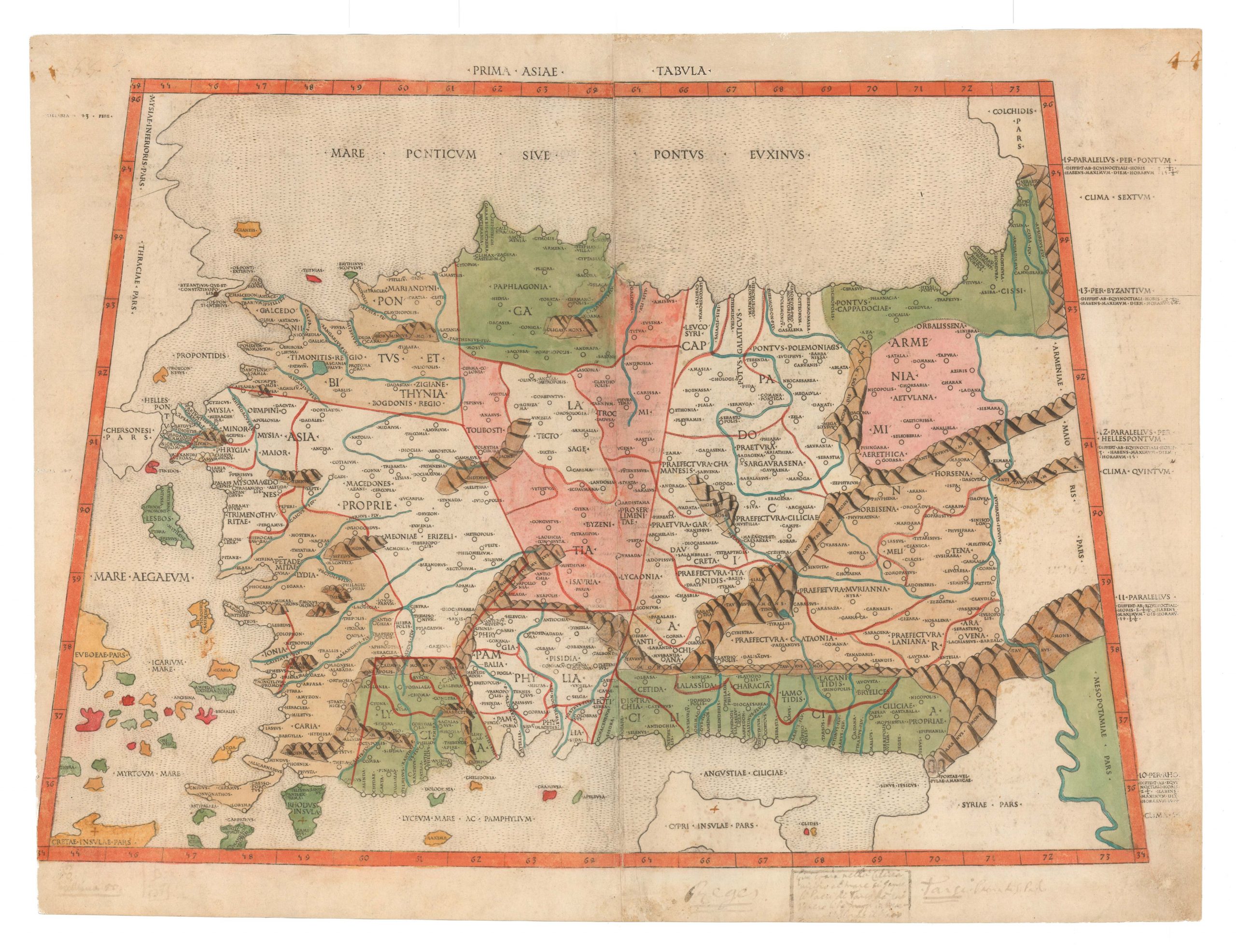
Prima Asiae Tabula.
- $9,500
- The first printed map of Turkey.
-
-
-
-
-
Add to cart
 Quick View
 - Featured Maps & Views, Pacific Northwest - Hawaii - Alaska
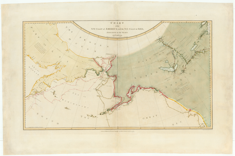
Chart of the N. W. Coast of America and the N. E. Coast of Asia, Explored in the Years 1778 and 1779. Prepared by Lieut’t Henry Roberts, under the immediate Inspection of Capt. Cook.
- $8,500
- The "Legendary lost chart of Captain Cook" - Rare first edition.
-
-
-
-
-
Add to cart

 Quick View
 - Americas, California, Michael's Collection, North America
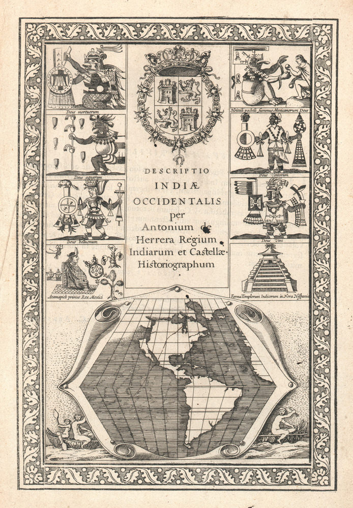
Descriptio Indiae Occidentalis per Antonium de Herrera.
- $3,600
- The first map to show California as an island!
-
-
-
-
-
Add to cart
 Quick View
 - Europe, Featured Maps & Views, Germany & the Netherlands
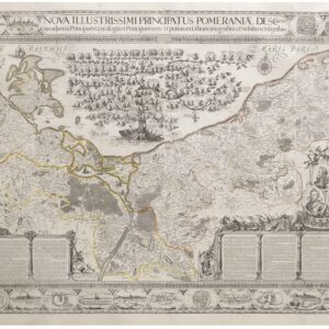
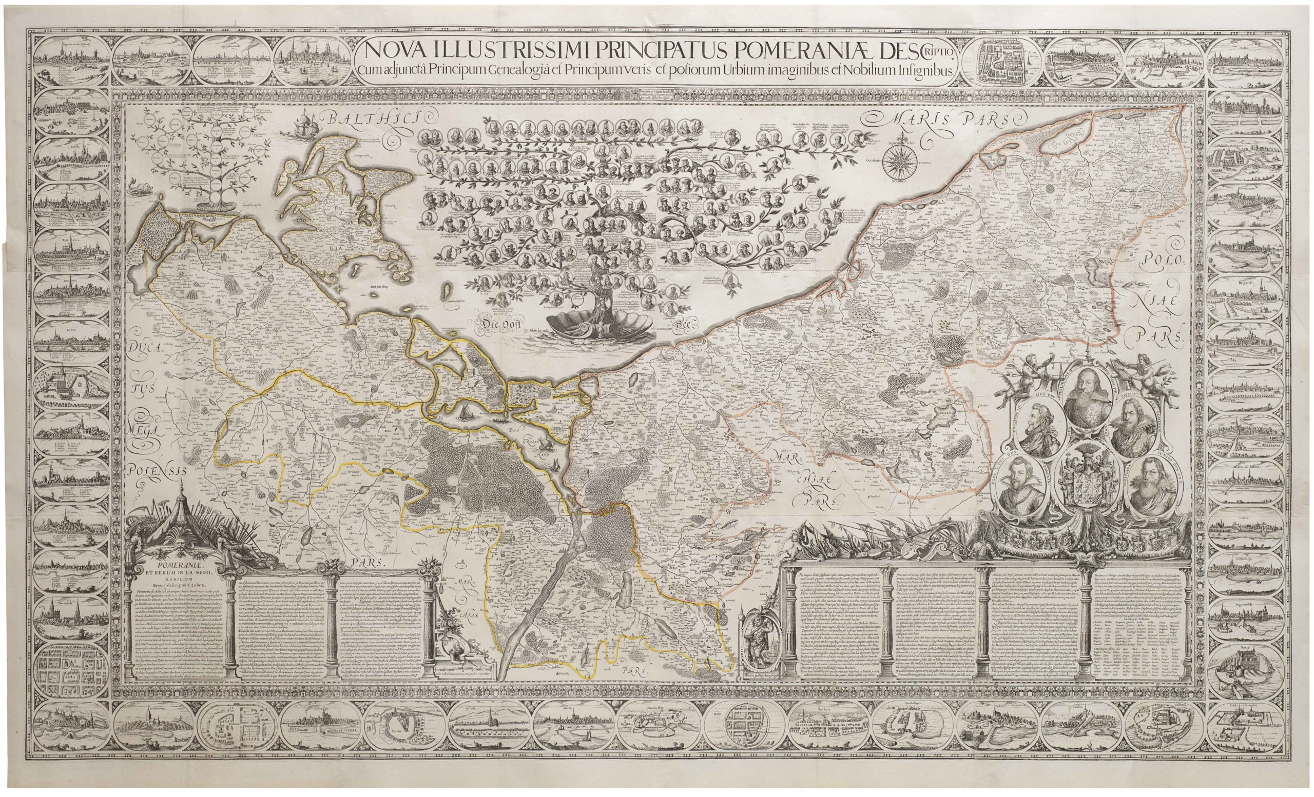
Nova Illustrissimi Principatus Pomeraniae Descriptio
- $27,000
- An exceptionally rare cartographic masterpiece — the finest and most important map of Pomerania, the plates of which were rediscovered in an attic after lost during the Thirty Years’ War.
-
-
-
-
-
Add to cart

 Quick View
 - Southeast Asia & Australia, Featured Maps & Views, Asia
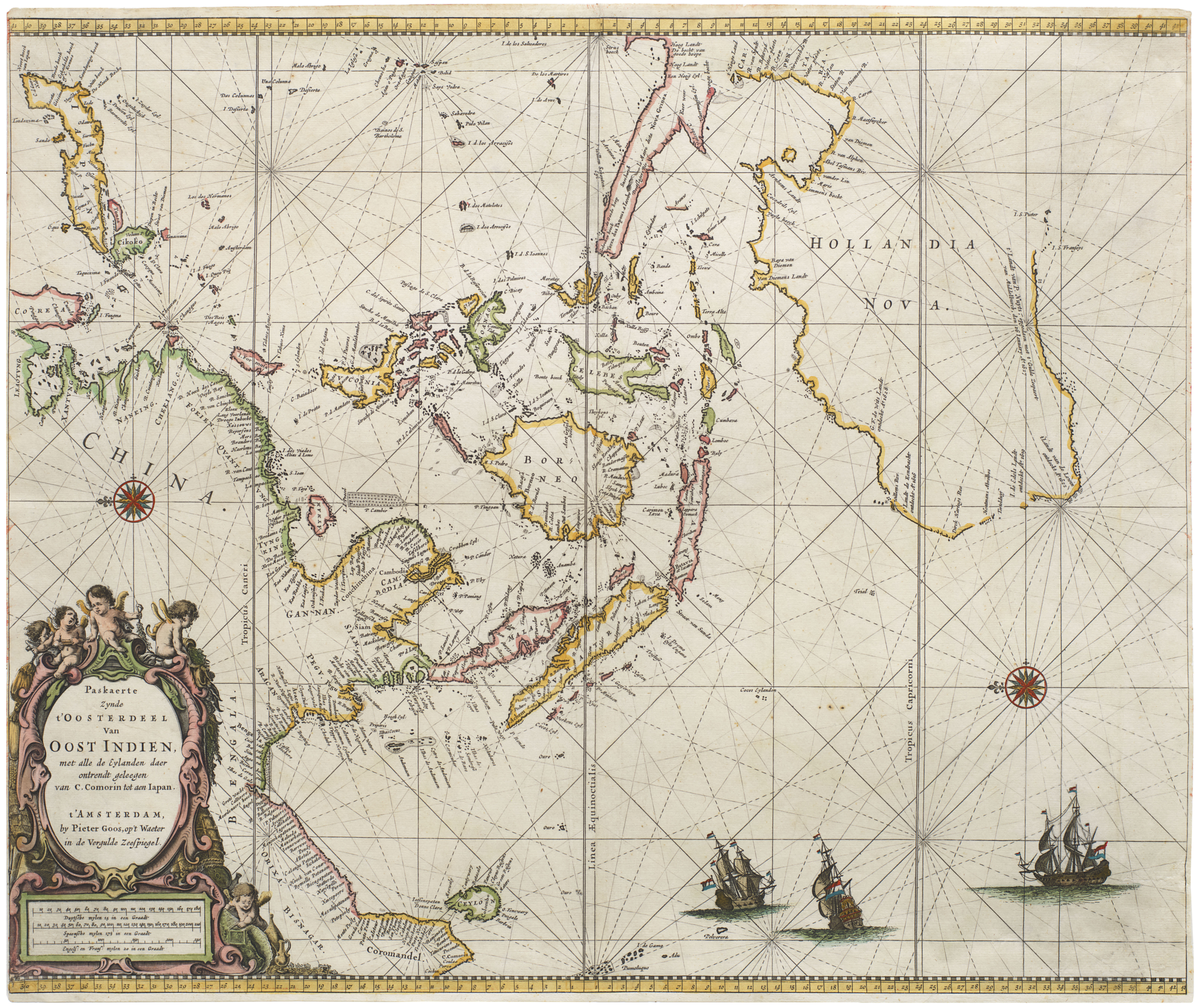
Paskaerte Zynde t’Oosterdeel van Oost Indien, met Alle de Eylanden daer Ontrendt Geleegen van C. Comorin tot aen Japan
- $9,000
- [Early color] Pieter Goos’ Striking Sea Chart of Southeast Asia, Australia, and the Indian Ocean.
-
-

-
-
-
Add to cart

 Quick View
 - Featured Maps & Views, San Francisco
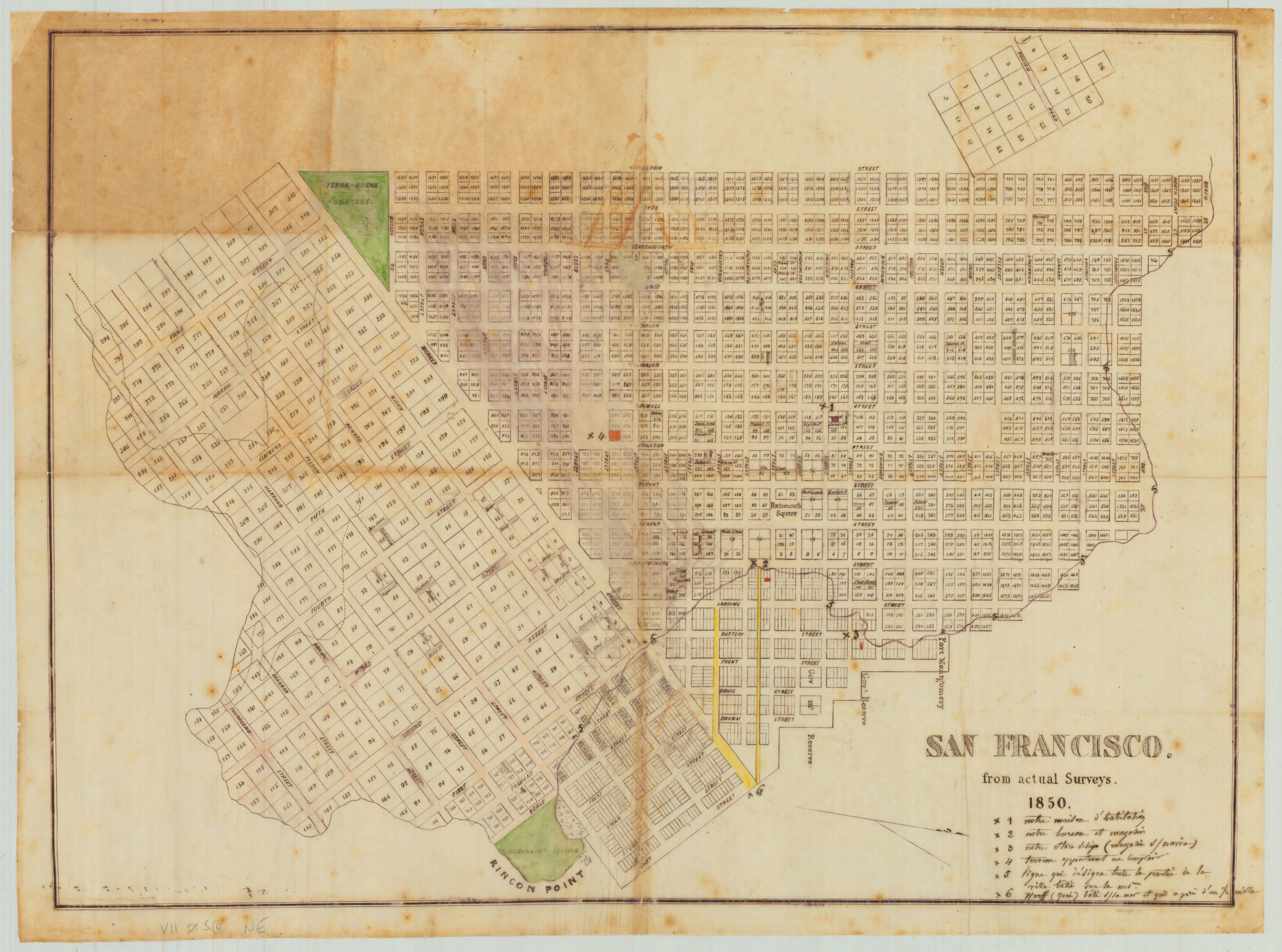
San Francisco. from actual Surveys. 1850.
- $75,000
- A unique artifact of Gold Rush San Francisco, including one of San Francisco's most famous buried ships!
-
-
-
-
-
Add to cart

 Quick View
 - Featured Maps & Views, San Francisco
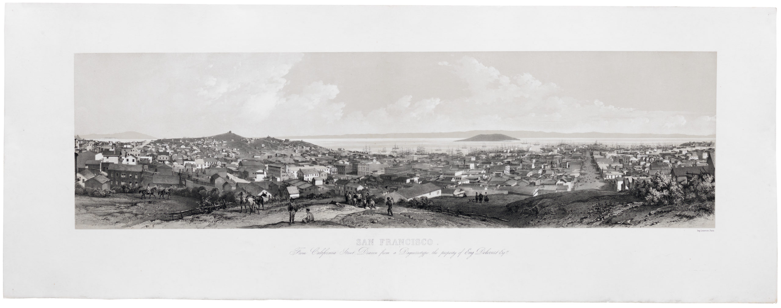
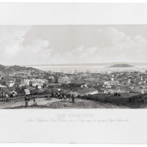
San Francisco. From California Street. Drawn from a Daguerreotype, the property of Eugene Delessert, Esq.re
- $8,000
- Spectacular Gold Rush era view of San Francisco published in Paris.
-
-
-
-
-
Add to cart

 Quick View
 - Africa, Arabia and the Red Sea, Asia, Michael's Collection
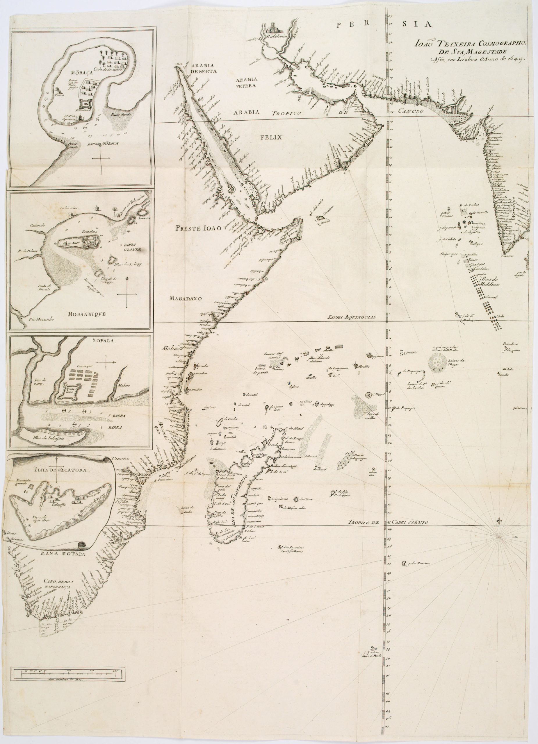
João Teixeira Cosmographo. De sua, Magestade. Aféz em Lixboa o Anno de 1649
- $6,000
- Rare 17th century portolan-style chart designed for use aboard Portuguese merchant vessels.
-
-
-