-
-
Add to cart
 Quick View
 - Arabia and the Red Sea, Iran - Persia - Central Asia
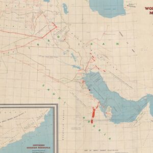
World Oil’s 1958 Middle East Oil Map
- $2,800
- World Oil’s iconic map of the Middle Eastern Petroleum Concessions and Infrastructure.
-
-
-
-
Add to cart

 Quick View
 - Curiosities - Miscellanea, Europe, Iran - Persia - Central Asia, Russia & Eastern Europe
Contro La Repressione e L’Imperialismo del Comunismo Sovietico.
- $750
- Italian Anti-Communist Poster protesting the Soviet invasion of Afghanistan and the arrest of peace activist and nuclear physicist, Andrey Sakharov.
-
-

-
-
-
Add to cart

 Quick View
 - Featured Maps & Views, Turkey - Ottoman Empire
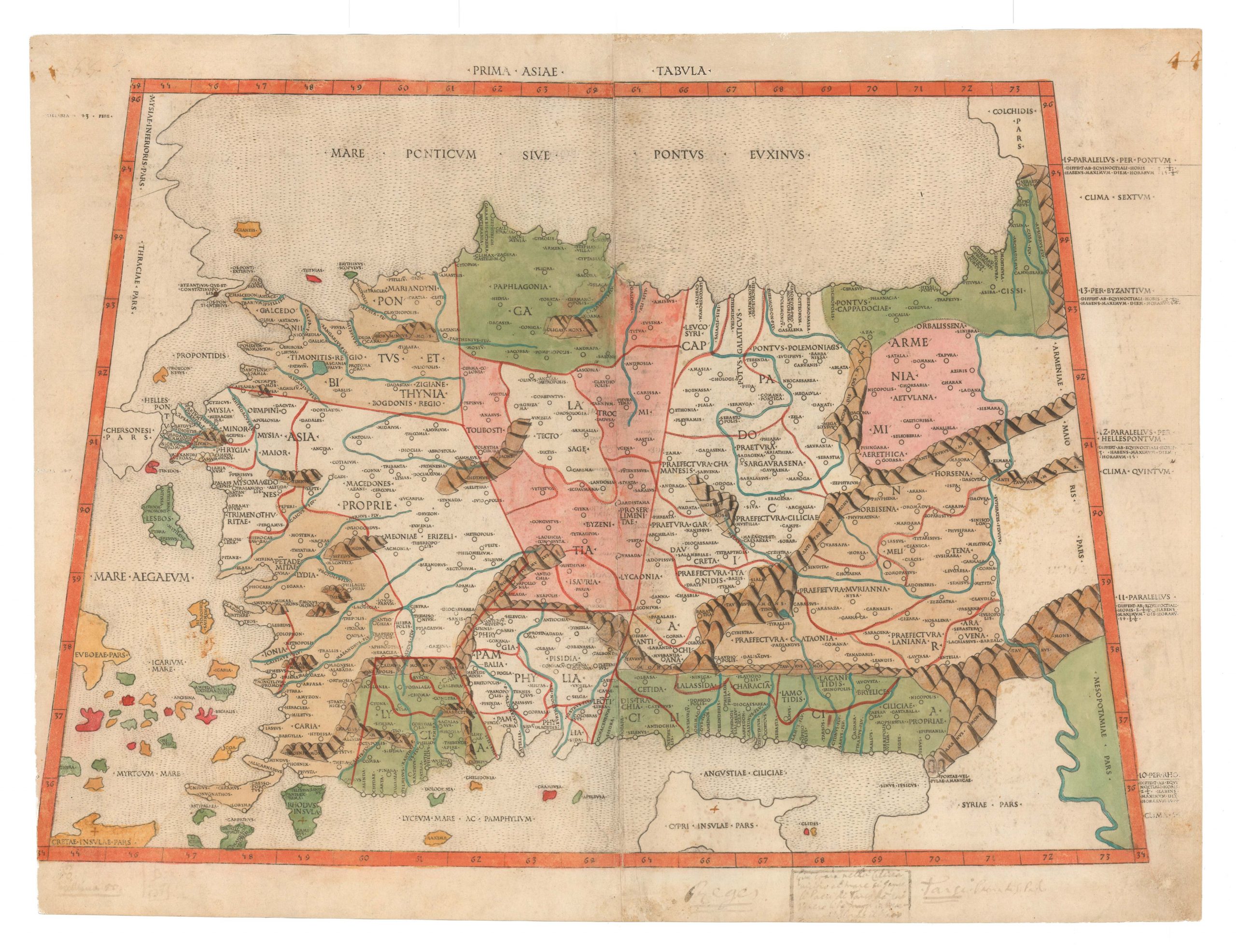
Prima Asiae Tabula.
- $9,500
- The first printed map of Turkey.
-
-
-
-
-
Add to cart

 Quick View
 - Curiosities - Miscellanea, Iran - Persia - Central Asia
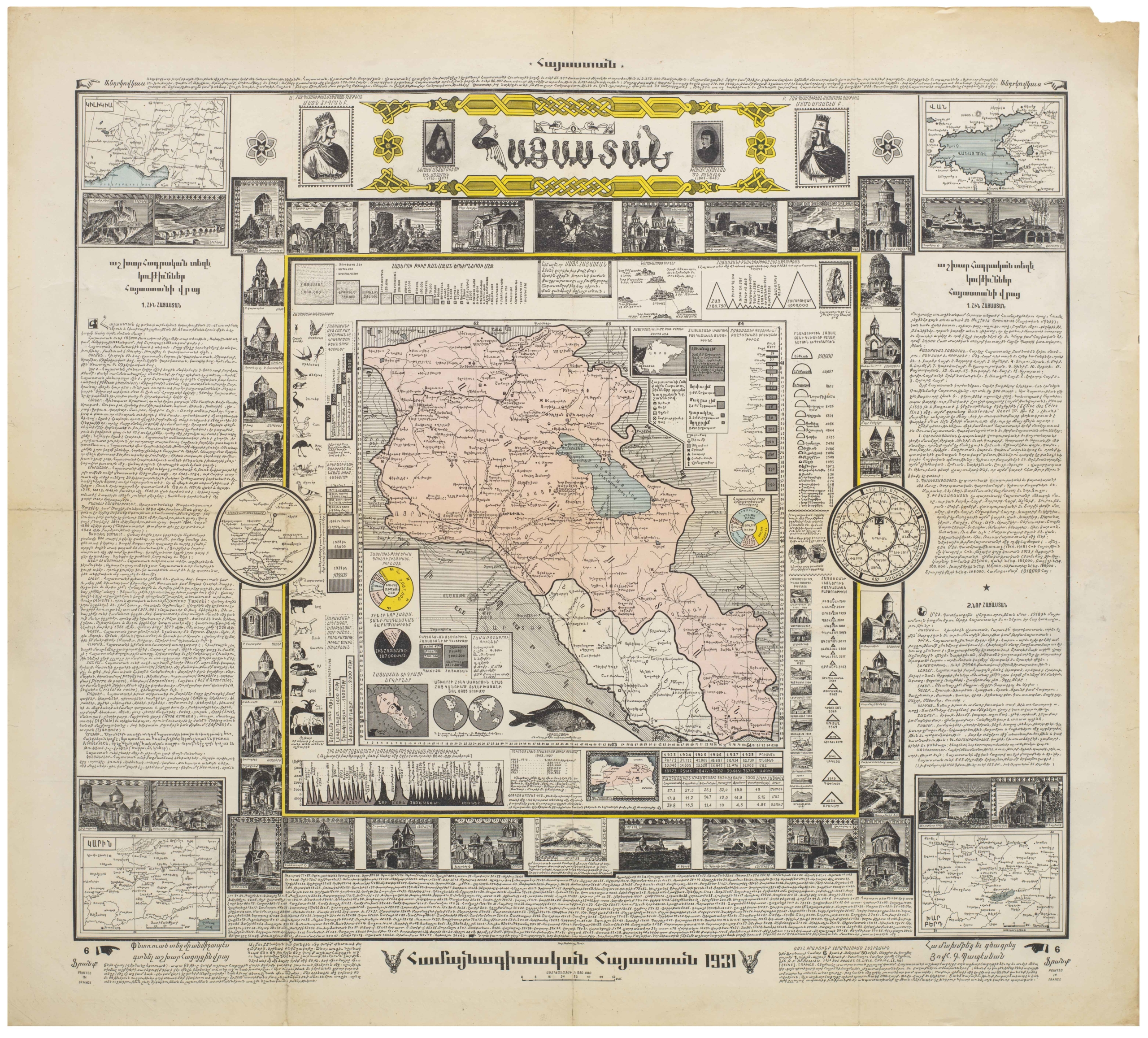
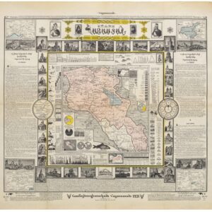
Hayastan: hamaynagitakan Hayastan (Armenia: Encyclopedic Armenia)
- $2,600
- A cartographic celebration of Armenia and Armenian culture.
-
-
-
-
-
Add to cart
 Quick View
 - Bird's-eye-views, Eastern Mediterranean - Holy Land
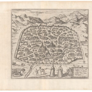
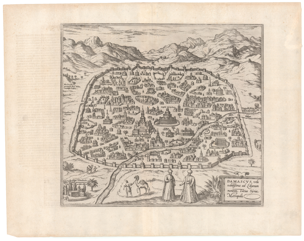
Damascus, urbs noblissima ad Libanum montem, Totius Sÿriae Metropolis
- $775
- An excellent example of Braun and Hogenberg's 1575 bird's-eye-view of Damascus in original black and white.
-
-
-
-
-
Add to cart

 Quick View
 - Eastern Mediterranean - Holy Land, Bird's-eye-views
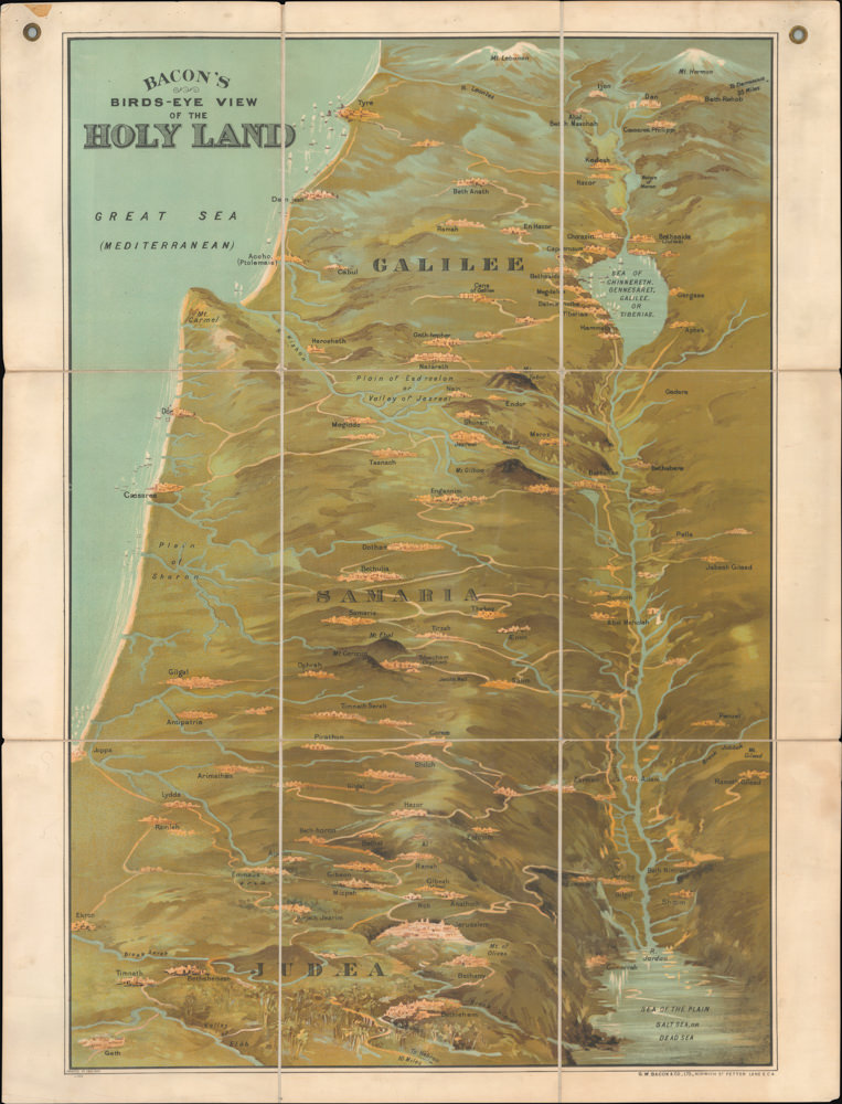
Bacon’s Bird’s-Eye View of the Holy Land
- $2,600
- George Washington Bacon’s iconic bird’s-eye-view of the Holy Land.
-
-
-
-
-
Add to cart
 Quick View
 - Arabia and the Red Sea, Asia, Curiosities - Miscellanea
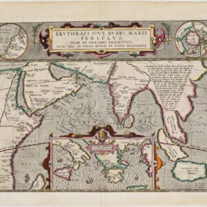
Erythraei Sive Rubri Maris Periplus, olim ab Arriano descriptus, nunc vero ab Abrah. Orelio ex eodem delineatus
- $1,200
- Illustrating a mysterious ancient text: fascinating Ortelius map mixing classical mythology and contemporary exploration.
-
-
-
-
-
-
Add to cart

 Quick View
 - Arabia and the Red Sea
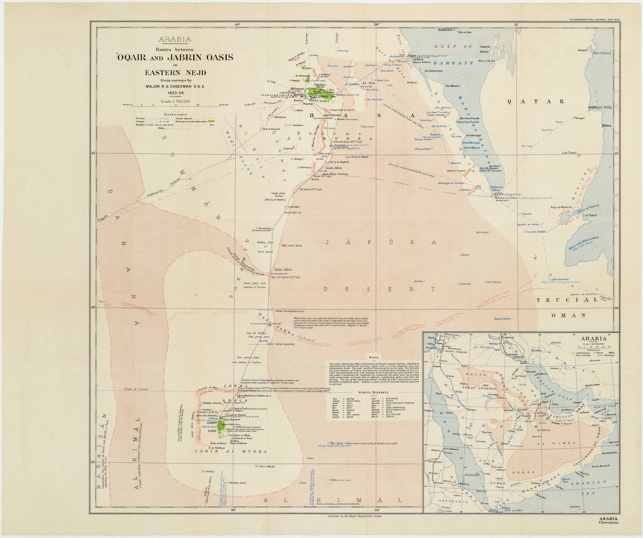
Routes between ‘Oqair and Jabrin Oasis in Eastern Nejd from surveys by Major R.E. Cheesman O.B.E. 1923-24
- $700
- A pioneering expedition for the mapping of the Arabian coast from the Gulf of Salwah to Uqair.
-
-
-
-
-
Add to cart

 Quick View
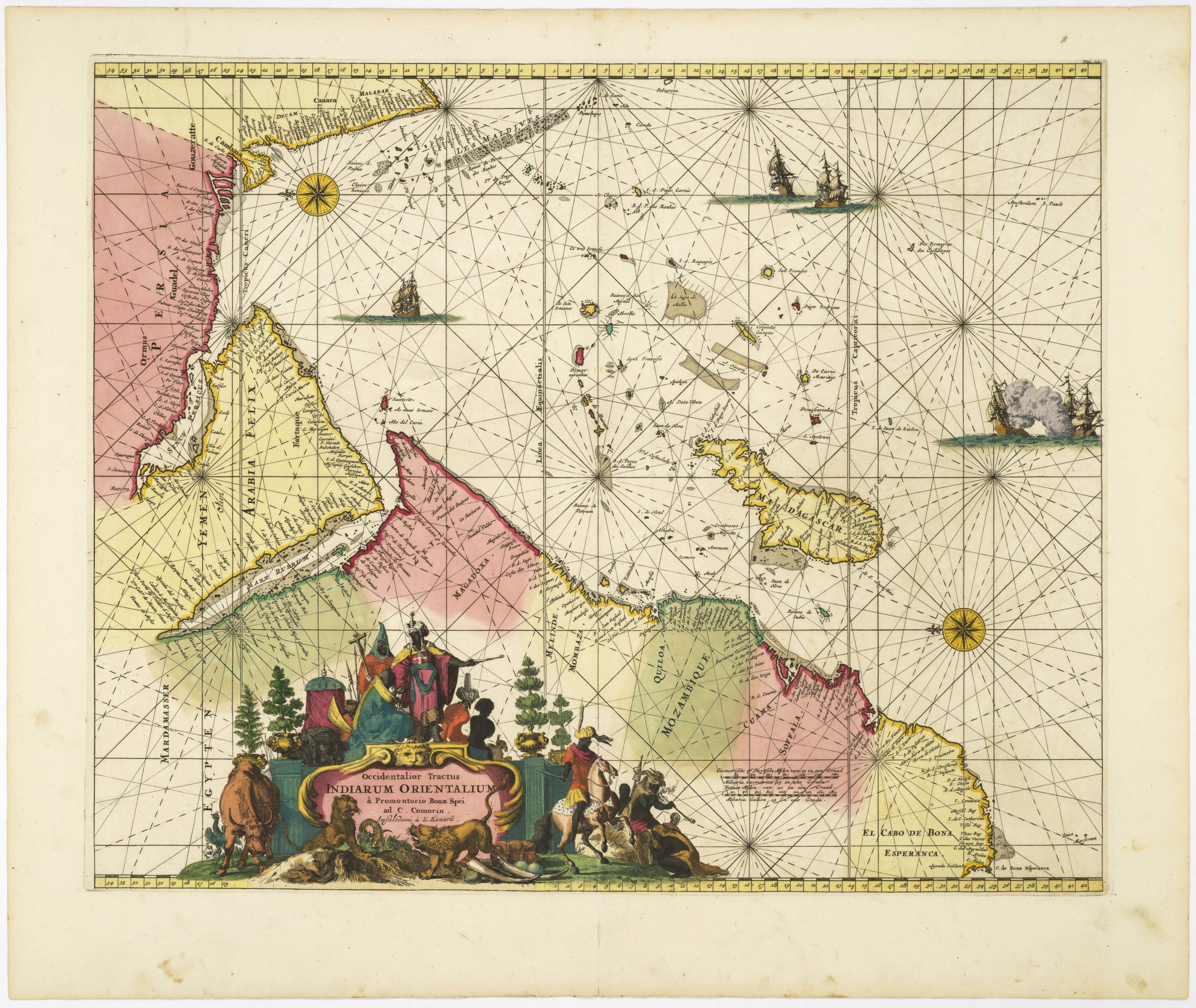
 - Africa, Arabia and the Red Sea
Occidentalior Tractus Indiarum Orientalium à Promontorio Bonae Spei ad C. Comorin
- $1,400
- Stunning Renard sea chart of the Indian Ocean, with East Africa, Arabia, and southern India, from the Atlas de la Navigation.
-
-
-
-
-
Add to cart
 Quick View
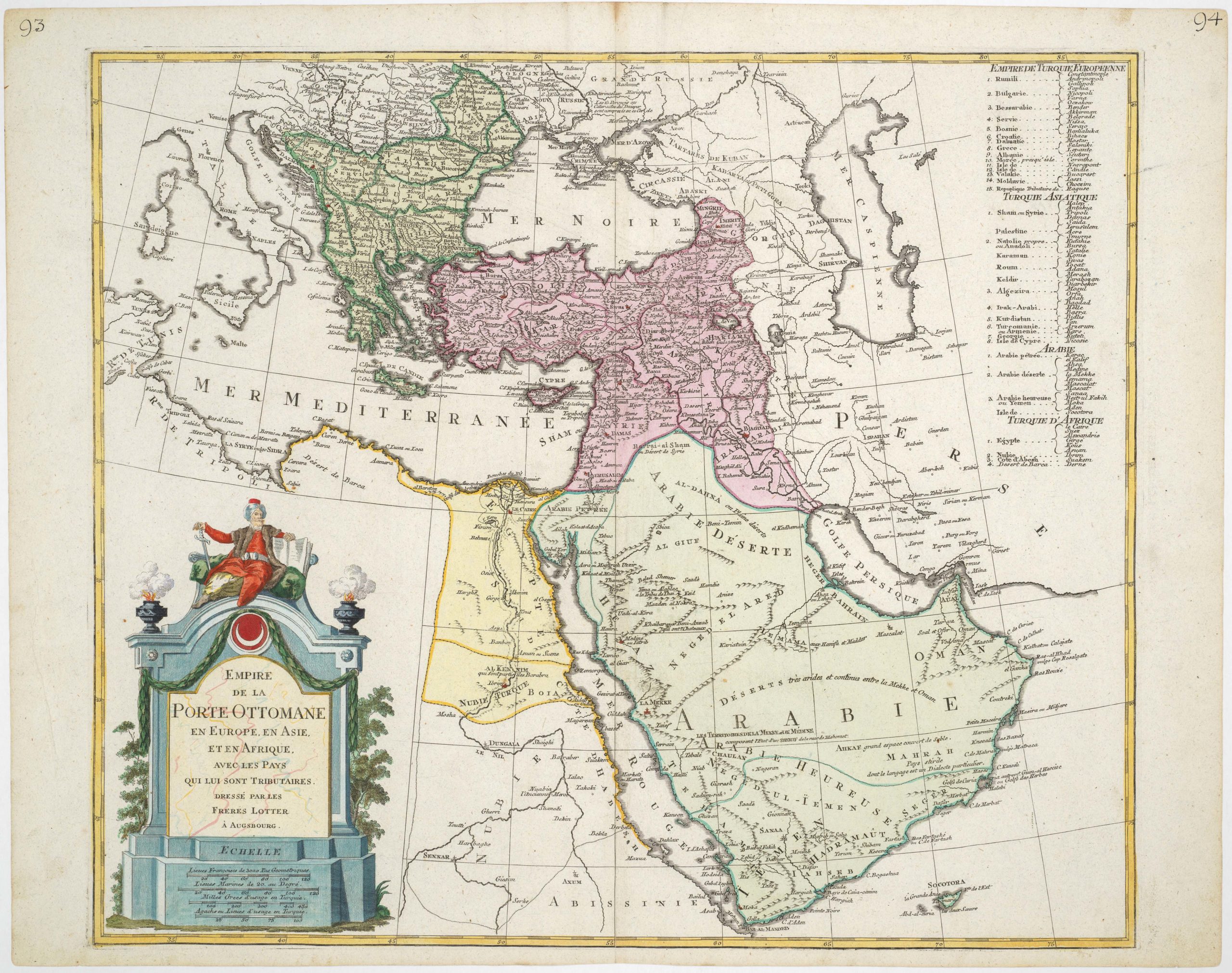
 - Turkey - Ottoman Empire
Empire de la porte Ottomane en Europe, en Asie, et en Afrique avec les pays qui lui sont tributaires, dressé par les freres Lotter
- $675
- Late 18th century map of the Ottoman Empire with large, striking cartouche.
-
-
-
-
-
Add to cart
![[Old Damascus]](https://neatlinemaps.com/wp-content/uploads/2019/09/NL-00657-scaled-300x300.jpg)
![[Old Damascus]](https://neatlinemaps.com/wp-content/uploads/2019/09/NL-00657-scaled.jpg) Quick View
Quick View - Eastern Mediterranean - Holy Land
[Old Damascus]
- $1,900
- Unrecorded large-scale cyanotype archaeological plan of Old Damascus during the Crusades.
-
-
-
-
-
Add to cart
 Quick View
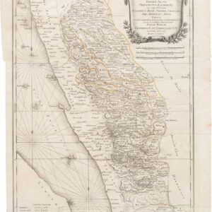
 - Arabia and the Red Sea
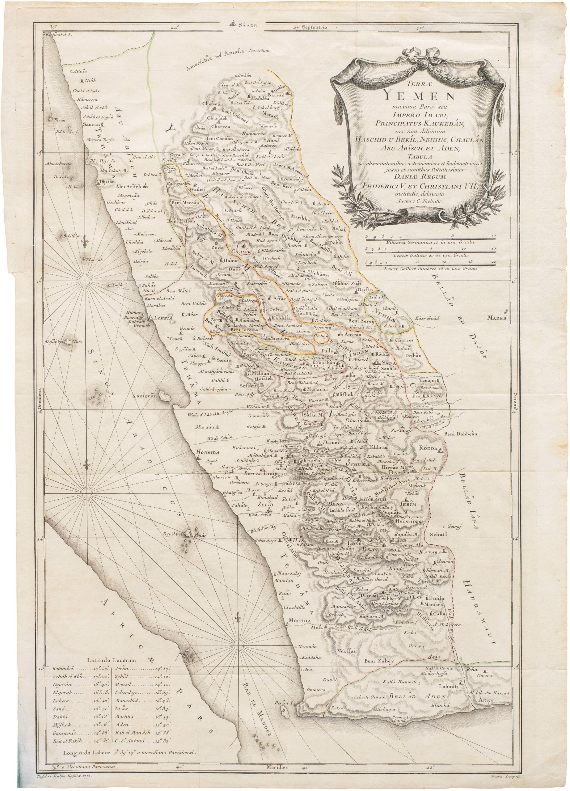
Terrae Yemen maxima Pars seu Imperii Imami, Principatus Kaukebân nec non ditionum Haschid u Bekil, Nehhm, Chaulan, Aleu Arisch et Aden Tabula
- $900
- Original Copenhagen edition of Niebuhr’s map of Yemen, from the first scientific mission to Arabia.
-
-
-