-
-
Add to cart
 Quick View
 - Pacific Northwest - Hawaii - Alaska
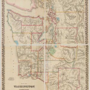
Map of Washington Territory West of the Cascade Mountains.
- $9,500
- The first large-format map of Washington Territory and a masterpiece of American cartography.
-
-
-
-
Add to cart
 Quick View
 - Pacific Northwest - Hawaii - Alaska
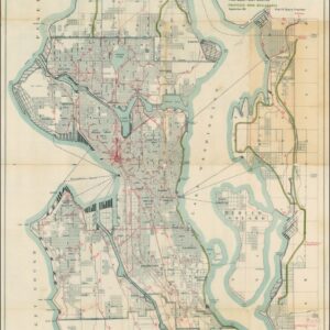
A Map for the City of Seattle and adjacent territory accompanying a report of MUNICIPAL PLANS COMMISSION.
- $1,200
- The famous ‘Bogue Plan’ of Seattle: an ambitious urban design for the city and environs from 1911.
-
-
-
-
Add to cart
 Quick View
 - Pacific Northwest - Hawaii - Alaska
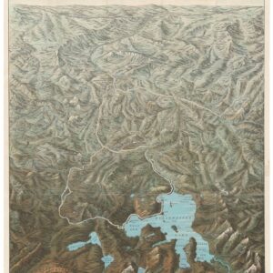
Mount St. Helen’s Quadrangle (7.5 Minute Series)
- $575
- Washington’s dramatic volcanic peak, taken a few years before the catastrophic 1980 eruption.
-
-
-
-
Add to cart
 Quick View
 - Bird's-eye-views, Pacific Northwest - Hawaii - Alaska
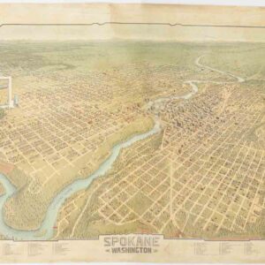
Spokane. Washington.
- $4,500
- A scarce and gorgeous bird’s-eye-view of Spokane during its heyday as the railroad hub of the Northern Plains.
-
-
-
-
Add to cart
 Quick View
 - Bird's-eye-views, Pacific Northwest - Hawaii - Alaska, Texas and The West
Yellowstone National Park. Northern Pacific Railway / Northern Pacific Railway Company for Yellowstone National Park Puget Sound and Alaska.
- $700
- A magnificent view of one of America's most majestic parks in its original envelope.
-
-
-
-
Add to cart
 Quick View
 - Pacific Northwest - Hawaii - Alaska
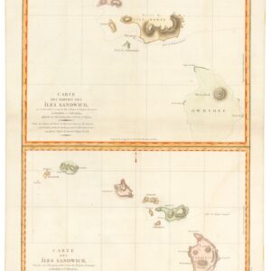
Carte des Parties des Îles Sandwich & Carte des Îles Sandwich.
- $1,600
- History’s second mapping of Hawaii.
-
-
-
-
Add to cart
 Quick View
 - Americas, North America, Pacific Northwest - Hawaii - Alaska, Texas and The West
Map of Oregon Territory.
- $550
- One of the earliest maps of Oregon Territory.
-
-
-
-
Add to cart
 Quick View
 - Pacific Northwest - Hawaii - Alaska, Pictorial maps, United States
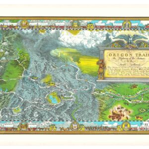
The Oregon Trail: The Highway of the Pioneers to the Pacific Northwest.
- $575
- William Forsyth McIlwraith’s vibrant and historically rich Oregon Trail map.
-
-
-
-
Add to cart

 Quick View
 - Americas, North America, Pacific Northwest - Hawaii - Alaska, United States
A Chart of North and South America, Including the Atlantic and Pacific Oceans, with the nearest Coasts of Europe, Africa, and Asia
- $4,200
- Sayer-Bennet-Mead's 1775 chart of the Western Hemisphere with Pacific and Arctic routes of exploration.
-
-
-
-
-
Add to cart
 Quick View
 - Atlases & Books, Europe, Pacific Northwest - Hawaii - Alaska, Russia & Eastern Europe, United States
Account of the Russian discoveries between Asia and America. To which is added the conquest of Siberia and the history of the transactions and commerce between Russia and China.
- $900
- The most comprehensive English assessment of Russian explorations in the Arctic and Pacific ever written.
-
-
-
-
Add to cart
 Quick View
 - California, Pacific Northwest - Hawaii - Alaska
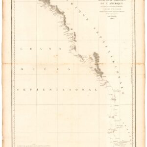
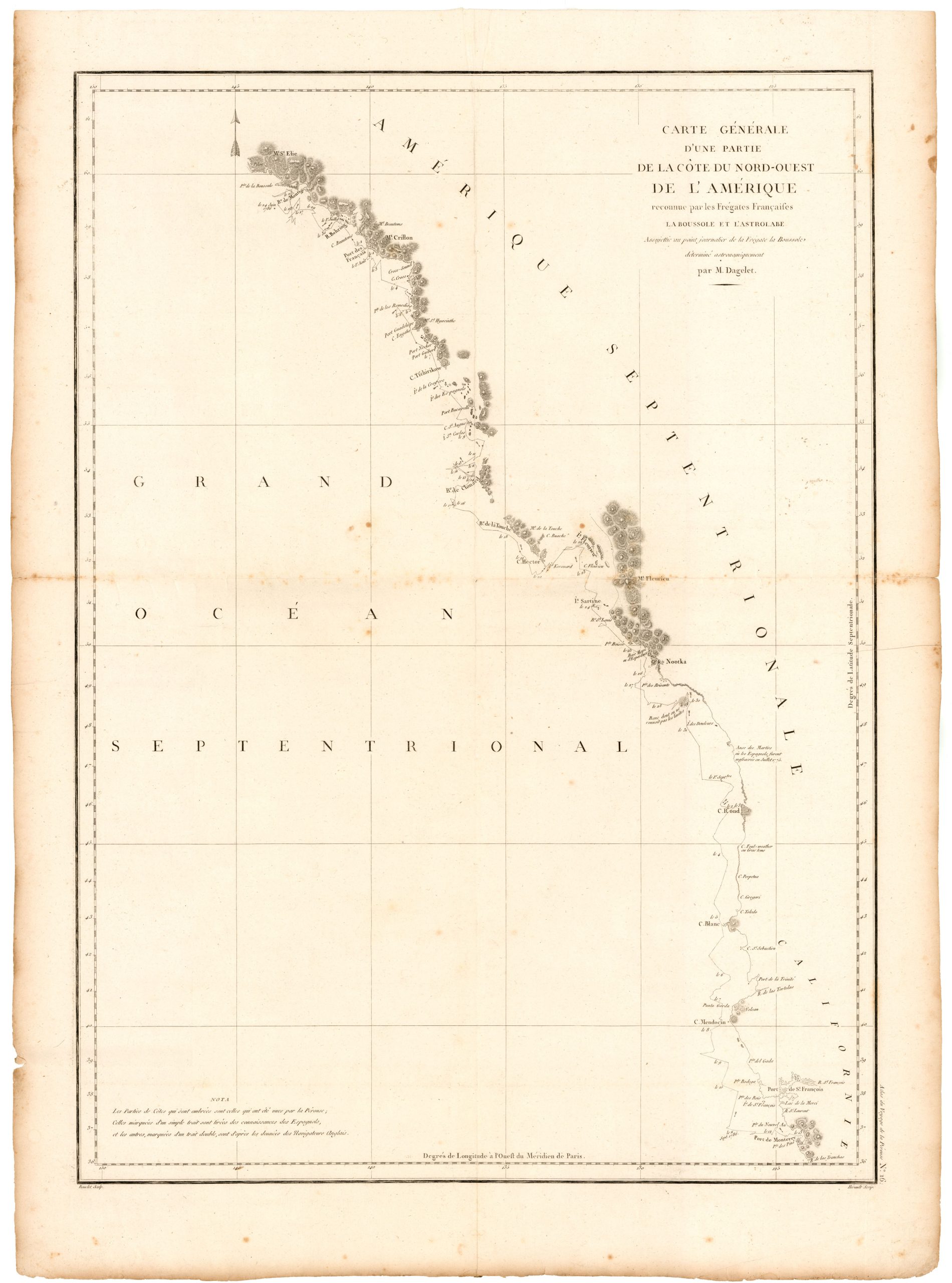
Carte de la Partie de la Cote Nord-Ouest de L’Amerique Reconnue pendant Etes de 1792, 1793, et 1794.
- $1,200
- Vancouver's chart of America’s Pacific coastline: the first printed map to identify the Columbia River estuary and Vancouver Island.
-
-
-
-
-
Add to cart
 Quick View
 - Pacific Northwest - Hawaii - Alaska
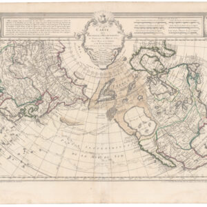
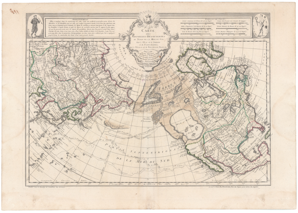
Carte Des Nouvelles Decouvertes Au Nord de la Mer de Sud, Tant a l’Est de la Siberie et du Kamtchatcka, Qu’a l’Ouest de la Nouvelle France, Dressee sur les Memoires…1750
- $1,800
- Famed North Pacific map, with a giant Sea of the West and the dubious discoveries of Admiral de Fonte.
-
-
-