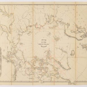
Linen-backed 1890 British Admiralty chart of the polar seas
Chart of the North Polar Seas
Out of stock
Date:
1890
Place:
London
Dimensions:
76.4 x 60.4 cm (30 x 23.75 in)
Add to Wishlist
Add to Wishlist
Description
This is a map that was made to be used in the field, and probably was.
Chart of the polar seas, first published in 1855, with improvements over the years as the mysteries of the far north were unveiled, as indicated with text in lower margin: “Small corrections VI-82 X-90. Large Corrections, March 1882.”
Backed with linen and sectioned for folding into original cloth slipcase 33.5 x 29 cm (13¼ x 11½ in).
Cartographer(s):
Condition Description
Slipcase worn; map very good.
References