
De Jode’s extraordinary map of Arabia — among the finest maps of the region on the market.
Secundae Partis Asiae.
$7,000
1 in stock
Description
Based on Giacomo Gastaldi’s landmark 1561 map and engraved by Joannes and Lucas Van Deutecum, this is undoubtedly one of the most spectacular 16th-century maps of Arabia. It covers an area stretching west-east from the West Nile Delta to the Maldives and south-north from the Horn of Africa to Damascus.
The geography of the map is a significant improvement over earlier Ptolemaic productions, especially the width of the Red Sea and the shape and orientation of the Persian Gulf. The ‘S’ curve of the Straight of Hormuz is a much more accurate reflection of reality. However, the topography of the interior of the Arabian Peninsula, still a great unknown for European mapmakers, is largely invented. This includes Ptolemaic legacies such as the mythical lake of Stag Lago and newly fabricated mountain systems not delineated by Ptolemy.
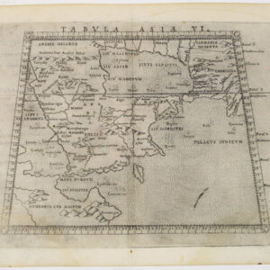
The Arabian Peninsula covers more than 1 million square miles and comprises the modern states of Saudi Arabia, Bahrain, Kuwait, Oman, Qatar, the United Arab Emirates, and Yemen. It is one of the largest regions in the world with no navigable rivers, a circumstance that made exploring and mapping its interior problematic. The first map of the Arabian peninsula to be printed in Europe was in the 1477 edition of Ptolemy. Tibbetts notes that, like other early Greeks, Ptolemy exaggerated the length of Eurasia to the east. The distance between the Red Sea and Persia was too big, and thus Arabia was stretched to fill the gap, mainly because Ptolemy knew the entrance to the Red Sea was very narrow; therefore, he had to make the shape fit.
By Ptolemy’s time, Greek sailors had sailed around the Arabian coast and were familiar with port towns. However, its interior remains largely unmapped until the 20th century. The northern part of the peninsula tended to be mapped more accurately because it was closer to populated lands and more frequently traveled. Still, the interior of Ptolemaic maps is almost entirely fanciful, including the mountain ranges, river systems, and lakes. The cartographic errors are a mix of stories told to sailors about what lies inland and the desire to fill space common in pre-18th-century cartography.
Cartographer(s):
Gerard de Jode (1511–91) was a Dutch printer and mapmaker born in Nijmegen who worked from Antwerp, then the center of European cartographic production. Accepted into the Guild of St. Luke in 1547, he quickly earned a reputation as a skilled mapmaker — though his business acumen never quite matched his cartographic talent. His greatest achievement was the two-volume Speculum Orbis Terrarum (1578), conceived as a rival to Ortelius’ enormously popular Theatrum Orbis Terrarum. Despite De Jode’s reputation, the atlas sold poorly — a commercial failure whose consequence is that barely a dozen copies survive today, making it one of the rarest atlases in existence.
Undeterred, De Jode began work on a revised and expanded atlas with his son Cornelis (1568–1600). The result, Speculum Orbis Terrae (1593), retained Gerard’s original maps while incorporating significant revisions and new maps compiled by Cornelis. Gerard died two years before publication. The atlas fared no better commercially, and after Cornelis’ death the plates were sold to J. B. Vrients — who also owned the Ortelius plates — effectively ensuring the work would never be reprinted. Where Ortelius ran to dozens of editions, the De Jode atlas exists only in its two original editions of 1578 and 1593.
Condition Description
Reinforced centerfold, overall excellent. Wide margins. Verso text: Latin. Watermark: two crossed arrows.
References
![[Mısır Haritası / Map of Egypt]](https://neatlinemaps.com/wp-content/uploads/2025/06/NL-02391_thumbnail-2-300x300.jpg)