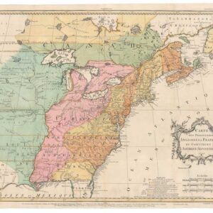
A French depiction of North America with a bold, fully-realized Republic of Texas.
[Independent Texas] Carte Générale de l’Amérique Septentrionale…
Out of stock
Description
This is an 1843 edition of Adrien-Hubert Brue’s Carte Générale de l’Amérique Septentrionale, updated and published in Paris by Charles Picquet, Brue’s successor and one of the leading official geographers of nineteenth-century France.
One of the map’s most striking and historically significant features is its depiction of the Republic of Texas as a fully sovereign nation, boldly outlined in hand color and extending south and west to the Rio Grande. French cartographers were among the most willing to accord Texas its full diplomatic footprint, partly reflecting France’s brief but genuine interest—along with Britain—in courting Texas as an independent buffer between the United States and Mexico. In 1843, Texas’s future was far from settled: annexation was still two years away, Mexican sovereignty was still asserted, and the maximalist Texan claims mapped here would help ignite the U.S.–Mexican War in 1846. Brue and Picquet’s treatment captures this moment of extraordinary geopolitical tension with unusual clarity.
A Continent in Flux
Across the wider continent, the map records a North America on the cusp of immense transformation:
1. Oregon Country appears as a vast, undivided Anglo-American condominium, predating the 1846 boundary settlement at the 49th parallel.
2. Mexico retains California, New Mexico, and its entire northern frontier—territories that would soon be lost after the Mexican–American War.
3. The interior West is composed largely of Indigenous homelands—Comanche, Cheyenne, Pawnee, Blackfeet, Shoshone—reflecting both the limits of European territorial control and the ethnographic interests of French cartography.
4. Russian America (Alaska) is engraved with fine coastal detail, evidence of Russian commercial and missionary presence along the Pacific arc.
5. In the United States, an expanding network of rivers, forts, and settlements traces the growing push into the Mississippi Valley and Missouri frontier.
Overall, a fascinating map of an exciting era in North American history.
Cartographer(s):
Adrien Hubert Brué (1786-1832) was a French cartographer active in the 18th and 19th centuries. He was born in Paris on March 20, 1786, and died of cholera on July 16, 1832, in Sceaux.
In his youth, Brué served as a cabin boy on various ships, including aboard the Naturaliste, which was part of the Baudin expedition (1800-1804) to the South Seas and New Holland (Australia). Upon his return, he began producing maps for a grand atlas, published for the first time in 1820. A new and better atlas was issued in 1830, the same year he was appointed Royal Geographer.
Brué’s production included various atlases and unique maps, all of which were recognized for the purity of the engraving and the accuracy of the information. His main work, the Atlas universel was expanded multiple by him and Charles Picquet (whose stamp is found on most of Brué’s maps). Among the many aspects that elevated Brué above his peers was the. The fact that he drew his maps directly onto copper plates, a process which he named cartel end prototypes.
Charles PicquetCharles Picquet (1771-1821) was a French cartographer especially celebrated for his collaborations with Adrien-Hubert Brué.
Condition Description
Good. Offsetting and toning.
References