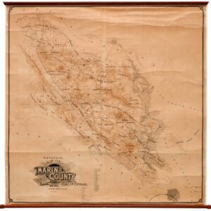
George M. Dodge was an engineer and cartographer active in northern California in the late 19th-century. Although detailed historical records about him are limited, his work, especially in surveying and mapping Marin County, indicates his role in the development of the area during that time.
In addition to creating a detailed survey of Marin County, Dodge was involved in local infrastructure projects, such as the Mount Tamalpais railway built in 1898.
His work in creating a wall map of Marin County was particularly important as it provided one of the most detailed and influential surveys of the county during that era, showcasing the geography, settlement patterns, and the remnants of Mexican land grants. Such maps were crucial for understanding land ownership, planning development, and historical documentation.
Archived
- Out of Stock
- Bay Area & Silicon Valley, California
Official Map of Marin County, California 1892 Compiled from Records and Surveys.
- Dodge's monumental 1892 wall map of Marin County: the greatest Marin map ever made.
- Read moreQuick View
-
- Out of Stock
- Marin, Sonoma, & Napa Valley
Official Map of Marin County, California 1892 Compiled from Records and Surveys.
- Dodge's monumental 1892 wall map of Marin County: the greatest Marin map ever made.
- Read moreQuick View
-

