Johannes Janssonius (1588 – 1664; born Jan Janszoon, also Jan Jansson) was a Dutch cartographer and publisher who lived and worked in Amsterdam in the 17th century. Janssonius was born in Arnhem, the son of Jan Janszoon the Elder, a publisher and bookseller. In 1612 he married Elisabeth de Hondt, the daughter of Jodocus Hondius. He produced his first maps in 1616 of France and Italy.
In the 1630s, Janssonius formed a partnership with his brother-in-law Henricus Hondius; they published atlases as Mercator/Hondius/Janssonius. Under the leadership of Janssonius, the Hondius Atlas was steadily enlarged. After Janssonius’s death, the publishing company was continued by his son-in-law, Johannes van Waesbergen. The London bookseller Moses Pitt attempted publication of the Atlas Major in English but ran out of resources after the fourth volume in 1683.
Archived
- Out of Stock
- Curiosities - Miscellanea
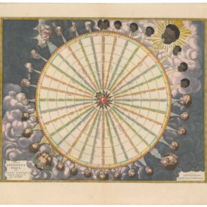
Tabula Anemographica seu Pyxis Nautica.
- The first plate from the world's first sea atlas.
- Read moreQuick View
-
- Out of Stock
- British Isles, Europe
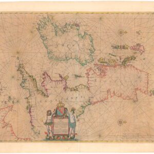
Pascaart vant Canaal, Tusschen Engelant en Vrancryck, alsmede ge heel Ierlant en Schotlant
- Nautical chart of the British Isles with original coloring heightened in gold leaf.
- Read moreQuick View
-
- Out of Stock

- Curiosities - Miscellanea
Typus Corporis Lunaris Panselini [First edition]
- Athanasius Kircher’s pioneering map of the Moon.
- Read moreQuick View
-
- Out of Stock
![America Septentrionalis [First State, Original Color]](https://neatlinemaps.com/wp-content/uploads/2022/08/NL-01504_thumbnail-scaled-300x300.jpg)
![America Septentrionalis [First State, Original Color]](https://neatlinemaps.com/wp-content/uploads/2022/08/NL-01504_thumbnail-scaled.jpg)
- North America
America Septentrionalis [First State, Original Color]
- Henricus Hondius’ iconic 17th-century map of North America: an entirely new cartographic vision of the continent.
- Read moreQuick View
-
- Out of Stock
![America Septentrionalis [Second State, Original Color]](https://neatlinemaps.com/wp-content/uploads/2019/09/NL-00047-NEW_thumbnail-scaled-300x300.jpg)
![America Septentrionalis [Second State, Original Color]](https://neatlinemaps.com/wp-content/uploads/2019/09/NL-00047-NEW_thumbnail-scaled.jpg)
- North America
America Septentrionalis [Second State, Original Color]
- Henricus Hondius’ iconic 17th-century map of North America: an entirely new cartographic vision of the continent.
- Read moreQuick View
-
- Out of Stock
- Africa
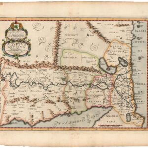
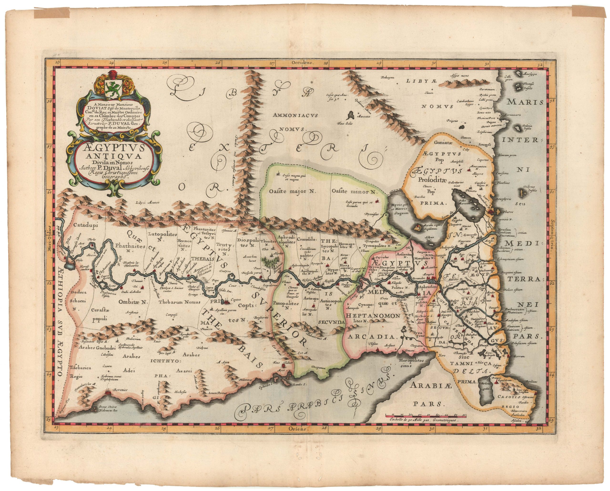
Aegyptus Antiqua Divisa in Nomos Authore P. Duval Abbevilliense Regis Christianissimi Geographo
- Attractive 17th-century map of Egypt with ancient place names.
- Read moreQuick View
-
- Out of Stock
- Asia
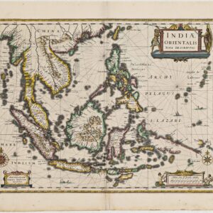
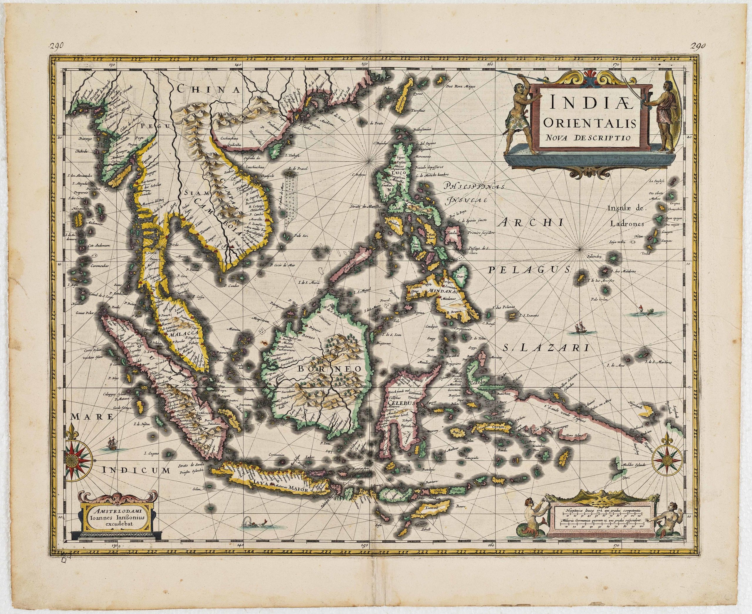
Indiae orientalis nova descriptio
- Mapping Dutch influence in Southeast Asia: elegant 1633 map with newest discoveries.
- Read moreQuick View
-
- Out of Stock
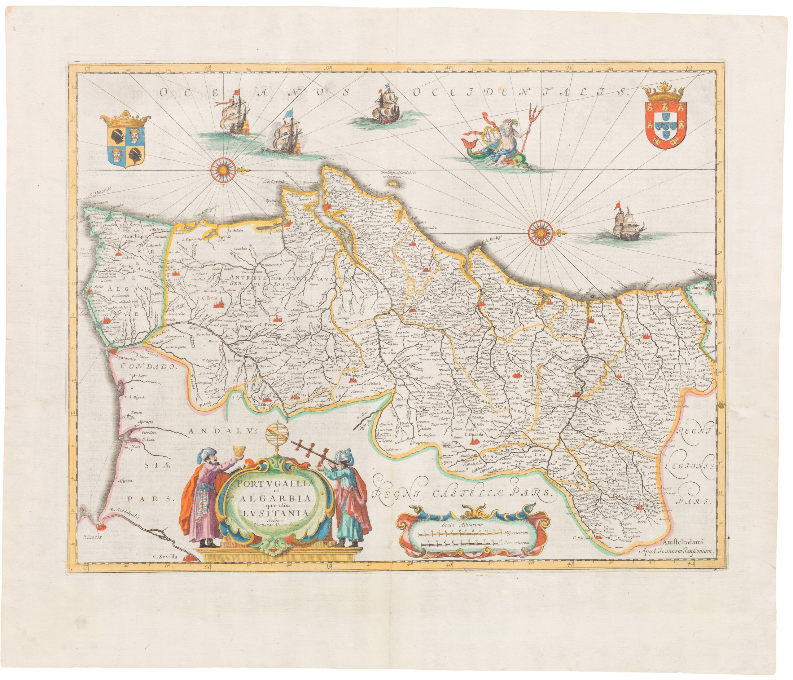
- Spain & Portugal
Portugallia et Algarbia quae olim Lusitania
- Attractive mid-17th century map of Portugal
- Read moreQuick View
-
- Out of Stock
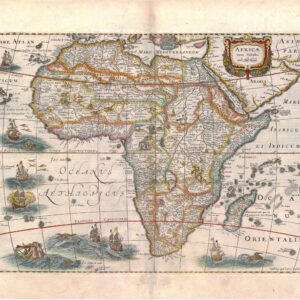
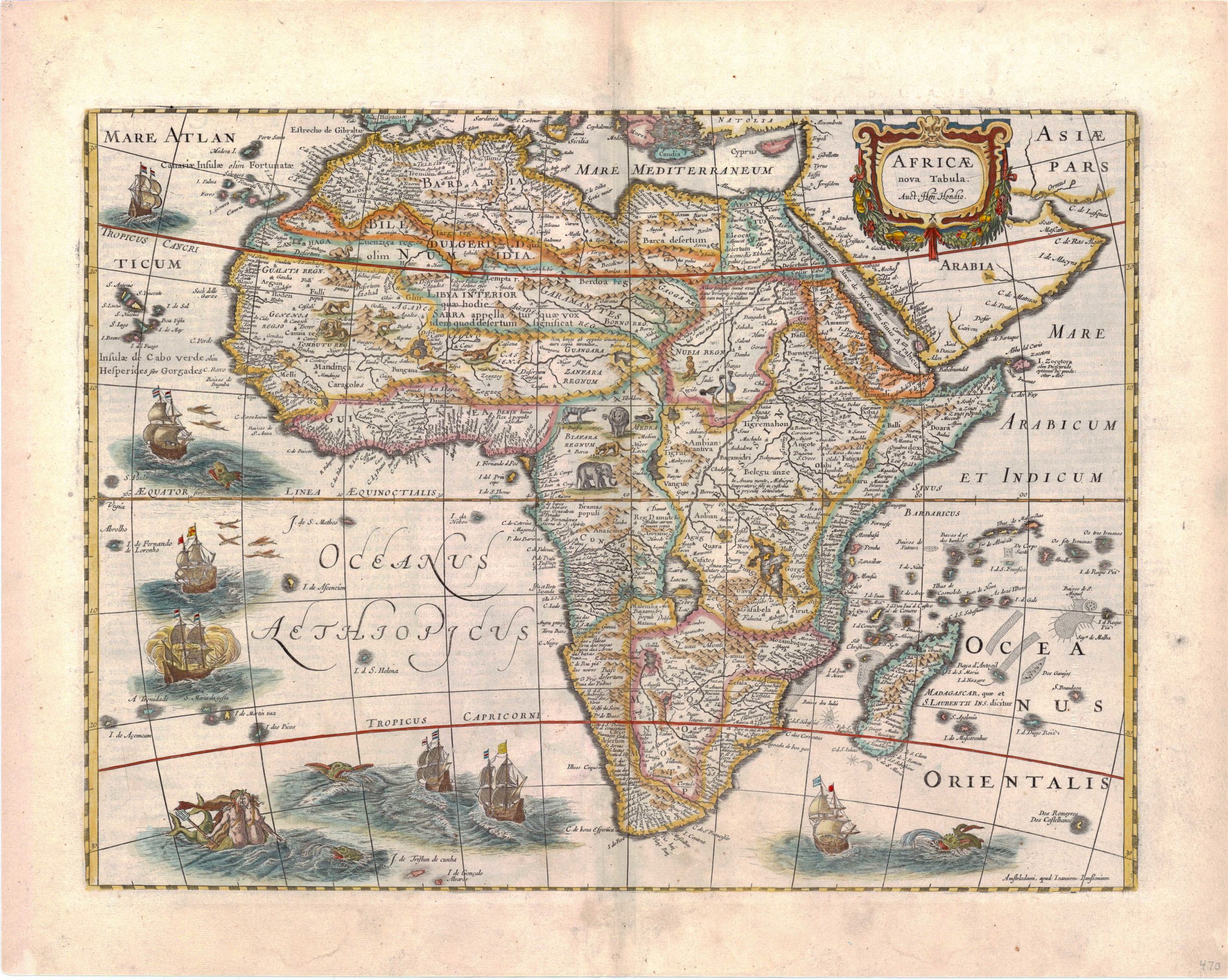
- Africa
Africae Nova Tabula
- Highly decorative mid-17th century map of Africa
- Read moreQuick View
-
- Out of Stock
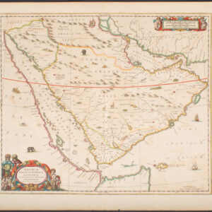

- Arabia and the Red Sea
Arabiae Felicis, Petrae ae et Desertae Nova et Accurata Delineatio
- Decorative Dutch map of Arabia.
- Read moreQuick View
-