Sebastian Münster (1488-1552) was a cosmographer and professor of Hebrew who taught at Tübingen, Heidelberg, and Basel. He settled in Basel in 1529 and died there, of the plague, in 1552. Münster was a networking specialist and stood at the center of a large network of scholars from whom he obtained geographic descriptions, maps, and directions.
As a young man, Münster joined the Franciscan order, in which he became a priest. He studied geography at Tübingen, graduating in 1518. Shortly thereafter, he moved to Basel for the first time, where he published a Hebrew grammar, one of the first books in Hebrew published in Germany. In 1521, Münster moved to Heidelberg, where he continued to publish Hebrew texts and the first German books in Aramaic. After converting to Protestantism in 1529, he took over the chair of Hebrew at Basel, where he published his main Hebrew work, a two-volume Old Testament with a Latin translation.
Münster published his first known map, a map of Germany, in 1525. Three years later, he released a treatise on sundials. But it would not be until 1540 that he published his first cartographic tour de force: the Geographia universalis vetus et nova, an updated edition of Ptolemy’s Geography. In addition to the Ptolemaic maps, Münster added 21 modern maps. Among Münster’s innovations was the inclusion of map for each continent, a concept that would influence Abraham Ortelius and other early atlas makers in the decades to come. The Geographia was reprinted in 1542, 1545, and 1552.
Münster’s masterpiece was nevertheless his Cosmographia universalis. First published in 1544, the book was reissued in at least 35 editions by 1628. It was the first German-language description of the world and contained 471 woodcuts and 26 maps over six volumes. The Cosmographia was widely used in the sixteenth and seventeenth centuries and many of its maps were adopted and modified over time, making Münster an influential cornerstone of geographical thought for generations.
-
-
Add to cart
 Quick View
 - Americas
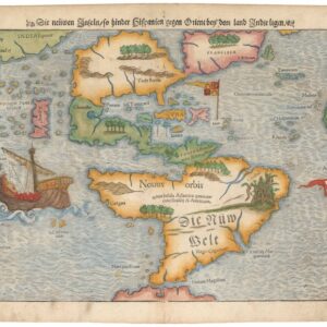
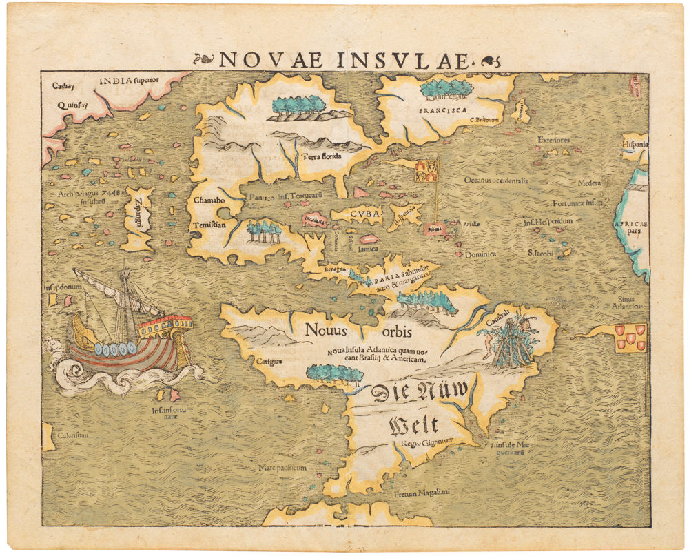
Die neüwe Inseln so hinder Hispanien gegen Orient bey dem land Indie ligen.
- $6,500
- Sebastian Münster’s Iconic Map of the New World.
-
-
-
-
Add to cart
 Quick View
 - Africa
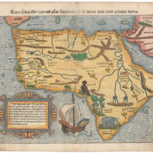
Africa Lybia Morenlandt mit Allen Künigreichen so zu unsern zeiten darin gefunden werden.
- $2,000
- A Seminal and Influential Early Map of Africa.
-
-
-
-
Add to cart
 Quick View
 - Europe, Italy
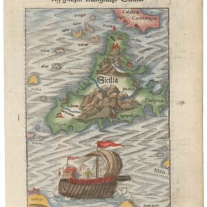
Beschreibung de Inseln und desz gantzen Künigreichs Sicilie / Sardinia Insula / Calaris die Hauptstatt in Sardinia / Neapolis.
- $500
- A Set of Four: Münster’s maps of Sicily and Sardinia, and views of Naples and Cagliari.
-
-
-
-
Add to cart
 Quick View
 - Europe, France & Switzerland
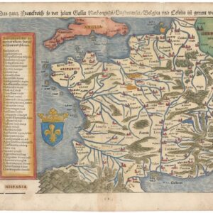
Das gantz Frankreich so vor Zeiten Gallia Narbonensis, Bugunensis, Belgica und Celtica ist genannt worden.
- $450
- Sebastian Münster’s 1567 Map of France.
-
-
-
-
Add to cart
 Quick View
 - Europe, Italy
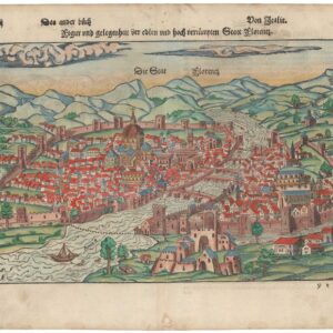
Figur und gelegenheit der ersten und hoch versümpten Statt Florenz.
- $1,200
- Sebastian Münster’s Bird’s-Eye View of Florence.
-
-
-
-
Add to cart
 Quick View
 - World
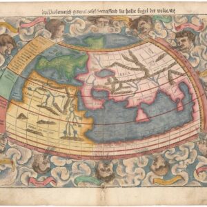
Ptolemaisch general Tafel begreifend die halbe kugel der Weldt.
- $1,200
- Sebastian Münster’s World Map According to Ptolemy.
-
-
-
-
Add to cart
 Quick View
 - Asia, Southeast Asia & Australia
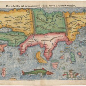
Die Länder Asie nach ihrer Gelegenheiten bis in Indien werden in dieser Tafel verzeichnet.
- $1,600
- Sebastian Münster’s Seminal Map of Asia.
-
-
-
-
Add to cart
 Quick View
 - Europe, Spain & Portugal
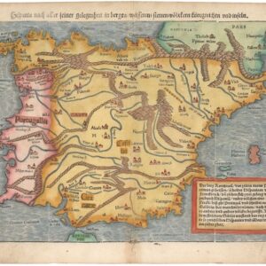
Hispania nach aller seiner gelegenheit in Bergen, Wåssern, Ståtten, Vólckern, Konigreichen und Inseln.
- $675
- Münster’s 1567 map of Spain and Portugal: the Iberian Peninsula at the Pinnacle of its Power.
-
-
-
-
Add to cart
 Quick View
 - Europe, France & Switzerland
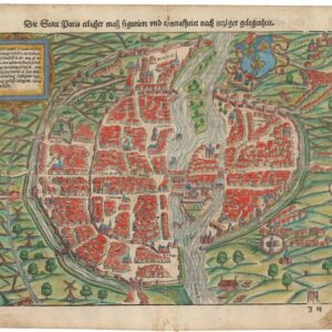
Der Statt Paris ehrlicher maß figuriert und concrafhetet nach ietziger gelegenheit.
- $825
- Sebastian Münster’s mid-16th-century bird’s-eye-view of Paris.
-
-
-
-
Add to cart
 Quick View
 - World
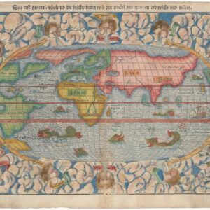
Das erst general-inhaltend die Beschreibung und den cirkel des ganzen erdereichs und märes.
- $1,600
- Münster’s New Map of the World.
-
-
-
-
Add to cart
 Quick View
 - World
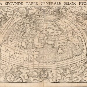
La Seconde Table Generale Selon Ptol.
- $1,500
- With a land bridge connecting Africa and Asia, a massive Sri Lanka, the Mountains of the Moon, and more!
-
-
-
-
Add to cart

 Quick View
 - Americas
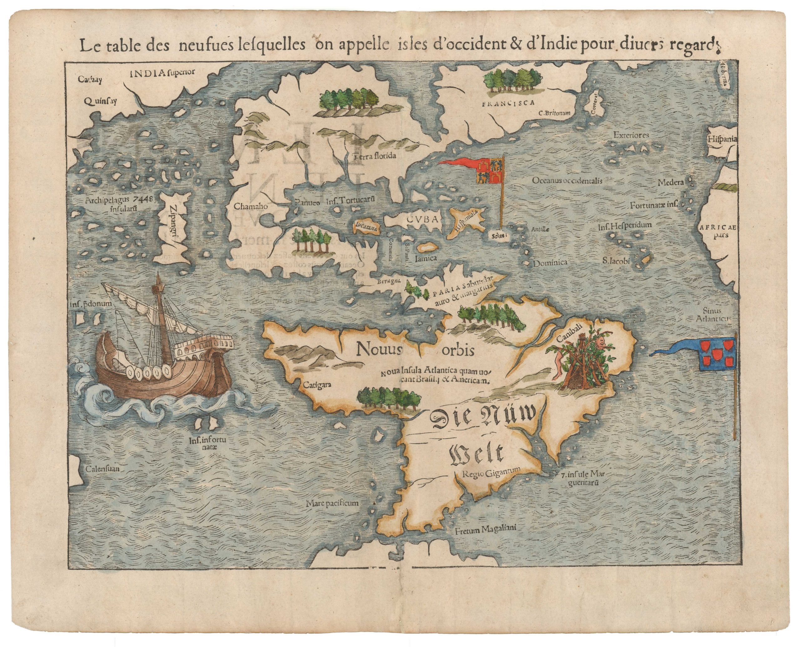
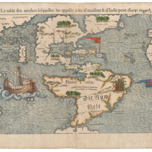
La table des isles neufues lesquelles on appelle isles d’occident & d’Indie pour diuers regardz.
- $6,500
- Sebastian Münster’s Map of the Americas: The first printed map of the new continents in their entirety.
-
-
-
Archived
- Out of Stock
- Europe, Germany & the Netherlands
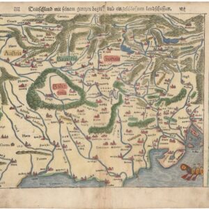
Teutschland mit seinem gantzen gegriff und eingeschlossen Landtsschafften.
- One of the First “Modern” Maps of Germany and the Czech Republic.
- Read moreQuick View
-
- Out of Stock
- Europe
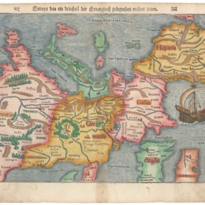
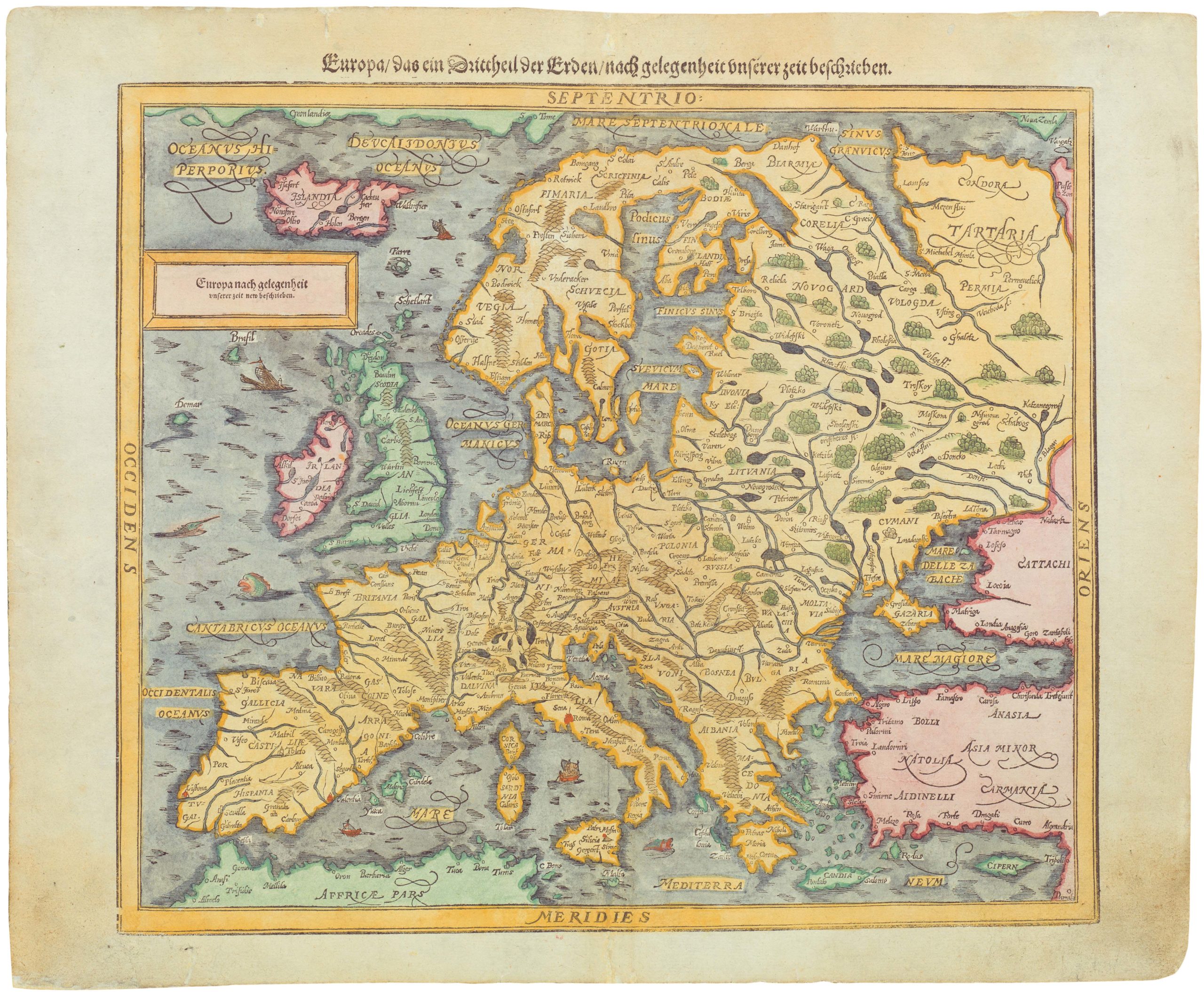
Europa das ein drittheil der Erden nach gelegenheit unsern Zeiten.
- Münster’s Upside-Down Map of Europe.
- Read moreQuick View
-
- Out of Stock
- Africa
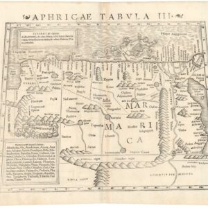
Aphricae Tabula III.
- Münster's woodblock-printed map of North Africa, featuring a large Silphium region.
- Read moreQuick View
-
- Out of Stock
- Germany & the Netherlands
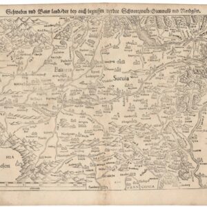
Schwaben und Baierland dar bey auch begriffen erzen Schwartzwald Otenwald und Nordgoew.
- One of the earliest printed maps of southern Germany.
- Read moreQuick View
-
- Out of Stock

- France & Switzerland
Die Eidtgnoschafft oder Schweitzerlandt mit den anstossenden Ländern.
- One of the earliest printed maps of Switzerland.
- Read moreQuick View
-
- Out of Stock
- Italy
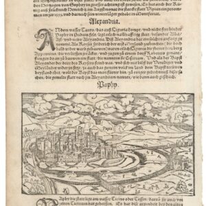
Paphy / Papia (Thurin on verso).
- A lovely 16th century woodcut of Pavia, Italy.
- Read moreQuick View
-
- Out of Stock
- Germany & the Netherlands
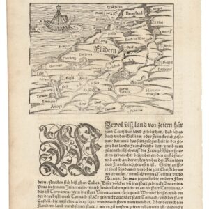
Von Dem Land Flandern.
- One of the earliest printed maps of Flanders.
- Read moreQuick View
-
- Out of Stock
- Italy
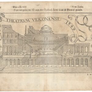
Theatrum Veronese 1549.
- A charming view of Verona's ancient Roman theater.
- Read moreQuick View
-
- Out of Stock
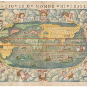
- World
La Figure du Monde Universel.
- Sebastian Münster’s fascinating map of a new world.
- Read moreQuick View
-
- Out of Stock
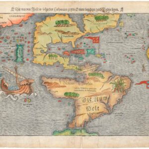
- North America
Die Neuwen Inseln. So Hinder Hispanien Gegeu Orient Bey Dem Land India Ligen.
- Sebastian Münster’s Map of the Americas: The first printed map of the new continents in their entirety.
- Read moreQuick View
-
- Out of Stock
![[Turkey with Constantinople] Tabula Asiae I.](https://neatlinemaps.com/wp-content/uploads/2023/07/NL-00243_thumbnail-2-300x300.jpg)
- Turkey - Ottoman Empire
[Turkey with Constantinople] Tabula Asiae I.
- The first edition of Munster's map of Turkey, based upon Claudius Ptolemy.
- Read moreQuick View
-
-
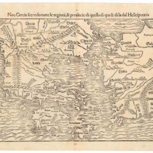
- Europe, Greece & the Balkans
Nou Grecia secondo tutte regioni, & provinicie di quella di qua…
- Blending the Renaissance concept of Ancient Greece with more recent historical developments in the East Mediterranean.
- Add to cartQuick View
-
- Out of Stock
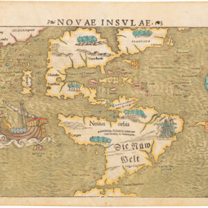
![Novae Insulae XVII Nova Tabula [First State!]](https://neatlinemaps.com/wp-content/uploads/2022/08/NL-01526_thumbnail-1-300x300.jpg)
![Novae Insulae XVII Nova Tabula [First State!]](https://neatlinemaps.com/wp-content/uploads/2022/08/NL-01526_thumbnail-scaled.jpg)
![Novae Insulae XVII Nova Tabula [First State!]](https://neatlinemaps.com/wp-content/uploads/2022/08/NL-01526_thumbnail-scaled-300x300.jpg)
- North America
Novae Insulae XVII Nova Tabula [First State!]
- Sebastian Münster’s Map of the Americas: The first printed map of the new continents in their entirety. Here a rare First State, Second Edition example.
- Read moreQuick View
-
- Out of Stock
- Featured Maps & Views, North America
Novae Insulae
- Sebastian Münster’s Map of the Americas: The first printed map of the new continents in their entirety.
- Read moreQuick View
-
- Out of Stock

- Europe
Europa das ein Drittheil der Erde nach gelegenheit unserer zeit beschrieben…
- 1588 Münster woodcut and letterpress map of Europe.
- Read moreQuick View
-
- Out of Stock
- Africa
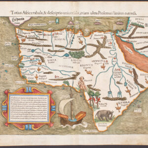
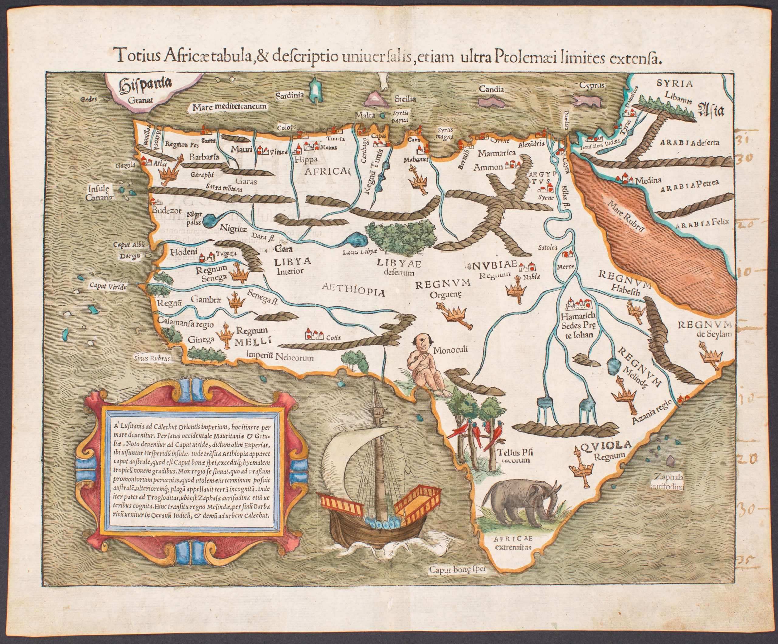
Totius Africae tabula, & descriptio universalis, etiam ultra Ptolemaei limites extensa.
- Exceptional example of one of the earliest maps to focus on the entire continent of Africa
- Read moreQuick View
-
- Out of Stock
![Tabula Asiae VI. [Arabia Felix]](https://neatlinemaps.com/wp-content/uploads/2019/09/NL-00450_r-scaled-300x300.jpg)
![Tabula Asiae VI. [Arabia Felix]](https://neatlinemaps.com/wp-content/uploads/2019/09/NL-00450_r-scaled.jpg)
- Arabia and the Red Sea
Tabula Asiae VI. [Arabia Felix]
- Rare old color Münster Ptolemaic woodcut map of Arabia.
- Read moreQuick View
-
- Out of Stock
- British Isles
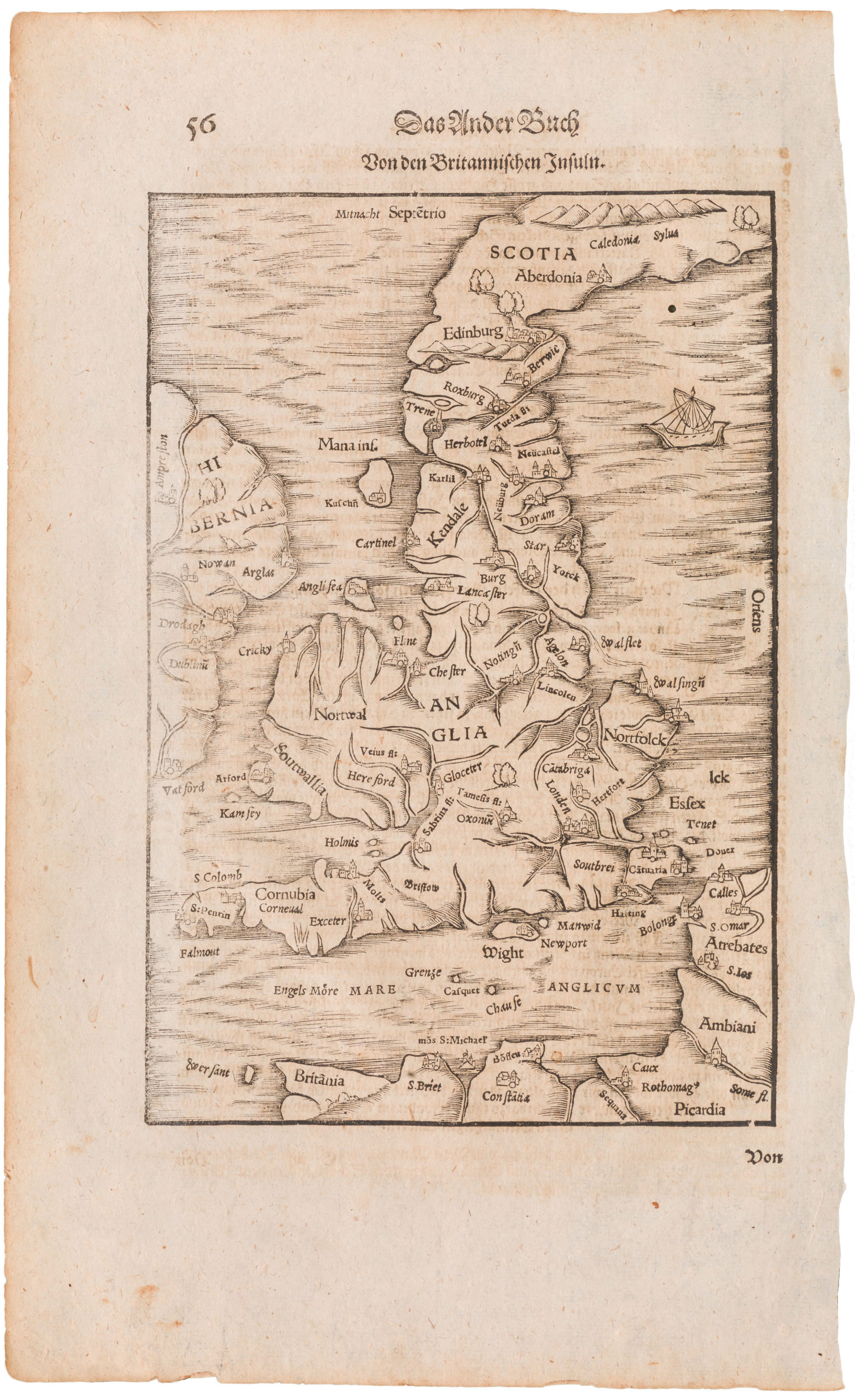
Britannischen Insula
- 1570 woodcut Ptolemaic map of the British Isles
- Read moreQuick View
-
- Out of Stock
- Italy
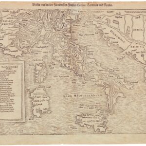
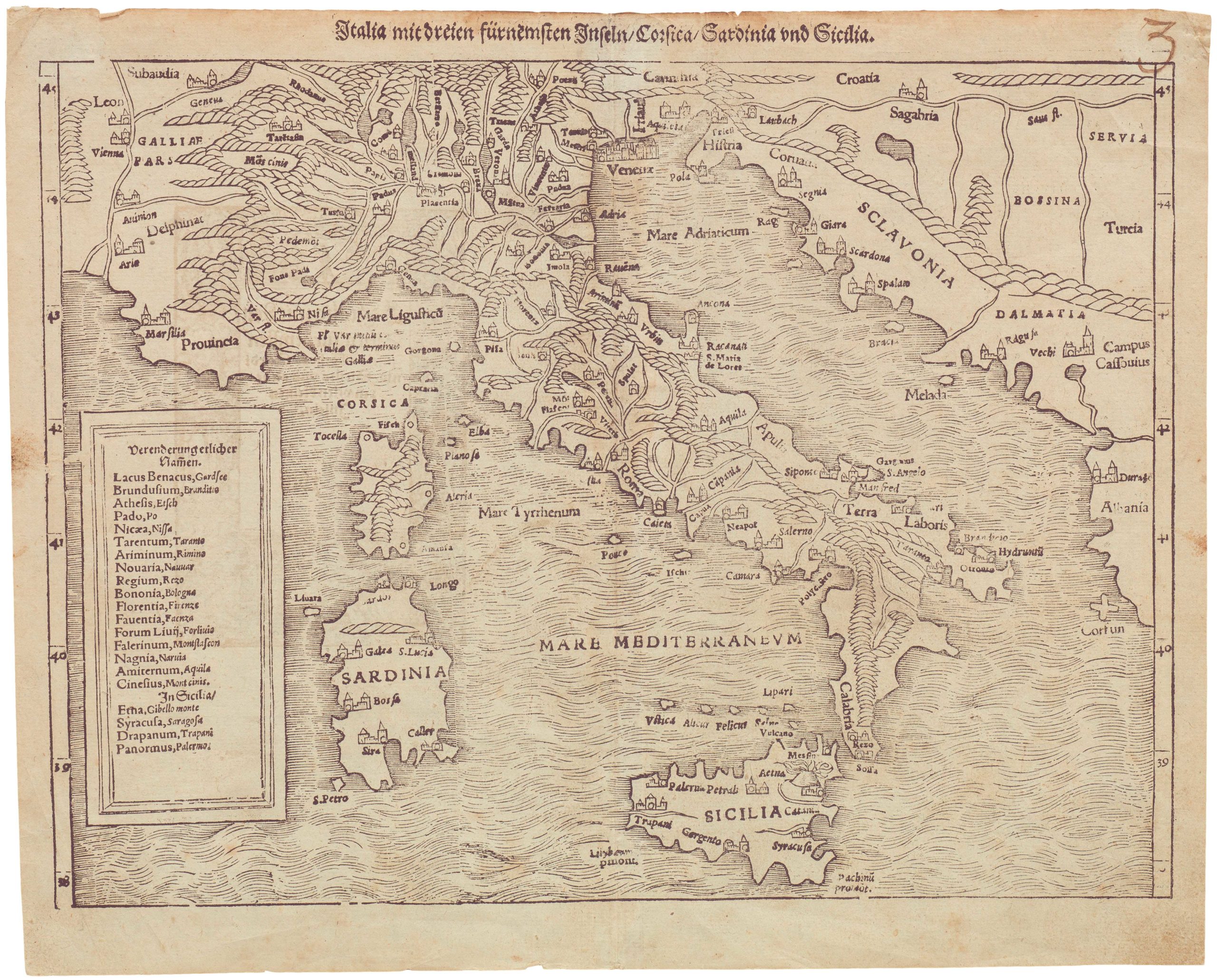
Italia mit dreien fürnemsten Inseln / Corsika / Sardinia und Sicilia
- 1600 Münster woodblock map of Italy from Sicily to the Alps
- Read moreQuick View
-
- Out of Stock
- Asia
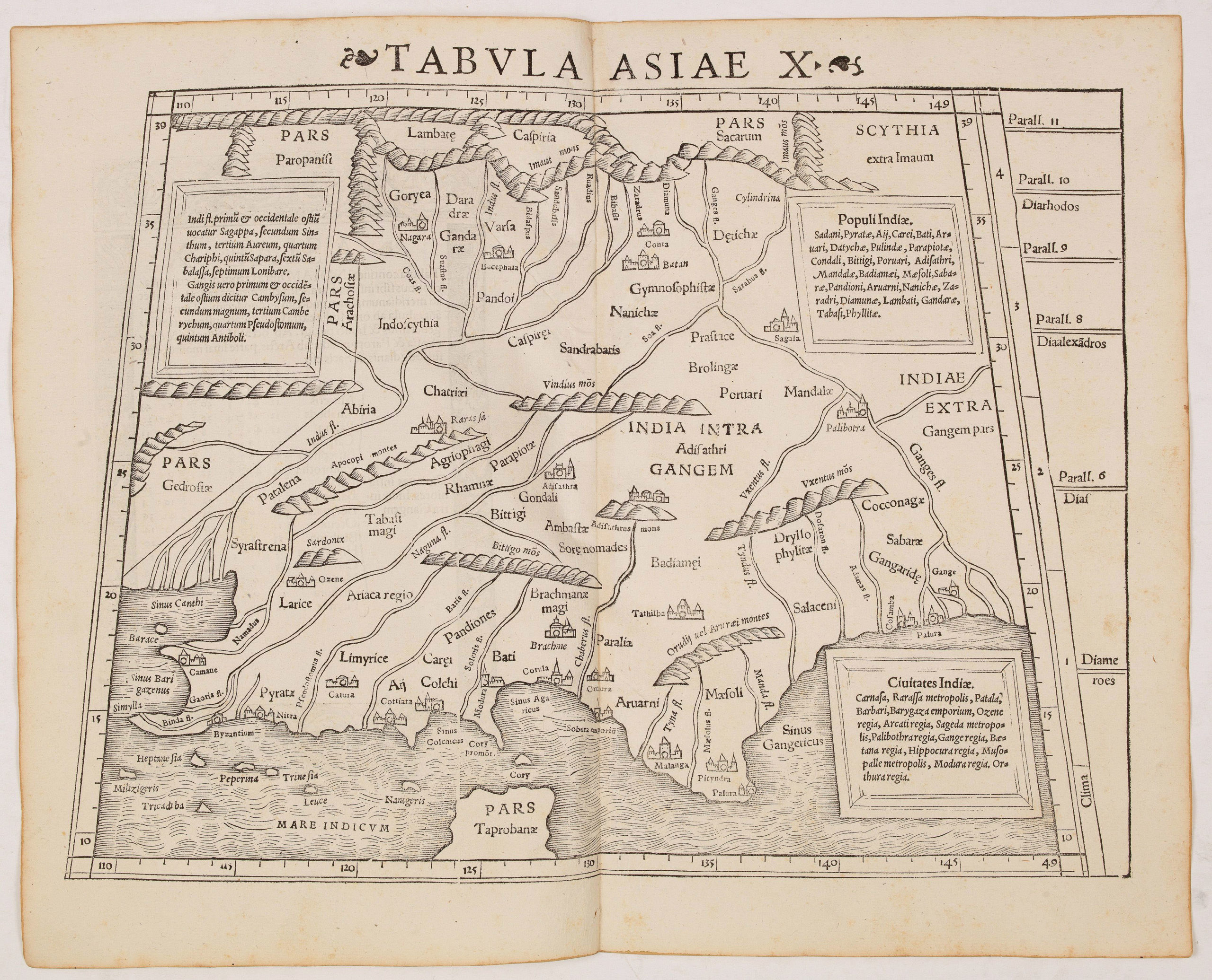
Tabula Asiae X (India)
- Mid 16th century Ptolemaic map of India with the Ganges and Indus rivers.
- Read moreQuick View
-
- Out of Stock
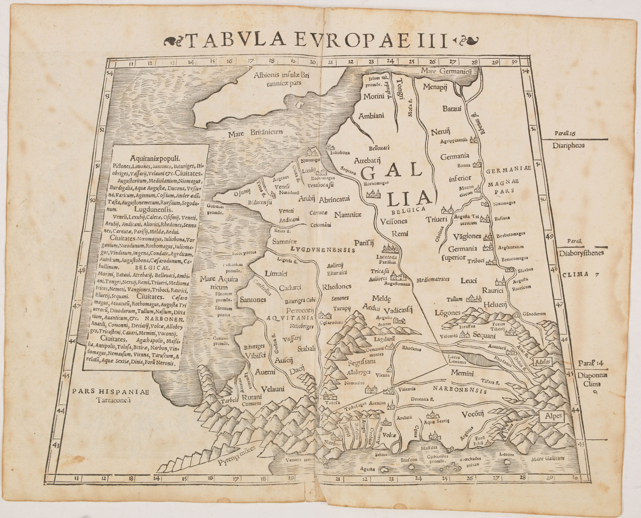
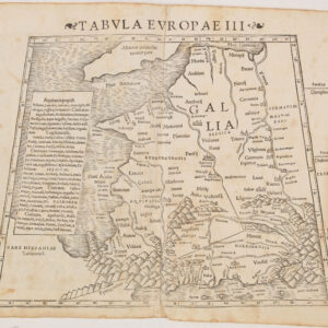
- France & Switzerland
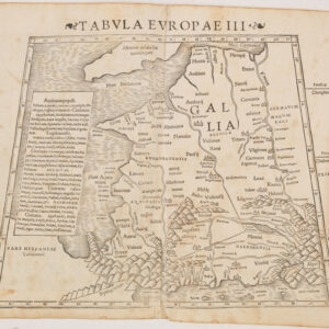
Tabula Europae III (France)
- Mid-16th century Ptolemaic woodcut map of France.
- Read moreQuick View
-
- Out of Stock
![[Europe as a Queen]](https://neatlinemaps.com/wp-content/uploads/2019/09/NL-00067_Thumbnail-300x300.jpg)
![[Europe as a Queen]](https://neatlinemaps.com/wp-content/uploads/2019/09/NL-00067_Thumbnail.jpg)
- Europe
[Europe as a Queen]
- Full-color example of Europe as a Queen.
- Read moreQuick View
-
- Out of Stock
![Tabula Europae II [Iberia]](https://neatlinemaps.com/wp-content/uploads/2019/09/NL-00031_Thumbnail-300x300.jpg)
![Tabula Europae II [Iberia]](https://neatlinemaps.com/wp-content/uploads/2019/09/NL-00031_r-scaled.jpg)
![Tabula Europae II [Iberia]](https://neatlinemaps.com/wp-content/uploads/2019/09/NL-00031_r-scaled-300x300.jpg)
- Spain & Portugal
Tabula Europae II [Iberia]
- Lovely mid-16th century woodblock map of the Iberian Peninsula.
- Read moreQuick View
-