-
-
Add to cart
 Quick View
 - World
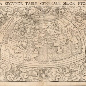
La Seconde Table Generale Selon Ptol.
- $1,500
- With a land bridge connecting Africa and Asia, a massive Sri Lanka, the Mountains of the Moon, and more!
-
-
-
-
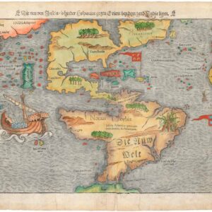
Add to cart
 Quick View
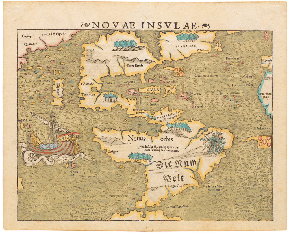
 - Americas
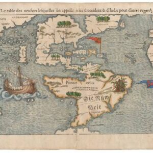
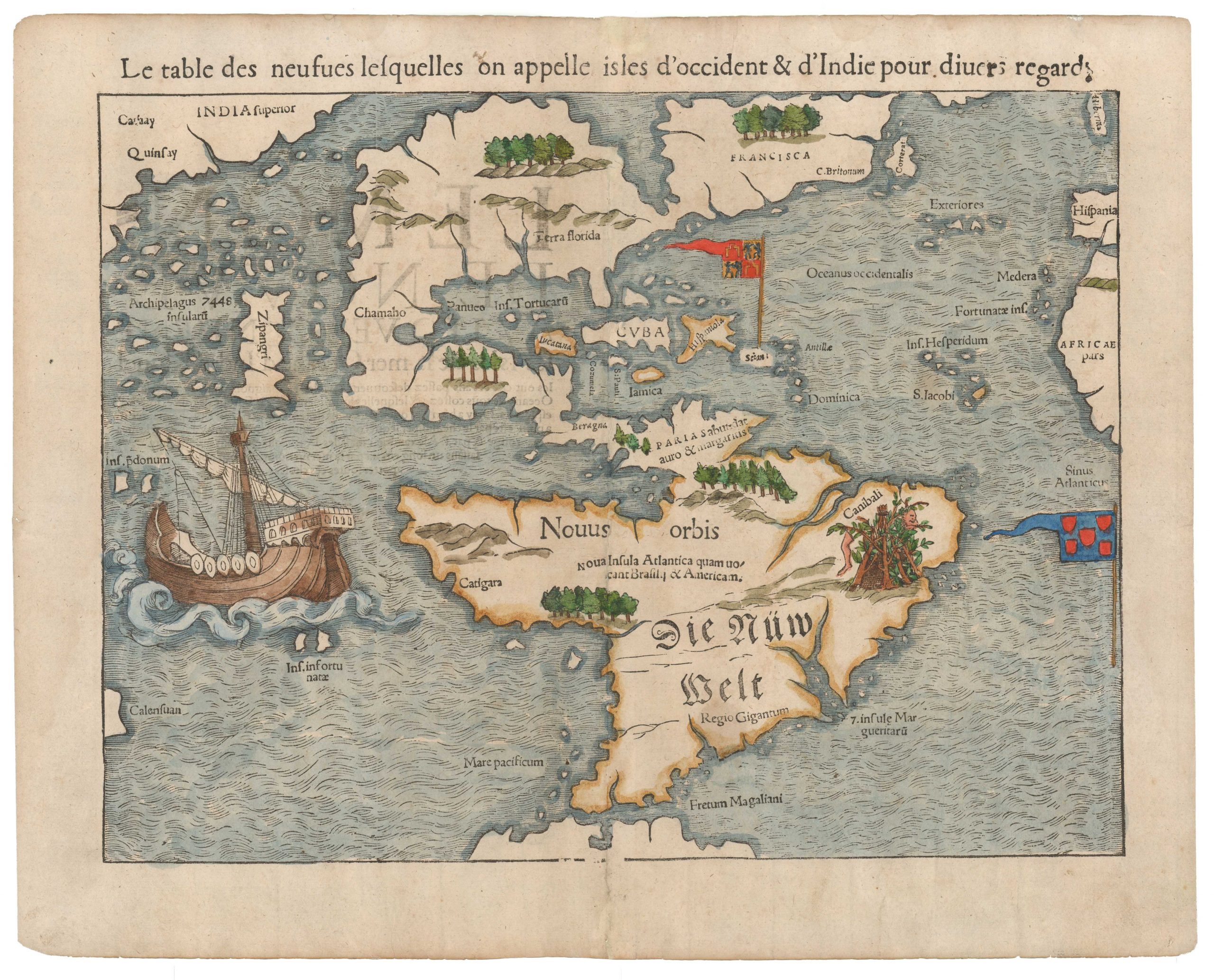
La table des isles neufues lesquelles on appelle isles d’occident & d’Indie pour diuers regardz.
- $6,500
- Sebastian Münster’s Map of the Americas: The first printed map of the new continents in their entirety.
-
-

-
-
-
Add to cart
![[Northern India and Pakistan] Tabula Asiae IX.](https://neatlinemaps.com/wp-content/uploads/2023/07/NL-00244-NEW_thumbnail-300x300.jpg) Quick View
Quick View - Asia
[Northern India and Pakistan] Tabula Asiae IX.
- $475
- The first edition of Munster's map of Northern India, present-day Iran, Afghanistan, and Pakistan, with the delta of the Indus River graphically depicted.
-
-
-
-
Add to cart
 Quick View
 - Asia
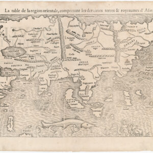
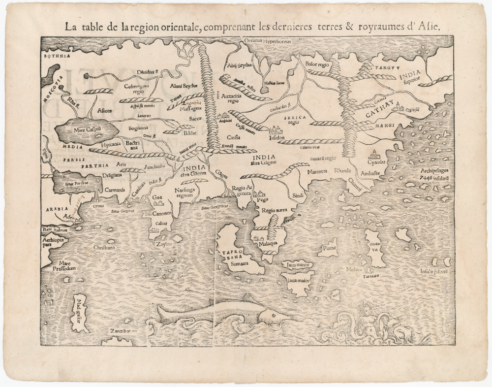
La table de la region orientale, comprenant les derniered terres & royraumes d’Asie.aumes d’Asie
- $1,600
- Münster's iconic map of Asia in original black & white.
-
-
-
Archived
- Out of Stock
- Africa
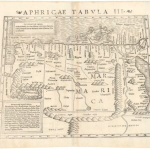
Aphricae Tabula III.
- Read moreQuick View
-
- Out of Stock
- Germany & the Netherlands
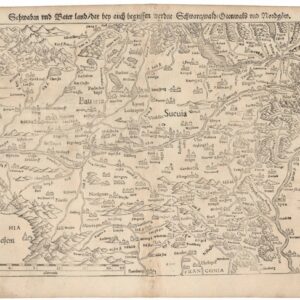
Schwaben und Baierland dar bey auch begriffen erzen Schwartzwald Otenwald und Nordgoew.
- One of the earliest printed maps of southern Germany.
- Read moreQuick View
-
- Out of Stock

- France & Switzerland
Die Eidtgnoschafft oder Schweitzerlandt mit den anstossenden Ländern.
- One of the earliest printed maps of Switzerland.
- Read moreQuick View
-
- Out of Stock
- Italy
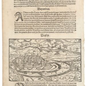
Paphy / Papia (Thurin on verso).
- A lovely 16th century woodcut of Pavia, Italy.
- Read moreQuick View
-
- Out of Stock
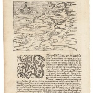
- Germany & the Netherlands
Von Dem Land Flandern.
- One of the earliest printed maps of Flanders.
- Read moreQuick View
-
- Out of Stock
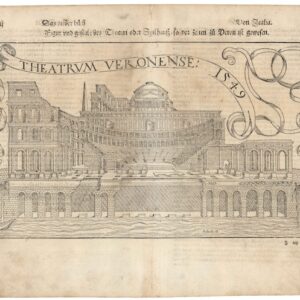
- Italy
Theatrum Veronese 1549.
- A charming view of Verona's ancient Roman theater.
- Read moreQuick View
-
- Out of Stock
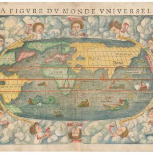
- World
La Figure du Monde Universel.
- Sebastian Münster’s fascinating map of a new world.
- Read moreQuick View
-
- Out of Stock
- North America
Die Neuwen Inseln. So Hinder Hispanien Gegeu Orient Bey Dem Land India Ligen.
- Sebastian Münster’s Map of the Americas: The first printed map of the new continents in their entirety.
- Read moreQuick View
-
- Out of Stock
![[Turkey with Constantinople] Tabula Asiae I.](https://neatlinemaps.com/wp-content/uploads/2023/07/NL-00243_thumbnail-2-300x300.jpg)
- Turkey - Ottoman Empire
[Turkey with Constantinople] Tabula Asiae I.
- The first edition of Munster's map of Turkey, based upon Claudius Ptolemy.
- Read moreQuick View
-
-
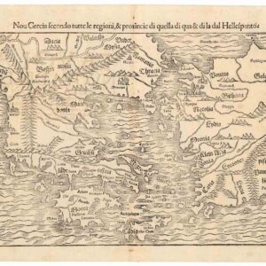
- Europe, Greece & the Balkans
Nou Grecia secondo tutte regioni, & provinicie di quella di qua…
- Blending the Renaissance concept of Ancient Greece with more recent historical developments in the East Mediterranean.
- Add to cartQuick View
-
- Out of Stock
![Novae Insulae XVII Nova Tabula [First State!]](https://neatlinemaps.com/wp-content/uploads/2022/08/NL-01526_thumbnail-1-300x300.jpg)
![Novae Insulae XVII Nova Tabula [First State!]](https://neatlinemaps.com/wp-content/uploads/2022/08/NL-01526_thumbnail-scaled.jpg)
![Novae Insulae XVII Nova Tabula [First State!]](https://neatlinemaps.com/wp-content/uploads/2022/08/NL-01526_thumbnail-scaled-300x300.jpg)
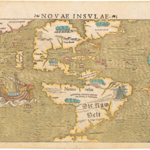
- North America
Novae Insulae XVII Nova Tabula [First State!]
- Sebastian Münster’s Map of the Americas: The first printed map of the new continents in their entirety. Here a rare First State, Second Edition example.
- Read moreQuick View
-
- Out of Stock
- Featured Maps & Views, North America
Novae Insulae
- Sebastian Münster’s Map of the Americas: The first printed map of the new continents in their entirety.
- Read moreQuick View
-
- Out of Stock

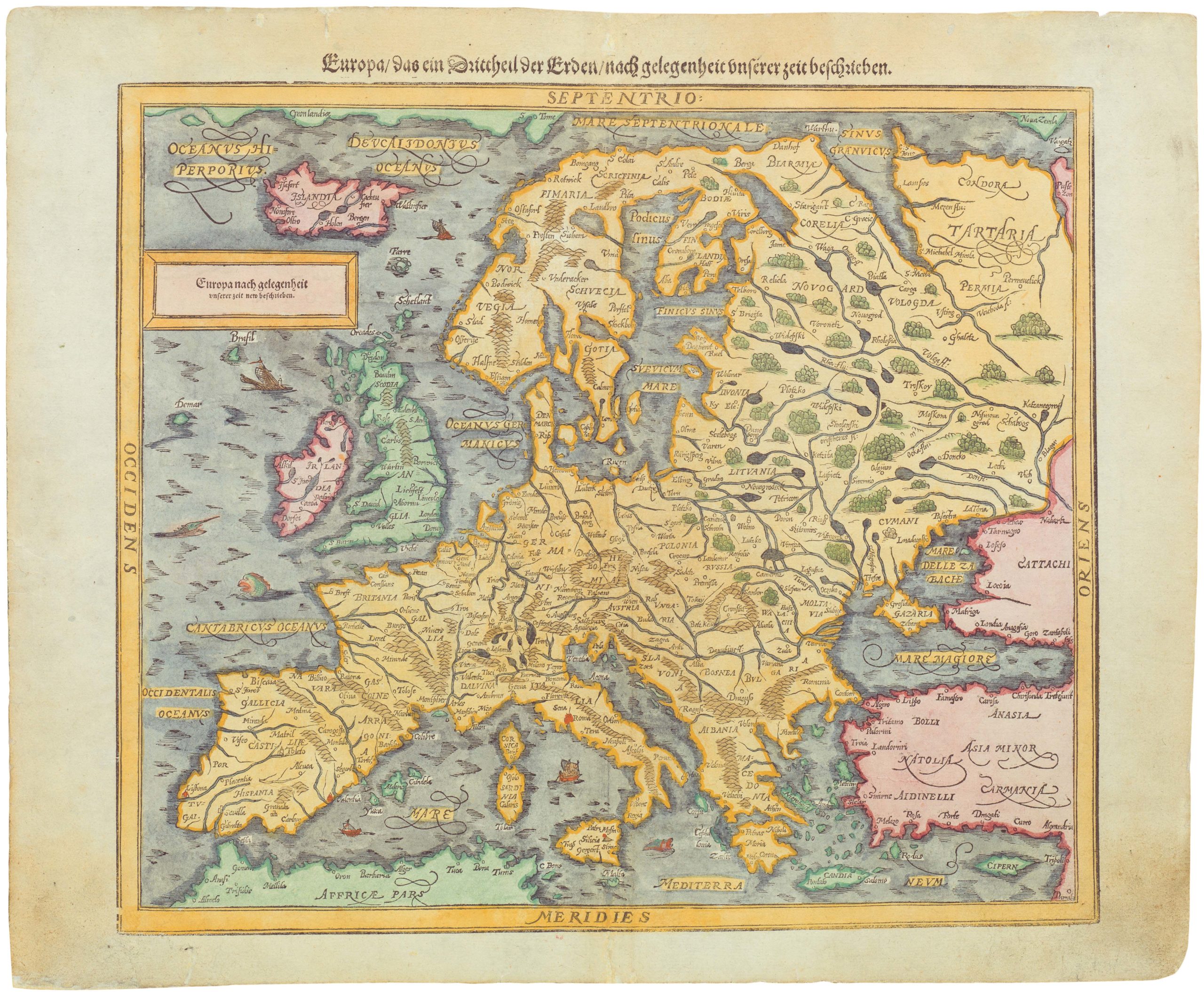
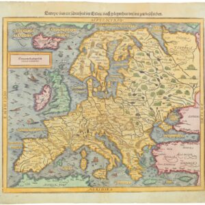
- Europe
Europa das ein Drittheil der Erde nach gelegenheit unserer zeit beschrieben…
- 1588 Münster woodcut and letterpress map of Europe.
- Read moreQuick View
-
- Out of Stock
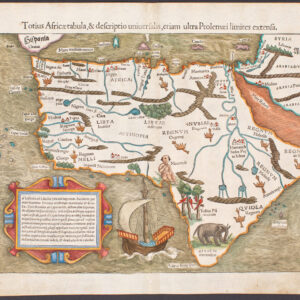
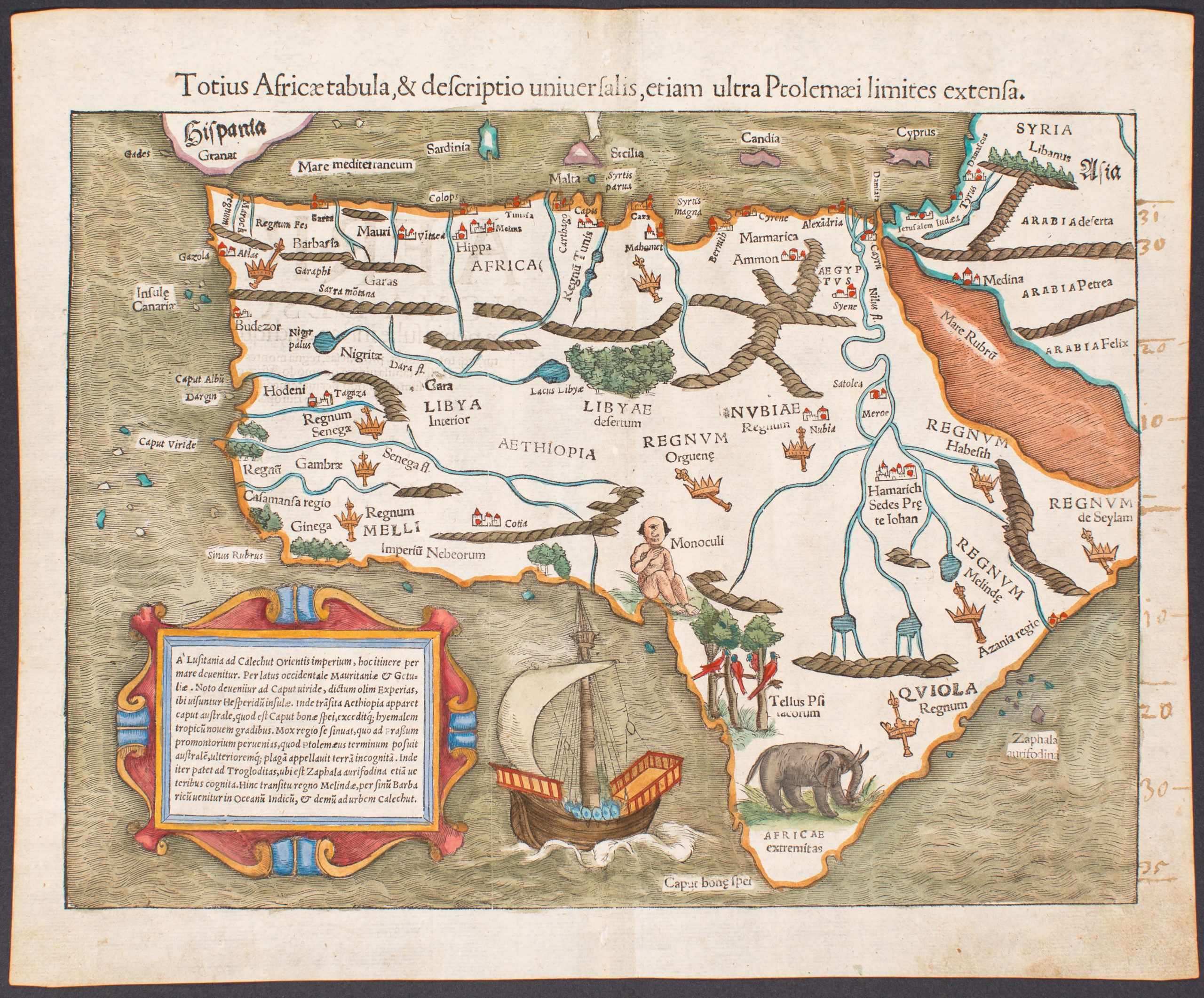
- Africa
Totius Africae tabula, & descriptio universalis, etiam ultra Ptolemaei limites extensa.
- Exceptional example of one of the earliest maps to focus on the entire continent of Africa
- Read moreQuick View
-
- Out of Stock
![Tabula Asiae VI. [Arabia Felix]](https://neatlinemaps.com/wp-content/uploads/2019/09/NL-00450_r-scaled-300x300.jpg)
![Tabula Asiae VI. [Arabia Felix]](https://neatlinemaps.com/wp-content/uploads/2019/09/NL-00450_r-scaled.jpg)
- Arabia and the Red Sea
Tabula Asiae VI. [Arabia Felix]
- Rare old color Münster Ptolemaic woodcut map of Arabia.
- Read moreQuick View
-
- Out of Stock
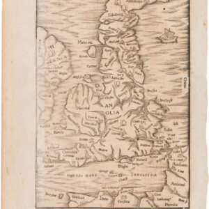
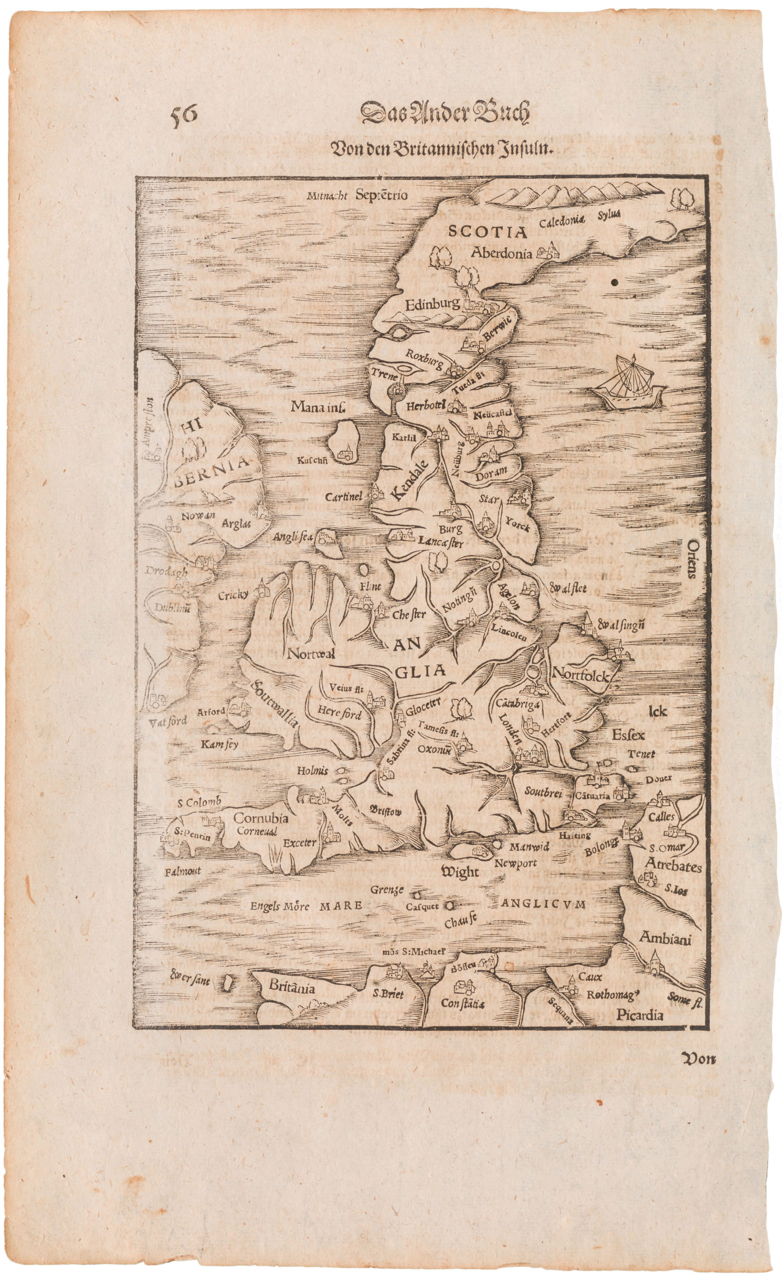
- British Isles
Britannischen Insula
- 1570 woodcut Ptolemaic map of the British Isles
- Read moreQuick View
-
- Out of Stock
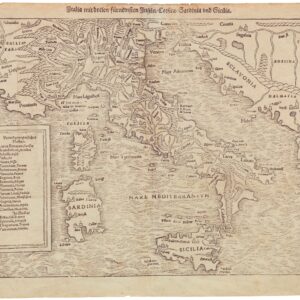
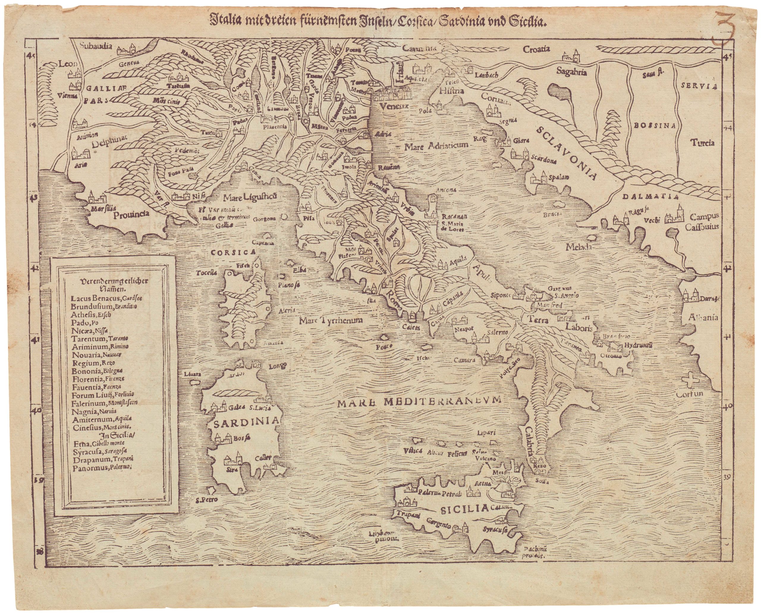
- Italy
Italia mit dreien fürnemsten Inseln / Corsika / Sardinia und Sicilia
- 1600 Münster woodblock map of Italy from Sicily to the Alps
- Read moreQuick View
-
- Out of Stock
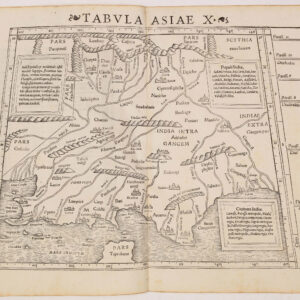
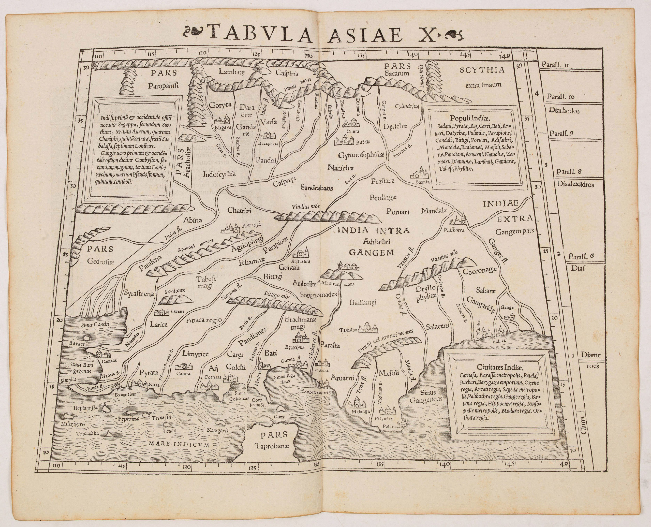
- Asia
Tabula Asiae X (India)
- Mid 16th century Ptolemaic map of India with the Ganges and Indus rivers.
- Read moreQuick View
-
- Out of Stock
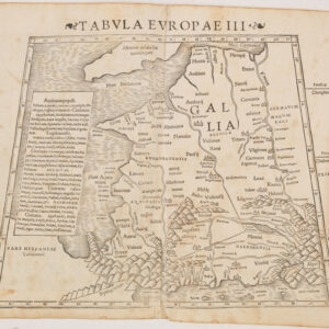
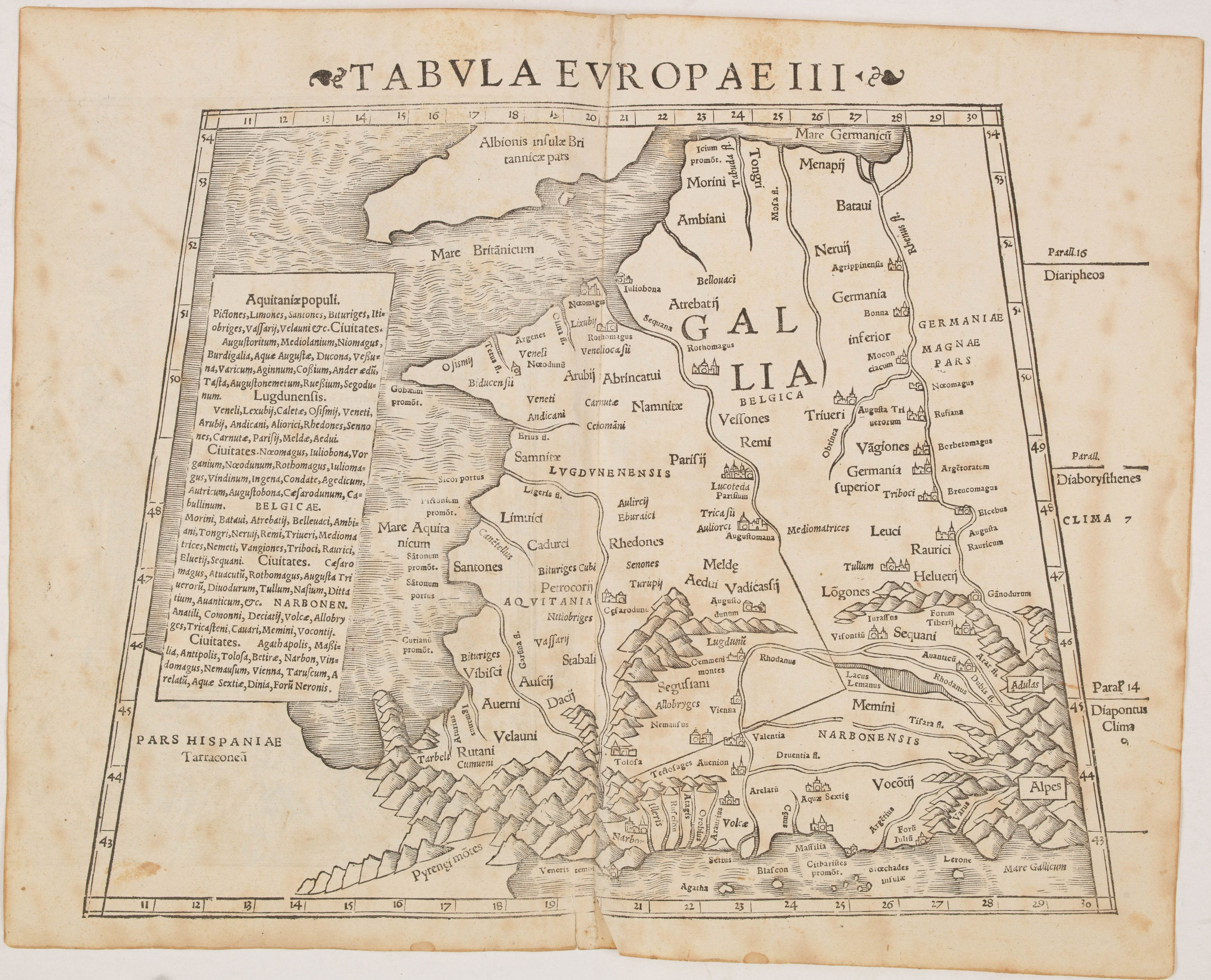
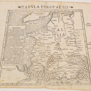
- France & Switzerland
Tabula Europae III (France)
- Mid-16th century Ptolemaic woodcut map of France.
- Read moreQuick View
-
- Out of Stock
![[Europe as a Queen]](https://neatlinemaps.com/wp-content/uploads/2019/09/NL-00067_Thumbnail-300x300.jpg)
![[Europe as a Queen]](https://neatlinemaps.com/wp-content/uploads/2019/09/NL-00067_Thumbnail.jpg)
- Europe
[Europe as a Queen]
- Full-color example of Europe as a Queen.
- Read moreQuick View
-
- Out of Stock
![Tabula Europae II [Iberia]](https://neatlinemaps.com/wp-content/uploads/2019/09/NL-00031_Thumbnail-300x300.jpg)
![Tabula Europae II [Iberia]](https://neatlinemaps.com/wp-content/uploads/2019/09/NL-00031_r-scaled.jpg)
![Tabula Europae II [Iberia]](https://neatlinemaps.com/wp-content/uploads/2019/09/NL-00031_r-scaled-300x300.jpg)
- Spain & Portugal
Tabula Europae II [Iberia]
- Lovely mid-16th century woodblock map of the Iberian Peninsula.
- Read moreQuick View
-