-
-
Add to cart

 Quick View
 - Americas, Curiosities - Miscellanea, Mexico - Central & South America, United States
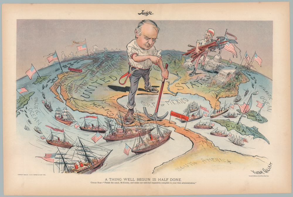
A THING WELL BEGUN IS HALF DONE. UNCLE SAM—“Finish the canal, McKinley, and make our national expansion complete in your first administration.”
- $1,200
- William McKinley & Uncle Sam: a wonderful 1899 persuasive map advocating for the construction of the Nicaragua Canal.
-
-
-
-
-
Add to cart
 Quick View
 - Americas, Cuba, West Indies, Caribbean, East & Midwest United States
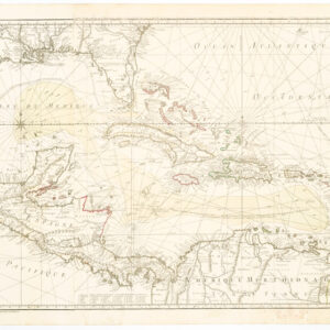
Carte Du Golphe Du Mexique Et Des Isles Antilles Reduite de la grande carte Angloise de Popple, Par PH. Buache…1780.
- $900
- Dezauche's exquisite chart of the Gulf Coast, Florida, and Caribbean Archipelago depicts a French Colonial Empire that is slowly falling apart.
-
-
-
-
-
Add to cart

 Quick View
 - Americas, California, Michael's Collection, North America
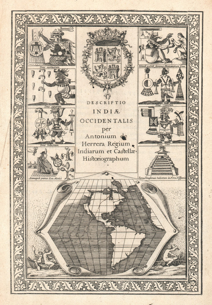
Descriptio Indiae Occidentalis per Antonium de Herrera.
- $3,600
- The first map to show California as an island!
-
-
-
-
-
Add to cart
 Quick View
 - Americas, Cuba, West Indies, Caribbean
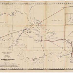
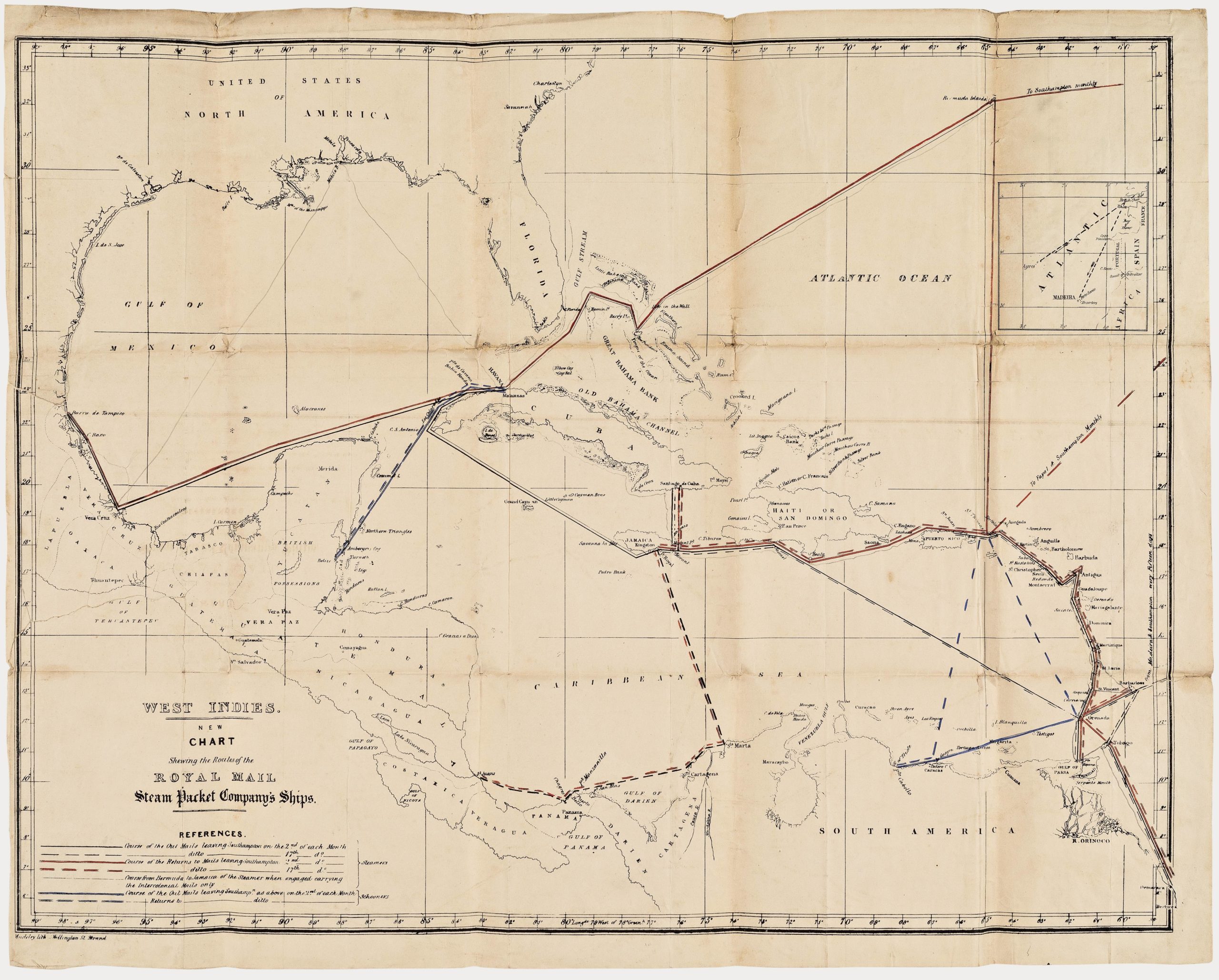
West Indies. New Chart shewing the Routes of the Royal Mail Steam Packet Company’s Ships.
- $1,800
- The communications lifeline of the British Caribbean: an unrecorded map of the Royal Mail Steam Packet Company’s Ships to the West Indies.
-
-
-
-
-
Add to cart
 Quick View
 - Americas, Mexico - Central & South America
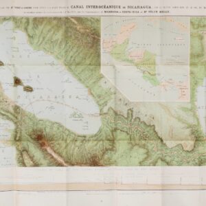
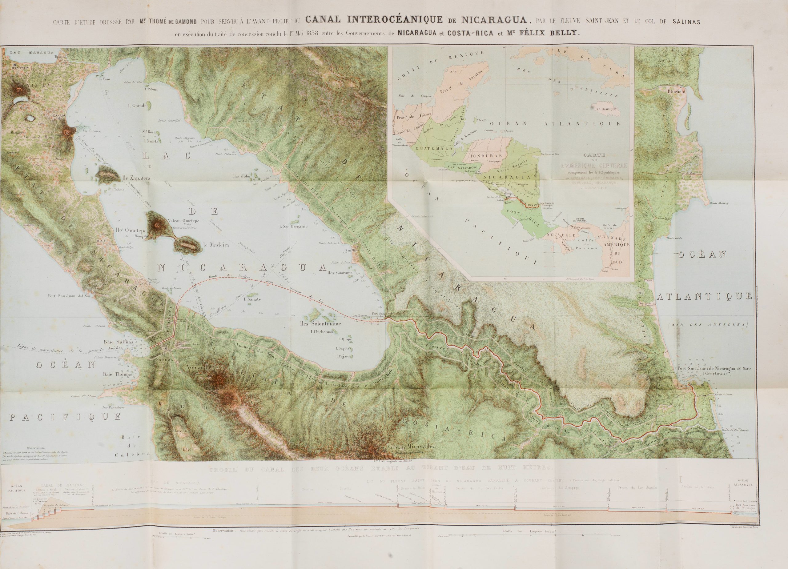
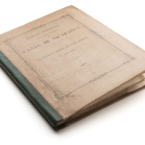
Carte d’étude pour le tracé et le profil du canal de Nicaragua par M. Thomé de Gamond, ingénieur civil, précédée de documents publiés sur cette question par Félix Belly
- $1,900
- Rare – the first serious and detailed published proposal for an interoceanic canal across Nicaragua, with a magnificent, chromolithographed map.
-
-
-
-
-
-
Add to cart
 Quick View
 - Americas, Cuba, West Indies, Caribbean
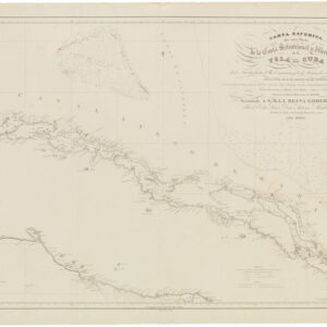
Carta Esferica de una Parte de la Costa Setentrional y Meridional de la Isla de Cuba con el canal viejo de Bahamas y el de Santarén. Por el comandante General y oficiales….
- $800
- Rare 1836 Spanish sea chart around central Cuba with manuscript lighthouse notations.
-
-
-
-
Add to cart
 Quick View
 - Americas, Mexico - Central & South America
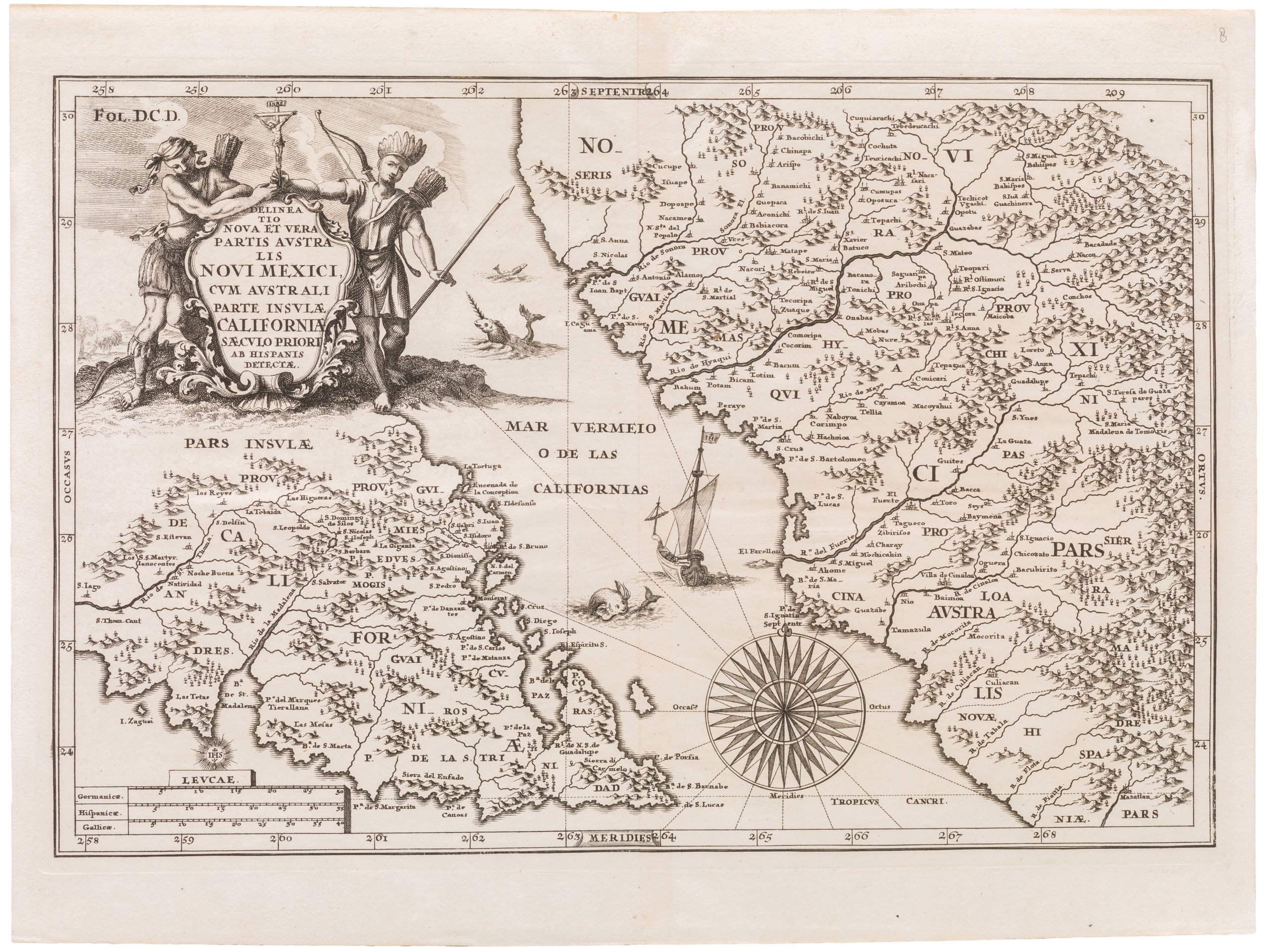
Delineatio Nova Et Vera Partis Australis Novi Mexici
- $975
- Scherer's detailed map of Lower California and adjacent mainland, based on correspondence with Father Kino.
-
-
-