-
-
Add to cart
 Quick View
 - Americas
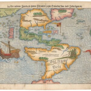
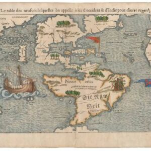
Die neüwe Inseln so hinder Hispanien gegen Orient bey dem land Indie ligen.
- $6,500
- Sebastian Münster’s Iconic Map of the New World.
-
-
-
-
Add to cart
 Quick View
 - Americas, Cuba, West Indies, Caribbean
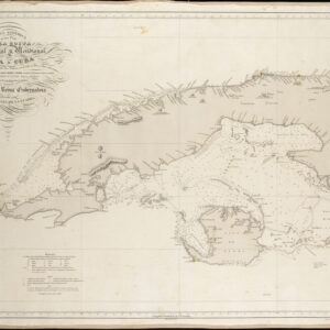
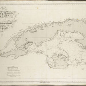
Carta Esferica De Una Parte de la Costa Setentrional y Meridional de la Isla de Cuba…
- $450
- Excellent Spanish sea chart of Western Cuba.
-
-
-
-
-
Add to cart
 Quick View
 - Americas, Featured Maps & Views, North America
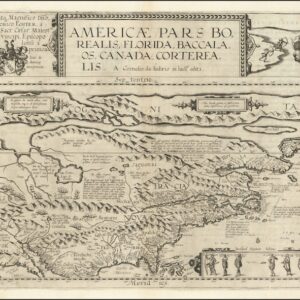
Americae Pars Borealis, Florida, Baccalaos, Canada, Corterealis. A Cornelio de Iudaeis in luce edita.
- $28,000
- A fine original black-and-white example of the first printed folio map of North America.
-
-
-
-
Add to cart
 Quick View
 - Americas, North America
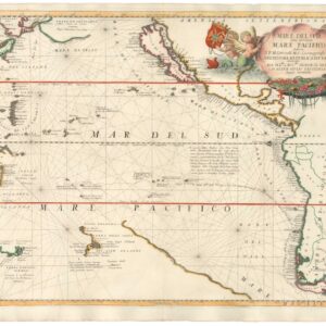
Mare Del Sud detto altrimenti Mare Pacifico.
- $2,500
- An excellent example of Coronelli's Pacific Ocean with California as an Island.
-
-
-
-
Add to cart
 Quick View
 - Americas, California, North America
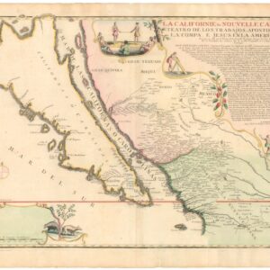
La Californie ou Nouvelle Caroline, Teatro De Los Trabajos Apostolicos De La Compa. E. Jesus En La America Septe…
- $7,500
- [Old Color] The largest cartographic depiction of the island of California ever made.
-
-
-
-
Add to cart
 Quick View
 - Americas, Cuba, West Indies, Caribbean, East & Midwest United States, North America
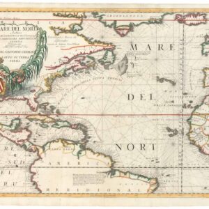
Mare del Nord.
- $2,200
- A gorgeous full-color example of Coronelli's chart of the Eastern Seaboard and North Atlantic.
-
-
-
-
Add to cart
 Quick View
 - Americas, Mexico - Central & South America
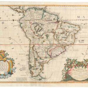
America Meridionale Auttore Il P.M. Coronelli M.C. Cosmografo dell Serenssima Repub. di Venetia.
- $2,200
- One of the 17th century’s most stunning and detailed depictions of South America.
-
-
-
-
Add to cart
 Quick View
 - Americas, Mexico - Central & South America, Michael's Collection
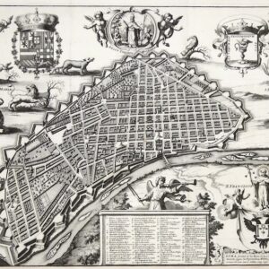
Lima, Ciudad de los Reyes, Corte y Emporio del Imperio Peruano.
- $6,500
- The first printed map of Lima.
-
-
-
-
Add to cart
 Quick View
 - Americas, Mexico - Central & South America, North America
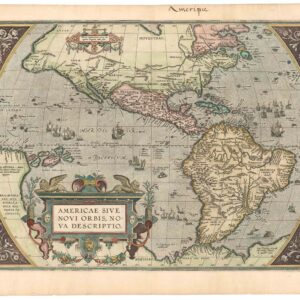
Americae Sive Novi Orbis, Nova Descriptio.
- $4,800
- The earliest acquirable map to name California.
-
-
-
-
Add to cart
 Quick View
 - Americas, Cuba, West Indies, Caribbean
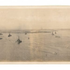
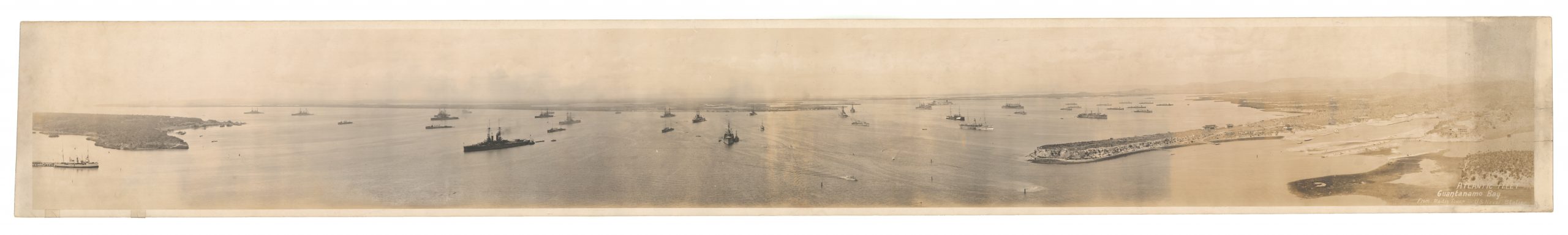
Atlantic Fleet. Guantanamo Bay from Radio Tower – U.S. Naval Station
- $800
- An evocative WW1 panoramic photograph of the U.S. Navy’s Atlantic Fleet stationed at their new base in Guantanamo Bay, Cuba.
-
-
-
-
-
Add to cart
 Quick View
 - Americas
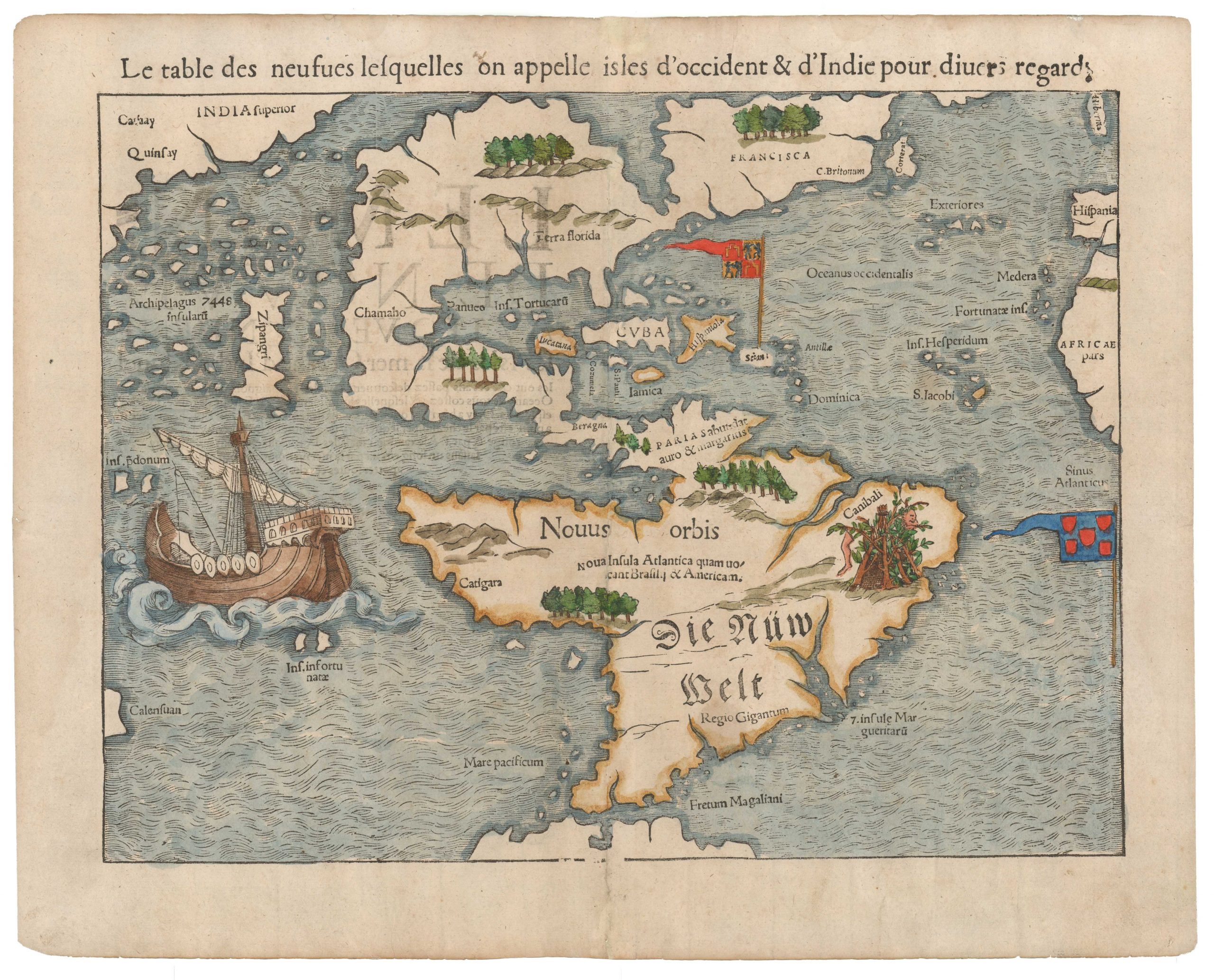
La table des isles neufues lesquelles on appelle isles d’occident & d’Indie pour diuers regardz.
- $6,500
- Sebastian Münster’s Map of the Americas: The first printed map of the new continents in their entirety.
-
-

-
-
-
Add to cart
 Quick View
 - North America
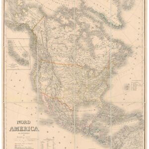
Nord America mit Westindien.
- $475
- A detailed German map of North America providing the latest configuration of the American West.
-
-
