-
-
Add to cart
 Quick View
 - Atlases & Books, Featured Maps & Views, Michael's Collection, Southern California
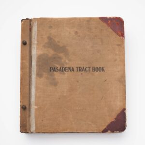
Pasadena Tract Book.
- $8,500
- An extremely rare tract book of Pasadena and Altadena, with numerous unrecorded pasted-in extra maps.
-
-
-
-
Add to cart
 Quick View
 - Americas, Mexico - Central & South America, Michael's Collection
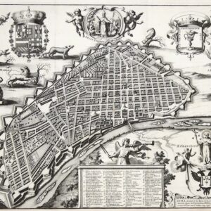
Lima, Ciudad de los Reyes, Corte y Emporio del Imperio Peruano.
- $6,500
- The first printed map of Lima.
-
-
-
-
Add to cart
 Quick View
 - Europe, Featured Maps & Views, Italy, Michael's Collection
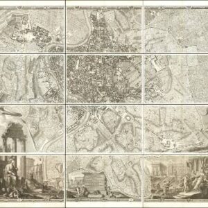
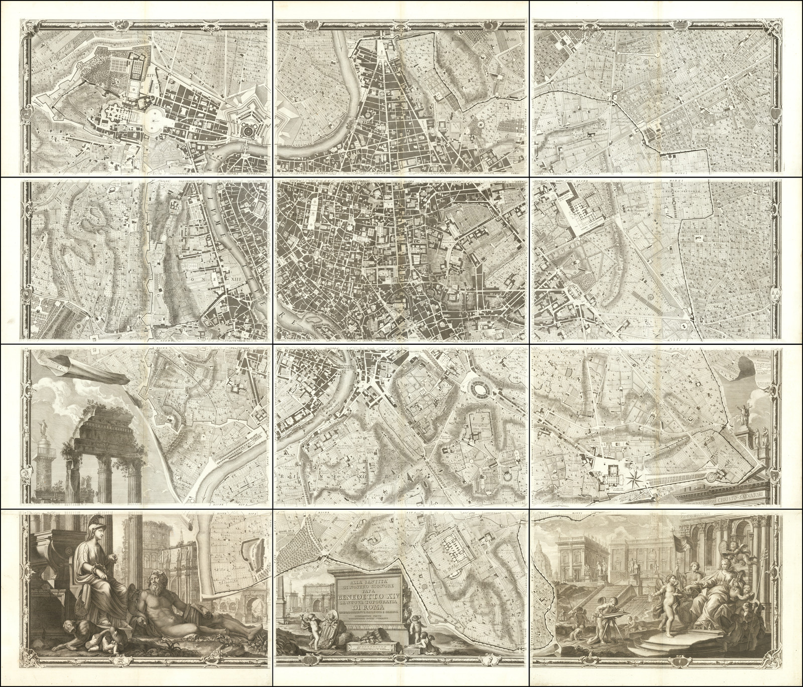
Alla Santità di Nostro Signore Papa Benedetto XIV La Nuova Topografia di Roma…
- $35,000
- The famous Nolli wall map of Rome: one of the finest urban plans ever made.
-
-

-
-
-
Add to cart
 Quick View
 - Michael's Collection, Featured Maps & Views, United States, East & Midwest United States, Bird's-eye-views
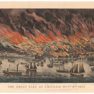
The Great Fire at Chicago. Octr. 8th 1871.
- $9,500
- Currier & Ives 1871 Great Chicago Fire.
-
-
-
-
Add to cart
 Quick View
 - Michael's Collection, San Francisco
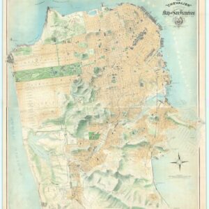
The “Chevalier” Commercial, Pictorial and Tourist Map of San Francisco From Latest U.S. Gov. and Official Surveys.
- $49,500
- The greatest San Francisco map ever made.
-
-
-
-
Add to cart
![[1838 Republic of Texas manuscript document detailing the votes for elected office, including President].](https://neatlinemaps.com/wp-content/uploads/2023/06/NL-01852-front_thumbnail-300x300.jpg) Quick View
Quick View - Michael's Collection, Texas and The West
[1838 Republic of Texas manuscript document detailing the votes for elected office, including President].
- $8,500
- Original Republic of Texas referendum document stipulating the results of the 1838 election of Mirabeau Lamar.
-
-
-
-
Add to cart

 Quick View
 - Americas, California, Michael's Collection, North America
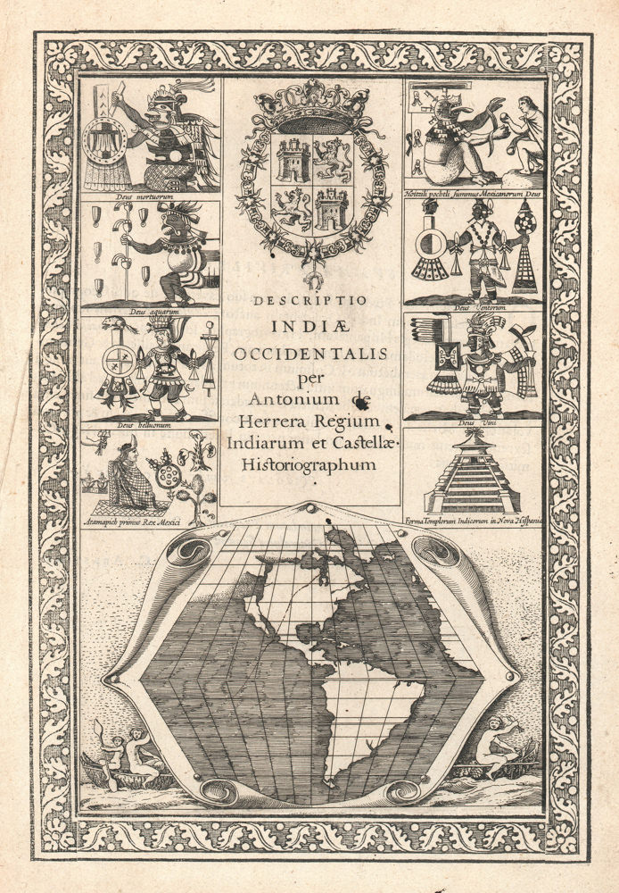
Descriptio Indiae Occidentalis per Antonium de Herrera.
- $3,600
- The first map to show California as an island!
-
-
-
-
-
Add to cart

 Quick View
 - Africa, Arabia and the Red Sea, Asia, Michael's Collection
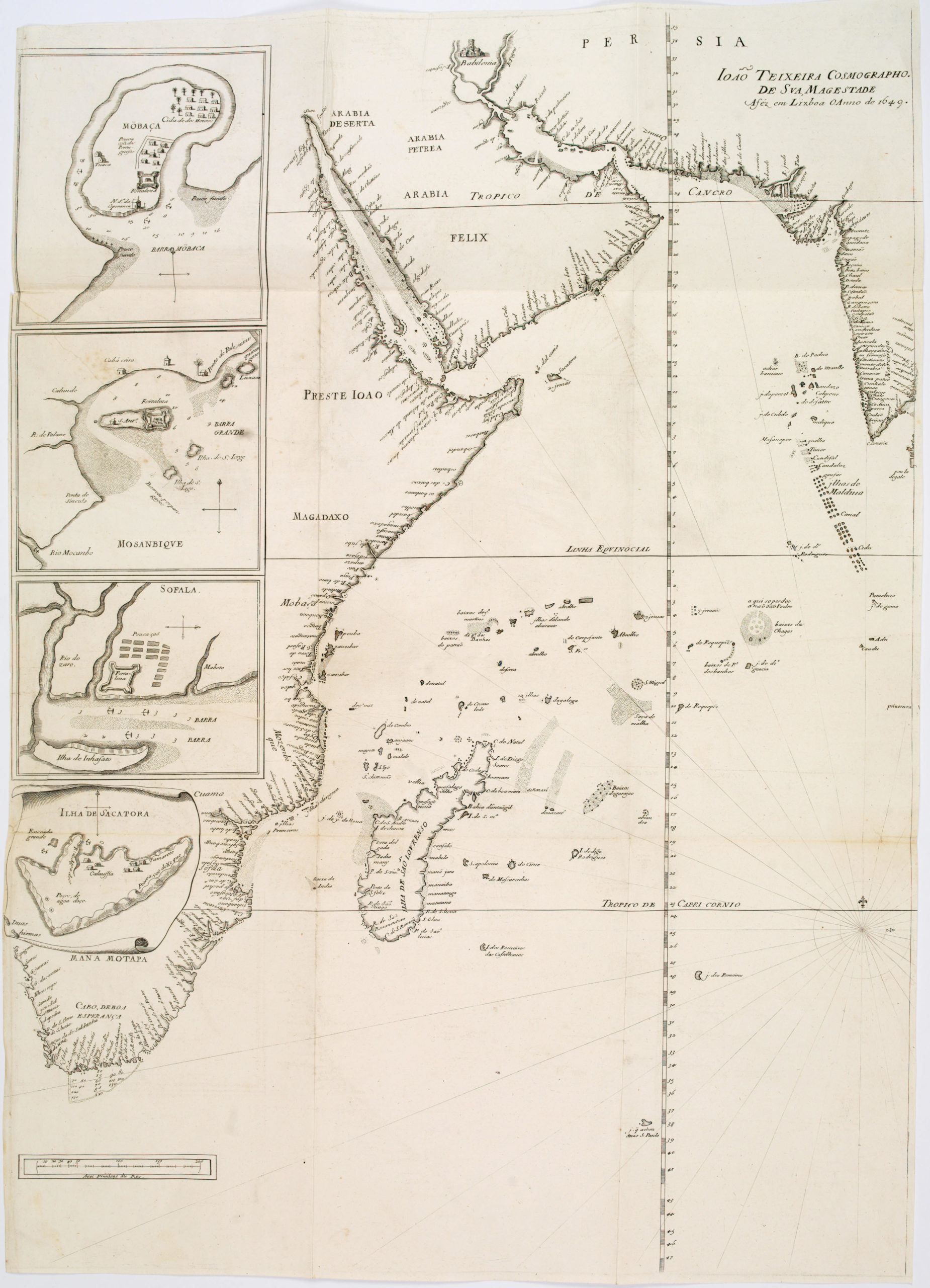
João Teixeira Cosmographo. De sua, Magestade. Aféz em Lixboa o Anno de 1649
- $6,000
- Rare 17th century portolan-style chart designed for use aboard Portuguese merchant vessels.
-
-
-