-
-
Add to cart
 Quick View
 - East & Midwest United States, United States
Gettysburg. Repulse of Longstreet’s Assault.
- $1,200
- Bachelder’s magnificent rendering of Longstreet’s Assault (Pickett's Charge).
-
-
-
-
Add to cart
 Quick View
 - Atlases & Books, East & Midwest United States, United States
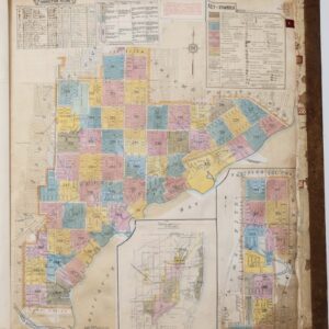
Insurance Maps of Miami, Florida Volume Three.
- $8,500
- Sanborn Fire Insurance Atlas of Miami, Florida – Volume 3: Coconut Grove & Silver Bluff.
-
-
-
-
Add to cart
![Carte De La Floride Occidentale et Louisiane…[with] La Peninnsule Et Golfe De La Floride ou Canal De Bahama Avec Les Isles De Bahama Traduit de Gefferys…1777.](https://neatlinemaps.com/wp-content/uploads/2025/01/NL-02329_thumbnail-300x300.jpg) Quick View
Quick View - East & Midwest United States
Carte De La Floride Occidentale et Louisiane…[with] La Peninnsule Et Golfe De La Floride ou Canal De Bahama Avec Les Isles De Bahama Traduit de Gefferys…1777.
- $2,800
- A scarce 1777 French map of Florida and the Gulf Coast.
-
-
-
-
Add to cart
 Quick View
 - Americas, Cuba, West Indies, Caribbean, East & Midwest United States, North America
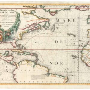
Mare del Nord.
- $2,200
- A gorgeous full-color example of Coronelli's chart of the Eastern Seaboard and North Atlantic.
-
-
-
-
Add to cart
 Quick View
 - Bird's-eye-views, East & Midwest United States, United States
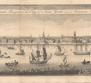
The South Prospect of the City of New York, in America.
- $5,500
- One of the Earliest Acquirable Views of New York City.
-
-
-
-
Add to cart
 Quick View
 - East & Midwest United States, Featured Maps & Views, United States
Gettysburg Battle-Field.
- $3,500
- Bachelder's iconic 1863 view of the Battle of Gettysburg.
-
-
-
-
Add to cart
 Quick View
 - East & Midwest United States, Featured Maps & Views
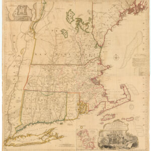
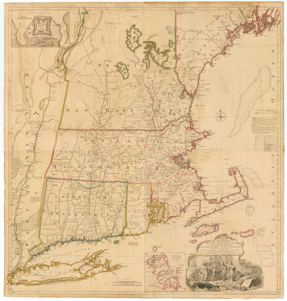
A MAP of the most INHABITED part of NEW ENGLAND, containing the PROVINCES of MASSACHUSETS BAY and NEW HAMPSHIRE, with the COLONIES of KONEKTIKUT AND RHODE ISLAND. Divided into Counties and Townships: The whole composed of Actual Surveys and its situation adjusted by ASTRONOMICAL OBSERVATIONS.
- $55,000
- Unobtainable first state of one of the most influential maps of New England ever made.
-
-
-
-
-
Add to cart
 Quick View
 - East & Midwest United States, Texas and The West
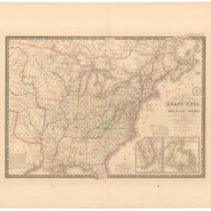
Carte Générale des Etats-Unis, des Haut et Bas-Canada, de la Nouvelle Ecosse, du Nouvelle Brunswick, de Terre Neuve.
- $875
- Brué’s important map of the United States prior to the Mexican-American War, with an overtly independent Texas.
-
-
-
-
Add to cart
 Quick View
 - United States, East & Midwest United States
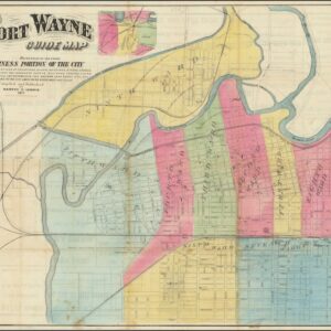
Fort Wayne Guide Map (location of First Professional Baseball Game shown).
- $6,500
- Earliest recorded printed map to locate the site of the world’s first professional baseball game.
-
-
-
-
Add to cart
 Quick View
 - Michael's Collection, Featured Maps & Views, United States, East & Midwest United States, Bird's-eye-views
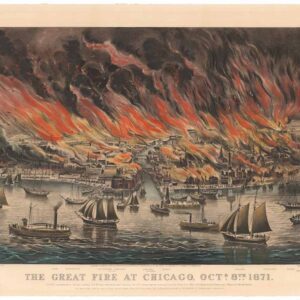
The Great Fire at Chicago. Octr. 8th 1871.
- $9,500
- Currier & Ives 1871 Great Chicago Fire.
-
-
-
-
Add to cart
 Quick View
 - East & Midwest United States, United States
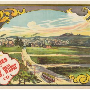
Buy Homes of J.W. Wilbur Co.
- $300
- An invitation to settle in New England.
-
-
-
-
Add to cart
 Quick View
 - East & Midwest United States
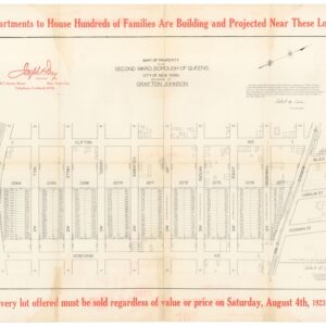
Map of Property in the Second Ward, Borough of Queens… / Absolute Long Island City Auction Sale.
- $475
- Joseph P. Day and the early days of Queens' development.
-
-