-
-
Add to cart
![[Persuasive Cartography] Die Araber, Israel und die Supermächte.](https://neatlinemaps.com/wp-content/uploads/2025/10/NL-02133_thumbnail-300x300.jpg) Quick View
Quick View - Eastern Mediterranean - Holy Land, Middle East - Holy Land Maps
[Persuasive Cartography] Die Araber, Israel und die Supermächte.
- $1,400
- Cold War Propaganda Map Depicting the Arab–Israeli Conflict and Superpower Rivalry.
-
-
-
-
Add to cart
 Quick View
 - Iran - Persia - Central Asia, Middle East - Holy Land Maps, World War I and World War II
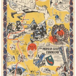
The Persian Gulf Command.
- Rare World War II propaganda map published in Tehran.
-
-
-
-
Add to cart
 Quick View
 - Curiosities - Miscellanea
Save or Delete.
- $1,800
- BANKSY Greenpeace Poster and Sticker Sheet.
-
-
-
-
Add to cart
 Quick View
 - East & Midwest United States, United States
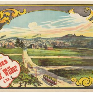
Buy Homes of J.W. Wilbur Co.
- $300
- An invitation to settle in New England.
-
-
-
-
Add to cart
 Quick View
 - East & Midwest United States, United States
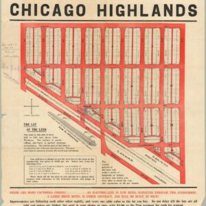
The Central Subdivision at Chicago Highlands.
- $775
- Promotional broadside for the industrial community of Chicago Highlands.
-
-
-
-
Add to cart

 Quick View
 - Bird's-eye-views, California, Pictorial maps, San Francisco
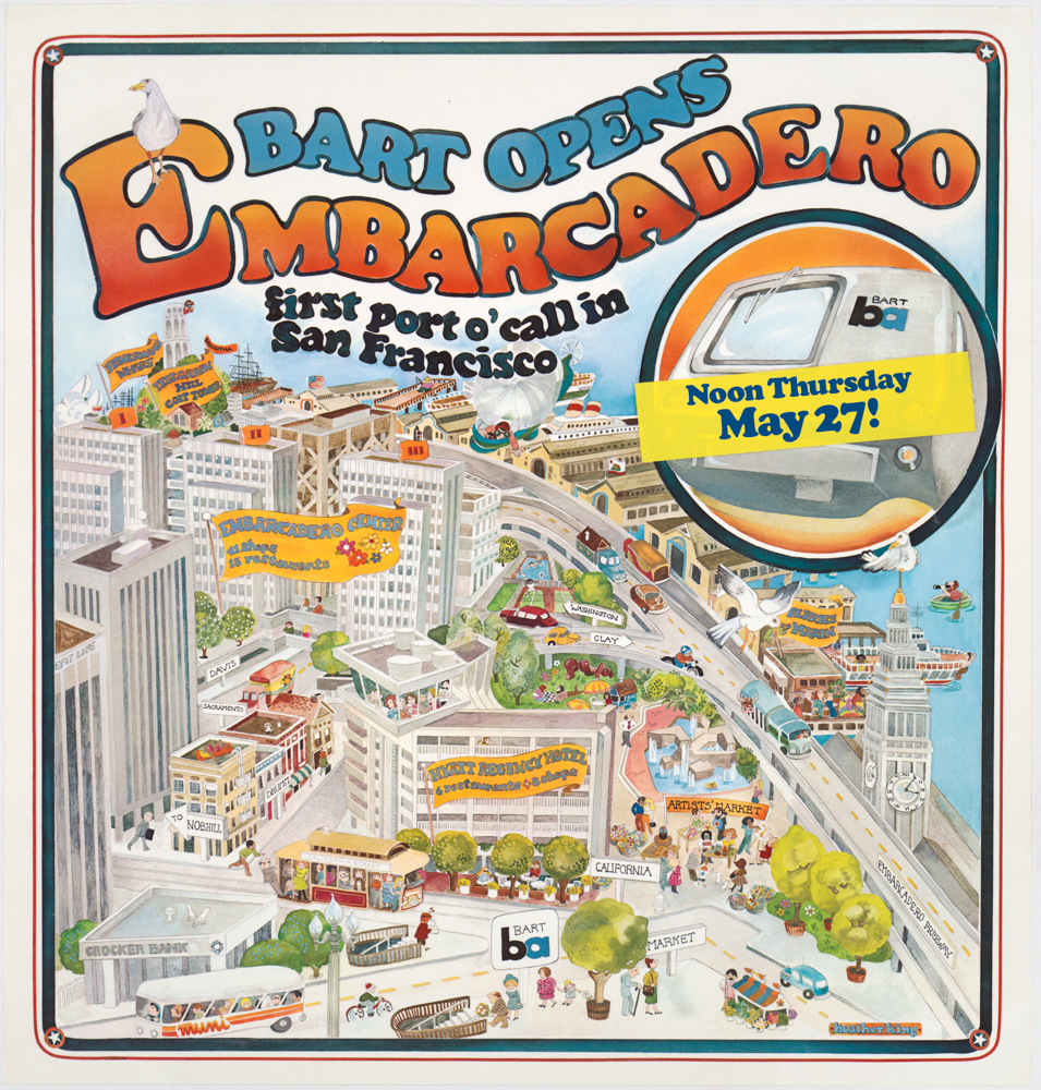
Bart Opens Embarcadero. First port o’call in San Francisco
- $475
- Celebrating public transit -- a pictorial view of downtown San Francisco announcing the 1976 opening of the Embarcadero BART station.
-
-
-
-
-
Add to cart
 Quick View
 - California, Curiosities - Miscellanea
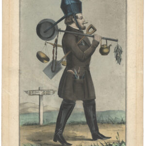
The Independent Gold Hunter on His Way to California. I Neither Borrow Nor Lend.
- $3,900
- The most iconic California Gold Rush lithograph.
-
-
-
-
Add to cart
 Quick View
 - Curiosities - Miscellanea
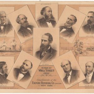
Kings of Wall Street
- $1,900
- A scarce and highly evocative 19th-century broadside depicting the most notable entrepreneurs of the day.
-
-
-
-
Add to cart
 Quick View
 - Curiosities - Miscellanea, San Francisco
The Tables Turned – “You Sabe Him? Kealney Must Go!”
- $575
- Political satire from one of San Francisco's first antiquarian booksellers.
-
-
-
-
Add to cart
 Quick View
 - Pictorial maps, San Francisco
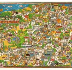
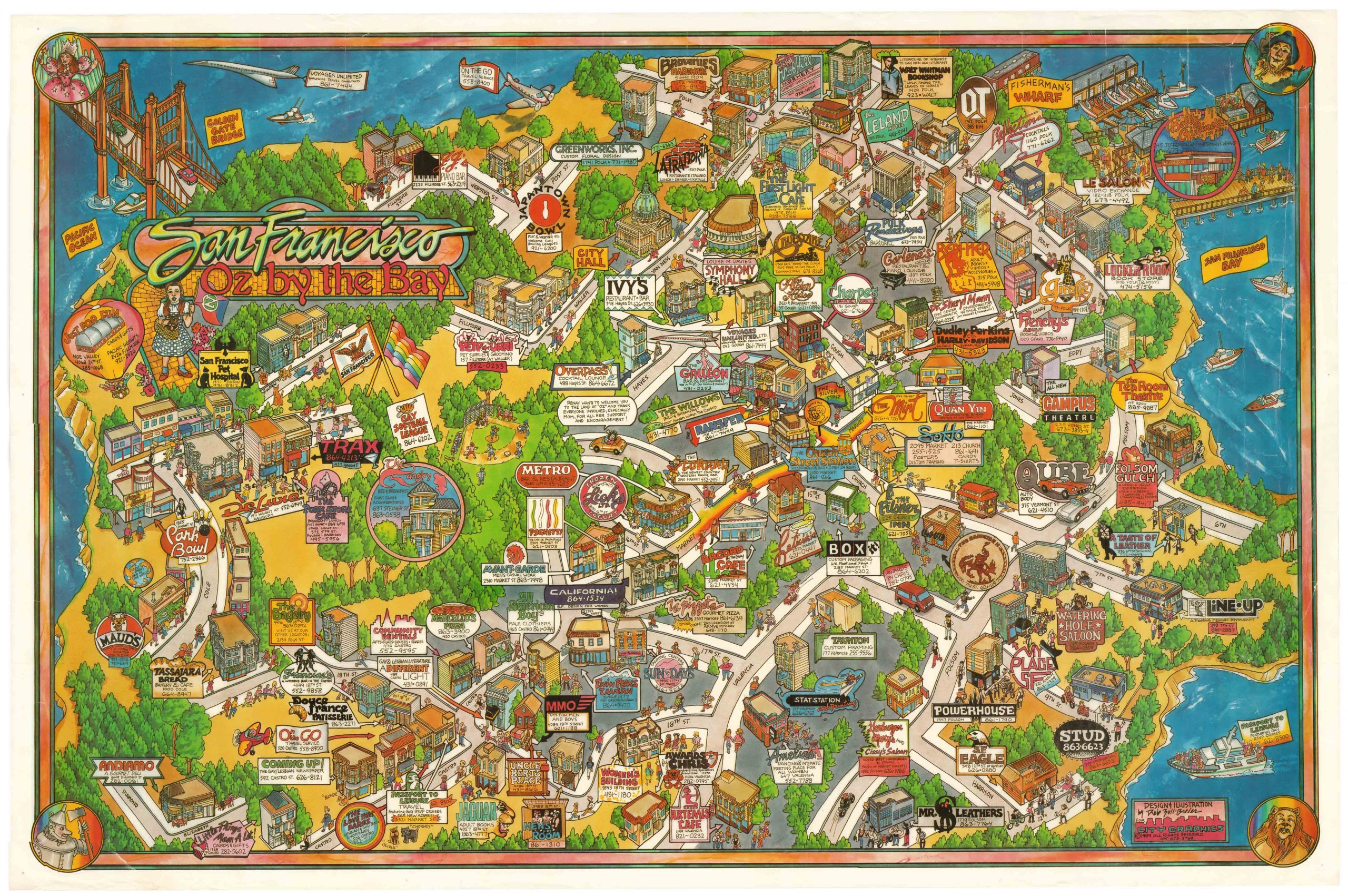
San Francisco Oz by the Bay
- $2,400
- Zell-Breier’s whimsical pictorial map of San Francisco in the 1980s.
-
-
-
-
-
Add to cart
 Quick View
 - Africa, Curiosities - Miscellanea
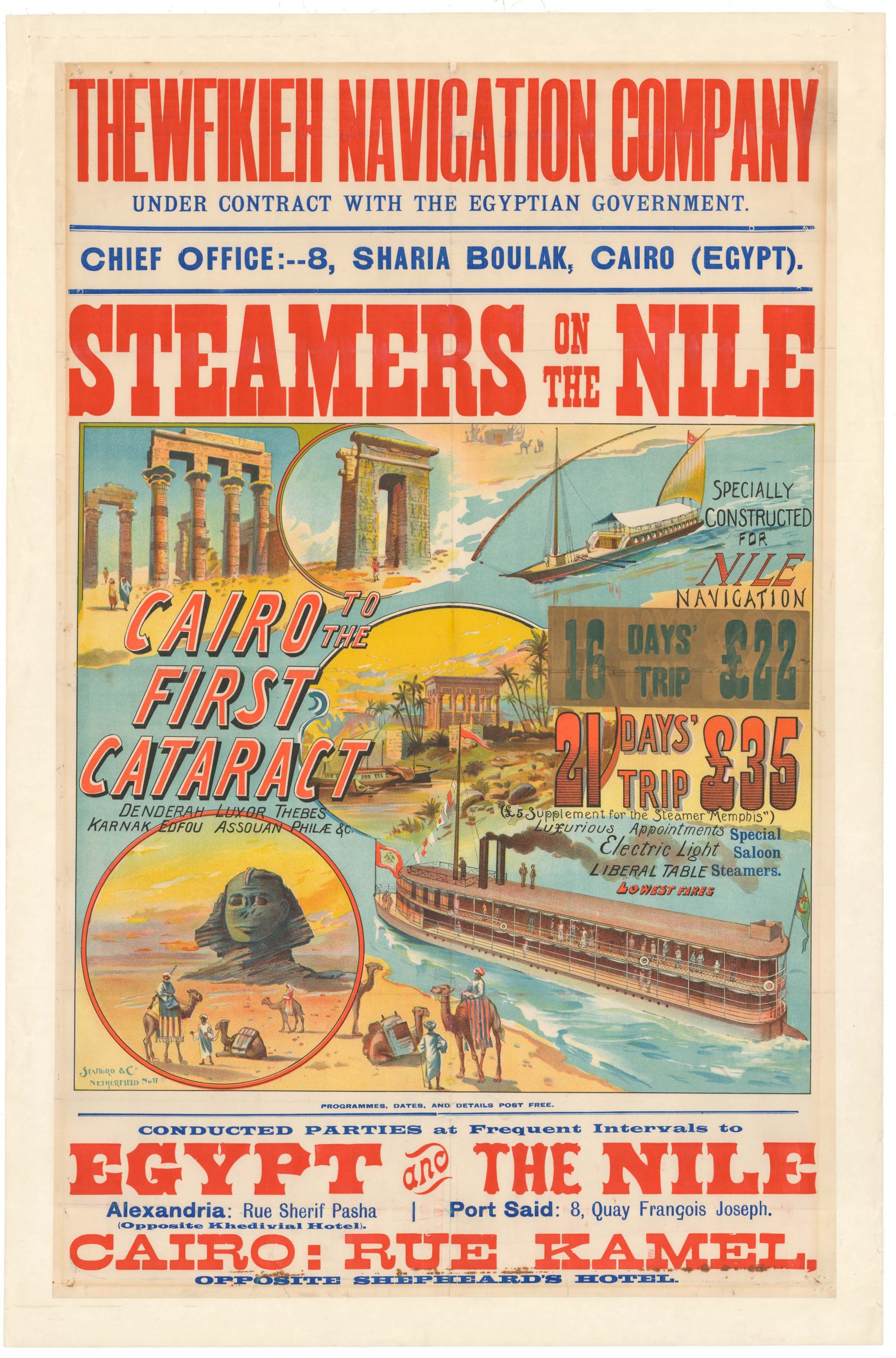
STEAMERS ON THE NILE / THEWFIKIEH NAVIGATION COMPANY.
- $3,500
- Gorgeous Victorian travel poster for the Egyptian Thewfikieh Navigation Company’s Nile Cruises.
-
-
-
-
-
Add to cart

 Quick View
 - Europe, World War I and World War II
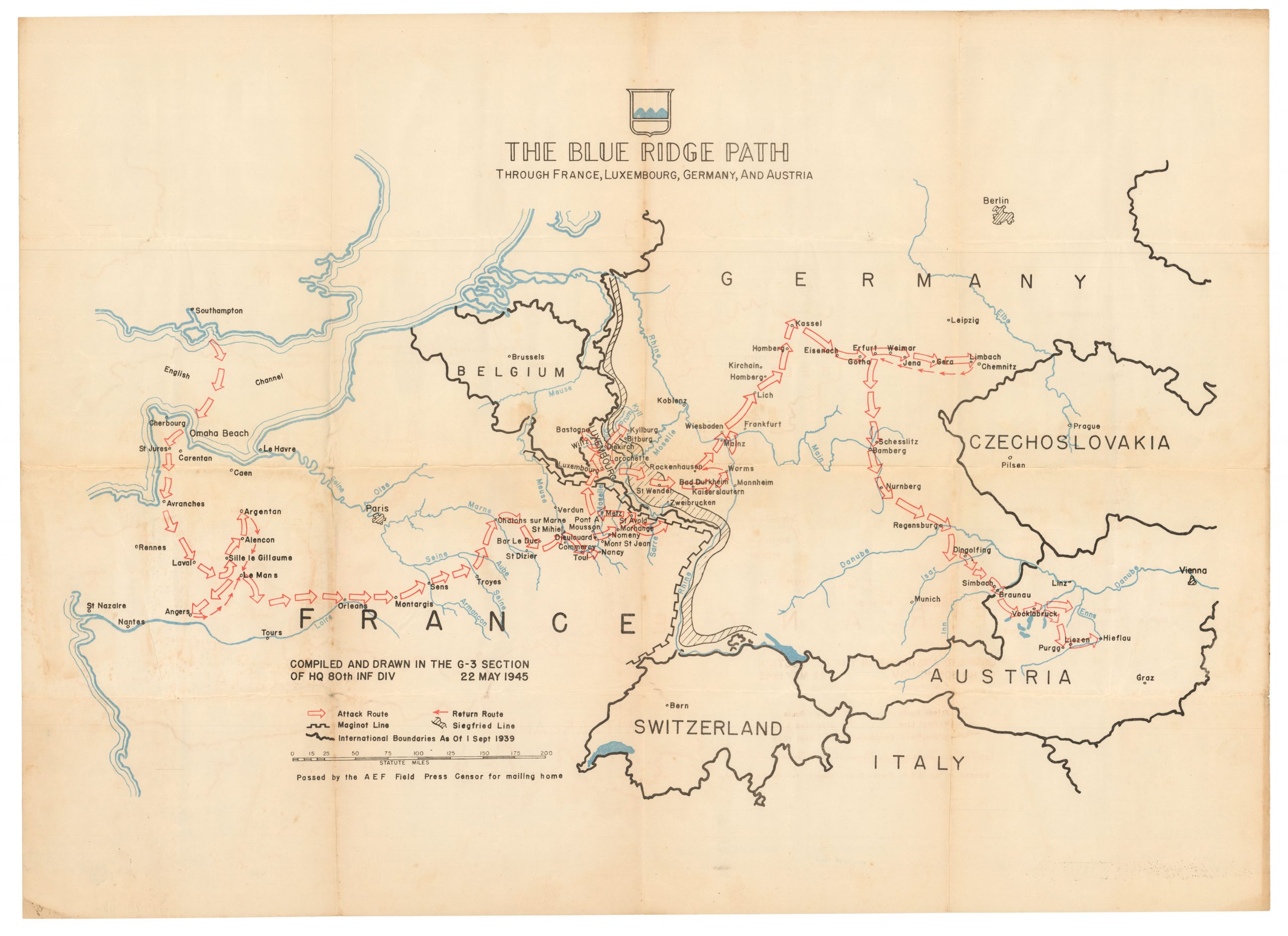
The Blue Ridge Path through France, Luxembourg, Germany, and Austria
- $1,000
- Patton’s 80th Infantry Division -- liberators of two concentration camps!
-
-

-