Unrecorded 1922 Thomas Bros. East Bay wall map.
Map of Principal East Bay Cities.
Out of stock
Description
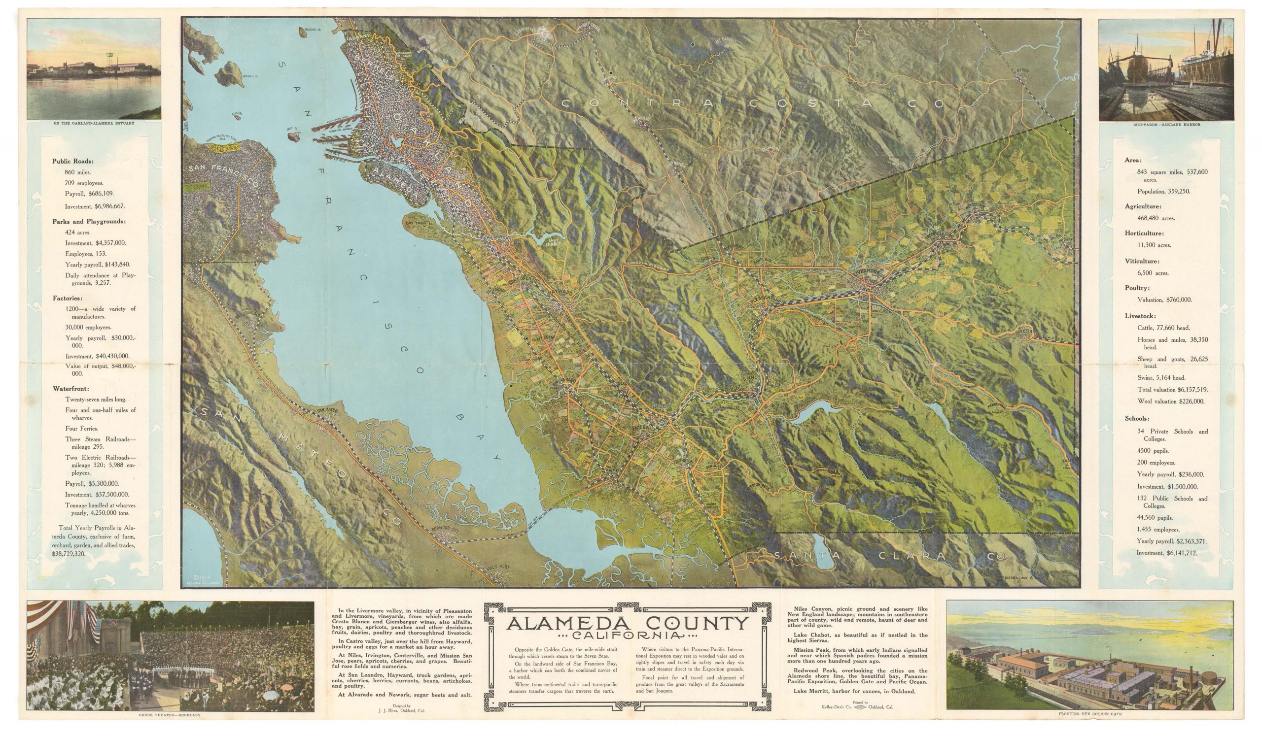
This large-format 1922 map covers the cities of Albany, Berkeley, Emeryville, Oakland, Alameda, and Piedmont. It provides a snapshot of the area with granular detail, at a time when it was undergoing breakneck urban growth.
Streets are labeled throughout and listed in indexes at the right, corresponding to a grid surrounding the map. Parkland, waterways, golf courses, cemeteries, libraries, firehouses, streetcar lines and stations (including the Key System with its famous ferry mole, a primary means of traveling across the Bay to San Francisco), mountains, and other features are prominently labeled. The University of California (Berkeley) is easily identifiable near the top. Some of the larger plots of land have their owners noted, generally railroads, utilities, and industrial interests, but in some cases the descendants of early, wealthy East Bay families.
Perhaps most importantly, the map includes survey lines in coastal areas and ghosts in planned landfill and development on the western end of Alameda. Once completed in 1927, this land would be used for both civilian and military air fields in the following decades, eventually coalescing as Naval Air Station Alameda, along with a pier for berthing aircraft carriers. The area thus became a key node in America’s long-distance transportation and military networks, particularly for movement across the Pacific.
Context is everything
Oakland and surrounding cities were experiencing rapid growth and urbanization at this time, a continuation of a population boom following the 1906 Earthquake and Fire when many San Franciscans whose homes had been destroyed migrated across the Bay. In the 1920s, Oakland was second only to Detroit in importance in the automobile industry, with East Oakland in particular becoming a hub (note here the labelled Fageol, Chevrolet, and Durant factories). Workers poured in from around the country to work in these factories, including many African-American families, leaving a deep impression on the city’s culture ever since. The scale of migration and urbanization was stunning; for example, in the years 1921-1924, some 13,000 new homes were built in Oakland alone to house industrial workers.
Census
This very curious map was printed in 1922 by Thomas Bros., early on in the company’s history. Given their usual clients at the time, it is likely that this map was prepared for urban planners or some other official use, or perhaps for realtors and real estate developers (the price of $22.50 was no small sum in 1922, equivalent to over $430 today). In any event, we have been unable to locate any other examples of this map in institutional collections, nor identify any market history.
Cartographer(s):
Thomas Bros. Maps, the publishers of the Thomas Guide, previously known as Popular Street Atlas, Street Guide, and Popular Atlas, was started in Oakland, California, in 1915 by cartographer George Coupland Thomas and his two brothers, who were business partners. Early publications were detailed block maps, bird eye view of communities, road & highway maps, and what would be generally referred as generalized tourist maps.
Condition Description
Very good. Some creasing and repaired tears along edge.
References