The Survey of Pakistan’s mapping of Peshawar and the Northwest Frontier.
D.I. Khan & Peshāwar Divisions, Amb, Chitral, Dir and Swat.
$275
1 in stock
Description
Frontier topography and Pakistani statecraft.
This is a first-edition topographic map, published by the Survey of Pakistan in 1968. It focuses on Pakistan’s northwestern frontier, with the graticule spanning ~31° to ~37°N and ~69° to ~74°E. This corresponds to the provinces and districts historically known as the Dera Ismail Khan (D.I. Khan) and Peshawar Divisions, including the Amb, Chitral, Dir, and Khyber Pakhtunkhwa territories, as well as the infamous Swat Valley. It is essentially a hybrid physical-topographic and administrative map, with major administrative centres such as Peshawar, Islamabad, Bannu, and Mardan shown with special typographic emphasis in the legend (i.e. capital or divisional headquarters).
The legend distinguishes international and administrative boundaries, demarcated and undemarcated division lines and district limits, and a variety of railways and roads (e.g. metalled trunk roads, unmetalled main roads, minor roads and paths). Rivers and streams are shown in blue. Symbols for towns, divisional headquarters, archaeological sites, and petrol filling stations are also included, showing the map’s practical application.
Relief is shown through a combination of shaded relief and specific elevations, a standard technique at this scale that provides a quick visual sense of the iconic Hindu Kush mountain range. But it also defines the Sulaiman-Range foothills, the highlands around Chitral and Swat, and the lowland alluvial plains surrounding the Indus and its tributaries.
The map was printed on pale cream paper in three colors (i.e. greens for administrative boundaries, red for principal roads, blue for rivers and water features), with black line-work and shading to indicate relief. A title panel and legend occupy the upper-left corner of the sheet, while publication and copyright notices, as well as series information, appear in the lower margin. Here we also find a printed political disclaimer in red declaring contested boundaries in Jammu & Kashmir: “The State of Jammu & Kashmir is in dispute; its accession to India or Pakistan has not been decided through plebiscite under the United Nations.” When folded, the printed Survey of Pakistan cover includes a handwritten note identifying the exact map and its price. A blue stamp at the bottom is from The London Book Co. in Rawalpindi.
Context is Everything
National survey maps at the 1:1,000,000 scale serve multiple administrative, planning, and strategic functions, being used by governments for regional planning, by civil engineers and transportation agencies for route planning, and by defense and intelligence services as national-scale reference charts. In Pakistan’s case, during the 1960s, mapping also played an essential role in the civil administration of frontier districts, the management of infrastructure (rail and road), and the communication of officially recognised boundaries and political positions (hence the printed Kashmir disclaimer on this map).
The late 1960s were an era of accelerated mapping worldwide as governments modernized planning, transport, and defense infrastructure. For Pakistan, this period followed the major political and military events of the 1950s and 1960s (including the 1965 war with India), but preceded the administrative reorganization of the early 1970s. The map reflects the administrative divisions and nomenclature from the specific era. For example, the use of colonial-inherited divisional units, such as D.I. Khan, and the framing of disputed boundaries, such as Jammu & Kashmir, all reflect the political stances of the time. The sheet thus combines practical topography with statements of official geography specific to that era.
Census
This sheet is a first-edition 1968 Survey of Pakistan map from the 1:1,000,000 series, covering the Dera Ismail Khan and Peshawar Divisions and adjacent frontier territories (Amb, Chitral, Dir, and Swat). It is an officially issued government sheet map, produced under the Surveyor-General, G. H. Khan, and intended for administrative, planning, and reference use.
While it is likely that copies of this map can also be found in a range of British and Pakistani archives, the OCLC lists only four institutional parallels to the 1968 edition. These are held by the Library of Congress, Ball State University, and the national libraries of Scotland and Australia (OCLC no. 5408252).
The National Library of Australia’s catalogue record (call number MAP G7643.N6 1968) confirms the publication details on Neatline’s example.
Cartographer(s):
The Survey of Pakistan (SOP) is Pakistan’s national mapping organization, established at the country’s independence in 1947. It is responsible for topographic mapping, geodetic control, aerial photography, and map publication. The SOP has produced a systematic map series at a variety of scales. The 1:1,000,000 series provided a standardized regional overview. The list of Surveyors-General shows G. H. Khan in office in the late 1960s; the sheet itself bears his imprint, dated 1968, which identifies the map as an official product of the SOP under his direction.
Condition Description
Good.
References
Related products
-
-
Add to cart
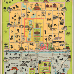
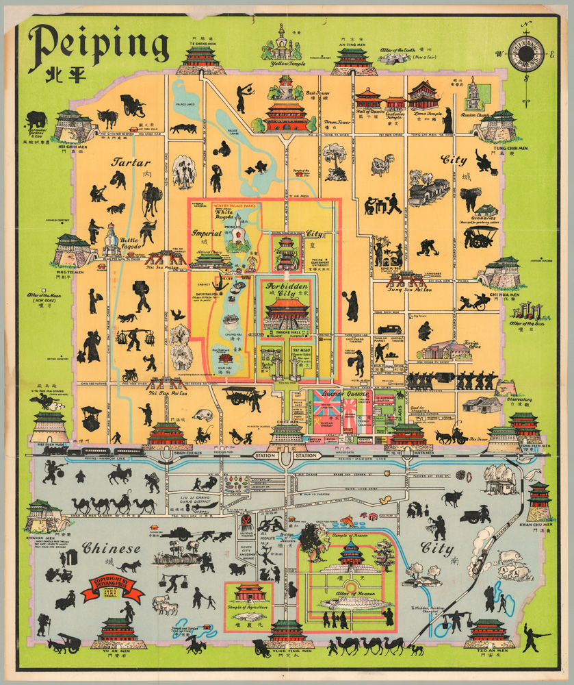
- Asia, Pictorial maps
Peiping
- $1,250
-
-
-