Exceedingly Rare South Chicago Map. Likely published just months before the Great Chicago Fire of 1871.
Map of Hyde Park, Calumet, Thornton, South Chicago and Northern Portion of Lake County, Ind. owing to the natural advantages of its situation South Chicago is to become the great industrial center of the north west.
$8,500
1 in stock
Description
No examples traced at auction and only three institutional holdings.
This rare circa 1871 map of Chicago’s far South Side and the adjoining corner of Indiana was prepared by surveyor Albert Joseph Vander Naillen. It is a remarkable real-estate planning document from the moment when the Calumet region was being imagined as the next great center of American industry.
The Map in Detail
The map runs from 39th St. (then Egan Ave., now Pershing Rd.), where the Union Stock Yards were located, well into northern Indiana. A township-and-section survey grid, railroad lines, waterways, wagon roads, a daily steamer route, harbor works, and ownership tracts are all labeled throughout. This was a working document, as evidenced by hand-colored shading and pencil annotations.
Three vignette illustrations appear; the first depicts the South Chicago Hotel, the first large, modern hotel in the area, conceived of as a summertime escape for the city’s elite. The second portrays the grounds of the “Wild Wood” estate of Colonel James H. Bowen, a major real estate developer of this region. After his main city home was destroyed in the Great Fire of 1871, Bowen fully relocated to Wildwood, which became a gathering place for Chicago’s elite in the following years. The final vignette illustrates the Stony Island Château, another early mansion in the area, on the outskirts of South Chicago.
Historical Context
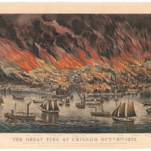
The map was likely made in the months and years just before the Great Chicago Fire of October 1871, which destroyed much of the city (including the School of Practical Civil Engineering referred to in the notices) but left the area shown here well south of the burned district. In the years that followed, this region attracted industries that needed cheap land, deep water, and railroad access. The Union Stock Yards (visible at the top of the sheet), which had opened in 1865, showed what large-scale industrial development on the city’s southern edge could look like.
Prominent real-estate developers like Colonel James H. Bowen promoted the harbor at the mouth of the Calumet as a rival to Chicago’s congested river. Heavy industry soon followed. Steel and iron works, rolling mills, and shipping facilities were established in the late 1870s and 1880s, and the area grew into one of the great steelmaking districts of the United States, joined in 1880 by George Pullman’s model town to the west (the germ of which can be seen as the ‘Pullman Tract’). The area covered by the map was annexed to Chicago with Hyde Park Township in 1889, and the same process transformed Indiana towns across the state line, giving rise to the industrial cities of the Calumet Region.
The map thus captures the area at a transitional moment, when marsh, prairie, farms, and small railroad settlements were still dominant but had already been surveyed, subdivided, and marketed for what was to come.
Publication History and Census
This map was issued c. 1871 by an unknown publisher, and it was presumably printed in a small run, given the level of detail and the paucity of surviving examples. It can reasonably be attributed to Albert Joseph Vander Naillen (Sr.) because of the notice at the bottom left, and cannot date later than 1871, as Vander Naillen relocated to California after the Great Chicago Fire that year. At the same time, the South Chicago Hotel did not open until 1871, which seems to fix that year as the only possible date.
We are aware of only three other examples of this map, held at the Library of Congress, the Chicago History Museum, and the Newberry Library. The latter two are potential examples of an alternate printing, attributed to the New York Lithographing and Engraving Co., while the Library of Congress catalog listing notes that its example is part of the John Alexander Logan Papers in the Library’s Manuscript Division (Logan was a U.S. Representative who became a Senator from Illinois the same year as the Great Fire).
Cartographer(s):
Albert Joseph Vander Naillen Sr. (1830 – 1928) was a Belgian-born engineer, surveying-geometrician, and author who established the short-lived Vander Naillen School of Engineering in Chicago. After graduating as a surveying-geometrician from the University of Ghent and receiving a special royal commission in Belgium, he immigrated to the United States in 1859. He contributed his technical expertise as a civil engineer during the American Civil War and worked in Chicago after the war before founding the Vander Naillen School of Practical Engineering. This innovative institution was designed to provide rapid, hands-on technical training, but its physical campus was completely destroyed by the Great Chicago Fire of 1871.
Following the devastating fire, Vander Naillen relocated to California, where he successfully rebuilt and expanded his engineering school in San Francisco. This campus was also ill-fated, being destroyed in the 1906 earthquake and fire, after which the school was again refounded in Oakland. Nevertheless, under Vander Naillen’s leadership, the institution became a premier training ground for hundreds of surveyors and engineers who helped build the American West’s infrastructure.
In his later years, Vander Naillen transitioned into a celebrated author of mystical and occult literature, publishing works such as In the Sanctuary and On the Heights of Himalay. He passed away in Oakland, California, at age 98, leaving a dual legacy as a pioneer of practical technical education and an influential philosophical writer. His children, Albert J. Vander Naillen Jr., Edmund L. Vander Naillen, and Gertrude Vander Naillen, were also deeply involved in the institution, which closed in 1917 because of the First World War, with its equipment and books handed over to the U.S. government to train military engineers.
Albert J. Vander Naillen Jr. (1858 – 1956) worked as the deputy county surveyor for Alameda County for nearly thirty years, while Edmund L. Vander Naillen worked as an engineer in California, Hawaii, and Mexico, designing levees along the Sacramento and San Joaquin rivers and a narrow-gauge railroad on Maui for the Spreckels Sugar Co.
Condition Description
Significantly worn, with wrinkling and scattered minor loss. Professionally restored and backed on new linen.
References