Abraham Ortelius (1527-1598) was born in Antwerp to Flemish parents in 1527. After studying Greek, Latin, and mathematics, he and his sister set up shop as book dealers and a ‘painter of maps.’ In his heart, Ortelius was, nevertheless, first and foremost a historian. He believed geography was the ‘eye of history,’ which explains why he collected maps and historical documents with such passion. Ortelius traveled widely in pursuit of his interests, building contacts with mapmakers and literati all over the European continent.
Ortelius reached a turning point in his career in 1564 with the publication of a World Map in eight sheets, of which only a single copy survives. In 1570, he published a comprehensive collection of maps titled Theatrum orbis terrarum (Theatre of the World). The Theatrum is conventionally considered the first modern-style atlas. It was compiled by collecting maps and charts from colleagues across the continent, which Ortelius then had engraved in a uniform size and style. The engraver for most of the maps in Theatrum was none other than the famous Frans Hogenberg, who also served as the main engraver for the 16th-century urban atlas Civitates Orbis Terrarum, published with Georg Braun in 1572.
Hogenberg’s re-drawn and standardized maps formed the basis of the first atlas in history (even though it was Mercator who was the first to use the term a few decades later). Unlike many of his contemporaries, Ortelius noted his sources openly and in the first edition, acknowledged no less than eighty-seven different European cartographers. This ‘catalogus auctorum tabularum geographicum‘ is one of the major innovations of his atlas. The list of contributing mapmakers was kept up-to-date for decades after Ortelius’ death. In the first edition of 1570, this list included 87 names, whereas the posthumous edition of 1603 contained no less than 183 names.
While compiled by Abraham Ortelius in the manner described above, the Theatrum was first printed by Gielis Coppens van Diest, an Antwerp printer experienced with cosmographical books. Van Diest was succeeded by his son Anthonis in 1573, who in turn was followed by Gillis van den Rade, who printed the 1575 edition of Ortelius’ atlas. From 1579, Christoffel Plantin took over, and his successors continued to print Theatrum until Ortelius’ heirs sold the copperplates and the publication rights to Jan Baptist Vrients in 1601. In 1612, shortly after Vrients’s death, the copperplates passed to the Moretus brothers.
-
-
Add to cart
 Quick View
 - Europe, Italy
Siciliae Veteris Typus.
- $1,400
- Ortelius’s pioneering of map of Sicily in Antiquity with excellent old color.
-
-
-
-
Add to cart
 Quick View
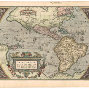
 - North America, Americas, Mexico - Central & South America
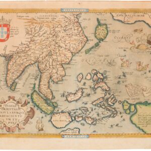
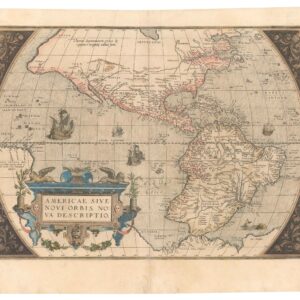
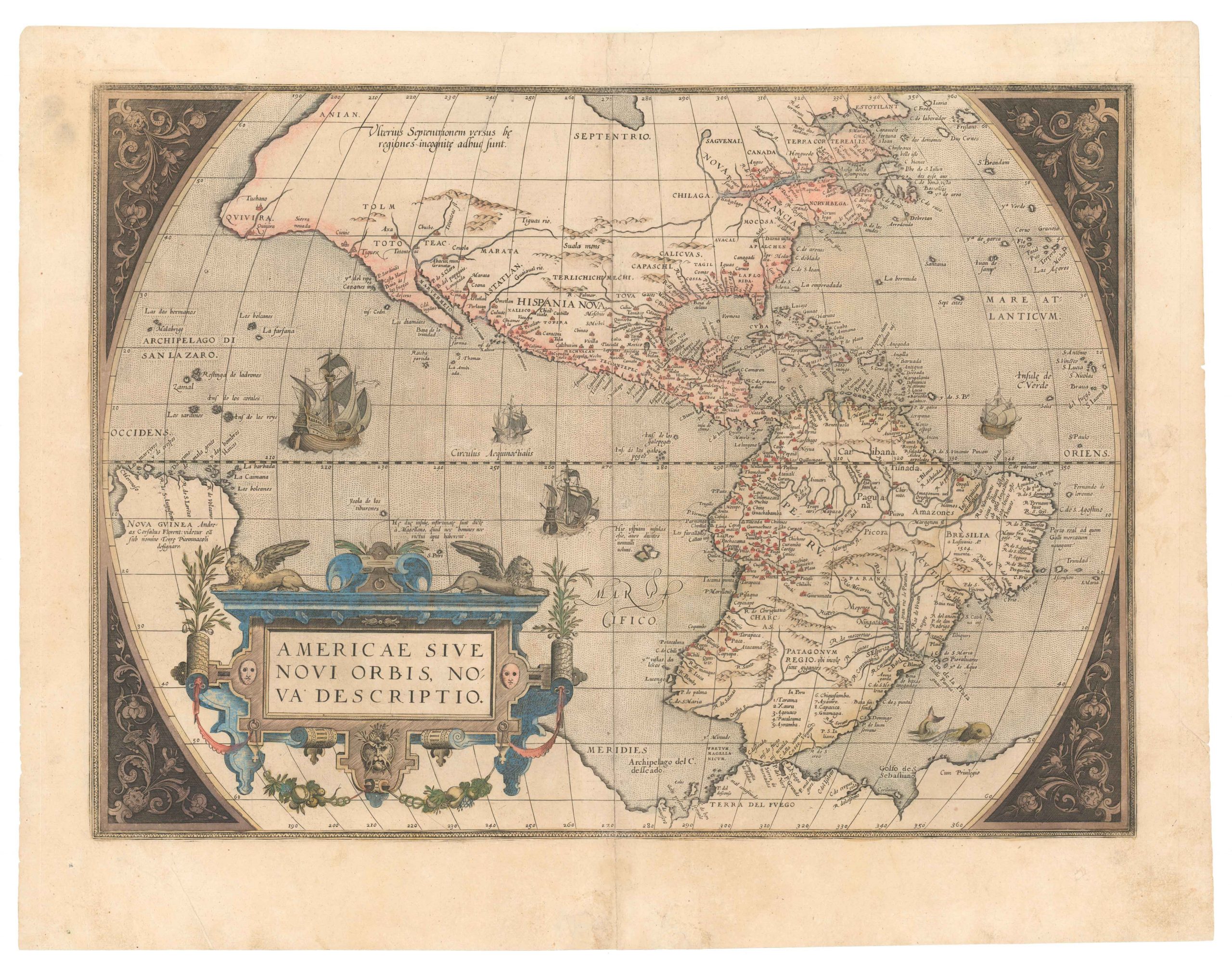
Americae Sive Novi Orbis, Nova Descriptio.
- $4,800
- The earliest acquirable map to name California.
-
-
-
-
Add to cart
 Quick View
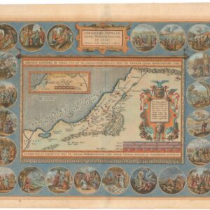
 - Eastern Mediterranean - Holy Land, Middle East - Holy Land Maps
Abrahami Patriarchae Peregrinatio, Et Vita.
- $2,600
- Ortelius' exquisite map of the Holy Land, showcasing the Journey of Abraham in stunning detail.
-
-
-
-
Add to cart
 Quick View
 - Europe, Spain & Portugal
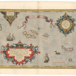
Acores Insulae.
- $950
- Discover the strategic and navigational significance of the 16th-century Azores with Ortelius' beautiful 1584 map from the famous Theatrum Orbis Terrarum.
-
-
-
-
Add to cart
 Quick View
 - Europe, France & Switzerland
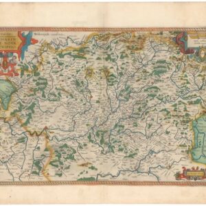
Lorraine. Lotharingiae Nova Descriptio.
- $450
- Old color Ortelius map of the Franco-German border region Lorraine.
-
-
-
-
Add to cart
 Quick View
 - Asia, California
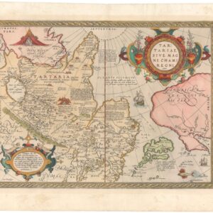
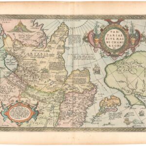
Tartariae Sive Magni Chami Regni Typus.
- $1,800
- From History's First Modern Atlas: a gorgeous Ortelius map of Asia with references to Marco Polo.
-
-
-
-
Add to cart
 Quick View
 - Arabia and the Red Sea, Asia, Curiosities - Miscellanea
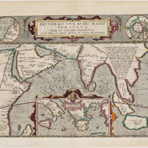
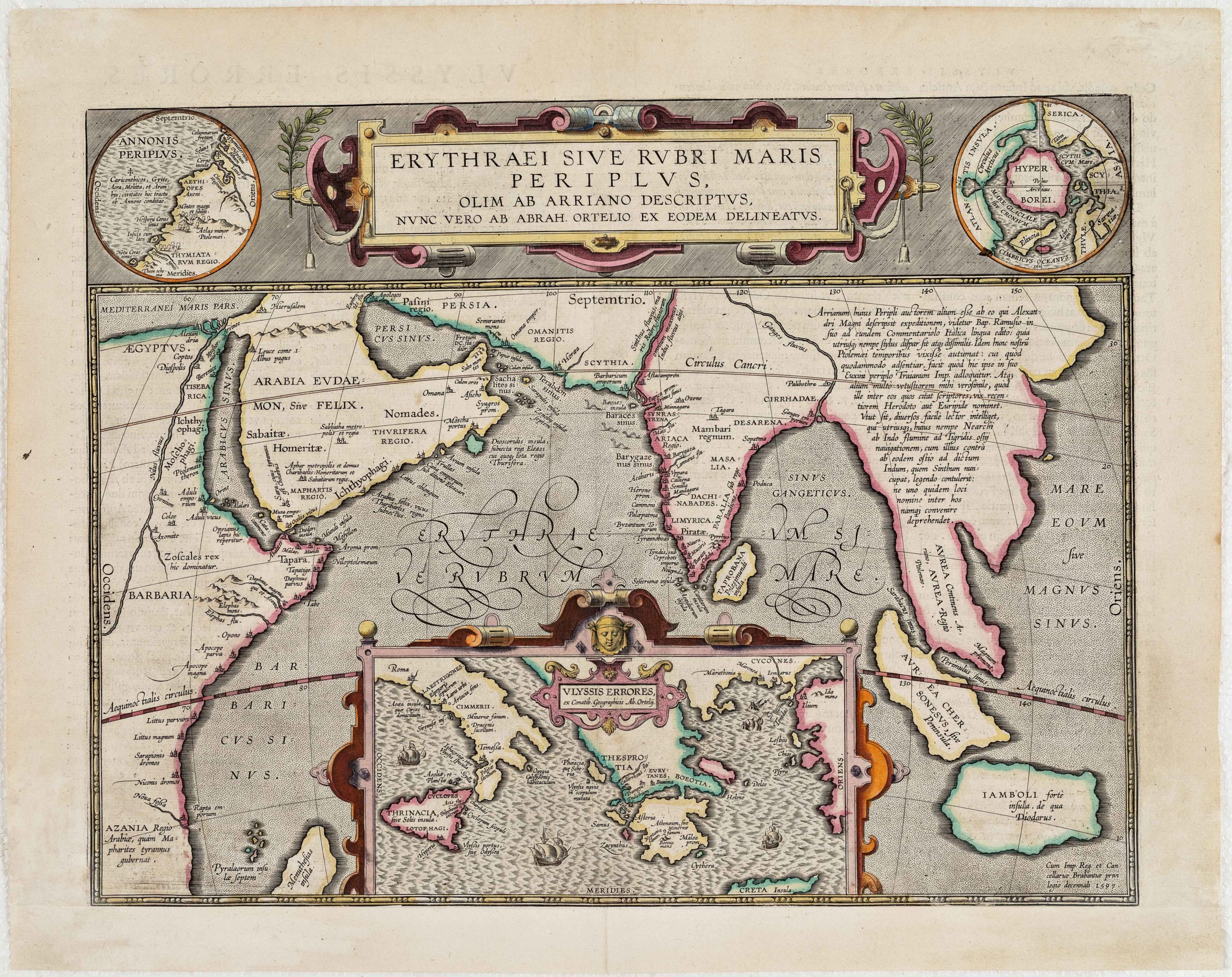
Erythraei Sive Rubri Maris Periplus, olim ab Arriano descriptus, nunc vero ab Abrah. Orelio ex eodem delineatus
- $1,200
- Illustrating a mysterious ancient text: fascinating Ortelius map mixing classical mythology and contemporary exploration.
-
-
-
-
-
-
Add to cart
 Quick View
 - Africa
Fessae, et Marocchi Regna Africae Celeberr.
- $700
- Ortelius’s fine map of Morocco, with an inset of Pigaffetta’s Kingdom of Congo.
-
-
-
-
Add to cart
 Quick View
 - Europe, British Isles
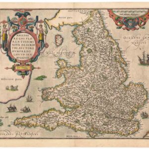
Angliae Regni Florentissimi Nova Descriptio, Auctore Humfredo Lhuyd Denbygiense
- $975
- Lovely 1574 Ortelius map of England and Wales with elaborate cartouche.
-
-
Archived
- Out of Stock
- Europe, Spain & Portugal
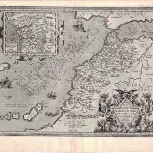
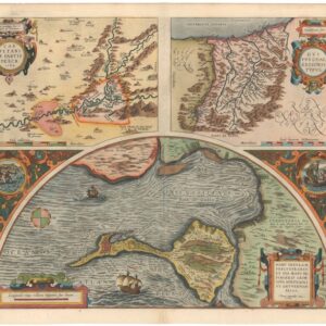
Carpetaniae Partis Descr.; Vardusorum, sive Guipuscoae Regionis Typus; Hanc Insulam Perlustrabat, et sua manu depingebat Georgius Hoefnaglius Antverpian. Belga.
- Ortelius' three key Spanish regions, from sources shrouded in mystery...
- Read moreQuick View
-
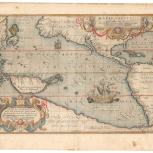
- Out of Stock
- Asia, North America, World
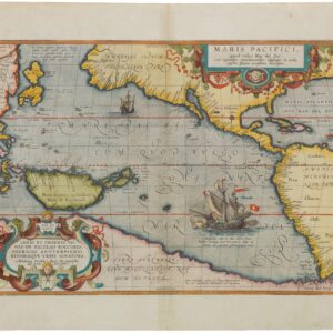
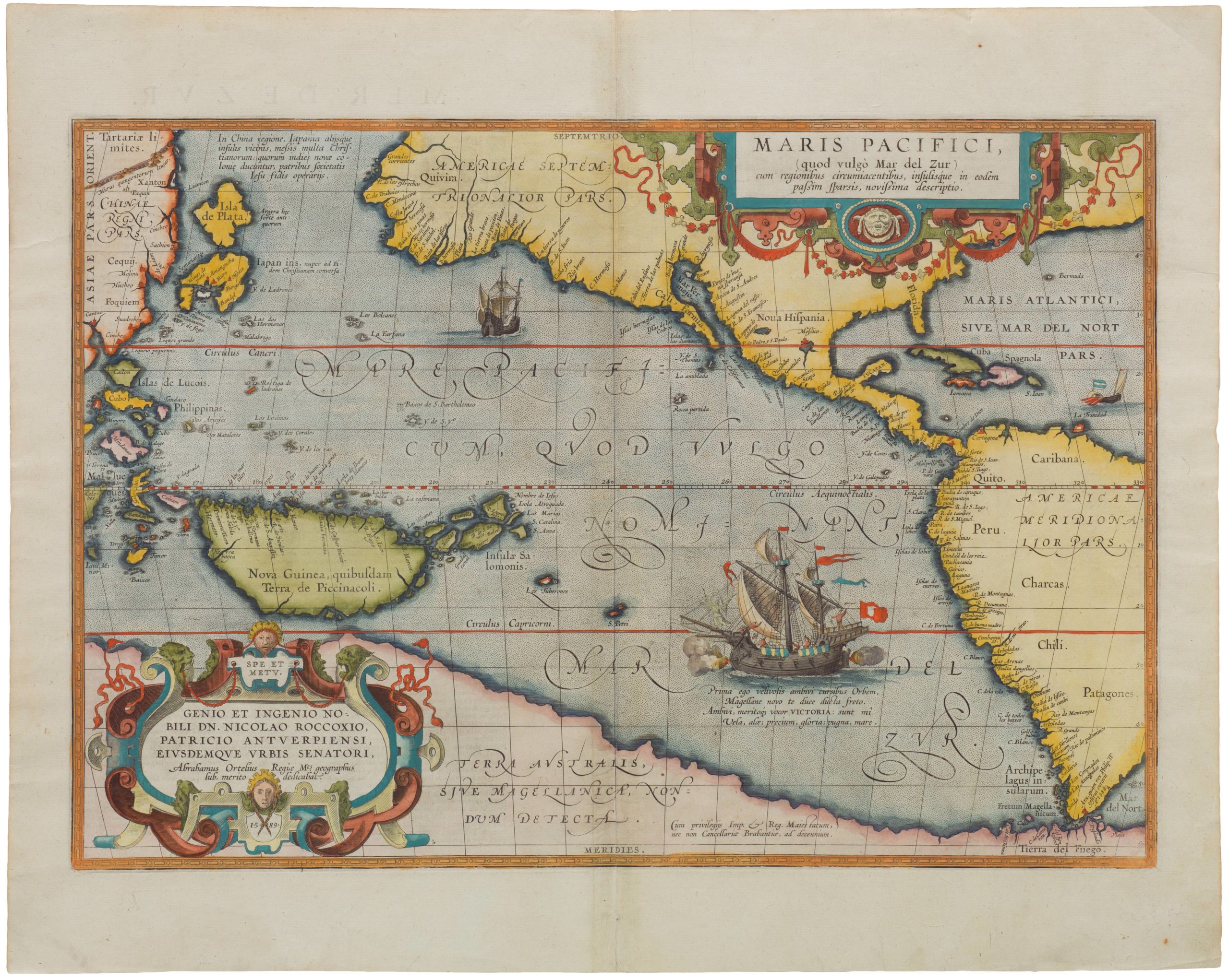
MARIS PACIFICI, (quod vulgó Mar del Zur) cum regionibus circumiacentibus, insulisque in eodem passim sparsis, novissima descriptio.
- Ortelius’ pioneering depiction of the Pacific Ocean.
- Read moreQuick View
-
- Out of Stock
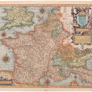
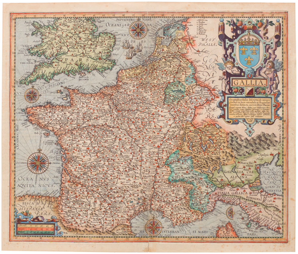
- France & Switzerland
Gallia Geographica Galliae descriptio, de integro plurimis in locis emendata ac Regionum limitibus distincta; auctore Petro Plancio…
- The famous Ortelius/Vrients map of Greater France.
- Read moreQuick View
-
- Out of Stock
- Asia, California, Pacific Northwest - Hawaii - Alaska
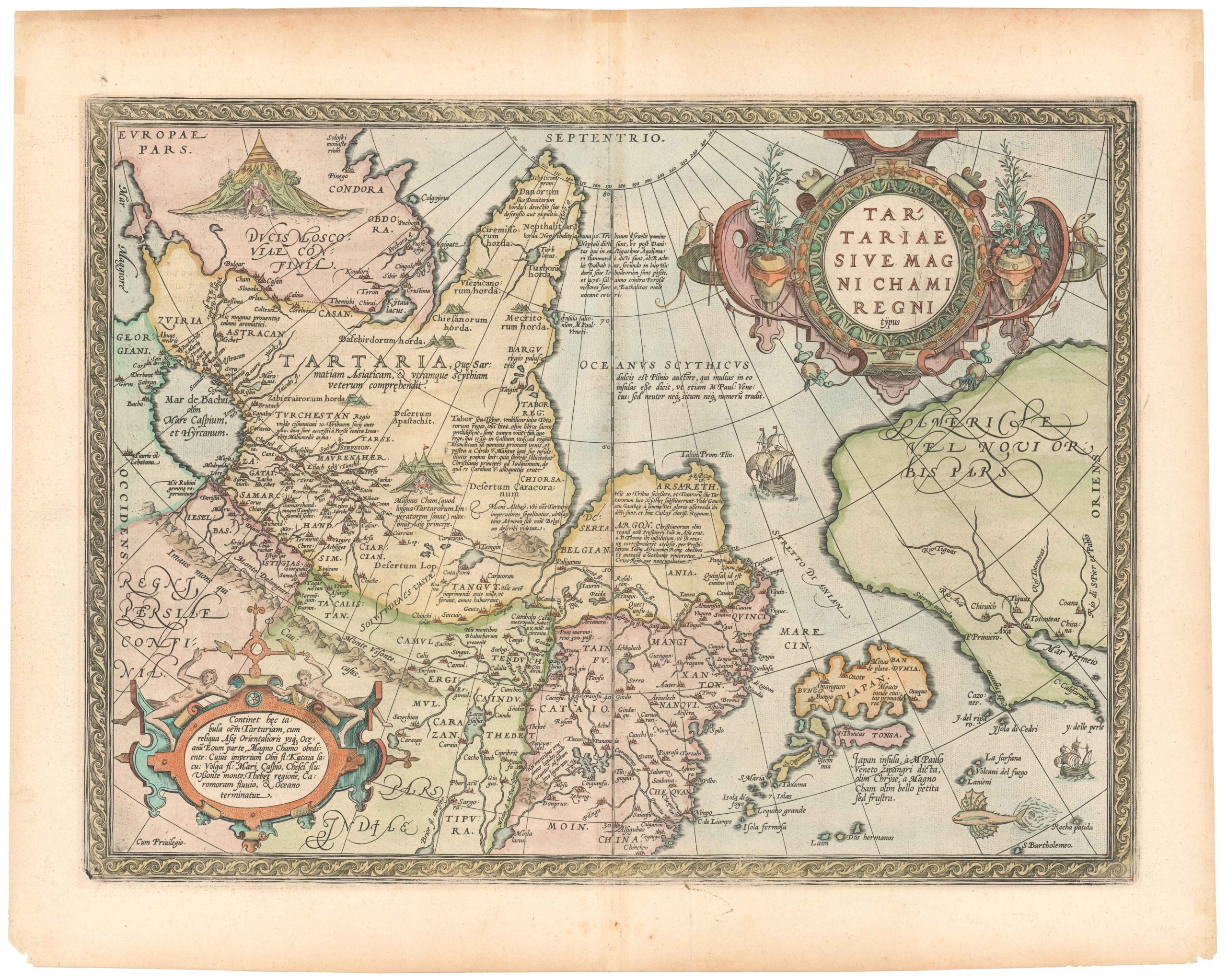
Tartariae Sive Magni Chami Regni Typus.
- From History's First Modern Atlas: a gorgeous Ortelius map of Asia with references to Marco Polo.
- Read moreQuick View
-
- Out of Stock
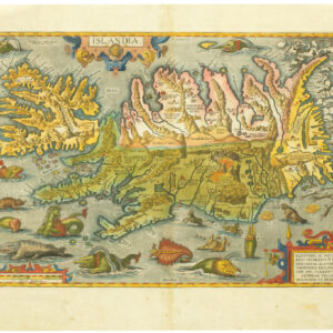
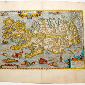
- Iceland & Scandinavia
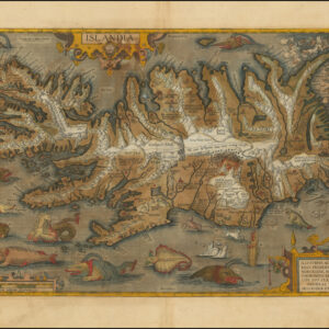
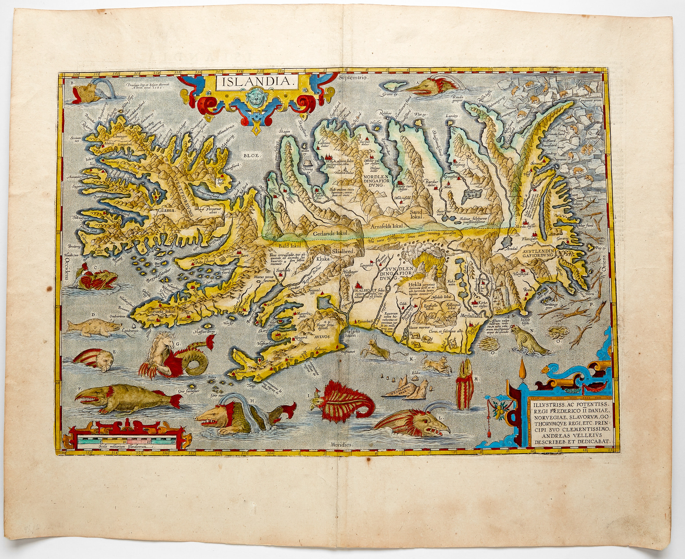
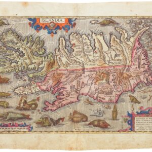
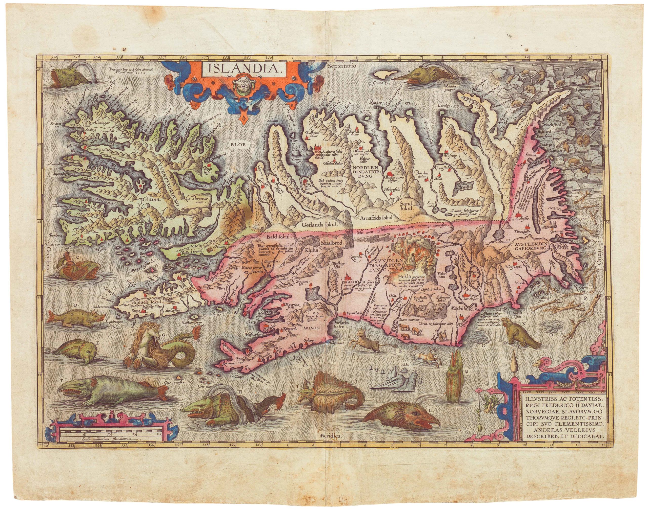
Islandia.
- The most decorative and famous map of Iceland ever produced.
- Read moreQuick View
-
- Out of Stock
- Iceland & Scandinavia
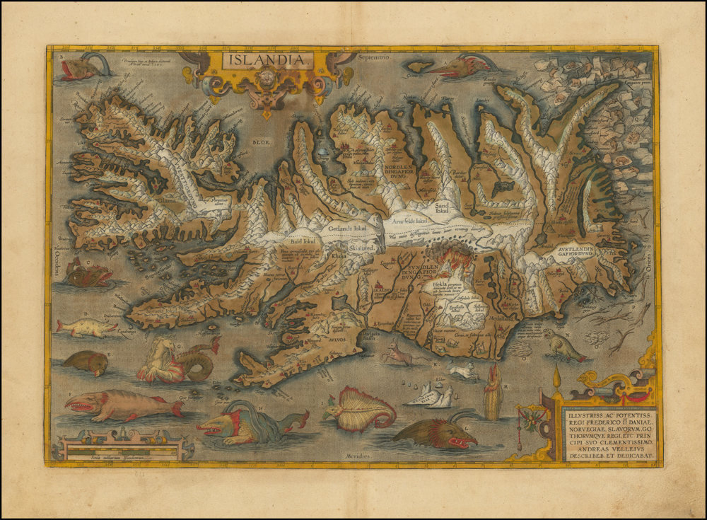
Islandia
- A beautifully preserved example of the most decorative and famous map of Iceland ever produced – with an additional hand-drawn sea-monster on the verso.
- Read moreQuick View
-
- Out of Stock
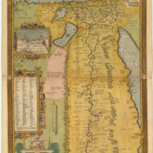
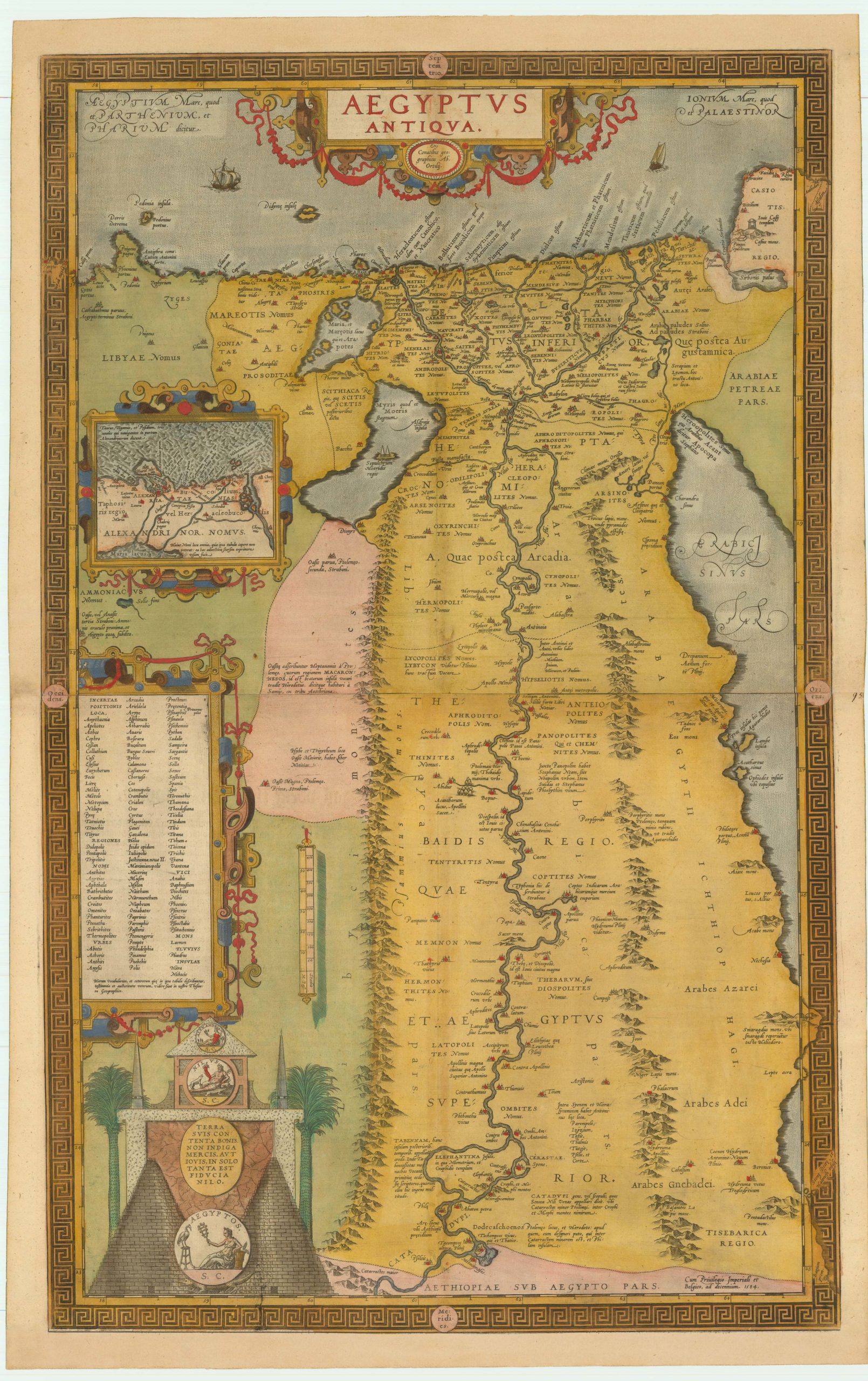
- Africa
Aegyptus Antiqua
- Stunning full color example of Ortelius's two-sheet map of Egypt.
- Read moreQuick View
-
- Out of Stock
- Iceland & Scandinavia
Islandia
- 1609 Ortelius extraordinary map of Iceland with Spanish text on verso
- Read moreQuick View
-
- Out of Stock
- Italy
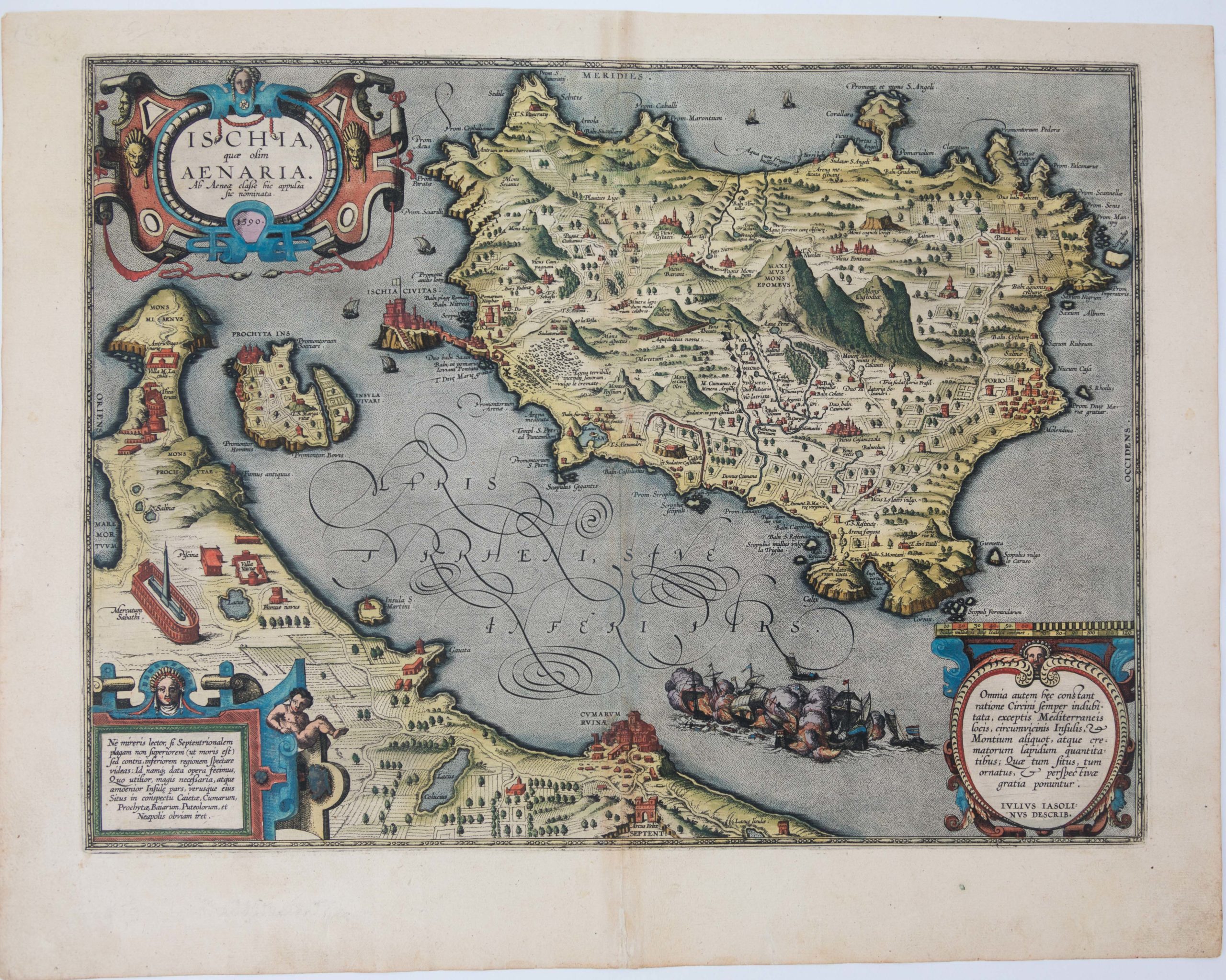
Ischia quae olim Aenaria
- 1590 old color Ortelius Island of Ischia.
- Read moreQuick View
-
- Out of Stock
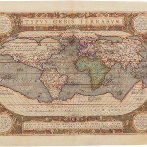
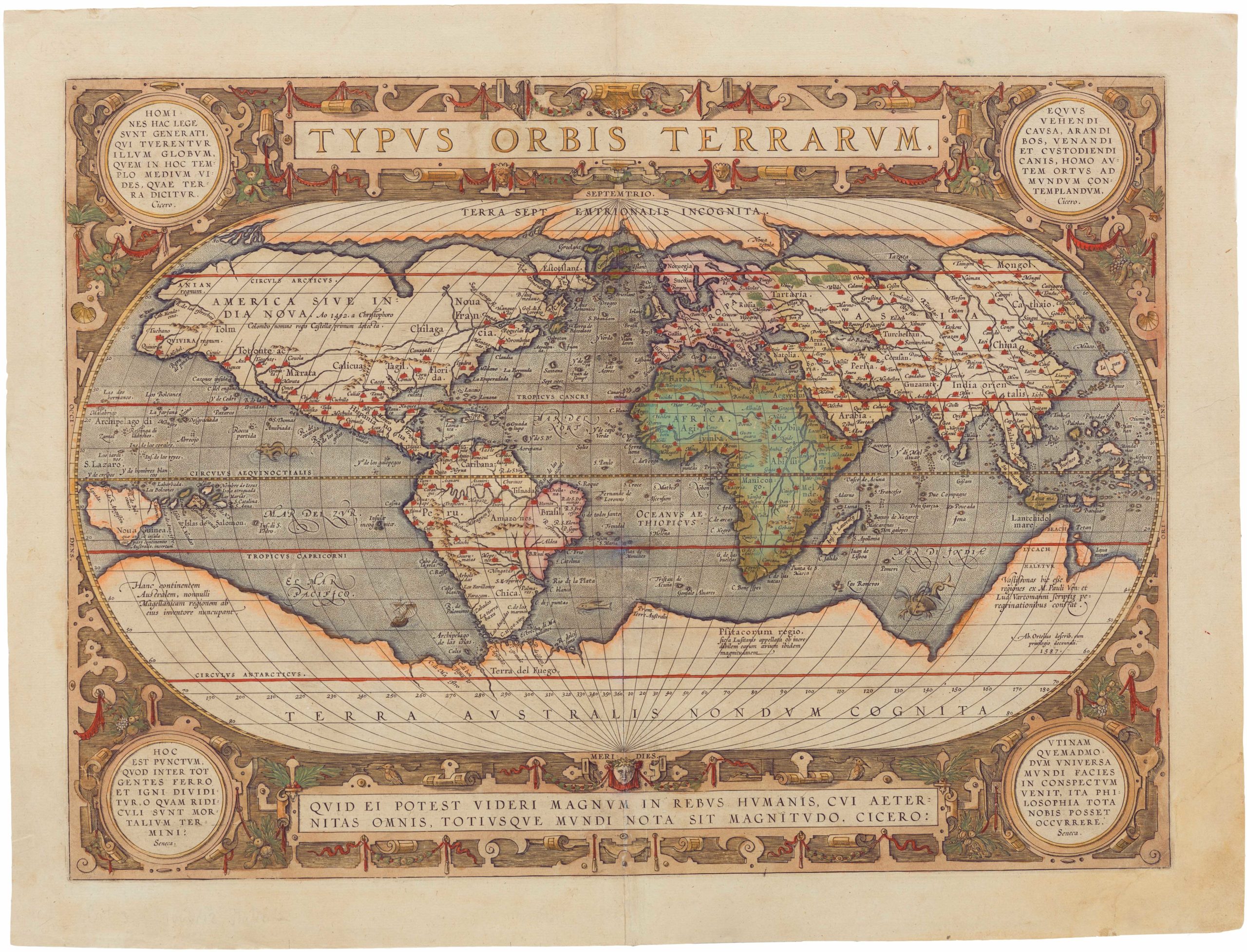
- Featured Maps & Views, World
Typus Orbis Terrarum
- Spectacular old color Ortelius world map showing the world as known in 1587.
- Read moreQuick View
-
-
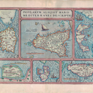
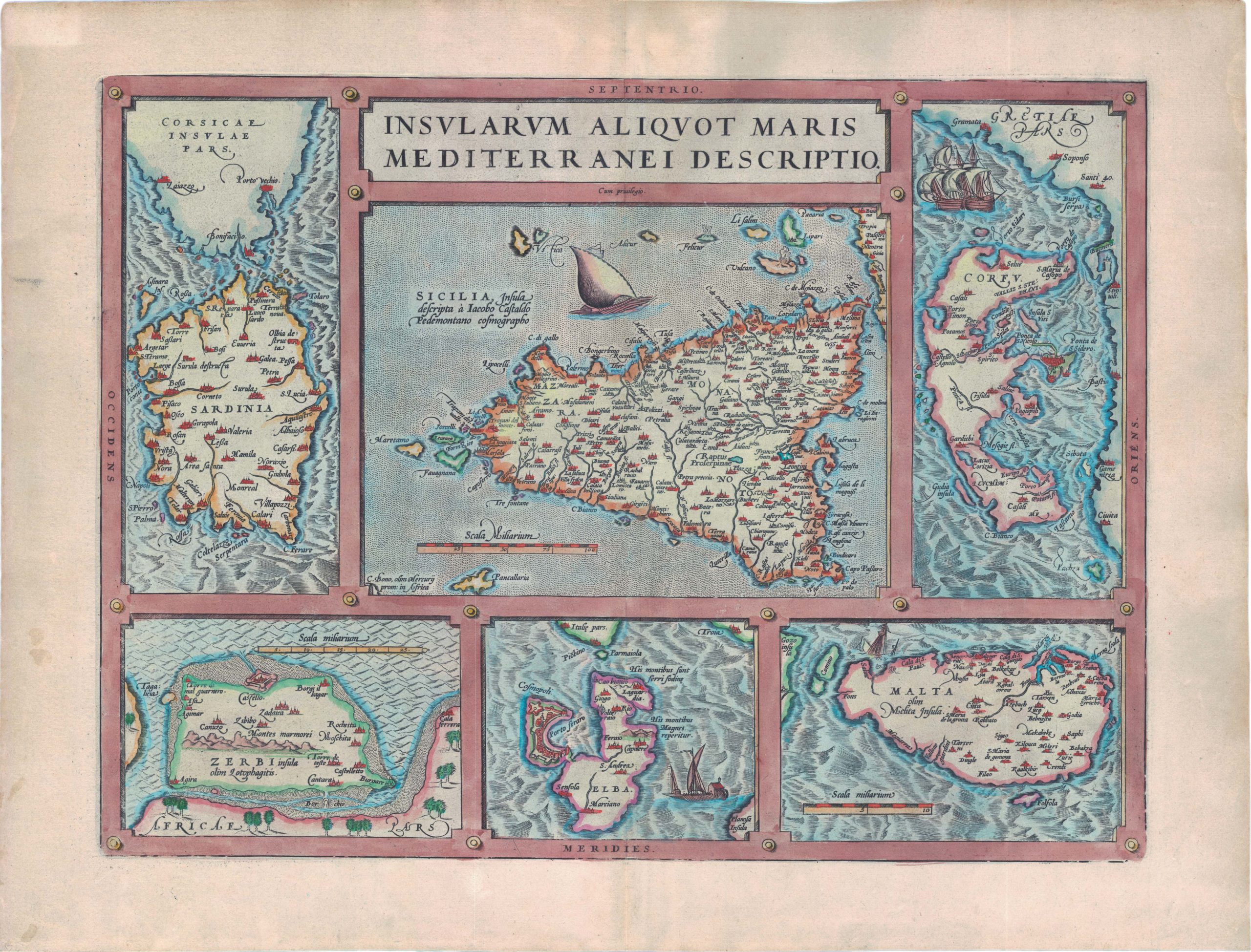
- Europe, Italy
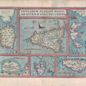
Insularum Aliquot Maris Mediterranei Descriptio
- 1587 Ortelius six maps in one: Sicily, Malta, Sardinia, Corfu, Elba, and Djerba.
- Add to cartQuick View
-
- Out of Stock
- Atlases & Books
Additamentum IV. Theatri Orbis Terrarum
- 1590 Ortelius including Islandia, Maris Pacifici, and many more.
- Read moreQuick View
-
- Out of Stock
- Asia
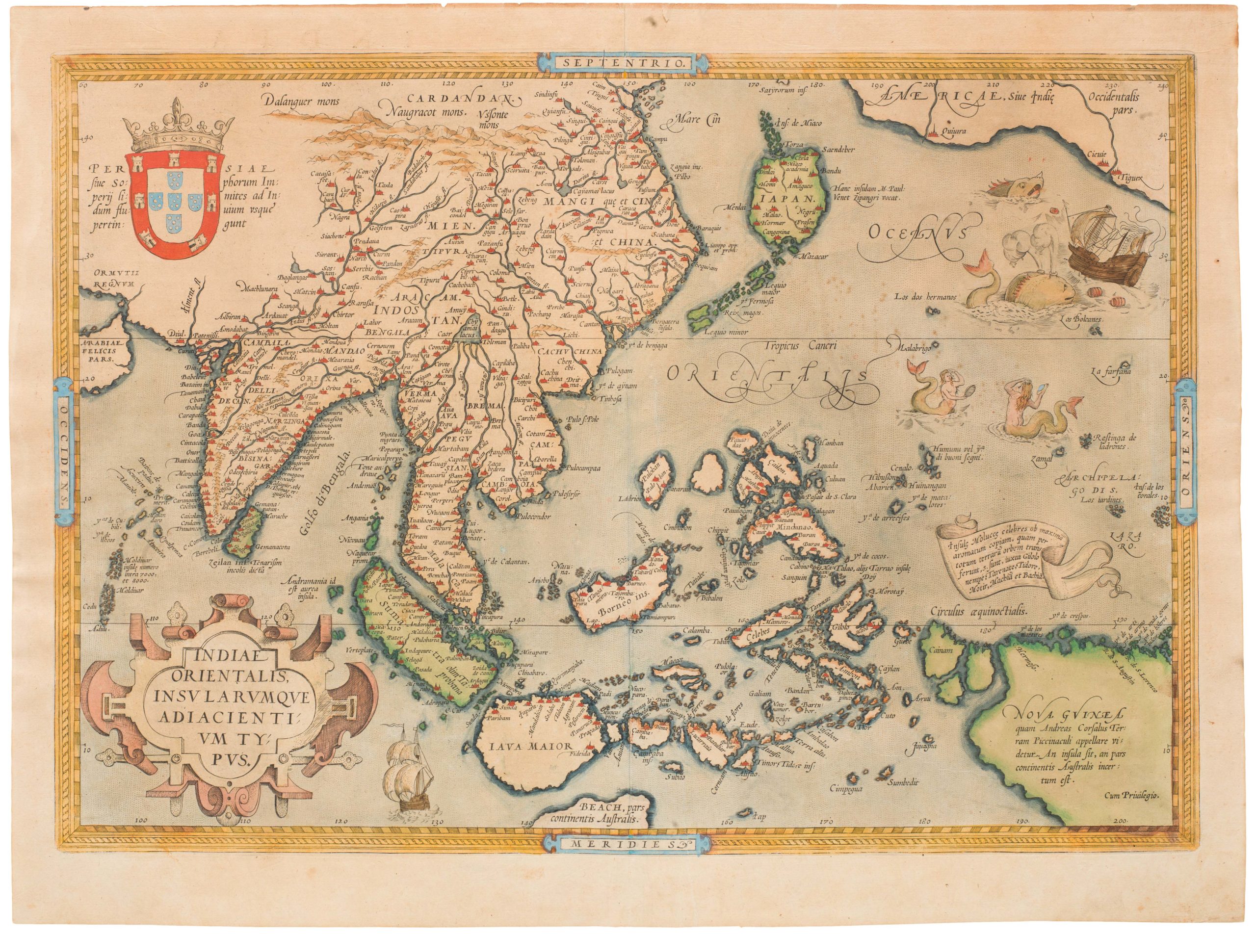
Indiae Orientalis, Insularumque Adiacentium Typus
- 1590 Ortelius map of Southeast Asia in original colors
- Read moreQuick View
-
- Out of Stock
- North America
Americae Sive Novi Orbis, Nova Descriptio
- The uncommon second plate of Ortelius's famous map of the Western Hemisphere in original colors.
- Read moreQuick View
-
- Out of Stock
- North America
Maris Pacifici
- Stunning 1595 example of Ortelius' landmark map of the Pacific Ocean.
- Read moreQuick View
-
- Out of Stock

- Mexico - Central & South America
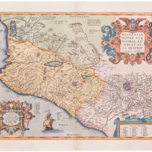
Hispaniae novae sive magnae recens et vera descriptio
- Ortelius's map of Mexico, one of the earliest printed maps of New Spain.
- Read moreQuick View
-
- Out of Stock
- Iceland & Scandinavia
Islandia
- Excellent old color Ortelius map of Iceland
- Read moreQuick View
-
- Out of Stock
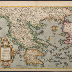
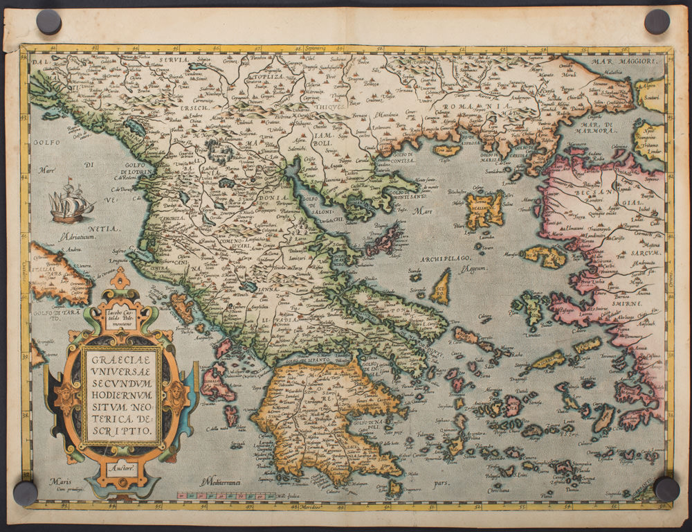
- Greece & the Balkans
Graeciae Universae Secundum Hodiernum Situm Neoterica Descriptio
- Ortelius Greece in attractive colors.
- Read moreQuick View
-
- Out of Stock
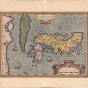
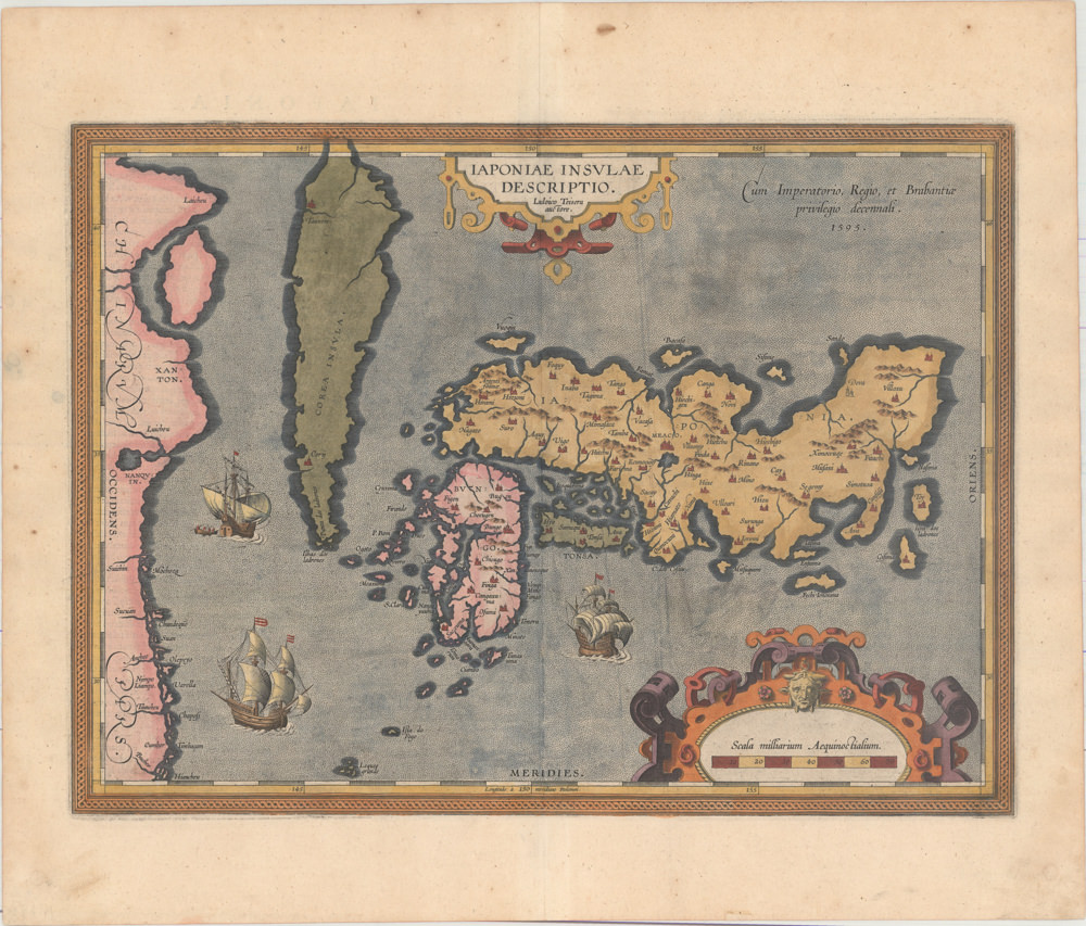
- Asia
Iaponiae Insulae Descriptio. Ludoico Teisera Auctore
- First map of Japan published in a European atlas.
- Read moreQuick View
-
- Out of Stock
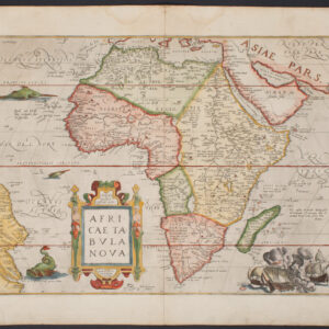
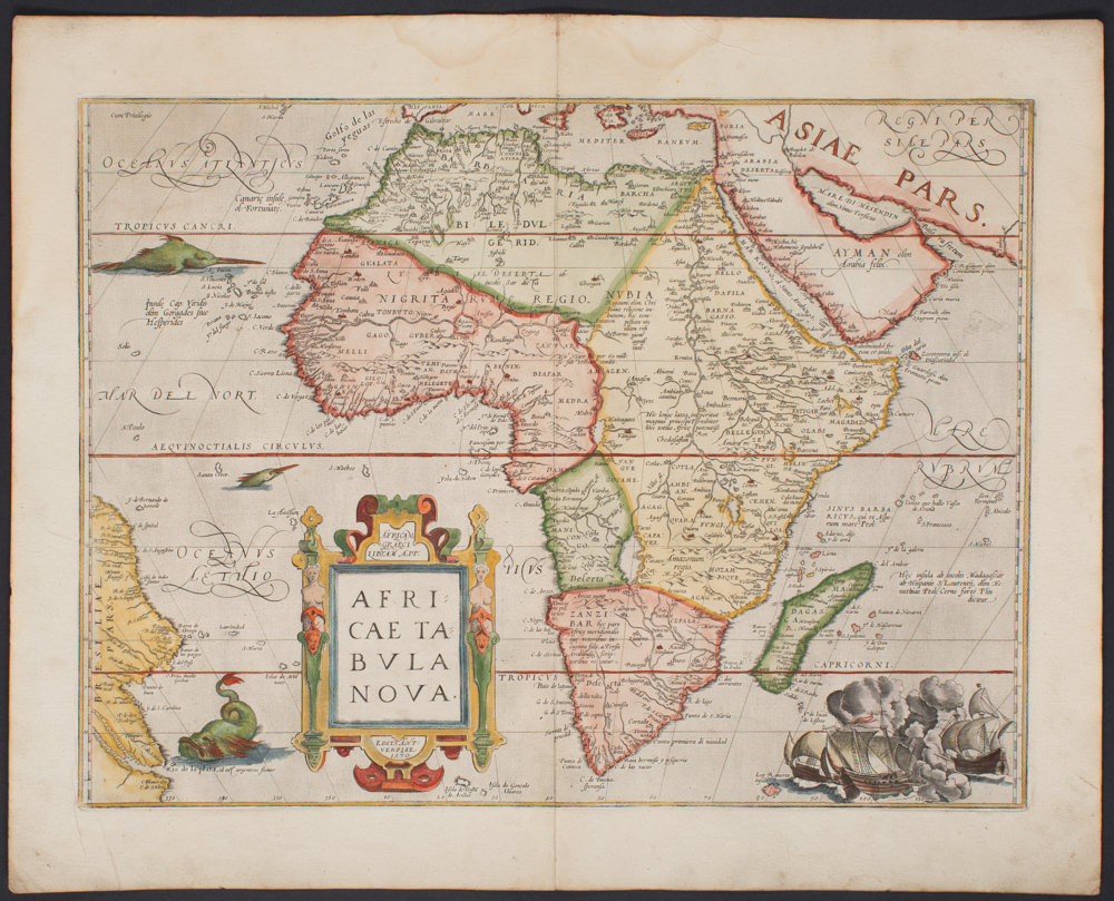
- Africa
Africae Tabula Nova
- Ortelius's gorgeous cornerstone map of Africa.
- Read moreQuick View
-
- Out of Stock
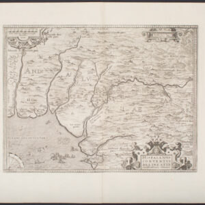
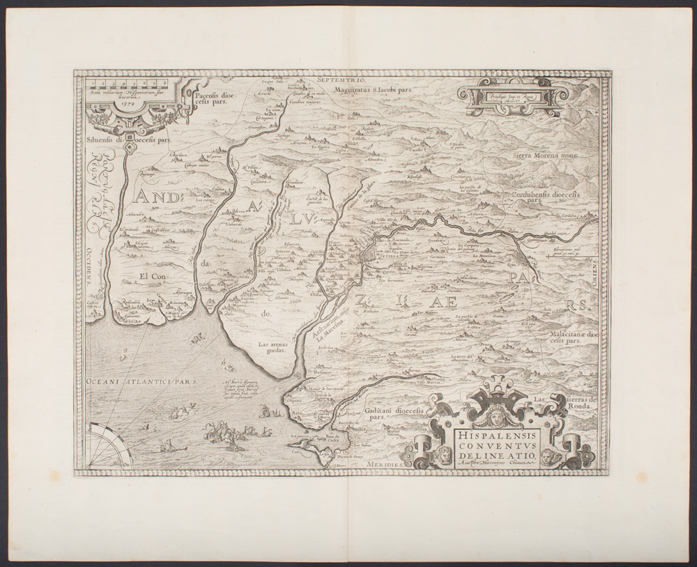
- Spain & Portugal
Hispalensis Conventus Delineatio, Auctore Hieronymo Chiaues
- 1579 Ortelius map of Southern Spain.
- Read moreQuick View
-
- Out of Stock
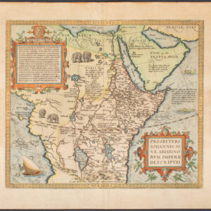
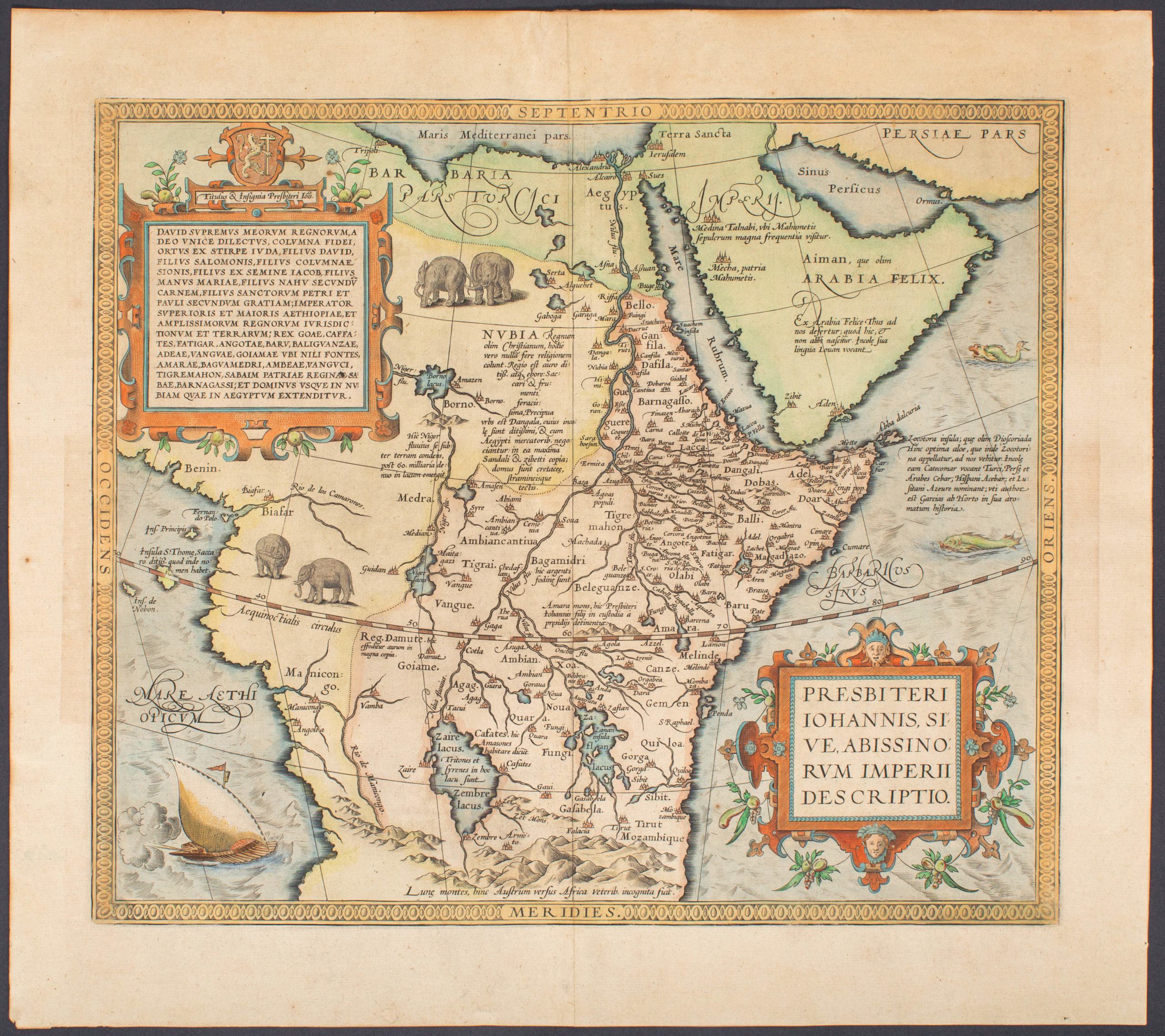
- Africa
Presbiteri Iohannis, sive, Abissinorum Imperii Descriptio
- 1598 map of East Africa with the mythical kingdom of Prester John.
- Read moreQuick View
-
- Out of Stock
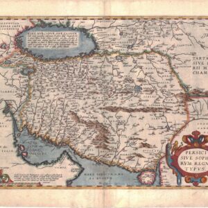
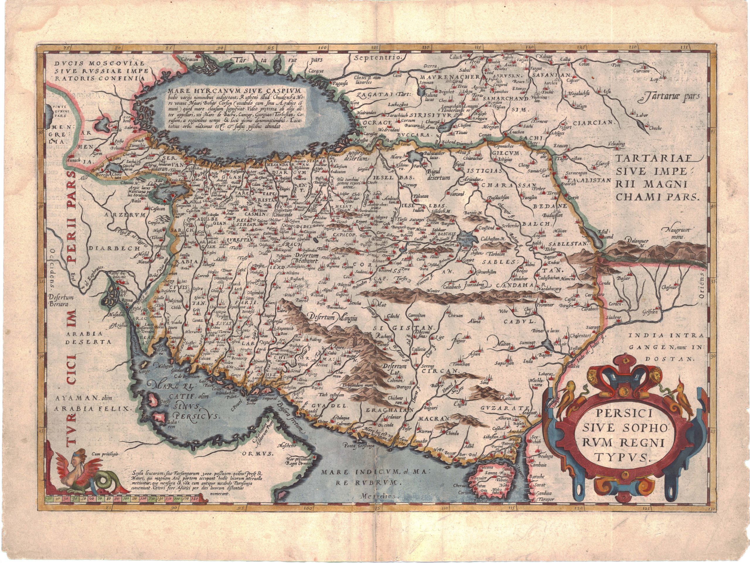
- Iran - Persia - Central Asia
Persici sive Sophorum Regni Typus
- Lovely 1601 Ortelius map of the Persian Empire
- Read moreQuick View
-