Frederick de Wit (1629–1706) was a Dutch cartographer and artist who drew, printed, and sold maps from his studio in Amsterdam. He was a pioneer of Dutch Golden Age cartography, and the founder of one of the most famous map-publishing houses in Amsterdam. He was born in Gouda but moved to Amsterdam at the end of the Thirty-Years-War (1618-48), which had engulfed most of Europe and ultimately liberated the Netherlands from centuries of Spanish dominion.
Soon after arriving in Amsterdam, probably in 1654, De Wit opened a printing shop named The Three Crabs (De Drie Crabben). A year or two before, he had married Maria van der Way, the daughter of a wealthy Catholic merchant, and this may have helped secure the funding to start his new operation. His aspirations as a cartographer were nevertheless made clear when he shortly after changed the name to The White Chart (Het Witte Pascaert), under which he gained international renown.
In the latter half of the century, De Wit began drawing, copying, and publishing atlases and maps. By the 1670s he was issuing large folios with up to a hundred maps in each tome, including a famous nautical atlas in 1675. From 1689, De Wit received a state privilege from the Dutch government to draw and issue maps. This protected his work from the illegal copying known from his earlier charts. De Wit was among the first to apply extensive coloring and his original color atlases and continental charts remain highly sought after to this day.
Following De Wit’s death in 1706, his wife ran the business for four years before selling it at auction in 1710. Their only surviving son was a successful merchant in his own right and had no interest in taking over. At the 1710 auction, most of De Wit’s plates were sold to Pieter Mortier, another Amsterdam cartographer and engraver. After passing the firm to his son, who teamed up with Johannes Covens, the firm became Covens & Mortier, the largest cartographic publisher of the eighteenth century.
-
-
Add to cart
 Quick View
 - Europe, France & Switzerland
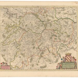
Ducatus Burgundiae Nova Descriptio Divisa, Correcta, et Edita.
- $475
- A gorgeous, old color 17th-century map of the Bourgogne wine district.
-
-
-
-
Add to cart
 Quick View
 - Europe, Russia & Eastern Europe
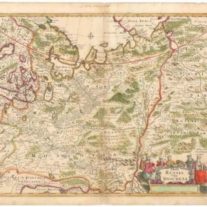
Tabula Russia Vulgo Moscovia.
- $425
- A grand depiction of the Russian Empire by one of the best representatives of the Golden Age of Dutch cartography.
-
-
-
-
Add to cart
 Quick View
 - British Isles
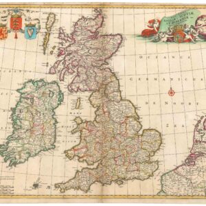
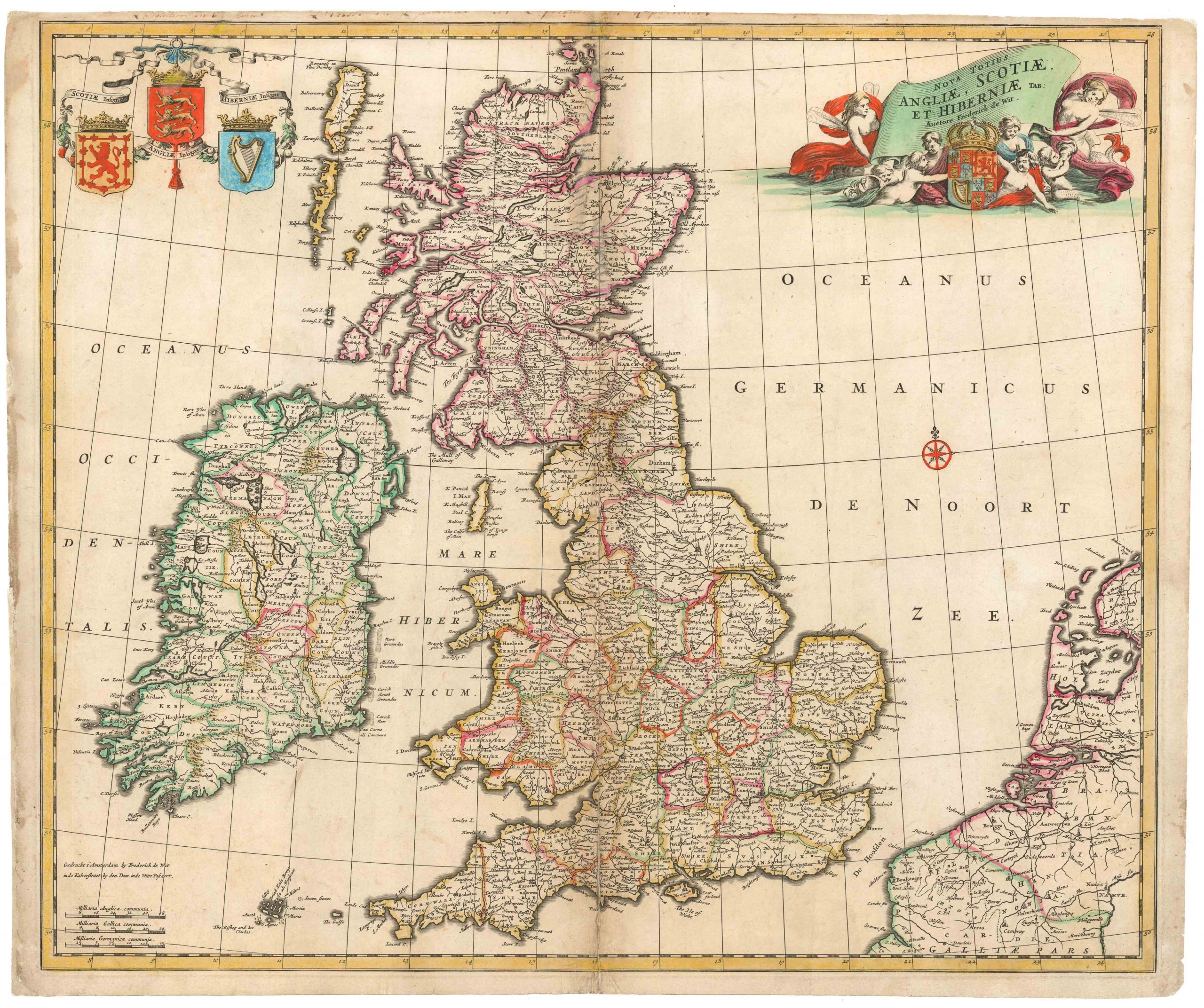
Nova totius Angliae, Scotiae et Hiberniae
- $450
- Frederick de Wit’s large folio of the British Isles in old color.
-
-
-
Archived
- Out of Stock
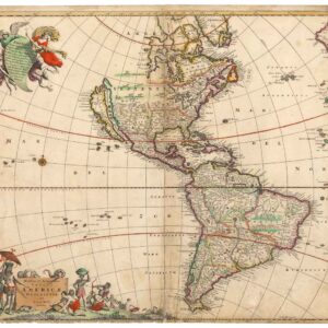
- North America
Novissima et Accuratissima Totius Americae Descriptio.
- De Wit's magnificent chart of the still partly obscure American continents.
- Read moreQuick View
-
- Out of Stock
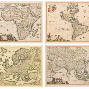
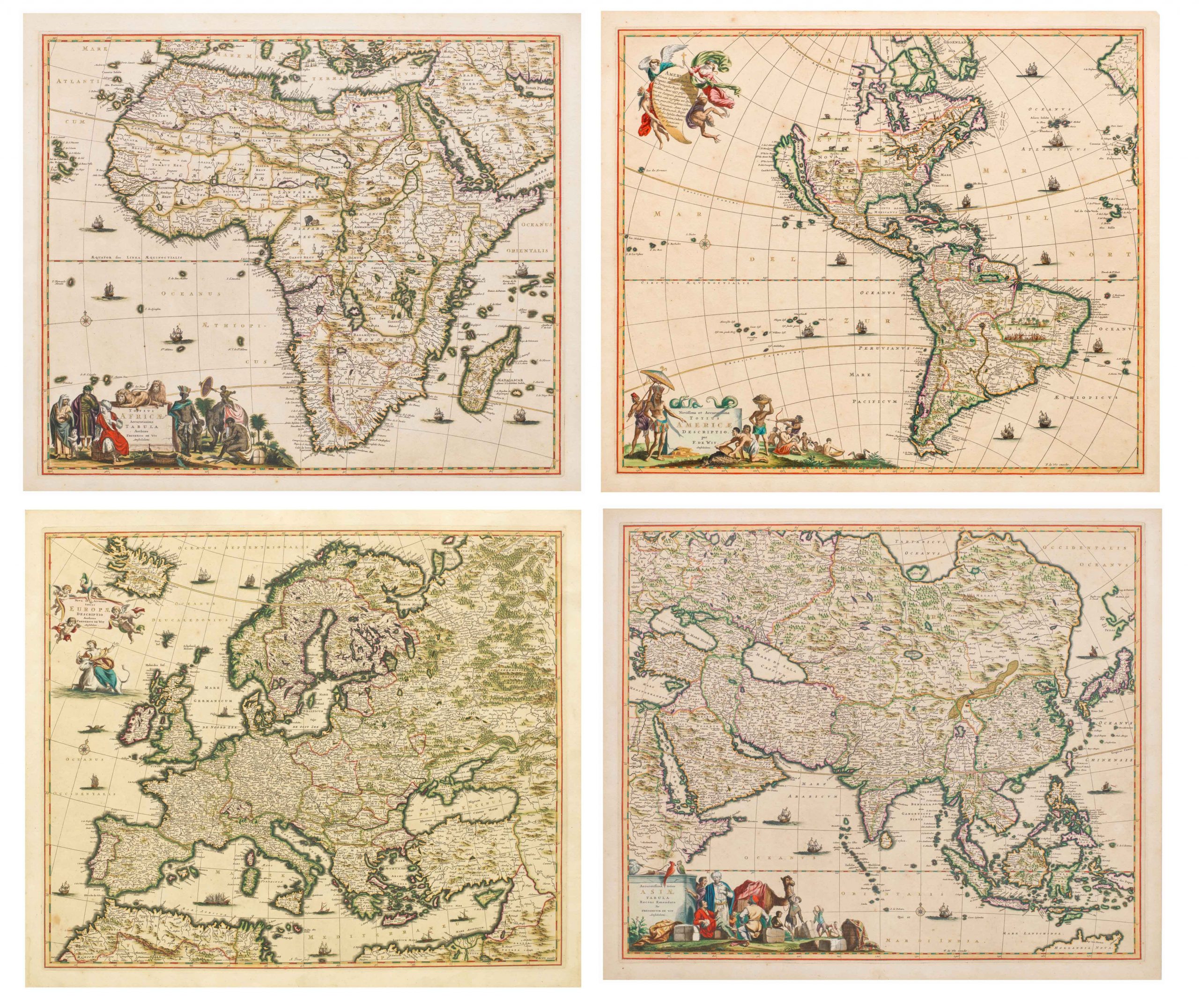
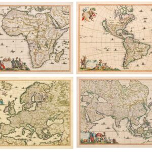
- Africa, Asia, Europe, Featured Maps & Views, North America
Novissima et accuratissima totius Americae descriptio; Accuratissima totius Asiae tabula recens emendata; Totius Africae accuratissima tabula; & Nova et accurata totius Europae descriptio. Per FREDERICUM DE WIT.
- A spectacular set of four continental maps, likely colored by Dirk Janz van Santen, the finest cartographic colorist of the Dutch Golden Age.
- Read moreQuick View
-
- Out of Stock
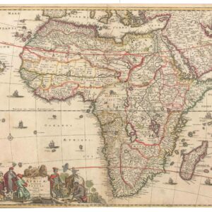
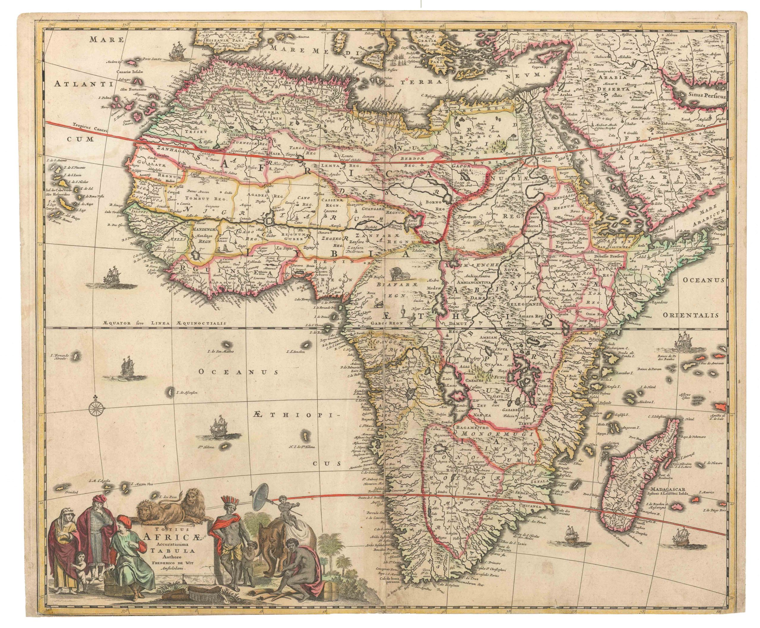
- Africa
Novissima et Perfectissima Africae Descriptio
- De Wit's Africa triumph in lovely old color.
- Read moreQuick View
-
- Out of Stock
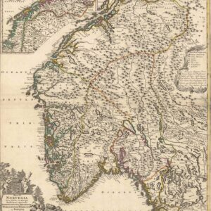
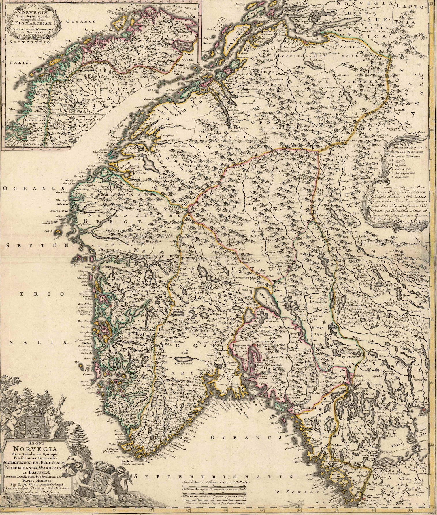
- Iceland & Scandinavia
Regni Norvegia Nova Tabula In Quinque Praefecturas Generalis Aggerhusiensem, Bergensem, Nidrosiensem, Warhusiae Et Bahusiae
- Frederik de Wit’s intricate map of Norway in old color.
- Read moreQuick View
-
- Out of Stock
- Iceland & Scandinavia
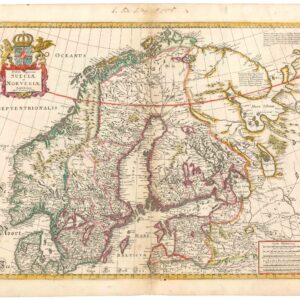
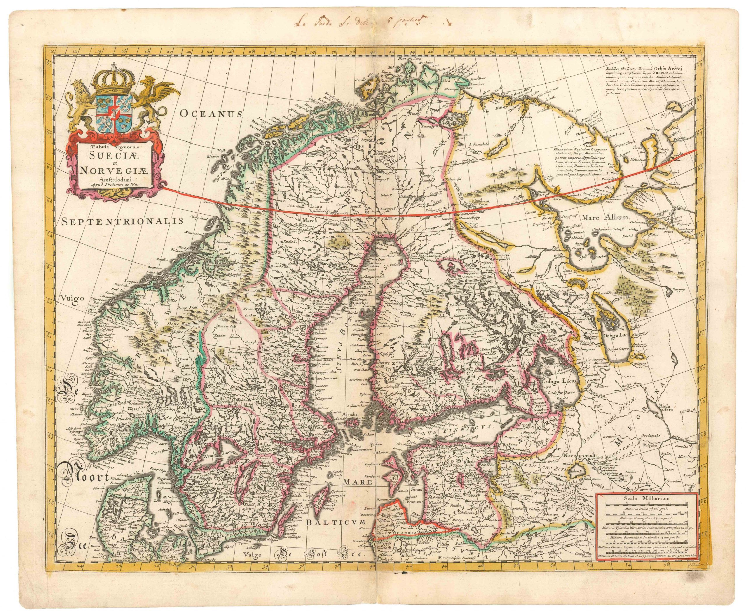
Tabula Regnorum Sueciae et Norvegiae
- Gorgeous old color 17th century De Wit map of Scandinavia.
- Read moreQuick View
-
- Out of Stock
- Eastern Mediterranean - Holy Land
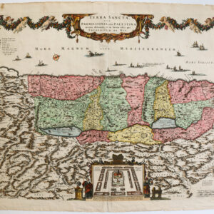
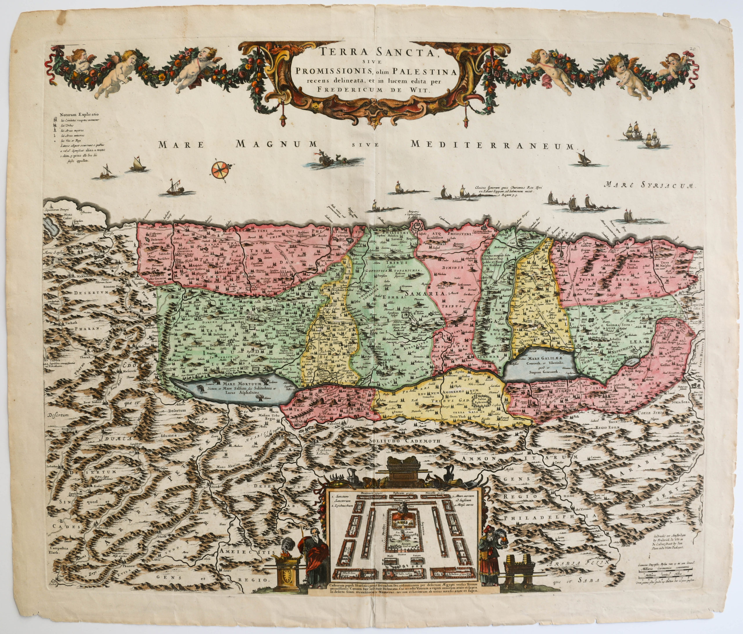
Terra Sancta, sive Promissionis, olim Palestina Recens Delineata, et in Lucem Edita
- 1680 De Wit map of the Holy Land with Jerusalem
- Read moreQuick View
-
- Out of Stock
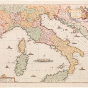
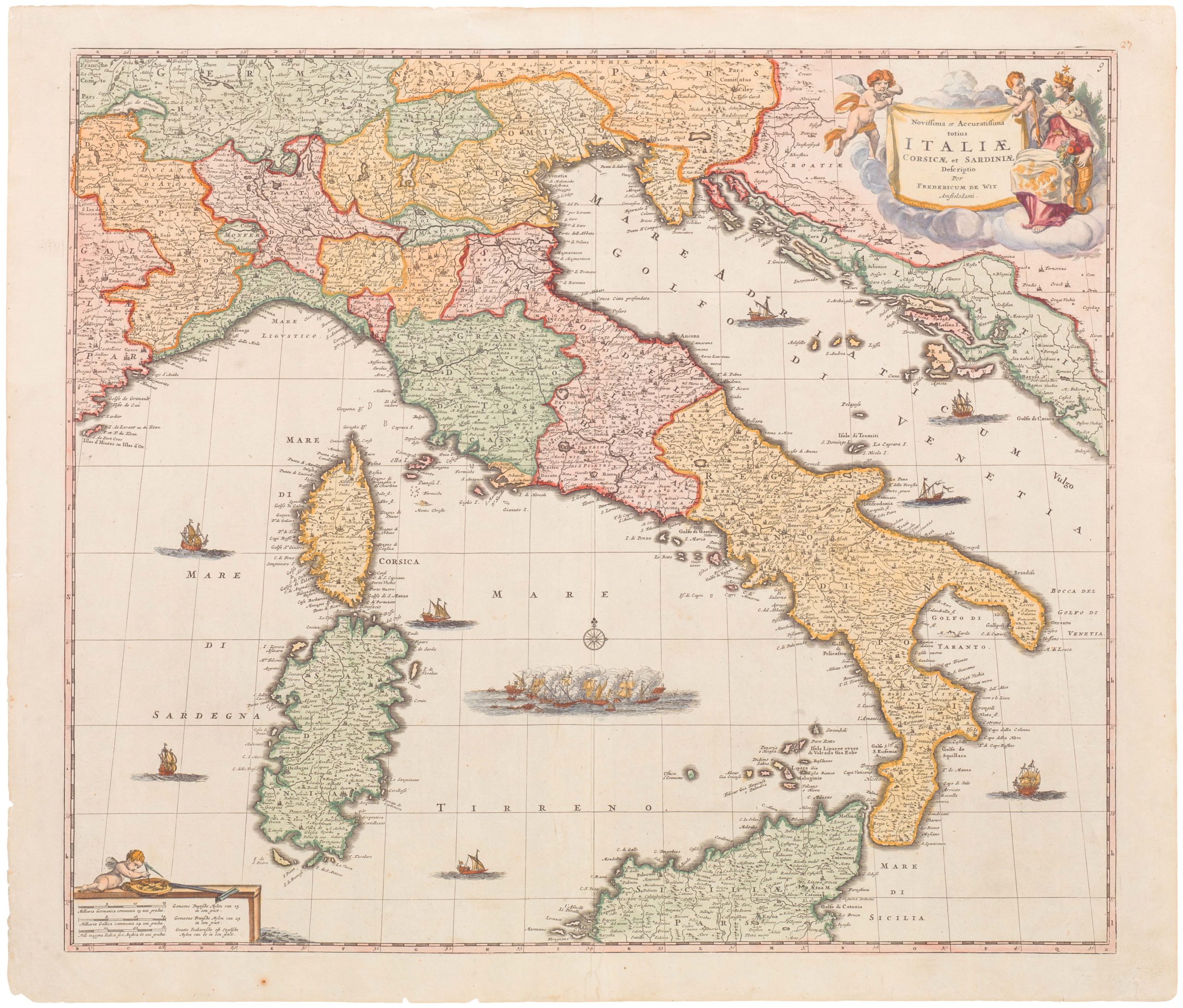
- Italy
Novissima et Accuratissima totius Italiae Corsicae et Sardiniae Descriptio
- Lovely 17th century Dutch map of Italy.
- Read moreQuick View
-
- Out of Stock
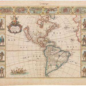
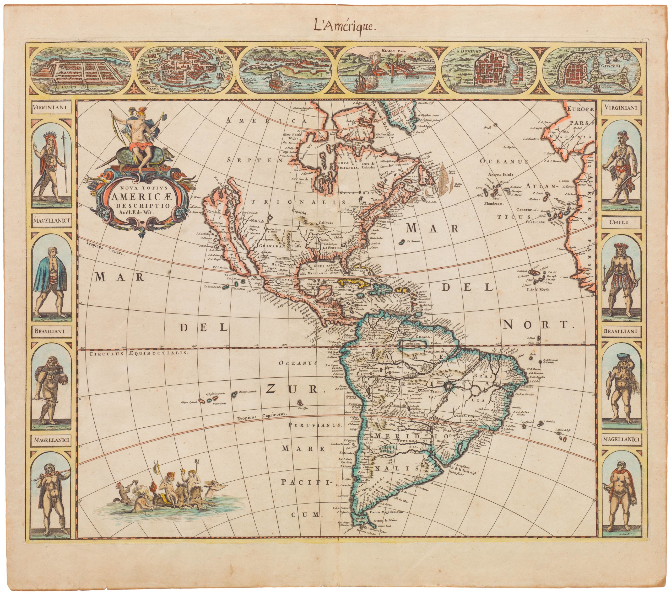
- North America
Nova Totius Americæ Descriptio
- De Wit's superb western hemisphere with carte-à-figures and Island of California.
- Read moreQuick View
-