-
-
Add to cart
 Quick View
 - East & Midwest United States, Featured Maps & Views, United States
Gettysburg Battle-Field.
- $2,400
- Bachelder's iconic 1863 view of the Battle of Gettysburg.
-
-
-
-
Add to cart

 Quick View
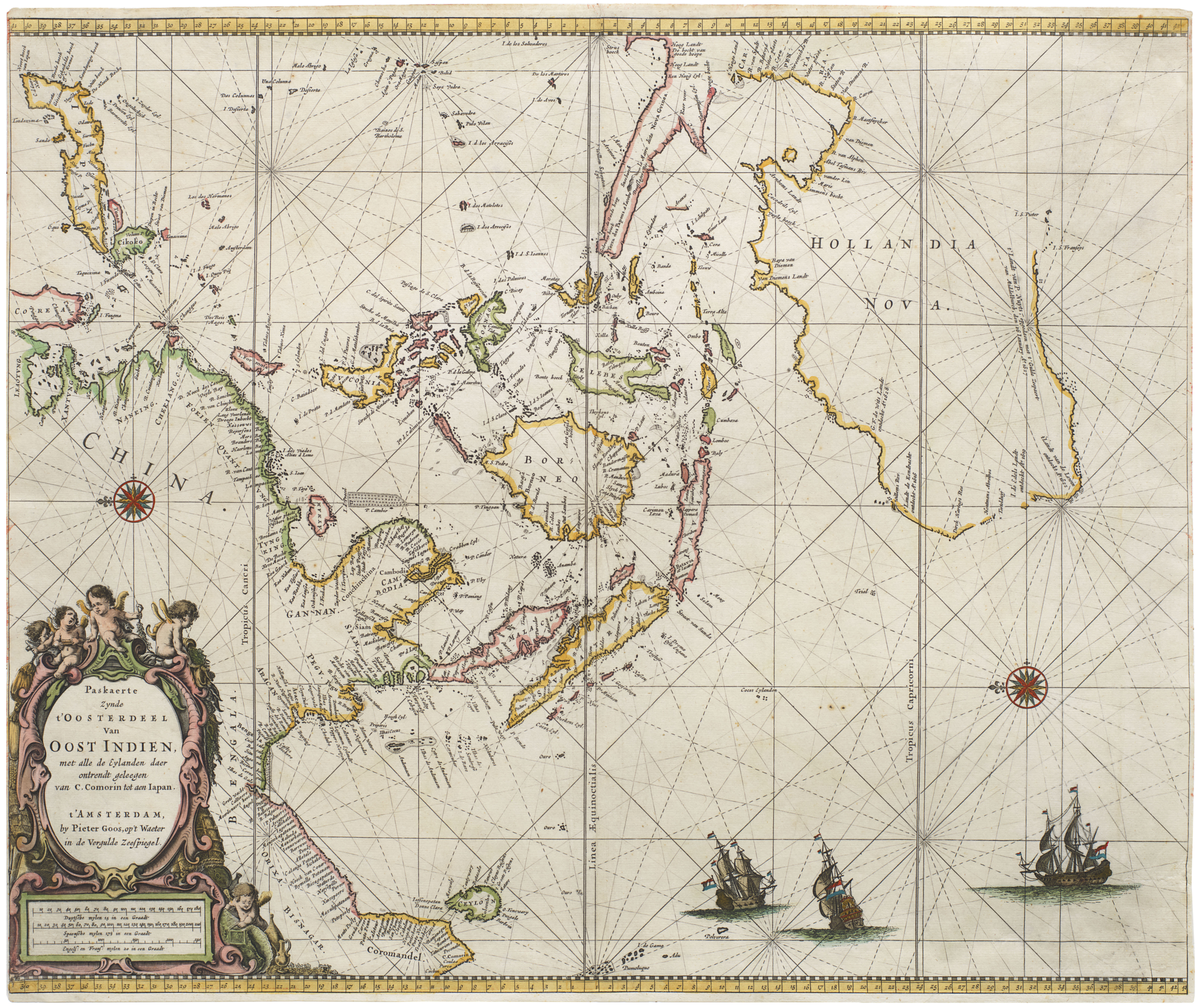
 - Asia, Featured Maps & Views, Southeast Asia & Australia
Paskaerte Zynde t’Oosterdeel van Oost Indien, met Alle de Eylanden daer Ontrendt Geleegen van C. Comorin tot aen Japan
- $6,500
- [Early color] Pieter Goos’ Striking Sea Chart of Southeast Asia, Australia, and the Indian Ocean.
-
-

-
-
-
Add to cart
![PORT OF SAN FRANCISCO. WHERE THE FAR EAST BEGINS [Japanese language version]](https://neatlinemaps.com/wp-content/uploads/2021/01/NL-00879_Thumbnail-300x300.jpg)
![PORT OF SAN FRANCISCO. WHERE THE FAR EAST BEGINS [Japanese language version]](https://neatlinemaps.com/wp-content/uploads/2021/01/NL-00879_Thumbnail.jpg) Quick View
Quick View - Bird's-eye-views, San Francisco
PORT OF SAN FRANCISCO. WHERE THE FAR EAST BEGINS [Japanese language version]
- $875
- Rare Japanese language bird's-eye-view in the style of Saul Steinberg showing the port of San Francisco as the gateway to Pacific commerce.
-
-
-
-
-
Add to cart

 Quick View
 - Bird's-eye-views, California, Pictorial maps, San Francisco
Bart Opens Embarcadero. First port o’call in San Francisco
- $475
- Celebrating public transit -- a pictorial view of downtown San Francisco announcing the 1976 opening of the Embarcadero BART station.
-
-
-
-
-
Add to cart
 Quick View
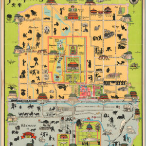
 - Asia, Pictorial maps
Peiping
- $1,250
- John Kirk Sewall's famous pictorial 1930 map of Beijing.
-
-
-
-
-
Add to cart
 Quick View
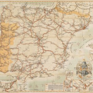
 - Europe, Spain & Portugal
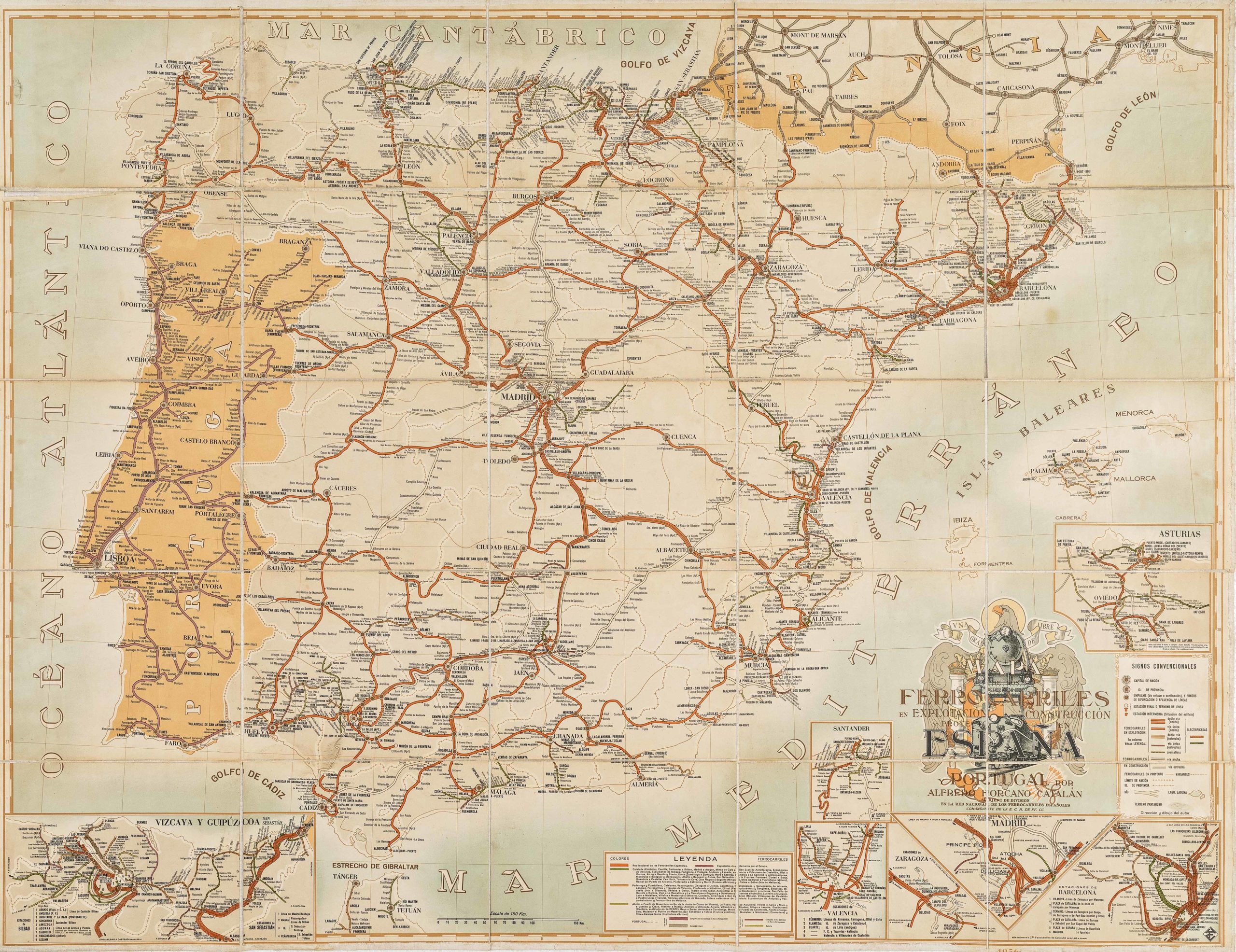
Mapa de los ferrocarriles en explotación, construcción y proyecto en España y Portugal
- $775
- Absolutely gorgeous 1956 railroad map of Spain and Portugal with Francoist coat-of-arms.
-
-
-
-
-
-
Add to cart

 Quick View
 - Europe, France & Switzerland, Bird's-eye-views
Klassischer Boden oder Malerisches Relief des Vierwaldstättersees / Plan Pittoresque du Lac des IV Cantons 1853. Lith Frères Eglin à Lucerne.
- Spectacular panoramic view of Lake Lucerne, with dynamic topographic relief and pictorial cities and towns.
-
-
-

-
-
-
Add to cart
 Quick View
 - World
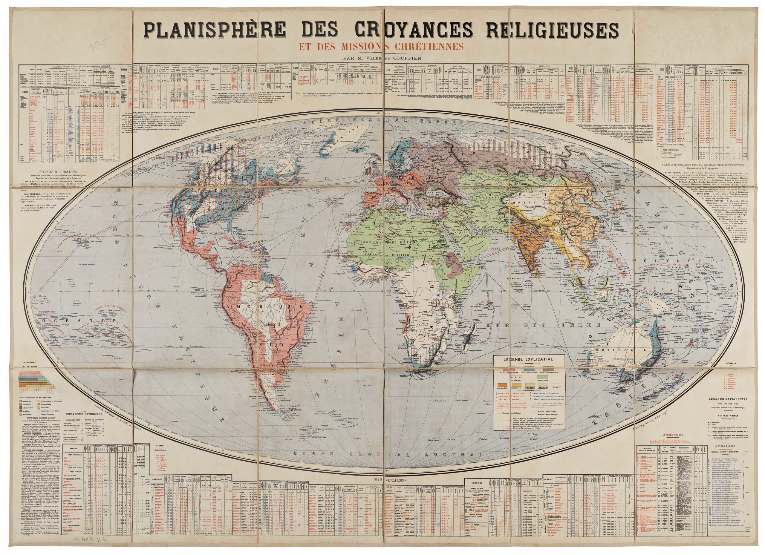
Planisphère des Croyances Religieuses et des Missions Chrétiennes
- $975
- Up-to-date statistical map presenting the worldwide distribution of religions in the late 19th century.
-
-
-
-
-
Add to cart

 Quick View
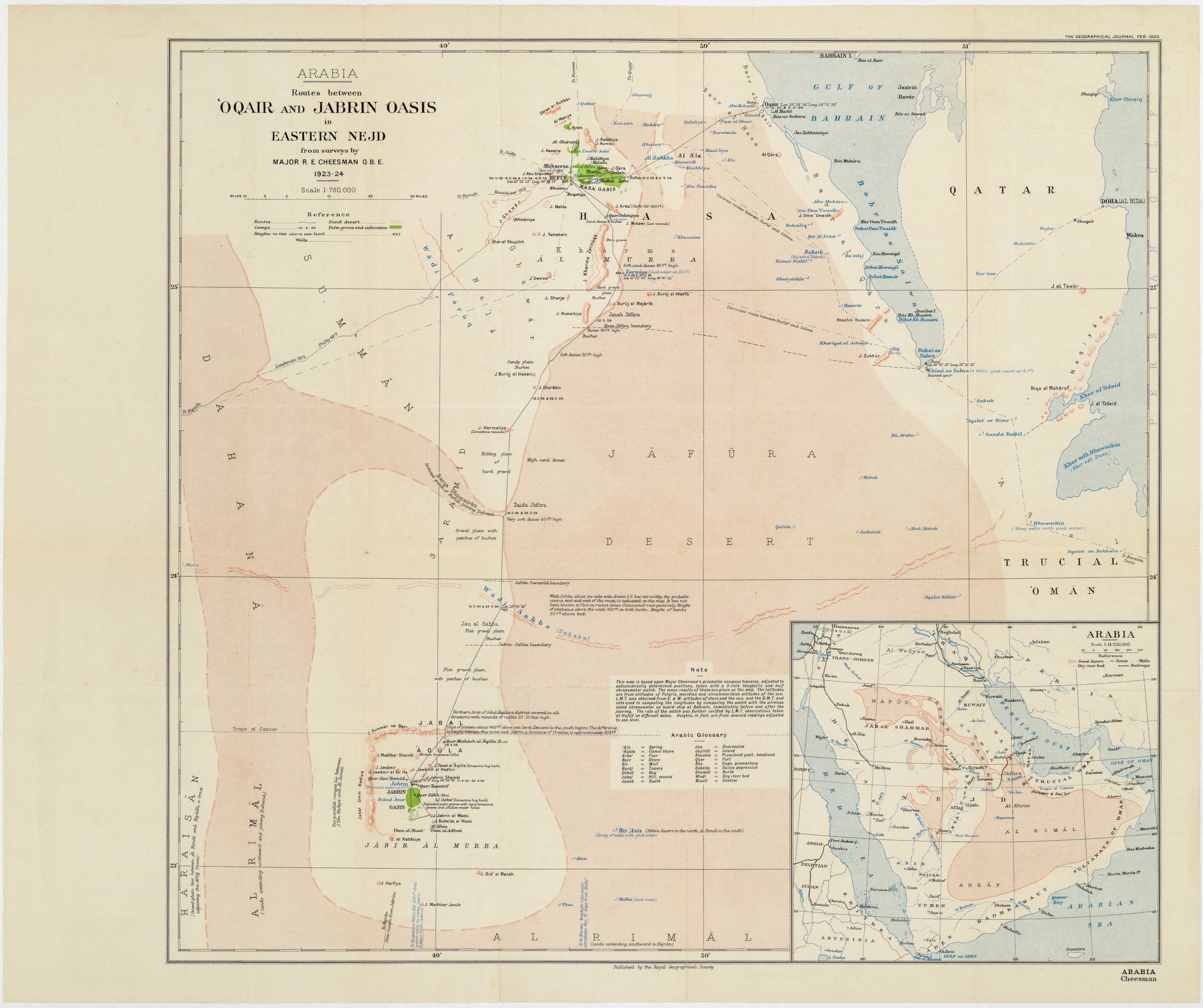
 - Arabia and the Red Sea
Routes between ‘Oqair and Jabrin Oasis in Eastern Nejd from surveys by Major R.E. Cheesman O.B.E. 1923-24
- $700
- A pioneering expedition for the mapping of the Arabian coast from the Gulf of Salwah to Uqair.
-
-
-
-
-
Add to cart

 Quick View
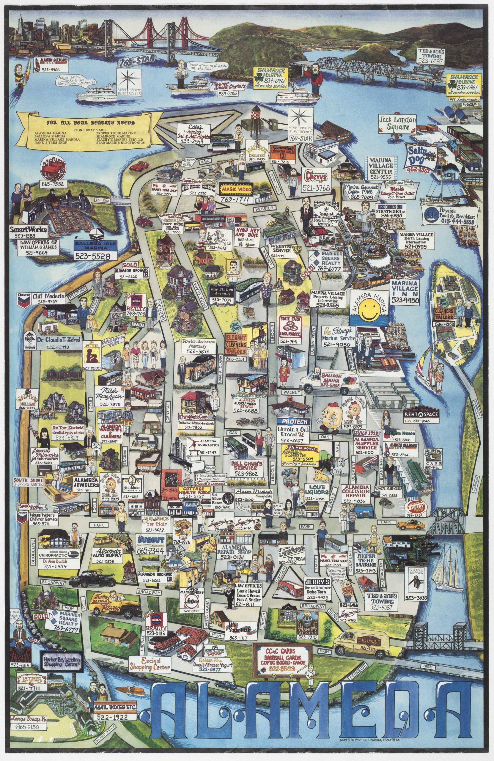
 - Bay Area & Silicon Valley, Pictorial maps
Alameda
- $545
- 1990 Alameda business map with illustrations of individual owners -- perhaps you know someone on the map?
-
-
-
-
-
Add to cart
 Quick View
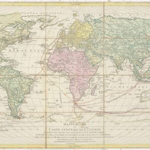
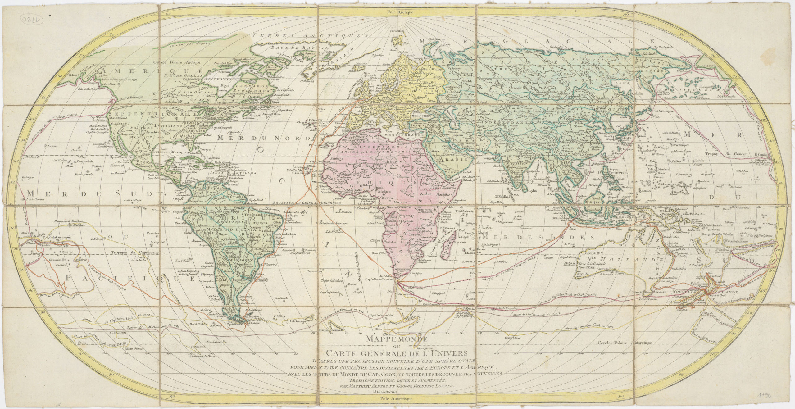
 - World
Mappe Monde ou Carte Generale de L’ Univers D’Apres Une Proejction Nouvelle D’Une Sphere Ovale…
- $600
- Charting Captain James Cook - 1790 world map with Cook's three voyages and Hawaii (O-Why-hee).
-
-
-
-
-
Add to cart
 Quick View
 - Bay Area & Silicon Valley, San Francisco
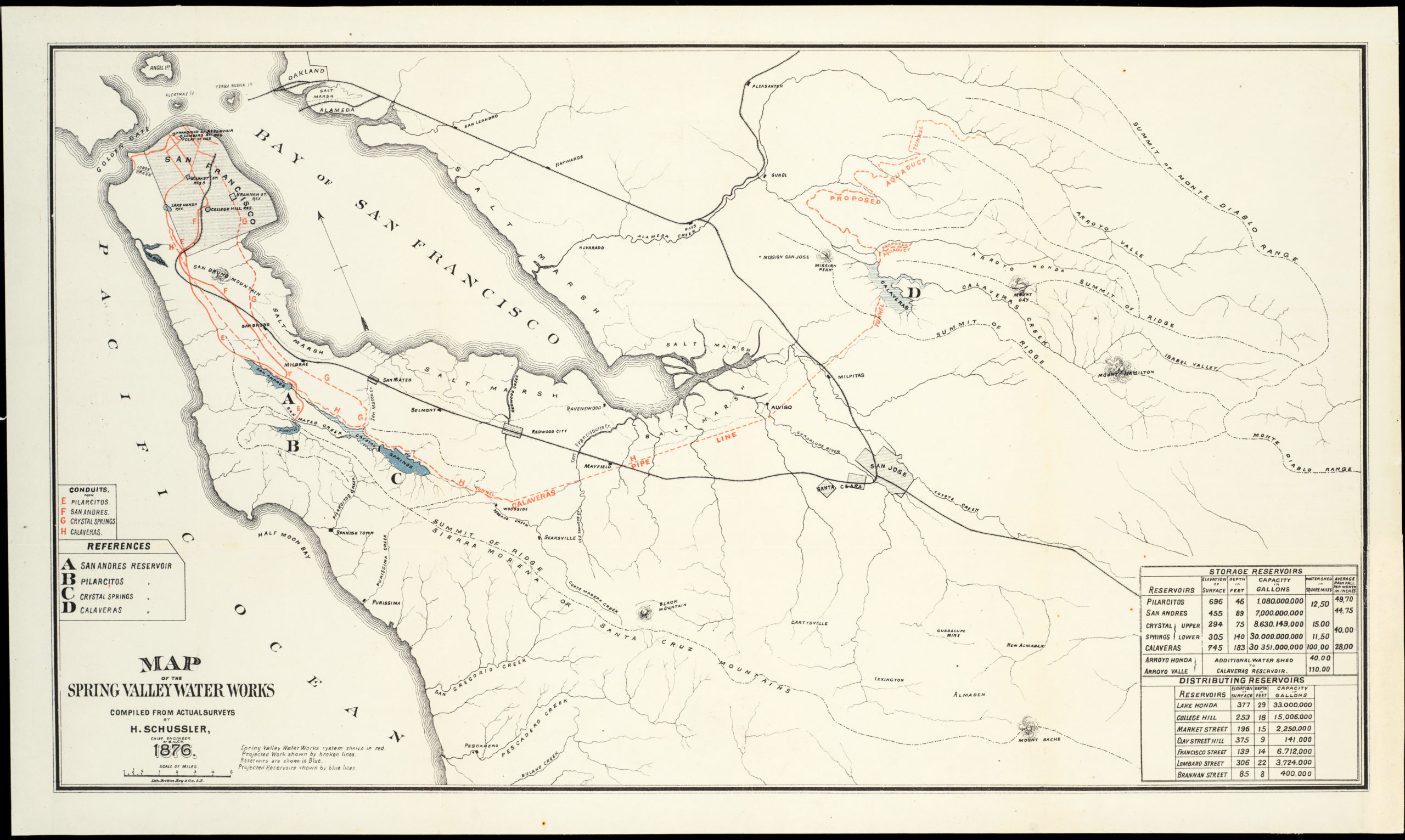
Map of the Spring Valley Water Works compiled from actual surveys
- $500
- Bringing water from Calaveras Reservoir to Crystal Springs - Spring Valley Water Works pipe line map.
-
-
-