-
-
Add to cart
 Quick View
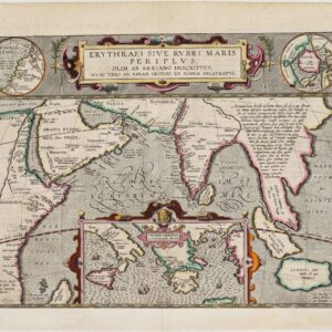
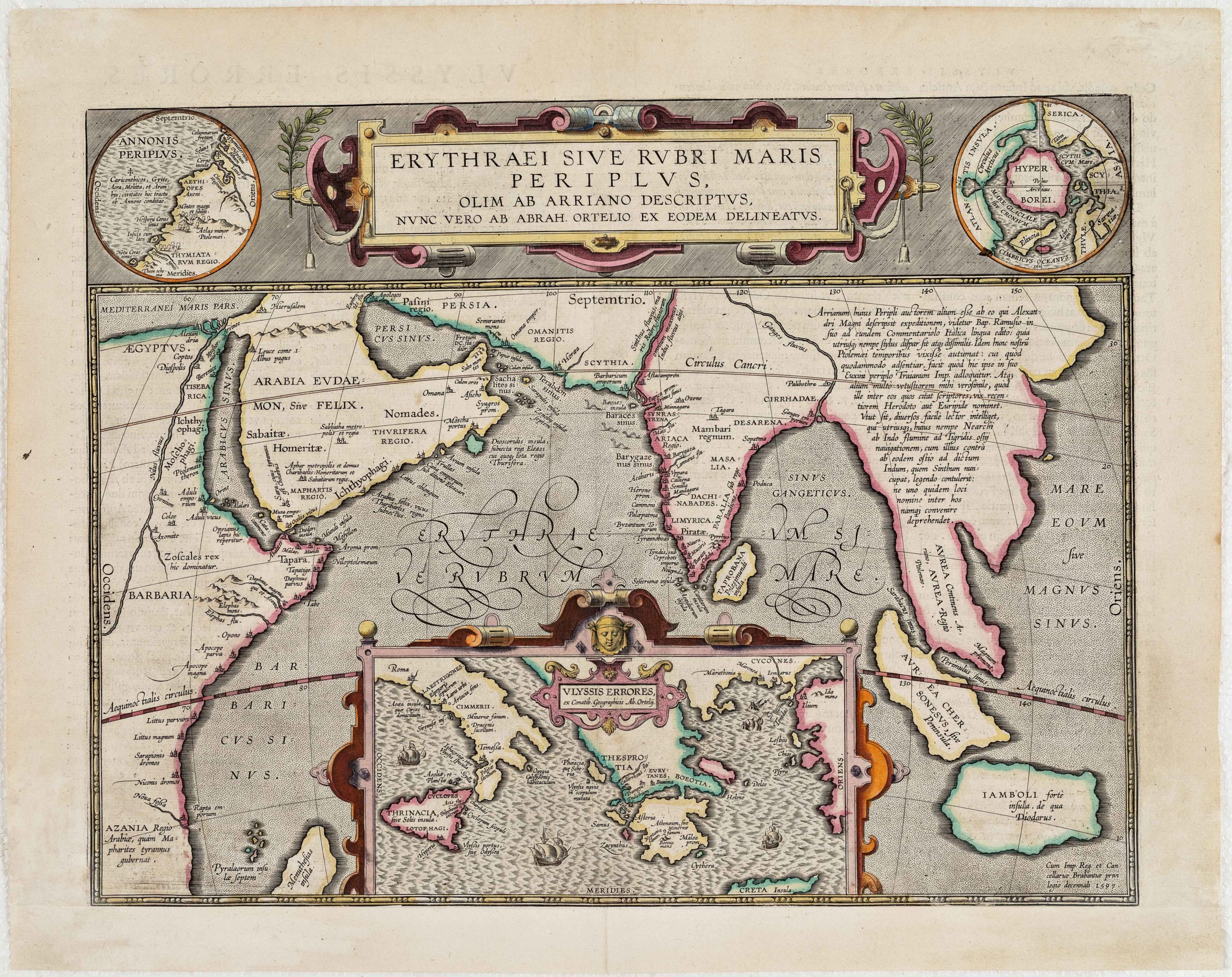
 - Asia, Arabia and the Red Sea, Curiosities - Miscellanea
Erythraei Sive Rubri Maris Periplus, olim ab Arriano descriptus, nunc vero ab Abrah. Orelio ex eodem delineatus
- $1,200
- Illustrating a mysterious ancient text: fascinating Ortelius map mixing classical mythology and contemporary exploration.
-
-
-
-
-
-
Add to cart
 Quick View
 - Asia
First Part of Asia being Turkey, Arabia, Persia most of India and Tartary Performed by the Sr D Anville…Revised and Improved by Mr Bolton MDCCLV.
- $850
- Attractive English edition of d'Anville's important map of Asia, among the most accurate presentations of Arabia at the time.
-
-
-
-
Add to cart

 Quick View
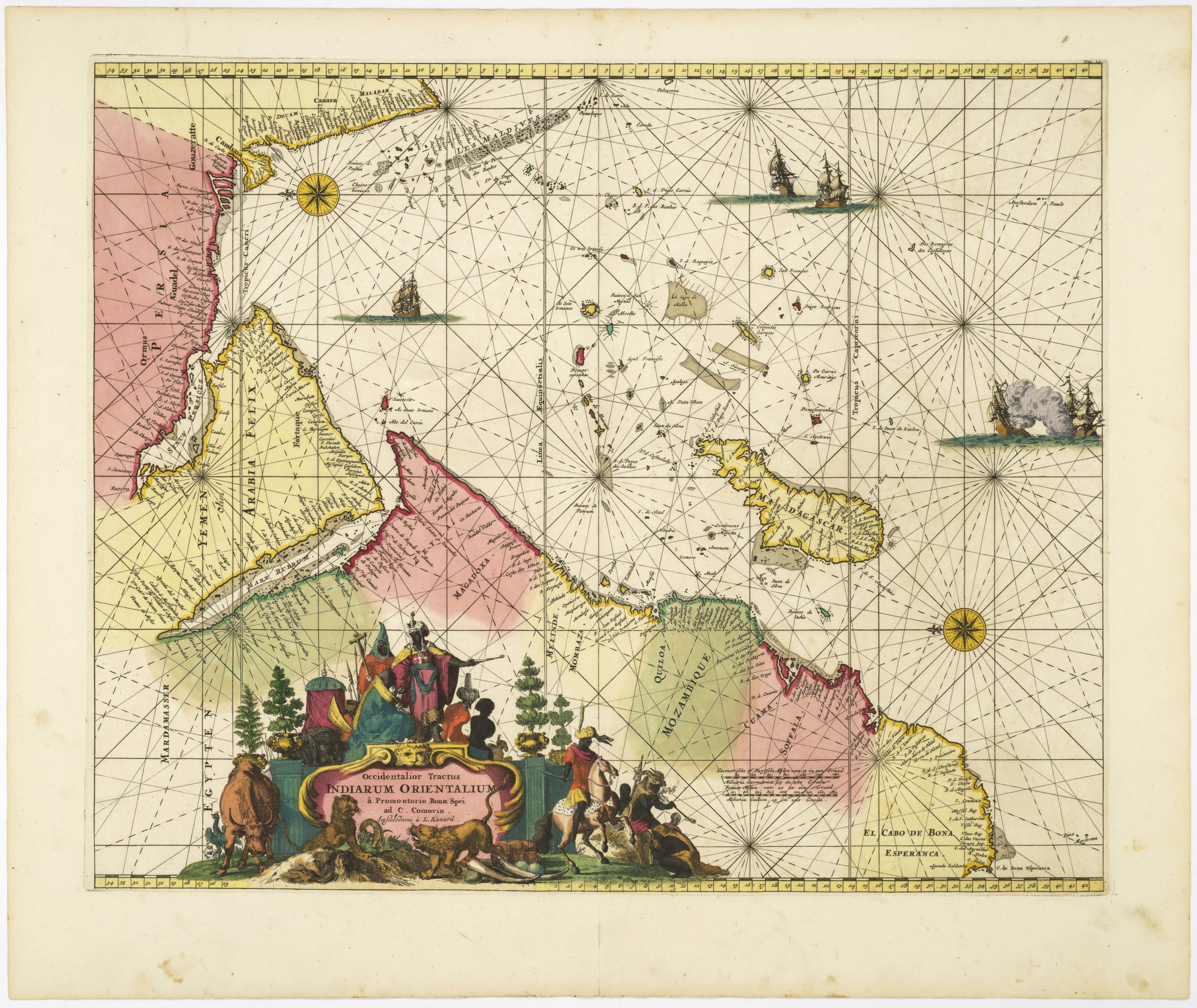
 - Africa, Arabia and the Red Sea
Occidentalior Tractus Indiarum Orientalium à Promontorio Bonae Spei ad C. Comorin
- $1,400
- Stunning Renard sea chart of the Indian Ocean, with East Africa, Arabia, and southern India, from the Atlas de la Navigation.
-
-
-
-
-
Add to cart
 Quick View
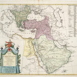
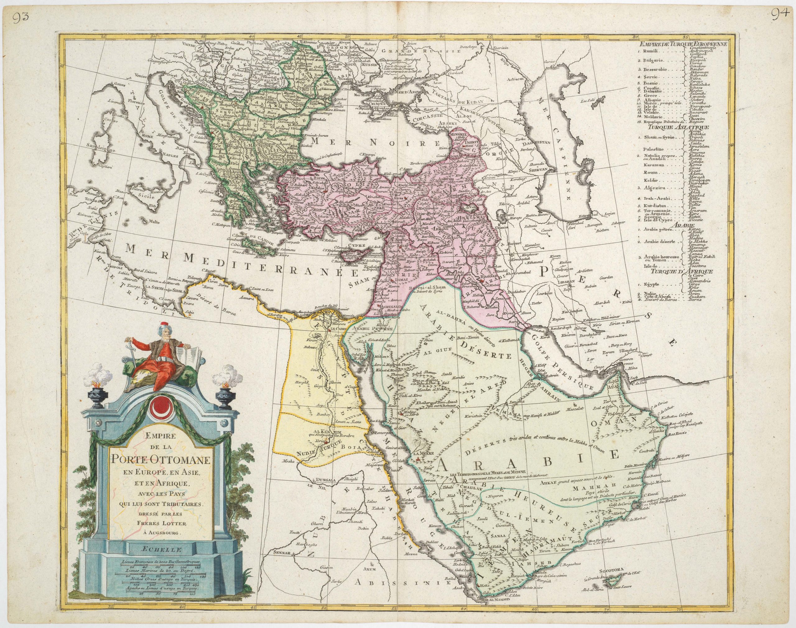
 - Turkey - Ottoman Empire
Empire de la porte Ottomane en Europe, en Asie, et en Afrique avec les pays qui lui sont tributaires, dressé par les freres Lotter
- $675
- Late 18th century map of the Ottoman Empire with large, striking cartouche.
-
-
-
-
-
Add to cart
 Quick View
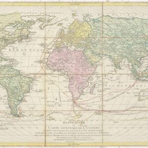
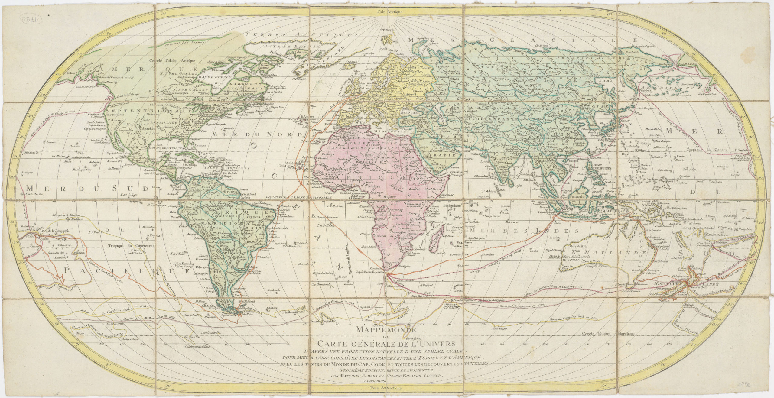
 - World
Mappe Monde ou Carte Generale de L’ Univers D’Apres Une Proejction Nouvelle D’Une Sphere Ovale…
- $900
- Charting Captain James Cook - 1790 world map with Cook's three voyages and Hawaii (O-Why-hee).
-
-
-
-
-
Add to cart
 Quick View
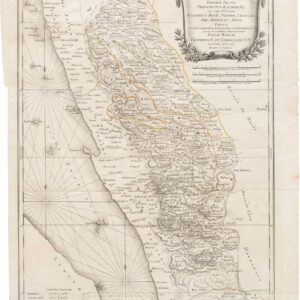
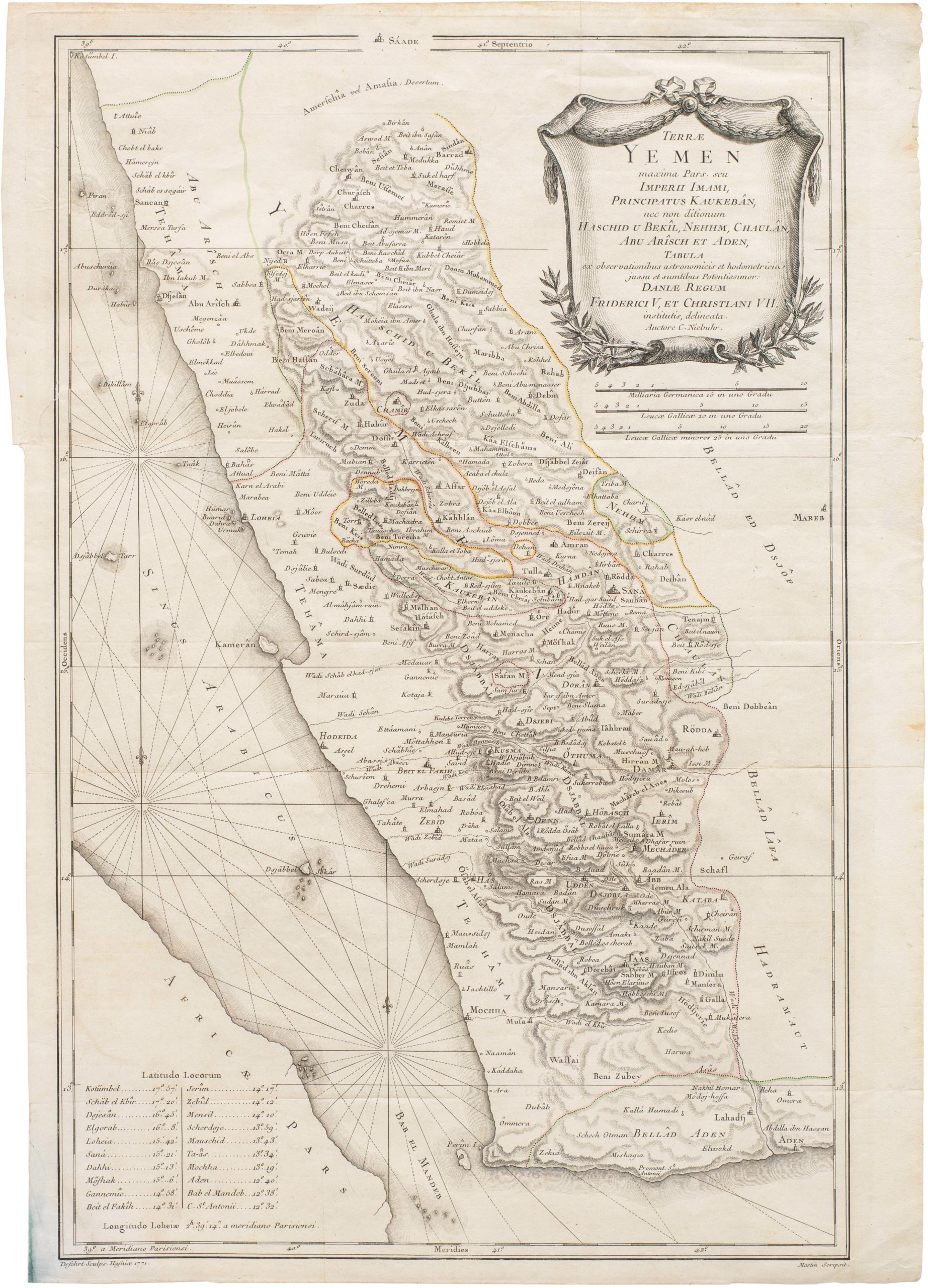
 - Arabia and the Red Sea
Terrae Yemen maxima Pars seu Imperii Imami, Principatus Kaukebân nec non ditionum Haschid u Bekil, Nehhm, Chaulan, Aleu Arisch et Aden Tabula
- $900
- Original Copenhagen edition of Niebuhr’s map of Yemen, from the first scientific mission to Arabia.
-
-
-
-
-
Add to cart

 Quick View
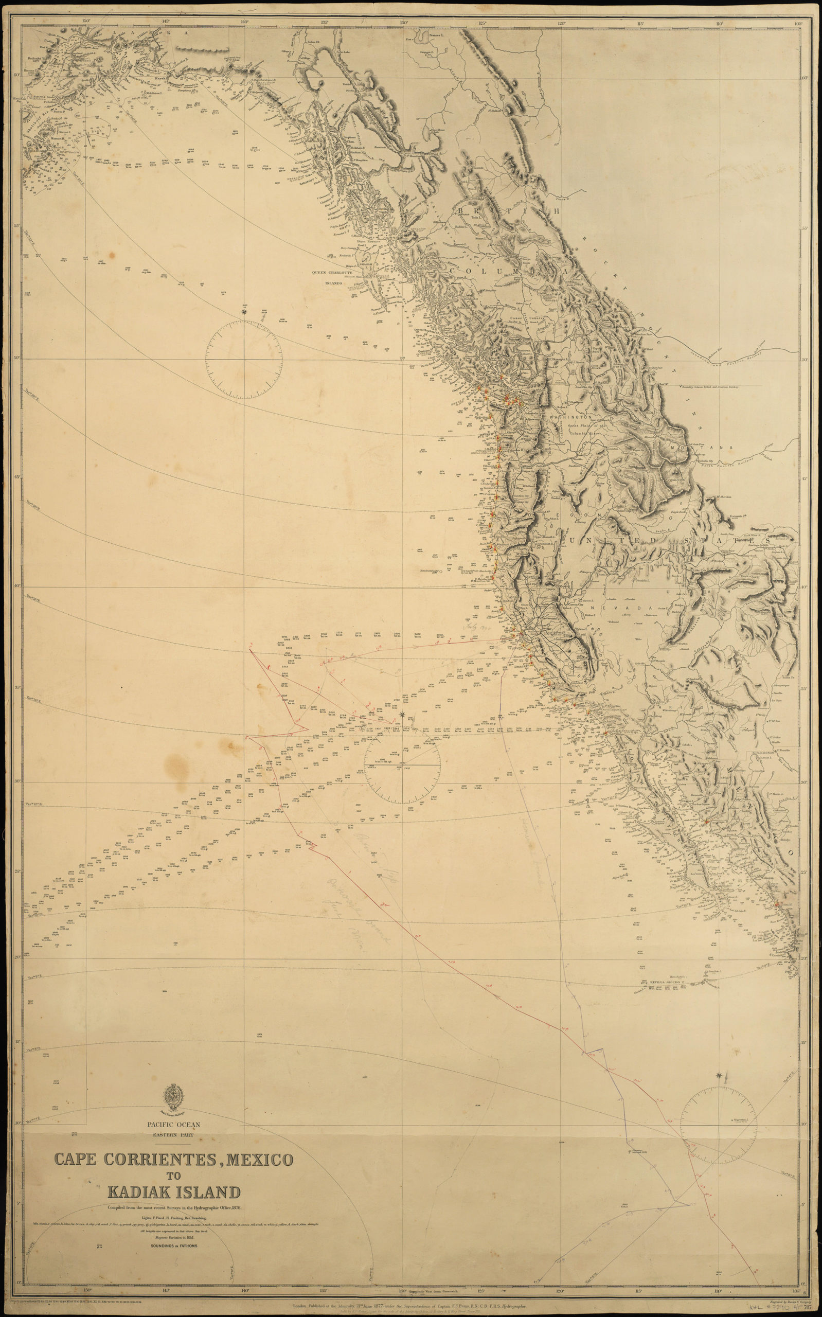
 - California, Pacific Northwest - Hawaii - Alaska
Pacific Ocean. Eastern Part. Cape Corrientes, Mexico to Kadiak Island. Compiled from the most recent Surveys in the Hydrographical Office. 1876. London, 21 June 1877
- $900
- Large, detailed sea chart of the West Coast of North America with added notations and sighting information.
-
-
-
-
-
Add to cart
 Quick View
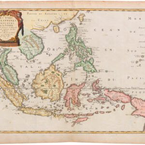
 - Southeast Asia & Australia, Asia
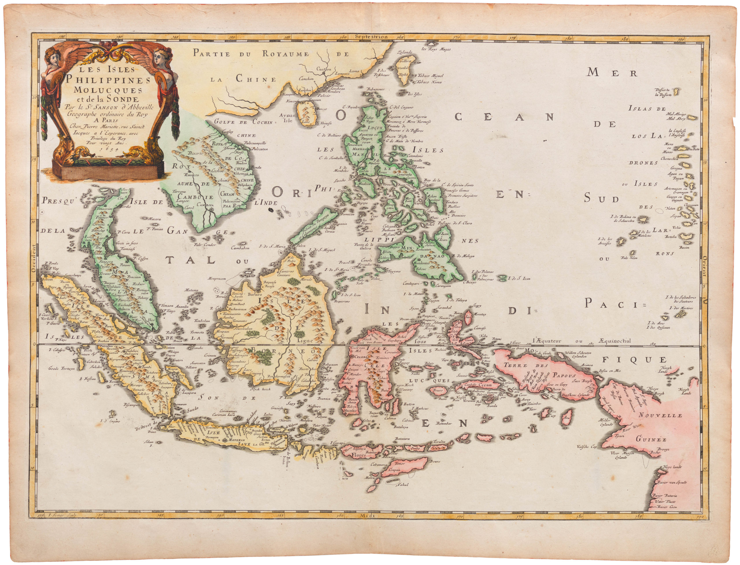
Les Isles Philippines Molucques et de la Sonde
- $875
- Fine 1654 French map centered on the Philippines, and with Singapore.
-
-
-
-
-
Add to cart
 Quick View
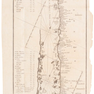
 - Arabia and the Red Sea
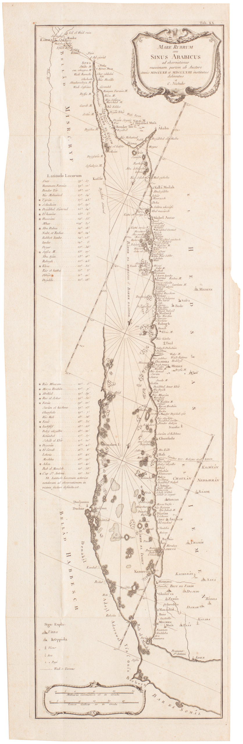
Mare Rubrum seu Sinus Arabicus ad observationes maximam partem ab Auctore annis MDCCLXII et MDCCLXIII institutas delineatus a C. Niebuhr
- Carsten Niebuhr's transformative map of the Red Sea.
-
-
-
-
-
Add to cart
 Quick View
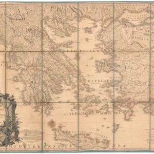
 - Europe, Greece & the Balkans
Greece Archipelago and part of Anadoli. By L.S. de la Rochette. MDCCXC. London, Published for Willm. Faden, Geographer to the King. January 1st. 1791
- Large, detailed 1791 map of Greece and Asia Minor with striking cartouche.
-
-